![]()
This trip has been on our to-do list for a while now and with the late
season snow in the mountains we took the opportunity to do this local
trip. The cool part of this trip is the fact that mass transit will
most likely be involved (unless you are lucky enough to have a yacht
and crew to drop you off and pick you up, if you do please email me).
We took BART to the
Ferry Terminal (at Pier 1) and then the Ferry to Angel Island (We
used the Blue and Gold Ferry). While the transit costs are
not cheap it is still cheaper than leaving a vehicle in San Francisco
overnight. There are other options for getting to Angel Island
like a kayak (yes, there is even a kayak camp) or a long swim (ok probably
not recommended).
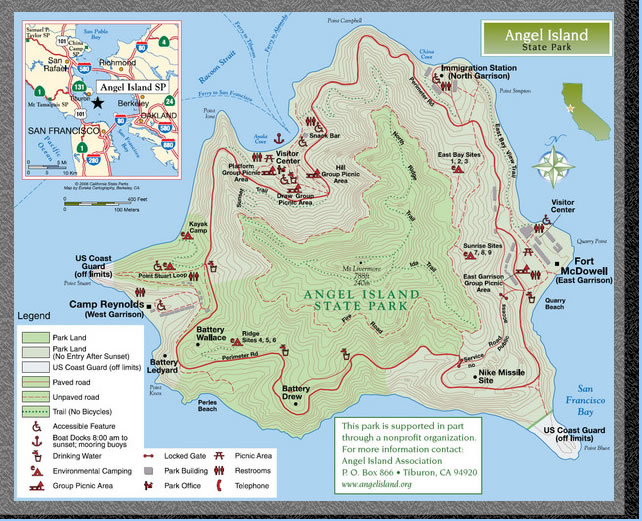
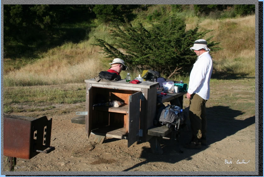
This is a popular destination so book your site early. Reservations can be made online at www.reserveamerica.com. I did not follow this advice so we got the last spot available, Sunrise site #8. Price for 4 with transaction fee was $38 for the night. We stayed on a Friday night and about with about three weeks before the trip this was the only site left. Sunrise camps are exposed but offer nice views. Ridge sites are the most popular as they have Golden Gate Views and East Bay are the most sheltered. I have been warned it can get both cold and windy (Remember you are on an island off San Francisco). Potable water is available at campsites (I always call the ranger ahead of time to double check this as water is kinda important) along with a picnic table and food locker. There are also grills should you want to barbeque something (although they did say no open fires so I am confused how a BBQ doesn’t fall into that same category). There is a cafe available where the Ferry drops you off and that opens at 10 am and yes as you may have heard they sell beer in addition to food. Ranger can be reached at 415-435-5390.
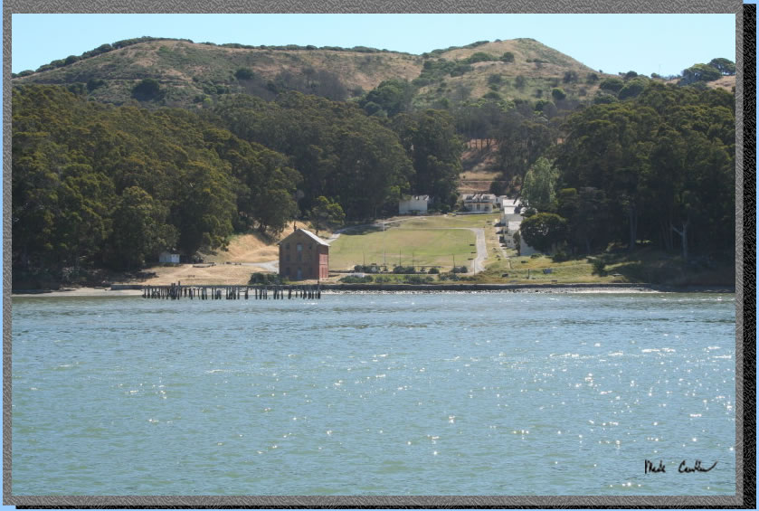
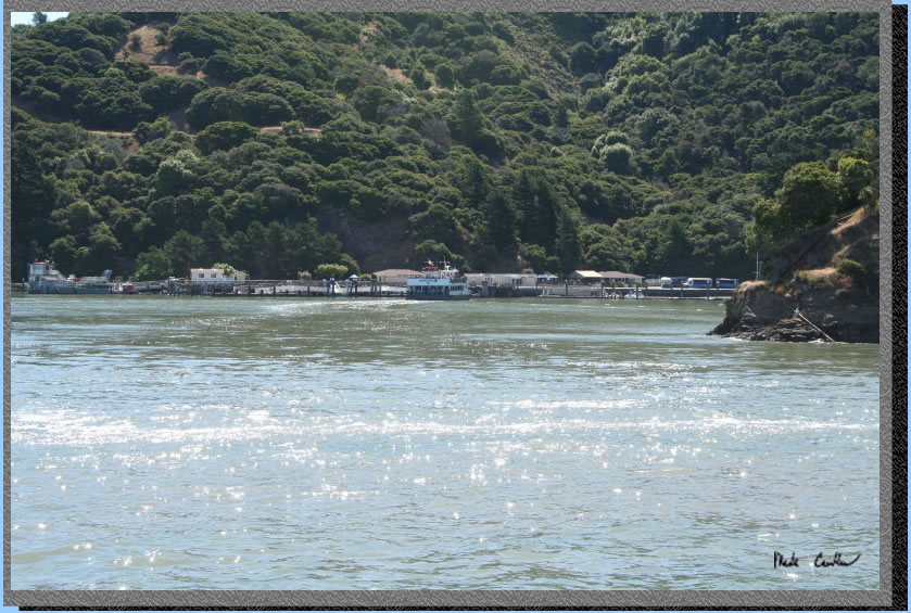
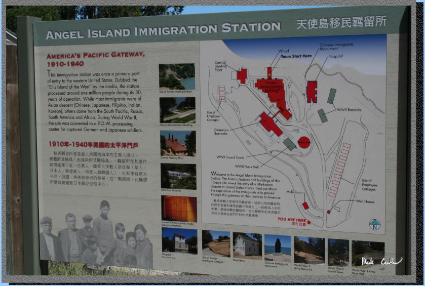
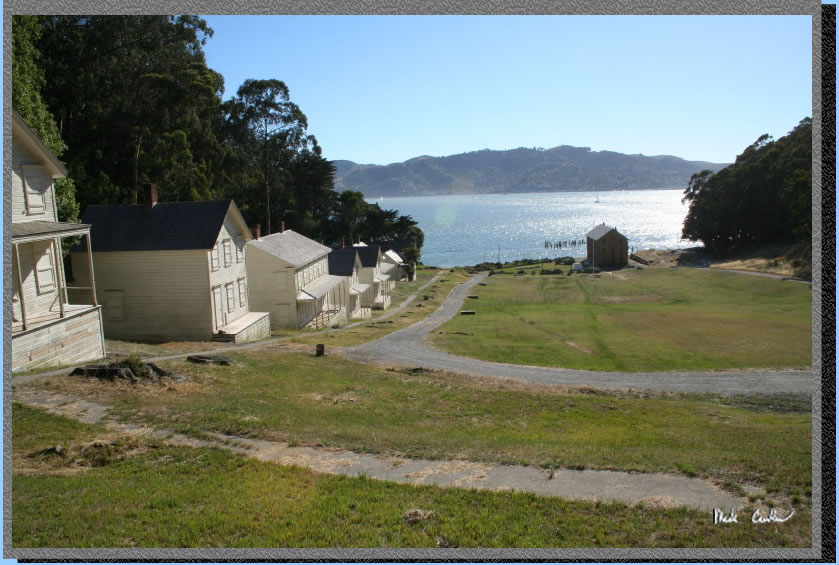
Guided tours are available and seem to be highly rated online. There are many structures to explore on the island. Make sure to make it to the top of Mount Livermore as the view is amazing (and the hike is pretty easy). The history on this island dates back about 2000 years (Coastal Miwok Indian’s hunting grounds) so I will give only a brief summary as I am not a tour guide. Camp Reynolds is the oldest permanent settlement on Angel Island and was built by the US Army in 1863 (Yes in the middle of the Civil War). Fort McDowell replaced Fort Reynolds and was used to process and stage troops from the Spanish American War until after World War Two ended. The island was also used as “Immigration Station” between 1910 and 1940 and called the Ellis Island of the west. Many immigrants spent long periods of time on the island while being processed. There is also a decommissioned missile silo from the Cold War on the southeast corner. Picture of Camp Reynolds (also called the West Garrison) from the ferry on the way in .
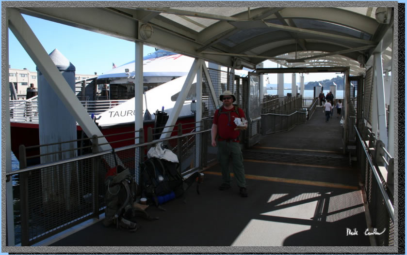
We started early on Friday morning as there was only one ferry that leaves from Pier 1 (the Ferry Terminal in San Francisco) and we did not want to miss it. We took BART to the Ferry Terminal and got some friendly questions as to what we were up to. We discussed telling people that we were backpacking through Europe but ended up telling people our real plan. Once we got off BART at the Embarcadero Station we had a short walk to Pier 1. After the boat let everyone off we had to wait until it was ready again to board. This afforded everyone a bathroom break that drank too much coffee on the way in. Here is Eric and I keeping an eye on all the gear. No need to buy a ticket ahead of time for the ferry as they let you purchase one onboard once you are under way. Kinda cool.
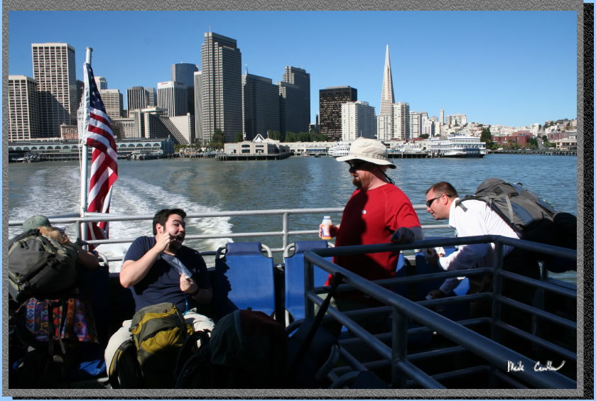
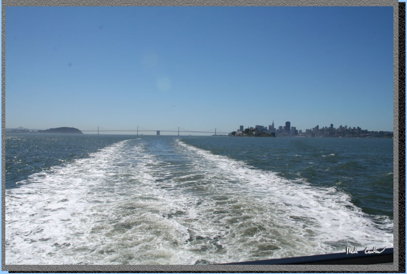
We were under way on the ferry here in this shot with the Bay Bridge behind us. We had beautiful clear weather (which we really lucked out on). The Bay was calm with a slight breeze making for near perfect picture taking opportunities. Here is a shot looking back at the ferry terminal and the rift-raft that rides the ferry. The ferry was pretty empty from Pier 1 to Pier 41. I guess it is not a popular commuter route.
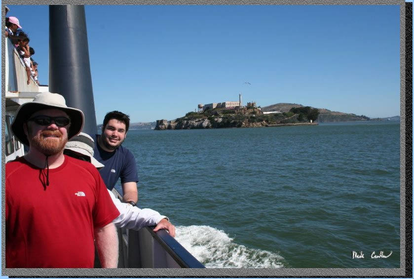
So we had to get off the ferry and then had to re-board and show our newly acquired tickets. After a short loading process we were off to Angel Island. First we had to pass by Alcatraz. Here is a shot of the crew with Alcatraz behind.
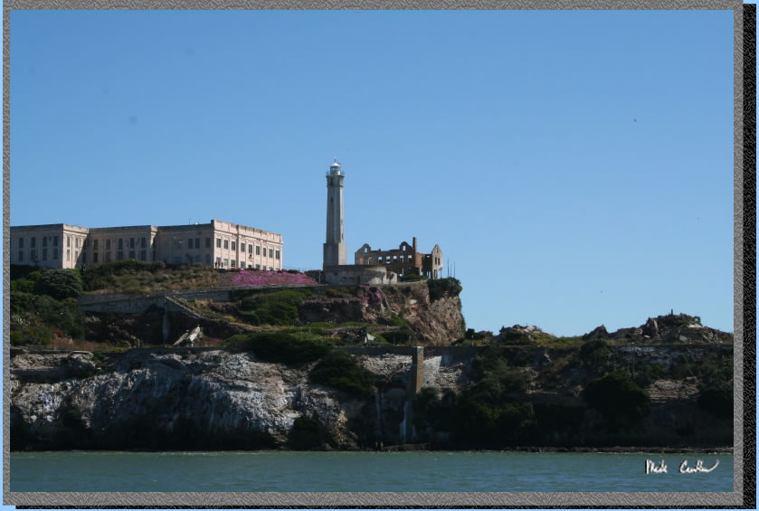
You get pretty close to Alcatraz which is pretty sweet. Here is a shot of one of the more decayed buildings.
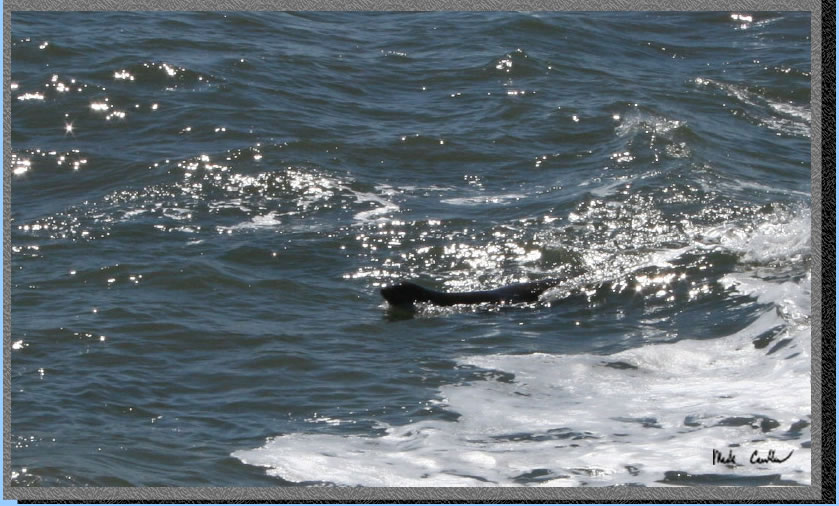
We had a school field trip on the ferry with us from pier 41 to Angel Island so we kept hearing about every shark that was swimming alongside the boat accompanied by adolescent giggling, screaming and general mayhem. Here is a shot taken of the sharks that nearly swarmed the boat (probably due to the screaming)
So we left the City far behind now and we are almost to our destination.
We spotted this structure on the edge of Angel Island. Not sure what it was and I forgot to ask the ranger on the way in. Here we are approaching the dock.
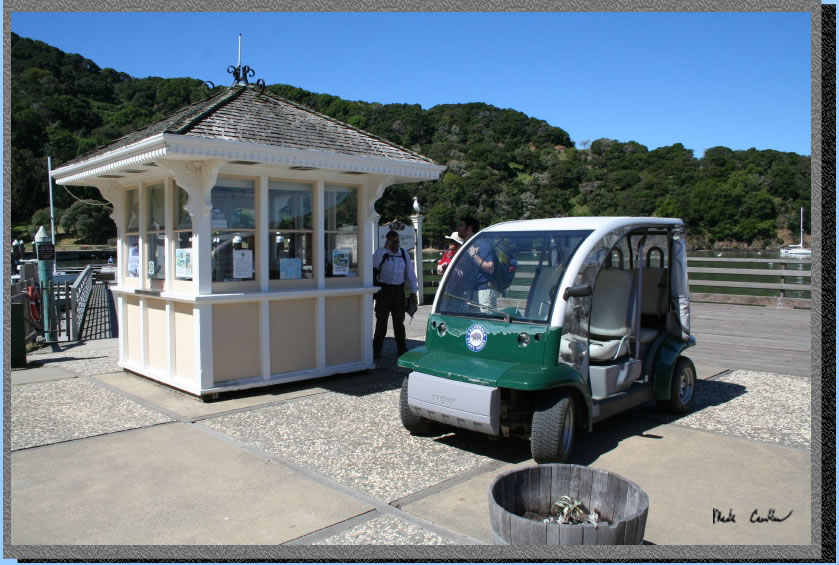
So after we disembarked a nice ranger asked us if we were staying the night. I guess the backpacks gave it away. She said she would take care of the field trip kids and then be with us. I didn’t ask her to elaborate on what exactly she was going to do to them *feed them to the sharks?). We waited by the kiosk for the ranger and checked out one of the electric vehicles on the island. The cantina and snack bar are located right here across from the docks. The hours are kinda weird on the snack bar (10 am ish to whenever they decide to close) They are nice enough, well except for the lady in charge, more on that later.
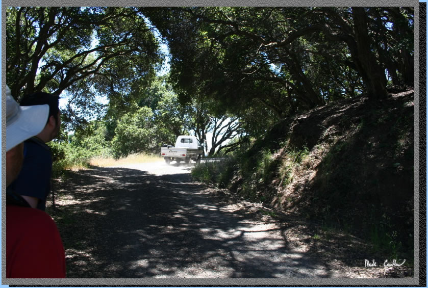
So the ranger only had one map that she could give us at the kiosk and we thought that we had better get at least one other one since there were 4 of us (and we didn’t want to become lost on an island this small). We followed her to the Visitor Center (that is worth checking out) and grabbed another map. We chatted with the ranger a bit and found out that we had many options to get to camp. We decided on the most direct route as we had lots of day hiking planned. We also found out that they were filming a movie at Fort McDowell (east Garrison). They were filming at night and besides seeing a couple lights below our camp we didn’t notice them. Here we are taking the road route to camp.
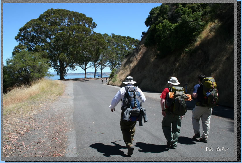
We hiked north of the snack bar to “the stairs” up to the Perimeter Road. There are great benches and tables scattered about to sit and enjoy the bay views. The immigration station was our first stop. We just checked it out with our packs on. The island was pretty empty except for the school age tour so we had pretty much run of the place. The Immigration Station was recently reopened as it was restored. It looked great to me but I hadn’t seen it prior. Here is one of the many colorful signs explaining the different buildings and history.
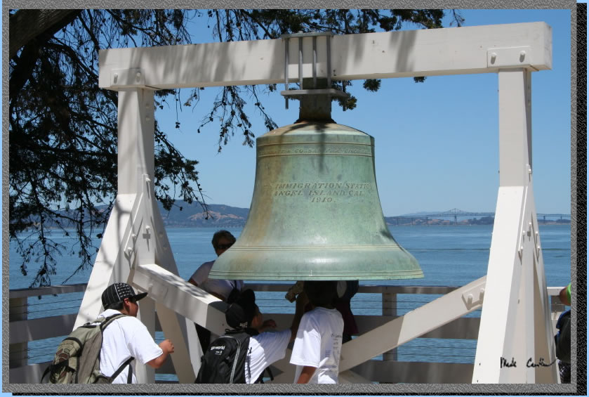
And the big bell that the kids were having fun ringing:
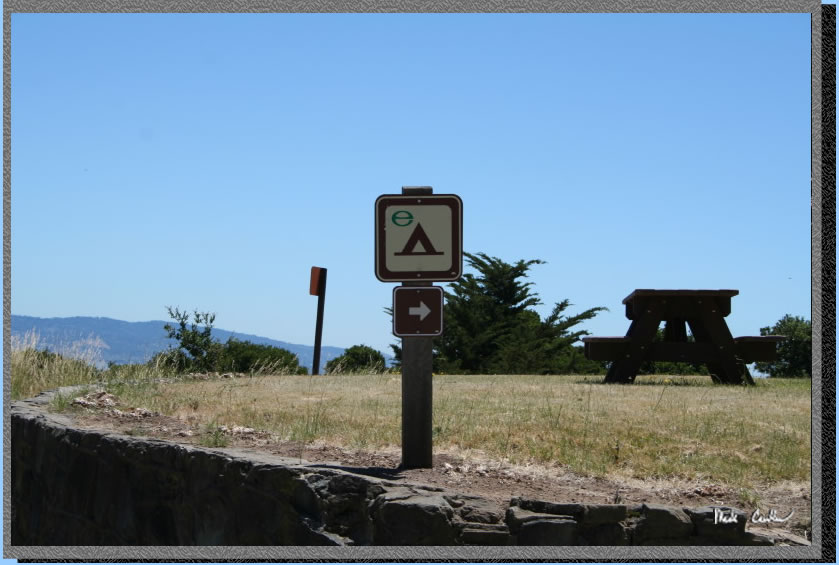
After a short hike back up to the road you break right for the environmental campsites on this side of the island. Here is the sign.
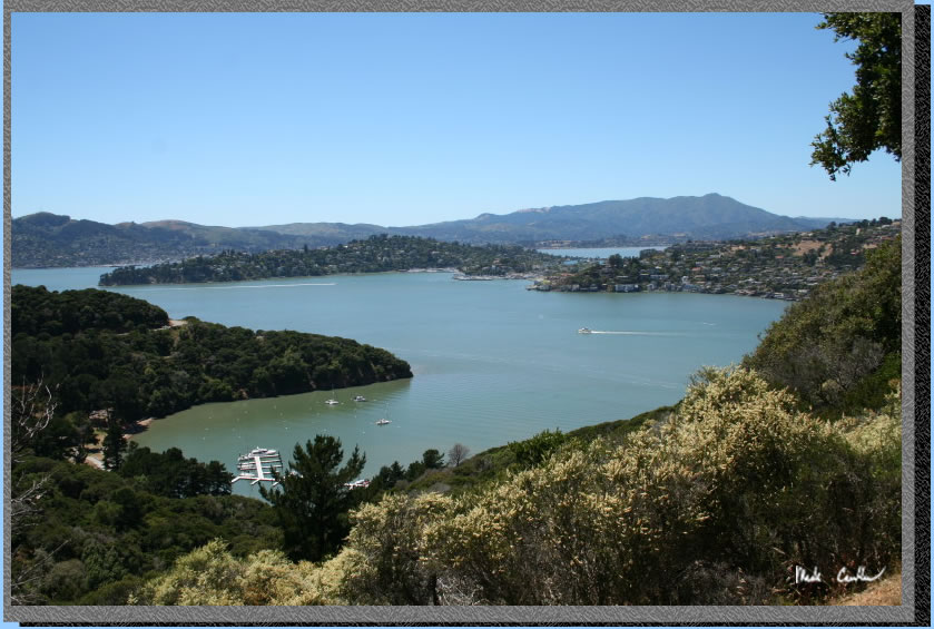
There are basically two circular trails on this island. The first is the paved circular Perimeter Road. This is wide and open with unobstructed views of the surrounding bay. The second is the Fire road which is unpaved and has more cover. All of the campsites lie in the area between the Perimeter Road and the fire road so there are trails that cross the two. And of course in the middle of the island is Mt Ida Livermore at 788 feet. Here is a shot on the fire road.
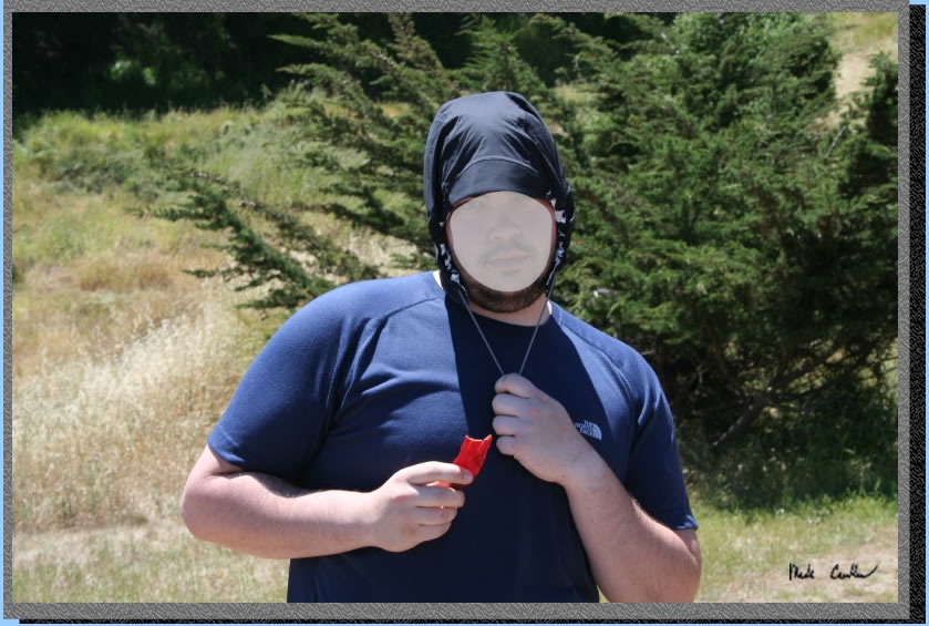
Here is someone wearing his “hat”. I subscribe to the notion that skin cancer is bad so I use sunscreen and wear a hat. Not everyone believes in that whole science/medical/common sense/don’t want to burn idea so they choose a different course. I have kept this person's identity a secret by blurring the face.
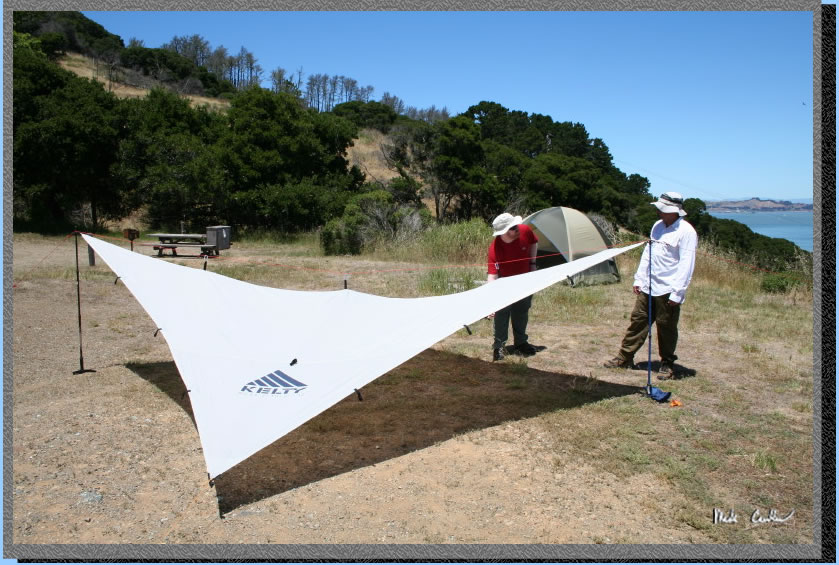
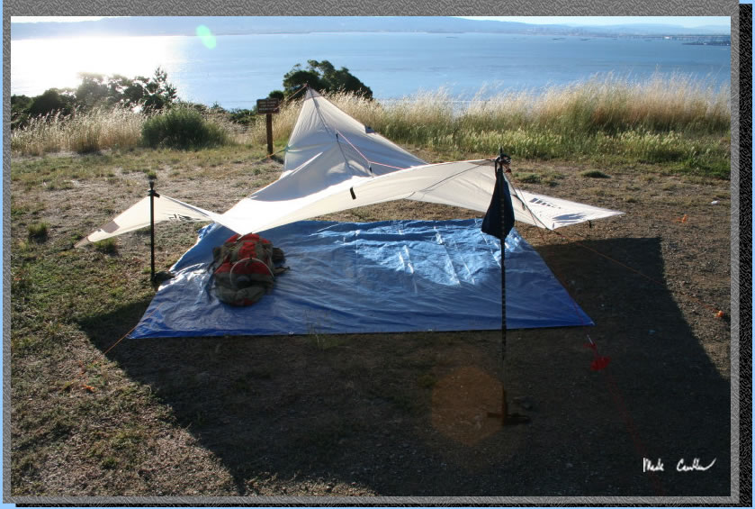
With the warm weather we decided to set up a tarp shelter for Leo, Eric and I while Dave soloed it in his tent. We set the gear in the shade under the tarp and then explored the island.
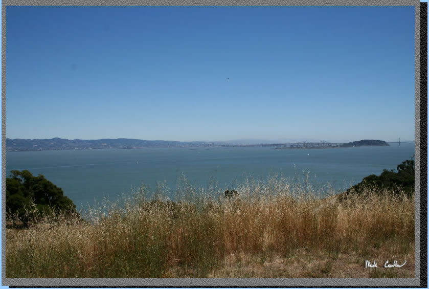
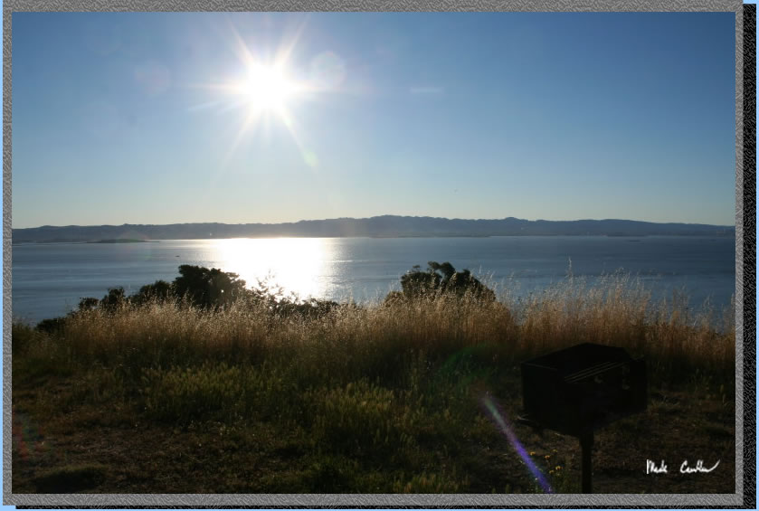
Here is the view from camp. Pretty great but also very exposed. We had no desire to sit out in the sun the rest of the afternoon so we hiked around some until the sun started to go down.
Our first stop was to hike back for lunch and cold drinks at the snack bar. Here is the view on the way down to the dock area. The trail from camp to dock area was pretty shaded if you take the fire road and then the connecting trail down to the dock. There is a little issue of how many stairs there are unless you want to hike down a little more to the visitor center and then back to the dock. We did this method on the way out to save our knees from the 303 stairs.
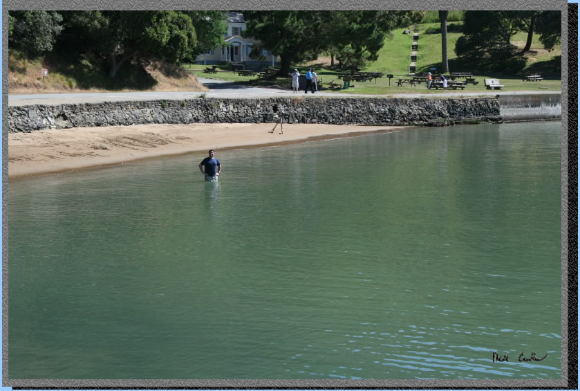
So we partook in the local cuisine and drink and discussed our plans for the rest of the day as we watched the last ferry of the day depart, along with all of the people. The people that work at the snack bar are an interesting crew. There seemed to be one lady who was in charge of everything and she didn’t seem to be one of those that looked at the brighter side of things. When we asked a question as simple as when are you closing it had to be run through her and she barked out answers. Her gruff responses held true even when some young girls went in to get some ice cream when they were closing up for the day. Luckily the girls thought she was kidding when she loudly told them to get out and someone else helped them with their purchase. While the food was not great it was descent for the price and the drinks were cold. The rest of the staff seemed more helpful and in better moods. Closing time seems dependent on when the last ferry leaves and the mangers mood so don’t be late. Here is Dave taking a swim in the Bay.
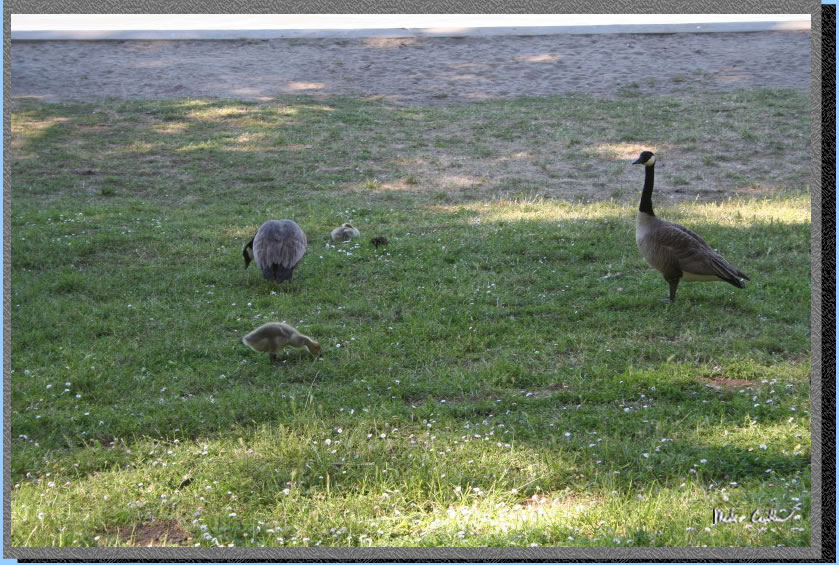
I think there were more geese and deer on this island after the last ferry left. Here is a shot of some of the Geese by the visitor Center. We decided to hike south now past the visitor center on the Perimeter Road and head to camp the longer way.
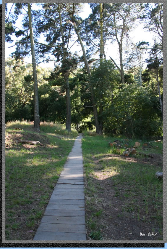
After walking the plank path we gained access to a dirt road that connected to the Perimeter Road.
We wanted to check out Fort McDowell as it looked cool on the ferry ride in. We walked thorugh the open house that served as the kitchen and then down to the beach pas all of the buildings used as bunkhouses. This was the area that the Civil War festivities would be going on tomorrow so ewe did see a few extra things set up for that.
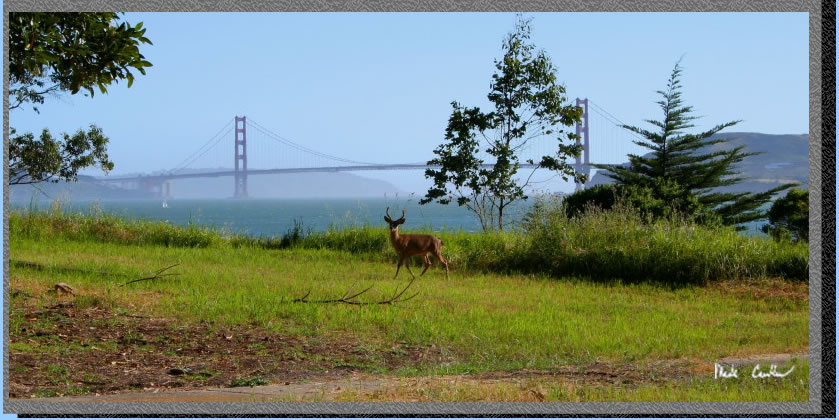
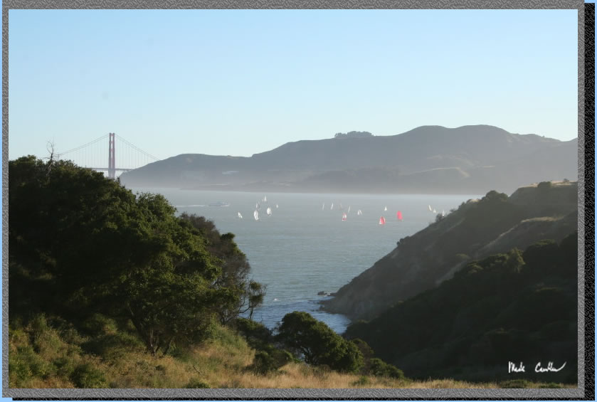
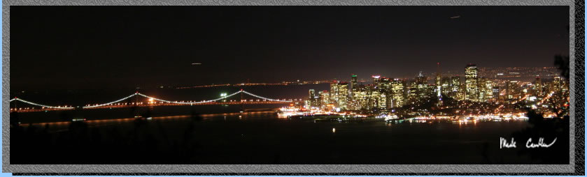
Awesome views of Golden Gate Bridge from here (and on a good sailing day for all of the sailboats). Here is a shot of the Golden Gate with a black-tailed deer in the front. The deer weren’t that afraid of us, and once I snapped a picture of this guy it seemed like all of the deer in the area came out to get their picture taken.
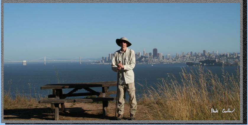
We hiked further to the north now and had some more awesome City views. Here I am with San Francisco behind me.
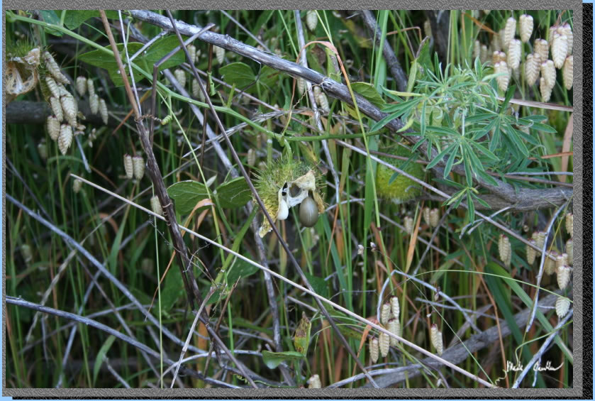
We saw this strange green spiked ball plant with some grape sized fruit in it. I am still working on getting it identified.
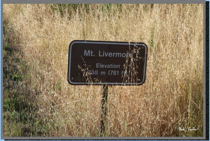
Here is where the trail leads up to Mount Ida Livermore at 788 feet. It is definitely a must do hike. Although I guess if you are socked in with fog it may not be worth it (unless you get above the fog).
Sailboats out in the Bay with the Golden Gate beyond.
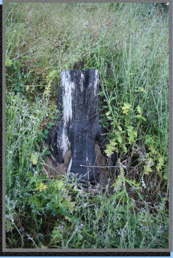
There was a fire in October 2008 that burned up 1/3 of the island. This stump was the only evidence that I found of it. The firefighters protected all of the historic structures on the island from any damage.
Watching the ships cruise by camp.

All of us before our night hike to the peak.
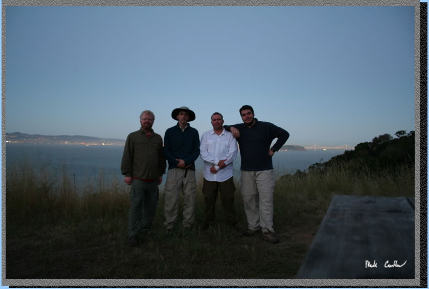
The view from the top.
Good morning! I guess that is why they call it Sunrise Camp. There was no sleeping in as it was supposed to get hot and the sun was bright. Overnight temperatures on the island had to be in the upper 50’s which is just too warm for me. I guess I am used to the Sierra’s cool nights.
We packed up to make the first ferry at 10:30.
Here is the tarp setup we used for three of us before we took it down. Even with the breeze it held up fine.
A great trip that is perfect for getting away without having to really go that far. Being surrounded by the City but being on an island away from everything is definitely a cool experience. Put this one on your to do list. I saw many kids on this island with packs and think it would be a great first trip for people of any age.