![]()
Day 1, Day 2
 Permit
- A permit is required for all overnight stays in Mokelumne Wilderness.
Permits can be obtained in person at the Pioneer Ranger Station at 26820
Silver Street in Pioneer off Highway 88. There are currently no fees
for the permit, and sites are first come, first served. **In the summer
you have to get a site specific permit at the Carson Pass Information
Station at the trailhead**
Permit
- A permit is required for all overnight stays in Mokelumne Wilderness.
Permits can be obtained in person at the Pioneer Ranger Station at 26820
Silver Street in Pioneer off Highway 88. There are currently no fees
for the permit, and sites are first come, first served. **In the summer
you have to get a site specific permit at the Carson Pass Information
Station at the trailhead**
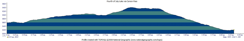
Mileage/Terrain - Day 1 was Carson Pass Trailhead to Fourth of July Lake, approximately 6.25 miles (your mileage will vary based on site selection). There is a net elevation loss of approximately 400', but you hike up 950' and down 1350'. Terrain is mainly exposed except for the section near the trailhead and when you get down to Fourth of July Lake. See map/profile below.
Camps/Water - There is a bathroom at Carson Pass trailhead, no water/trash (although maybe in summer they have trash service).
Hazards - Black Bears, cold/snow, mice/squirrels, and wind. Nearest Ranger # 209-295-5996 (always check with ranger ahead of time for current water/weather/trail conditions).
DAY 1
Zakk, Eric and
I wanted to get in a last minute Sierra trip prior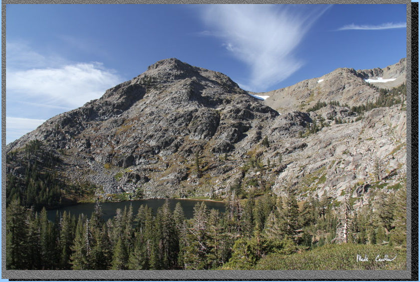 to the white stuff falling this year. We decided to return to Fourth
of July Lake in Mokelumne Wilderness. I had been out to this lake 16
years earlier (you can read about it here).
Besides the trail being a little longer now, it was just as great as
a remember. A testament to the management of this area. This area is
heavily used in the summer, and is managed as the Carson Pass Management
Area. There are marked sites at Winnemucca Lake, Round Top Lake and
Fourth of July Lake. No camping is allowed at Frog Lake. In the summer
months you must get your permit in person at the Carson Pass Information
Station at Carson Pass. Sites are assigned at the time of the permit
being issued. There is a year-round ban on fires in the Carson Pass
Management Area. We had some high winds forecast, so a fire would have
been a bad idea anyway. Being the off-season, the Carson Pass Information
Station was closed for the season. This time of year you need to get
a permit from the ranger in Pioneer (which seems like it is past the
town, headed eastbound). In the off season sites are first come, first
served. We had the lake to ourselves, and didn't see any other backpackers
out there around any of the lakes. There are 3 sites at Winnemucca Lake,
6 sites at Round Top Lake and 6 sites at Fourth of July Lake. This shot
shows Fourth of July Lake on the way out on day 2.
to the white stuff falling this year. We decided to return to Fourth
of July Lake in Mokelumne Wilderness. I had been out to this lake 16
years earlier (you can read about it here).
Besides the trail being a little longer now, it was just as great as
a remember. A testament to the management of this area. This area is
heavily used in the summer, and is managed as the Carson Pass Management
Area. There are marked sites at Winnemucca Lake, Round Top Lake and
Fourth of July Lake. No camping is allowed at Frog Lake. In the summer
months you must get your permit in person at the Carson Pass Information
Station at Carson Pass. Sites are assigned at the time of the permit
being issued. There is a year-round ban on fires in the Carson Pass
Management Area. We had some high winds forecast, so a fire would have
been a bad idea anyway. Being the off-season, the Carson Pass Information
Station was closed for the season. This time of year you need to get
a permit from the ranger in Pioneer (which seems like it is past the
town, headed eastbound). In the off season sites are first come, first
served. We had the lake to ourselves, and didn't see any other backpackers
out there around any of the lakes. There are 3 sites at Winnemucca Lake,
6 sites at Round Top Lake and 6 sites at Fourth of July Lake. This shot
shows Fourth of July Lake on the way out on day 2.
The trailhead
is pictured below with the Information Station (cabin building) and
the trail (see Pacific Crest Trail logo on the tree).
Parking is $5 per day via an iron ranger. The lot is decently sized
and more than adequate for the amount of travelers we saw that day.
In the summer the lot can get full. There is another lot on the opposite
side of Highway 88 that serves the area to the north (see trips to Showers
Lake, or Round Lake for trail
descriptions for many trips in the Meiss
Country Roadless Area). They were shutting down the information
station for the season (that is why there is a lot of stuff outside).
When we returned to the trailhead the next day it was cleaned up - even
the information boards were gone.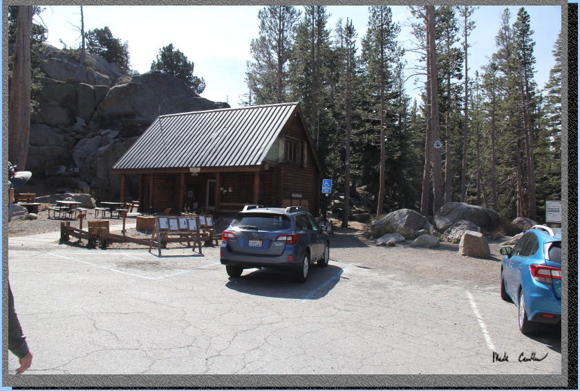
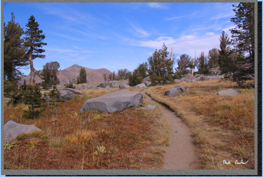
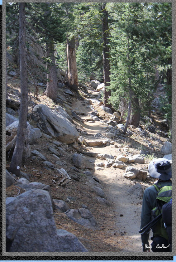
The trail (which is the PCT)
starts off tree covered. The first half mile allow you to get warmed
up before you start the ascent to Frog Lake. None of the trail is that
difficult through this section, and before you know it you will be at
Frog Lake. I will also mention that you will also realize you are at
elevation (the trailhead is at roughly 8,600'). Even a little uphill
will remind you the air is a little thinner up here.
Here is the junction with
Frog Lake. You can see the lake from the junction but take a minute
to walk to it to get a good view.
Here is Frog Lake. You can see that there is not too much tree cover
anymore. Elevation is 8,900' at Frog Lake.
The trail continues the
upward direction to a junction to either stay on the PCT or head to
Winnemucca Lake. I have done the loop option once before (many years
ago) and it was a bit of a haul to go down into Summit City and back
up to Fourth of July Lake (it can be done though). There was at least
one section that can have a decent size snowfield that you will need
to cross, so be prepared for that possibility if you are trying it.
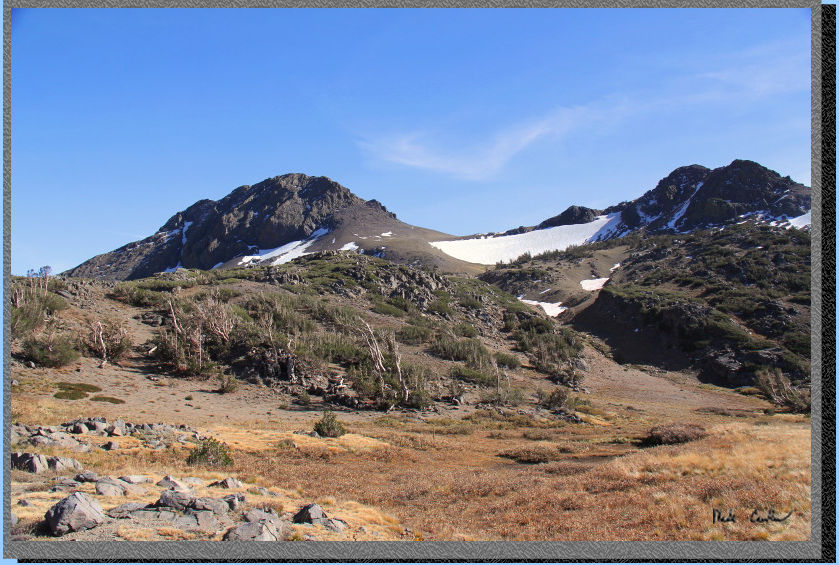
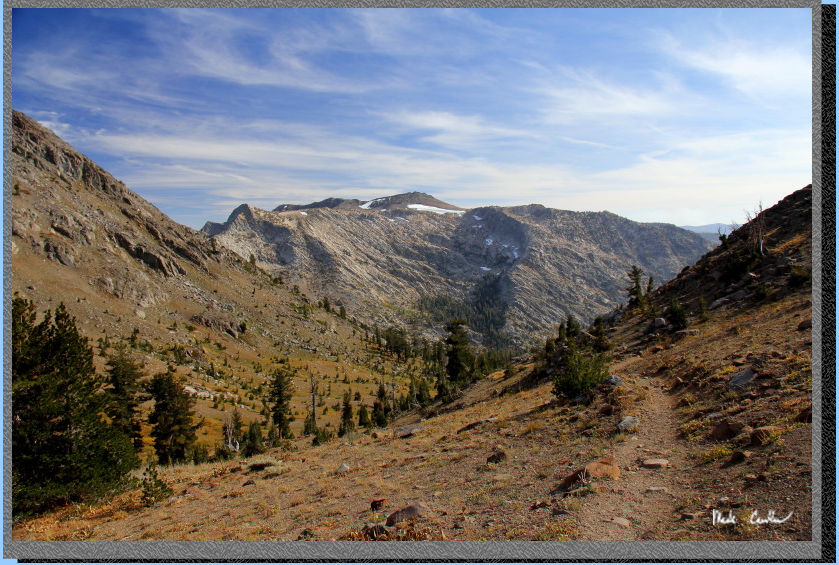
Here is a shot of the trail before the junction, with Round Top and
the Sisters in the distance.
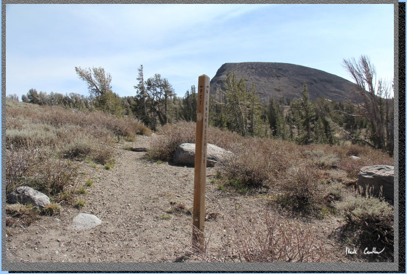
Here is the junction with
the PCT. The PCT stays north of Elephants Back, seen in the distance
in this shot. Continue straight/right to Winnemucca Lake. You can tell
people you hiked a section of the PCT now, maybe leave out the distance
part...
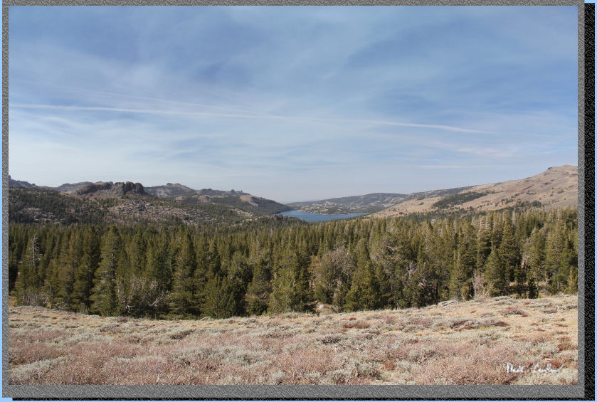
Looking west you can see Caples Lake now (which remains in view for
much of the trail now). You can also see that you are above the treeline
now. The wind was keeping us cool through here on the way in, on the
way out it was downright blasting us.
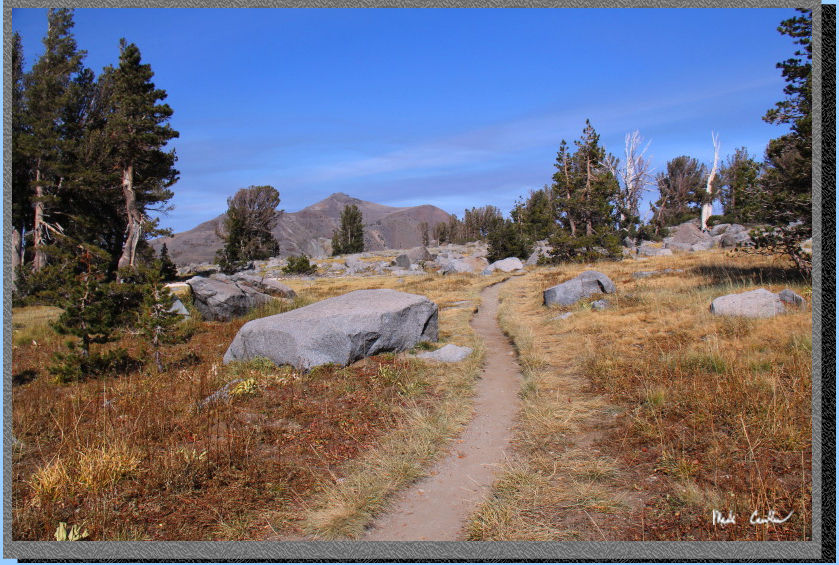
This section of trail is
my favorite. The grade is pretty nice, still slightly uphill to Winnemucca
Lake, but nothing too steep. There are some neat textures, and the fall
colors really make the distant Red Lake Peak stand out. This shot is
looking north toward the trailhead. I was trying to duplicate the same
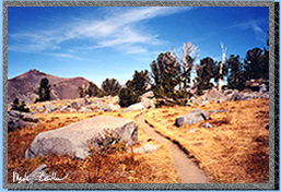
picture I took 16 years prior. I have the old shot below for comparison.
I was impressed with how
close I got just from memory.
Of course I did take a few shots before I came across this spot and
realized that this was where I took the original picture. It is even
more amazing how much of nature has remained, essentially the same.
I apologize for the tiny picture, I was shooting on film back then,
and had to scan printed pictures to post them. Then I had to worry about
bandwidth and page load times over dial up. Ahh dial up, those were
good times.
Here is Winnemucca Lake. The water levels seemed great for this late
in the season. There was still a little water coming out too. The sites
here were just off the trail. You are pretty open to the wind at these
sites. 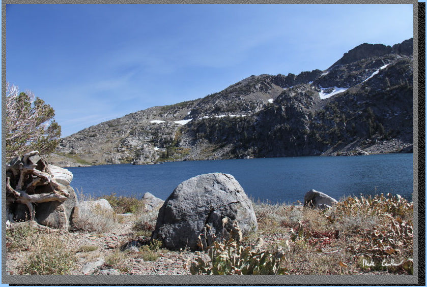
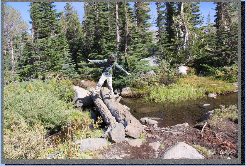
There is a nice clump of
trees at the outlet to Winnemucca Lake. The crossing was easy this late
in the season. The logs were nice and stable and well above the water
level. I imagine that things were different in the early summer though
with our record snow fall and spring runoff.
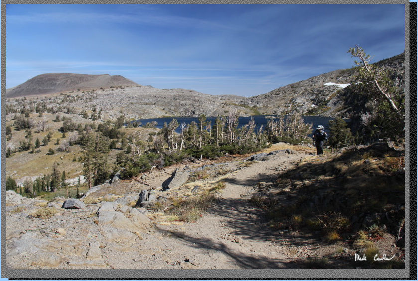
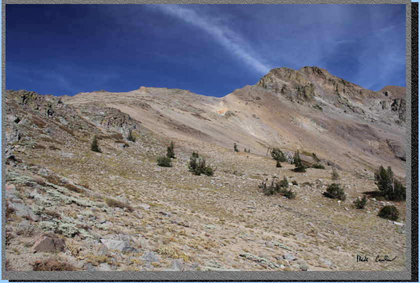
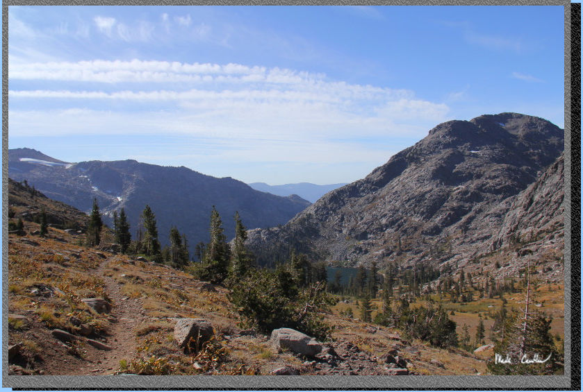
After crossing the inlet the next section of trail takes you up to Round
Top Lake at 9,350'. Here is Zakk headed up the trail with view of the
island in Winnemucca Lake behind him. You can see we have traveled a
good distance from Elephants Back now too. With good landmarks and good
junction markings it was easy route finding.
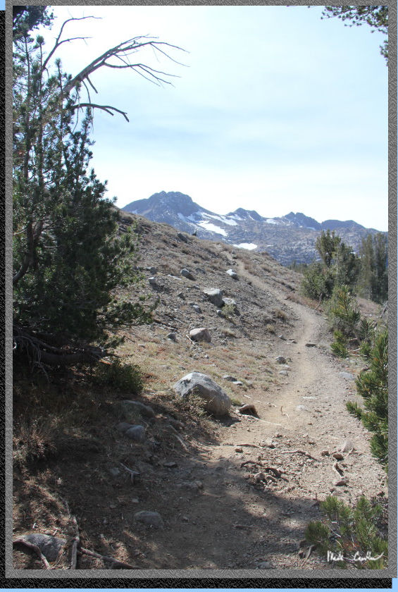
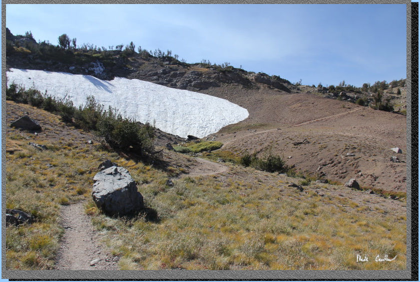
Round Top Lake is just over
the ridge in this shot. You can see a snow field hiding in the shadows
trying to make it to next year. There was a small creek that was traveling
under this snow field that came out about where the dark spot is near
the trail. The trail switches back up the ridge. You can see the trail
on a diagonal before it disappears into the bushes.
You are really close to the
ridge to the south now (Round Top and the Sisters). You come across
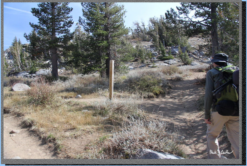
a junction to Woods Lake next, before getting to Round Top Lake.
Continue left/straight at
the junction with Woods Lake and head towards Round Top Lake (the marker
says Fourth of July Lake). You are pretty much done with the uphill
at this point. You follow the trail past the Sisters and through a notch
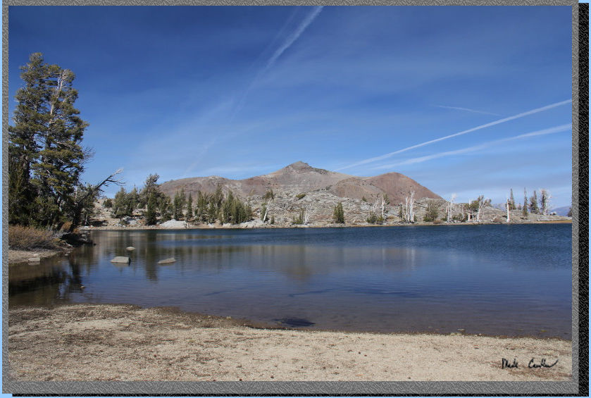
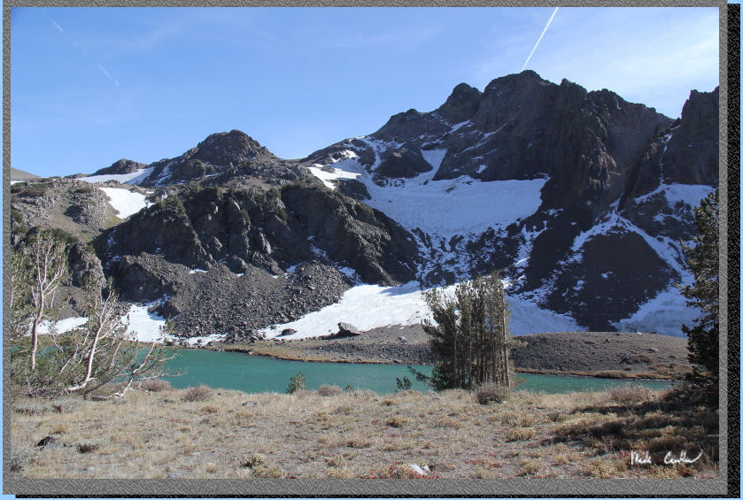
before you get to Fourth of July Peak. Here is a shot of Round Top Lake
and the glacial looking color of the lake. I did put my hand in some
of the water out here, yes it was cold. That white stuff was melting
and keeping water temperatures cold. Most of the white stuff will be
the base layer for this winter's storms..
I am looking back toward
Round Top Lake in this shot before the trail starts to curve around
the last Sister. 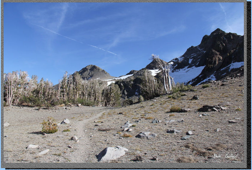
Here we are hiking down to
Fourth of July Lake on the backside of the Sisters now. Can you see
the lake? OK, that was a trick question because you can't. The lake
is down in the trees on the right of this picture, just around the corner.
You lose about 1,100' during this section, the lake is at 8,200'. This
section of trail used to be shorter. The trail used to go more straight
down the mountain style. I like the current configuration though as
the switchbacks make the grade more knee friendly. It is still a lot
of downhill, which makes tomorrow, and the trek back, have a lot of
uphill.

It was a glorious fall day
to be hiking. Sections of trail like this can be hard to appreciate
when the temperatures, and sun, are high. Today couldn't have been better
for a long hike with a pack.
I took a lot of pictures
on this hike, a plethora of pictures. This section will seem like it
takes a while, as the lake always seems just out of reach, maybe just
100 yards away.
You are close once you start to see the lake, but there are many switch
backs. If you look at the map you can see that there
are a lot of squiggled lines. I did not add those to the map by hand.
If you are paying attention to the lighting you will see that this shot
was taken on the way out the next morning. I think I was focused to
just head down the trail at this point to get to camp so failed to get
a good shot on the way in. With the fall you have to plan for daylight
carefully. The sun sets early and the ridge to the west of the campsite
meant we had even less light left.
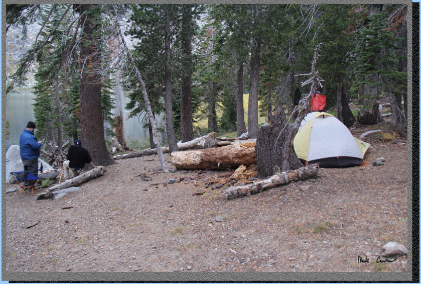
We looked at site numbers
one and two when we got to the lake. We decided that site 2 had better
views and had the tents/kitchen closer together. We setup tents, filtered
water and hung a bear bag before it got too dark. The site had two good
tent spots. Site one also had at least two good places for tents. The
wind was forecast to be significant that night. On the trail in we felt
some gusts, but down at the lake it was sheltered some from the gusts.
We did guy out and stake the tents just in case things "picked
up". We had the lake to ourselves (I think anyway). The stargazing
was good and the slight to moderate breeze kept the bugs away. The evening
quickly cooled down, as it does this time of year. It was forecast to
get down below 30 that night, and I think it did. We did not have anything
freeze on us but there was ice along the trail the next morning.
Continue to Page 2 by clicking here. Scroll down for map and elevation profile.
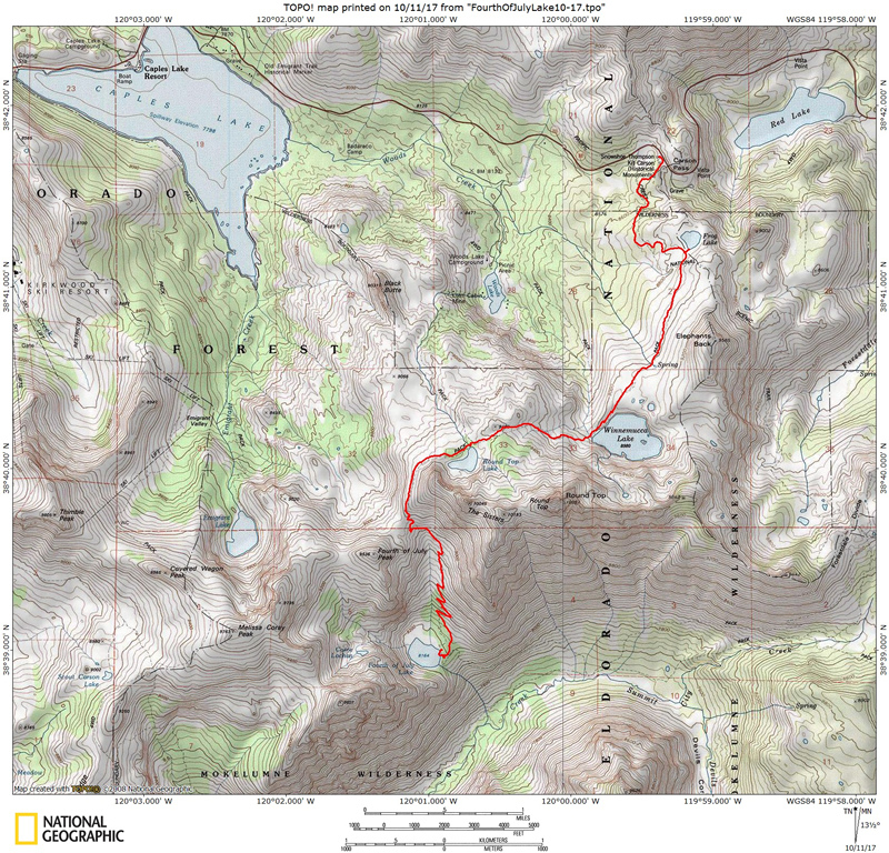
Red line shows the
section we hiked from Carson Pass Trailhead to Fourth of July Lake site
#2.
Elevation profiles below map.
Click on map or profile for larger version.
.
(back to top)