


![]()
 Permit
- A permit is required for all overnight stays in Emigrant Wilderness.
Permits can be obtained in person at the Summit Ranger Station at 1
Pinecrest Road in Pinecrest off Highway 108. There are currently no
trailhead quotas or fees for the permit.
Permit
- A permit is required for all overnight stays in Emigrant Wilderness.
Permits can be obtained in person at the Summit Ranger Station at 1
Pinecrest Road in Pinecrest off Highway 108. There are currently no
trailhead quotas or fees for the permit.
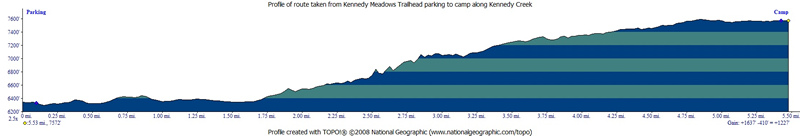
Mileage - We did 5.5 miles each way from Kennedy Meadows Trailhead parking lot to our site. Your mileage may vary depending on site selection. See map/profile below.
Camps/Water - There is a bathroom, trash cans, and water at Kennedy Meadows Trailhead. The first part of the hike takes you past the Kennedy Meadows Pack Station (has store and restaurant).
Hazards - Black Bears, creek crossings, mice/squirrels, and mosquitoes. Nearest Ranger # 209-965-3434 (always check with ranger ahead of time for current water/trail conditions).
Eric, Leo, Dan and
I planned this late season Sierra trip. We
would start at the Kennedy Meadows Trailhead off Highway 108 east of
Strawberry (and west of Sonora Pass) and head to Kennedy Creek to find
a nice site above the creek. The trailhead bathroom is pictured below.
If you are headed eastbound on highway 108 you will make a right onto
Kennedy Meadows Road and quickly drive past Baker Campground.
You will see the trailhead parking on the left side of the road. There
is a large lot with some spaces designated for horse trailers. The sign
at the trailhead says there is a two night maximum on trailhead camping
(that can be paid to the iron ranger). Trailhead has pit toilet, trash
cans, some picnic tables and water. Being midweek in late September
we had plenty of available parking spots.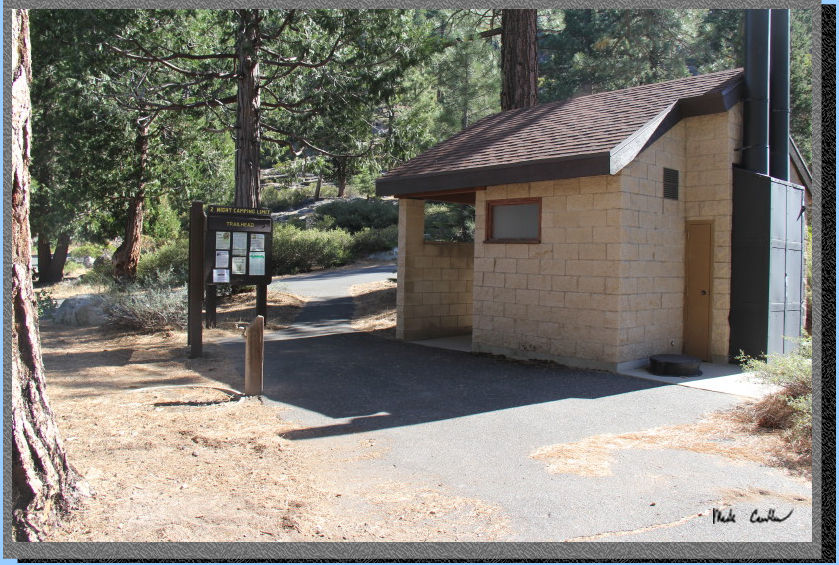
Once you are ready
to hit the trail you can either walk out the way you drove in, or head
to the end of the parking lot and make a right down the path to the
road you came in on (either way is equally fine). The trail winds you
down alongside (but below) the parking lot before meeting up with the
road again. There are no signs to tell you that this is the trail down
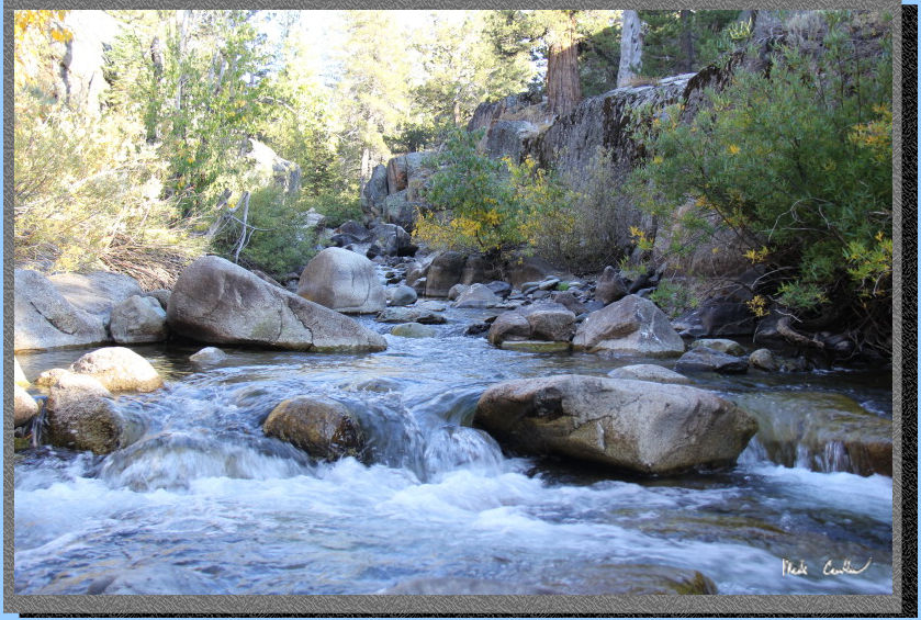
to the road. Here is the Middle Fork of the Stanislaus River on the
way in. If you want to really see what full flow looks like check out
pictures from a previous trip to Relief Reservoir
after a wet winter.
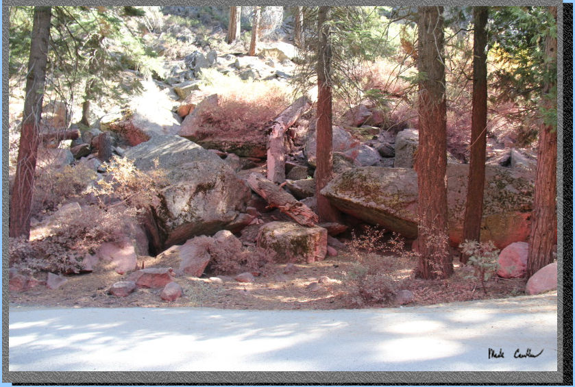
Did I mention there
was a giant forest fire out here. When I was planning this trip there
was some concern that Kennedy Meadows might be consumed in the Donell
Fire. Luckily they were able to save Kennedy Meadows Pack Station. The
image below shows how worried they were though. This red dust is fire
retardant that was dropped before the bridge the road goes over to reach
Kennedy Meadows Pack Station.
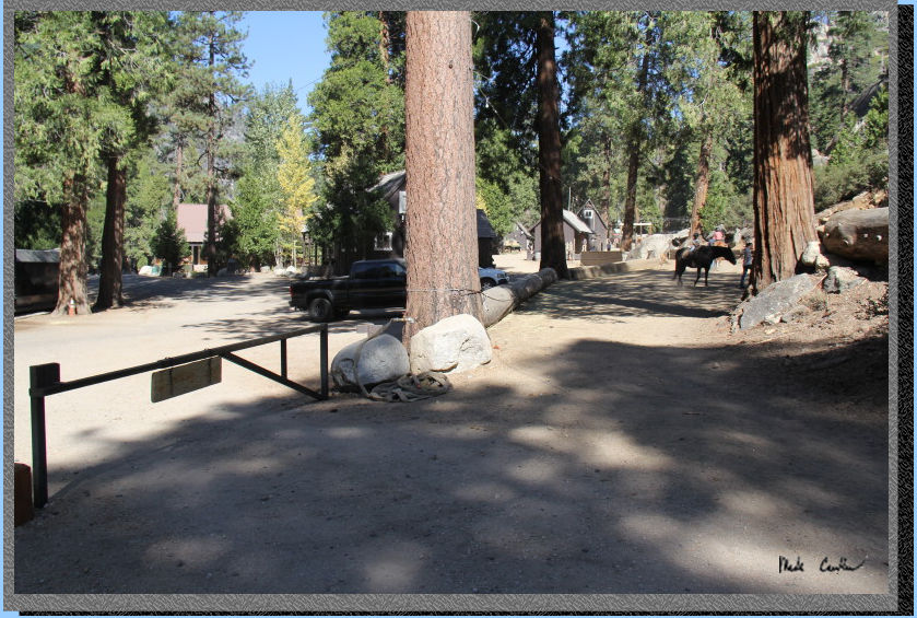
Hike past the cabins along the road and past the restaurant and pack
station to the gate in the picture below. You can see the stable/horse
area behind the restaurant/store in the distance (and a horse). Unsurprisingly,
you will encounter horses along this road/trail. There is a sign that
says it it one and a half miles from the trailhead parking lot to the
wilderness boundary (seems accurate). You are not at the wilderness
boundary yet.
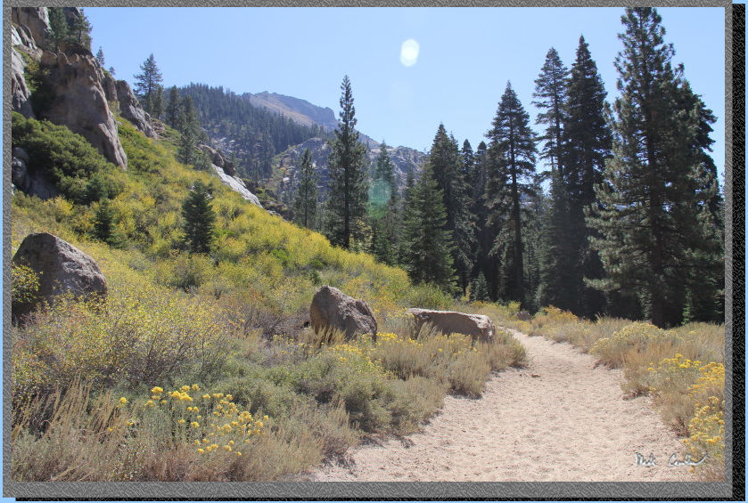
The section along
the road is level and mainly covered. After passing through the gate
above, you will hike up to a water tank, and then the trail levels off
again as you follow river.
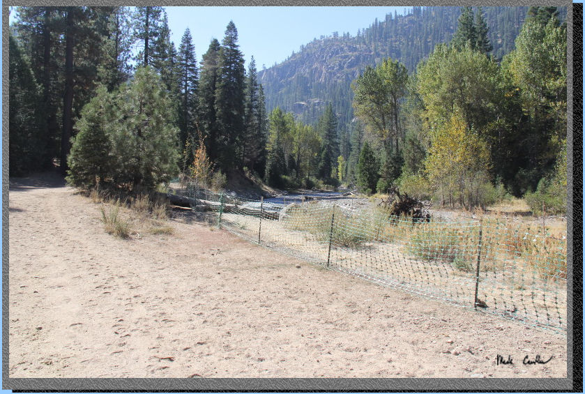
PG&E is doing some restoration project along the river to stabilize
the shores. The fencing is to keep you out, and off of the new plantings.
There are some informational signs you can check out on the way in.
There was also a small weather station as well in the meadow. The trail
is open through this section, but as you can see in the image below
the trail goes left now into some trees. You are near the wilderness
boundary now.
The trail does head up now again to the first bridge. The frequent horse
traffic and popular nature of this trail means there is a fair amount
of trail dust. Our crew was actually split into two groups this trip.
Leo and Dan headed up before Eric and I, to get a head start on us and
beat the heat. When we met up with them at camp they told us some cattle
were being driven down the trail toward Kennedy Pack Station. Leo and
Dan didn't look that dusty but said there was some dust involved when
the cattle went by. I don't believe them, but this time I made an exception
:-)
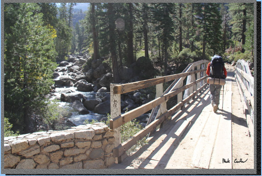
Here is the first
bridge with Eric hiking ahead. We didn't see many people on the trail,
actually saw more horses than people.
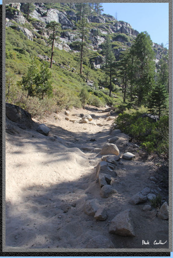
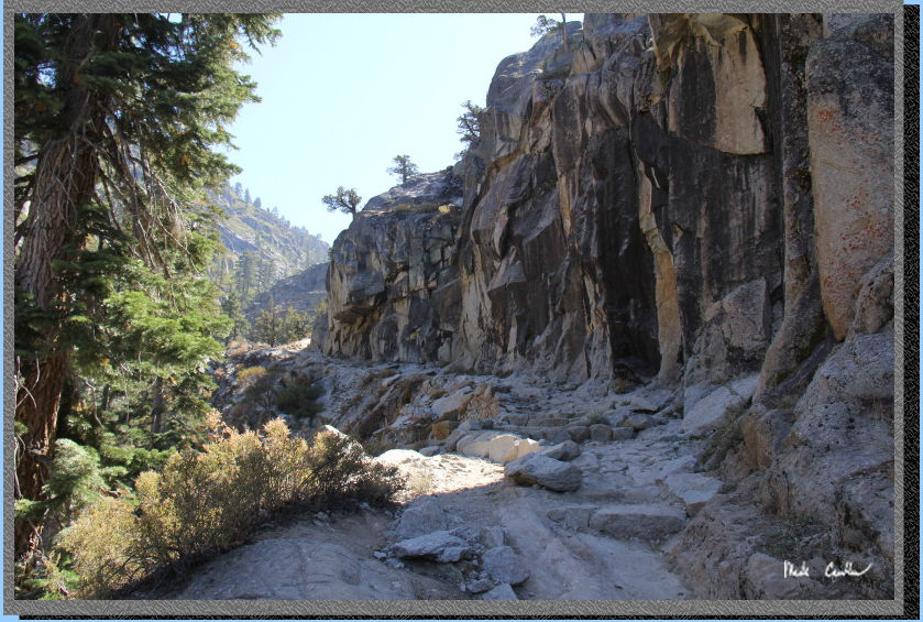
The trail is uphill
now for a good stretch with it being mostly rock underfoot. We got some
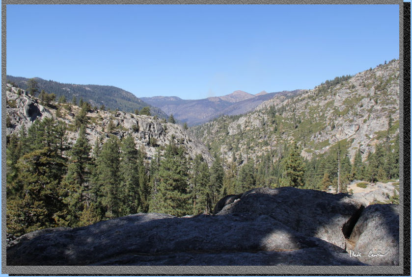
shade from the cliff face. This section of trail is amazing. The river
is down below and provide some good views and some great sounds with
the sounds bouncing off the rock face. This is one of those sections
of trail that you need to experience in person.
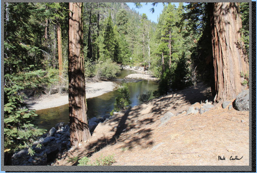
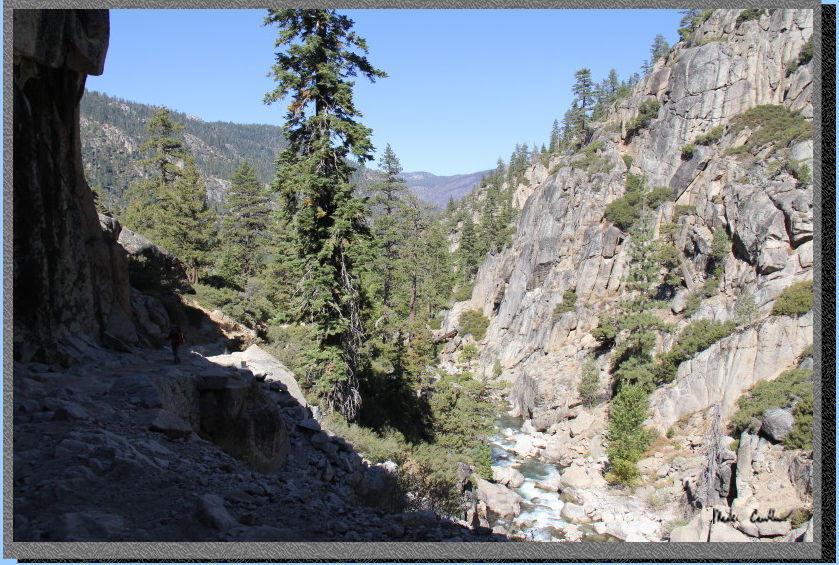
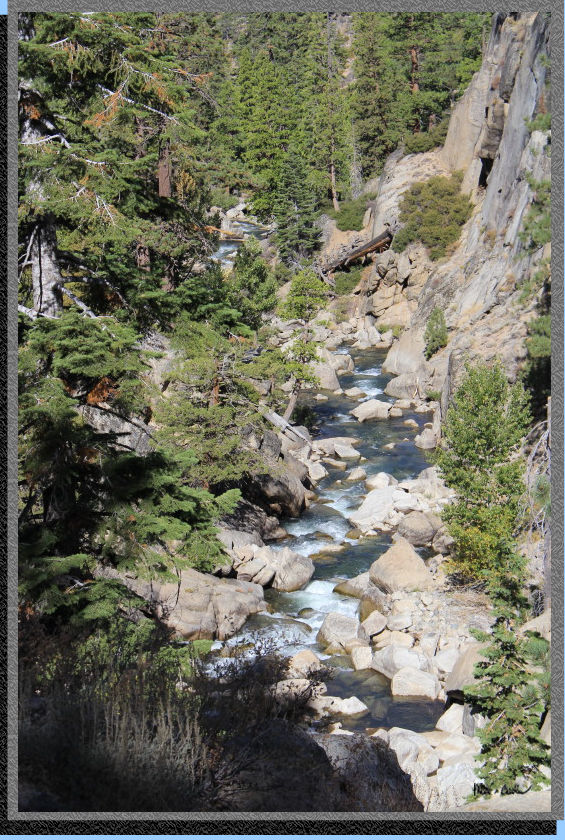
Here is the trail
and the river down below. I was glad to see so much water still flowing
out here late in the season.
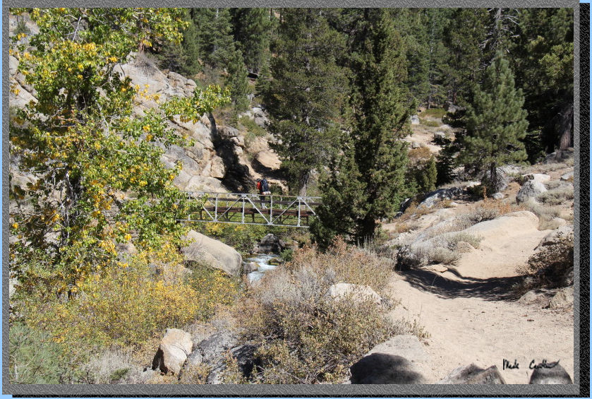
Here is the second
bridge now, which is high over the water coming out of Relief Reservoir.
The next section gets a little steeper and has more rock stairs to climb.
No more shade provided by the rock cliff face :-(
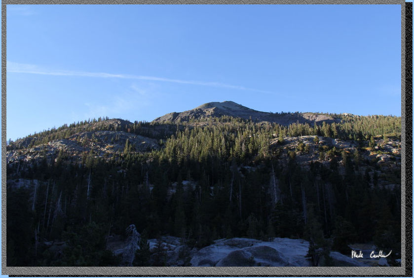
Here is a shot looking
back toward Kennedy Meadows. I try to turn around and look where I have
been occasionally, otherwise I could miss a good view.
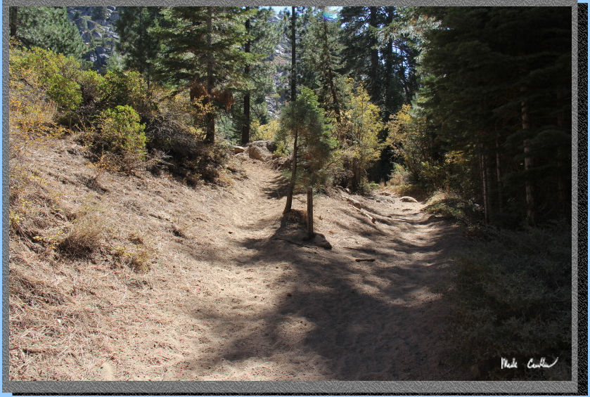
Eventually the trail
will flatten out and get sandy, but only briefly as the junction to
Kennedy Lake is just ahead. The trail remains open through this section
as well. It was getting a little warm at this point (well warm for seven
thousand feet).
Here is the junction.
If you continue right/straight you will go toward Relief
Reservoir, we took a left toward Kennedy Lake and started another
ascent.
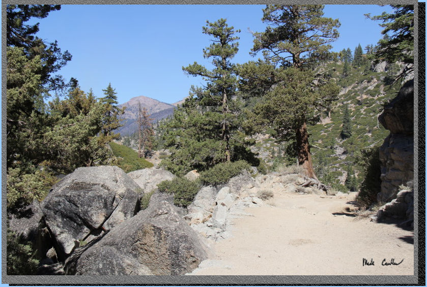
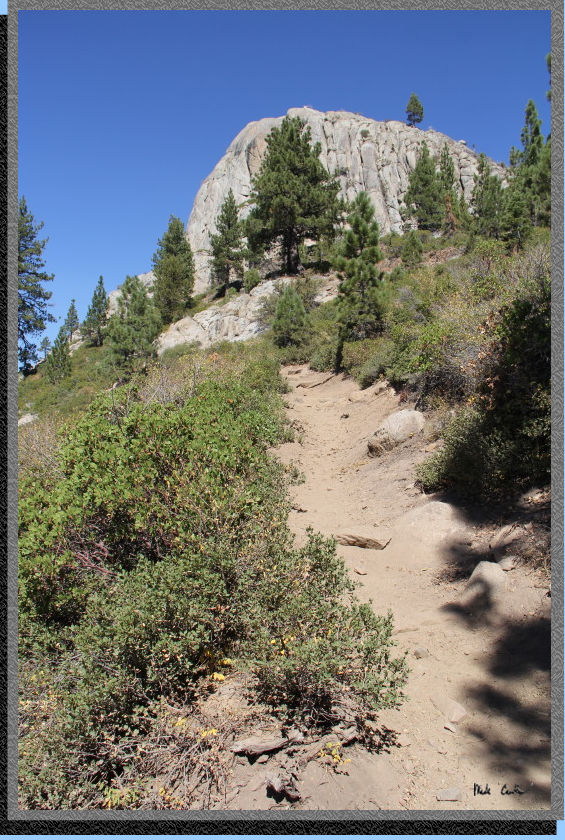
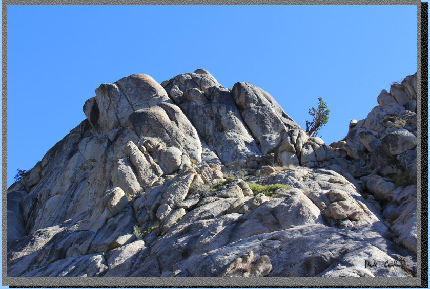
There are quickly
some great views of the surrounding landscape. Here is a rock that looked
like a mini El Capitan to us. There are views off to Relief Reservoir
as well, but you never see the water. You can see a rather large pool
formed from water leaving the reservoir though.
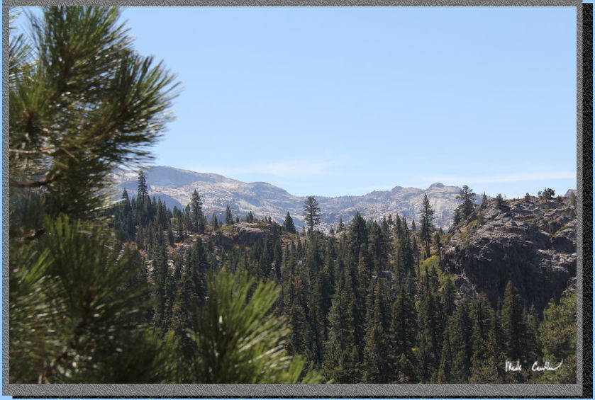
Here is the view toward Relief Reservoir. You will have to trust me
that there is a large pool of water to see. This section is mainly exposed
and switch-backed.
We continued going up and into some cover where the trail is more gentle.
We decided to break for lunch here on a granite outcropping before heading
down to the next bridge. It was nice to take a quick break and enjoy
the view/breeze.
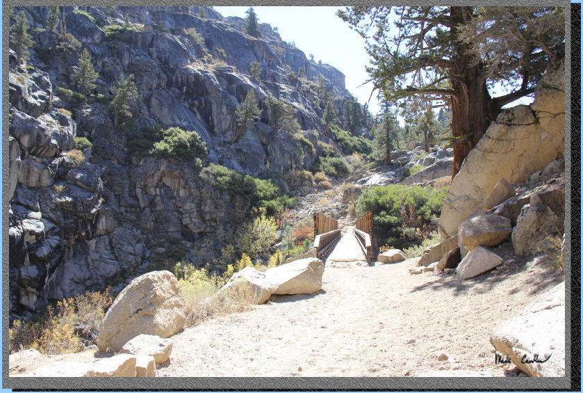
Here is Eric on
the bridge over Kennedy Creek. The trail ascends again on the other
side of the bridge, but not as steep as previous sections of the trail.
According to Eric this section is dusty, I think it was about the same
as the rest of the trail.
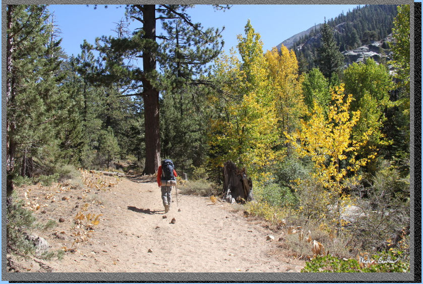
Here is Eric on
the trail, alongside the creek. The deciduous trees were starting to
turn making for some great fall colors.
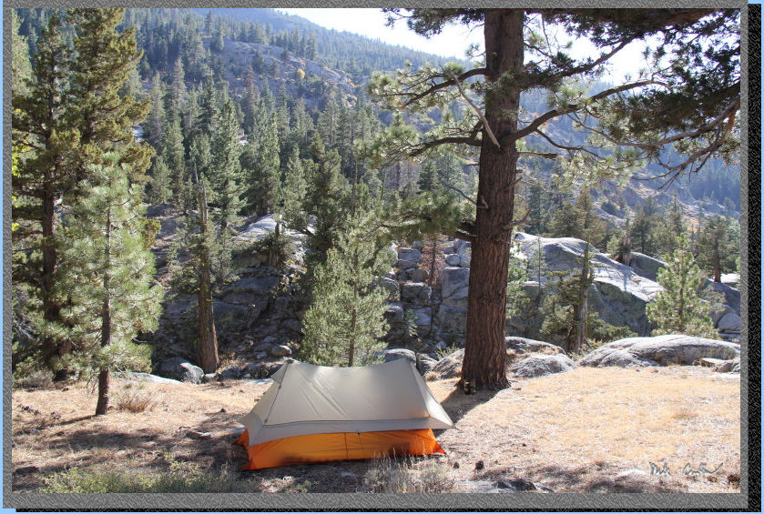
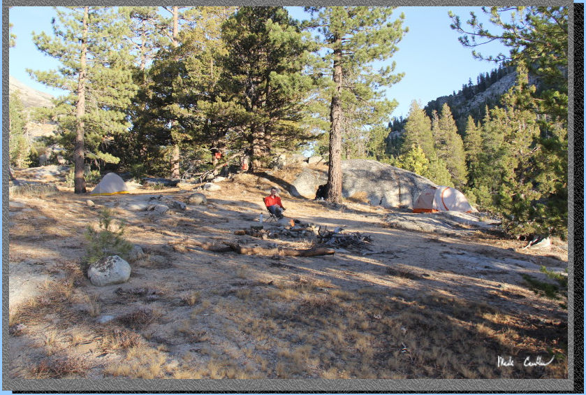
Before we could
make it to the next junction we ran into Leo and Dan who had beat us
by quite a bit, and had already scouted out a good campsite above the
creek. We setup tents and explored the creek below (well some of our
group decided a power nap would be more fun). Here is my tent setup.
I decided to roll up the pant legs and explore the creek some. The rocks
were slippery and the water was numbing, but it was fun to try to go
upstream some to see how far I could go. There were some decent sized
pools and the water was flowing good. I was in the middle of the creek
in this shot.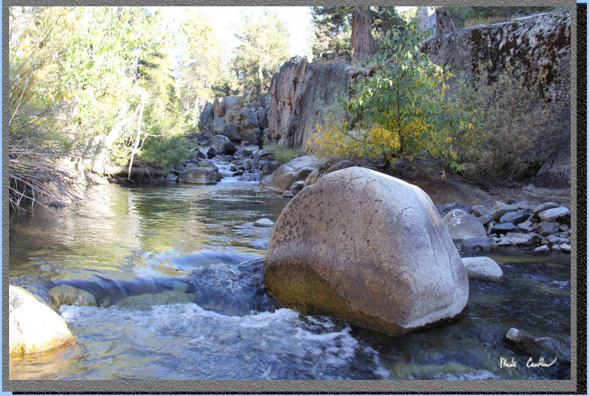
Another shot of
Kennedy Creek (thanks Eric!). You can see Leo and I lounging by the
creek.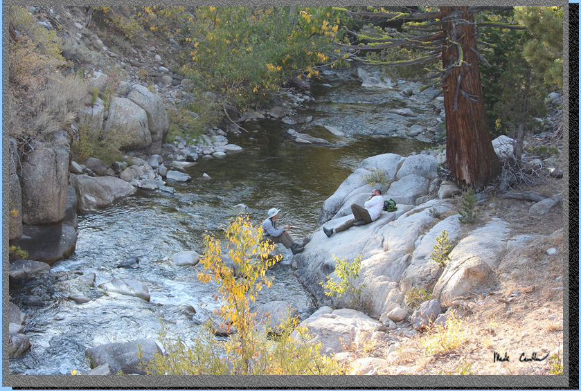
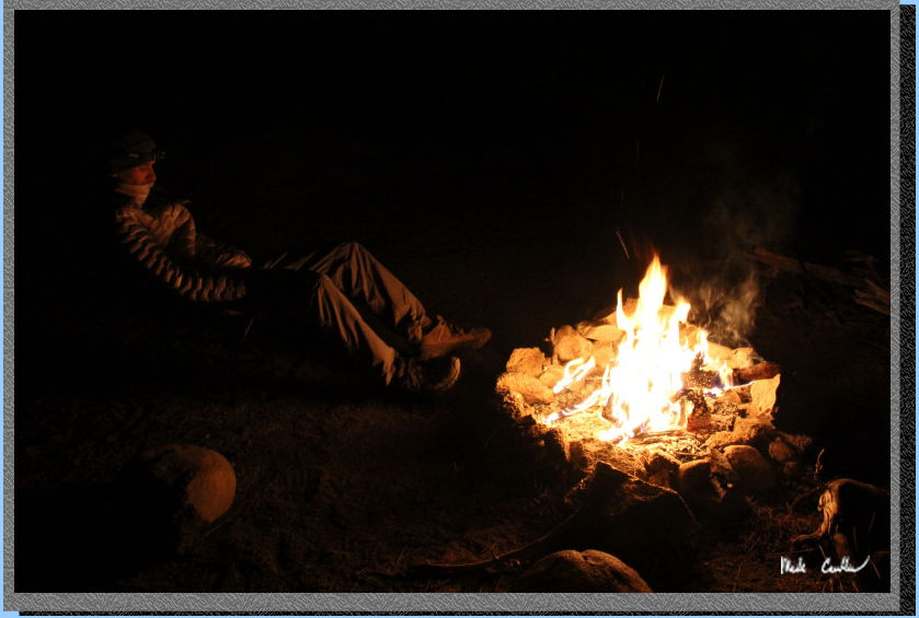
While Leo and I
were down at the creek Eric decided to get a fire started. I was surprised
with the recent forest fire that there were no restriction out here.
We stayed up until
it got dark, which isn't that late this time of year. We had a couple
collapsible buckets filled with water and completely doused the fire
(and stirred) before retiring for the evening. I brought my bear canister
and we also bear bagged the rest of the group's food (including stuff
bears think is food). Here is Eric "watching" the fire.
The beauty of this
campsite was you got to hear the creek all night (hard not to fall asleep).
It was a shame to leave this great site after only one night (but it
was also great to be able to get out into the wilderness). I took this
shot as the sun was rising that morning.
We headed out the
way we came in. This time is was almost all downhill of course. I will
leave you with some shots of things I grabbed on the way out, and the
suggestion you should stop in to have a meal/cold beer at the restaurant
after your trip (you won't be disappointed).
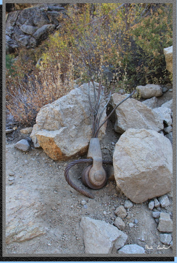
Leftover reservoir
construction equipment.
Thank goodness for
the footbridges on this trail!
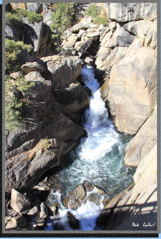
Looking down the
river.
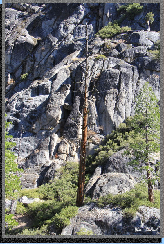
Obligatory "dead
tree" picture.
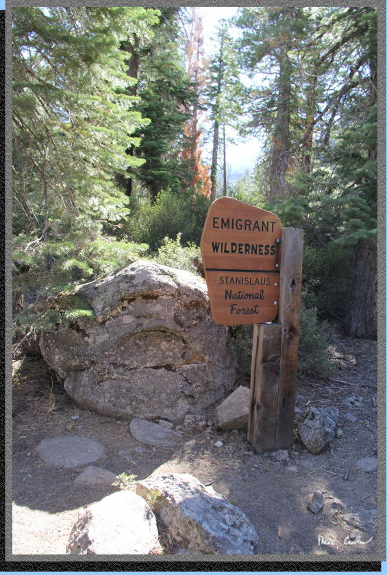
I swear this sign
looks the same as it did two years prior when I thought it was new!
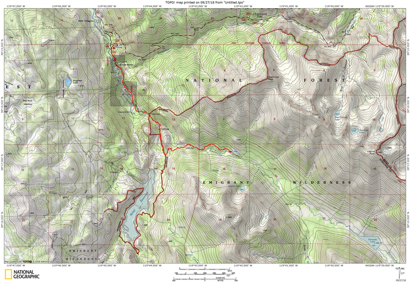
The red line shows
hike in to camp (Kennedy
Meadows Trailhead to camp along Kennedy Creek).
Scroll down for elevation profile. Click on map
or profile to be taken to the larger
version.
(Back
to top)
Here
is the profile for day one from the Kennedy Meadows Trailhead to camp
along Kennedy Creek.
(Back
to top)