![]()
 Permit
- Permits can be obtained through www.reserveamerica.com.
Permits must be picked up from the Bear
Valley Visitor Center (located at 1 Bear Valley Road Point Reyes
Station, CA 94956, 415-464-5100). If you are arriving outside of the
visitor center's hours they will post permit outside for you. Sites
run $20 per site per night (up to 6 per site). There are also a few
group sites with prices starting at $40 per night.
Permit
- Permits can be obtained through www.reserveamerica.com.
Permits must be picked up from the Bear
Valley Visitor Center (located at 1 Bear Valley Road Point Reyes
Station, CA 94956, 415-464-5100). If you are arriving outside of the
visitor center's hours they will post permit outside for you. Sites
run $20 per site per night (up to 6 per site). There are also a few
group sites with prices starting at $40 per night.
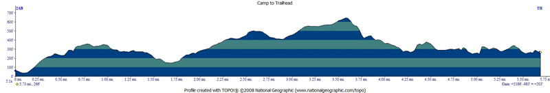
Mileage - Wildcat Camp is approximately 5.8 miles each way from the Palomarin Trailhead (see map and profile below). Alamere Falls is another mile from camp each way, you must know when high tide is before setting off on this hike or you could get trapped against cliffs by waves (not good)
Camps/Water - Wildcat Camp has 7 sites (three of them are group sites). Sites 6 & 7 are closest to ocean. Nice pit toilets are near site 2 (yes some can be nice). Each site has a metal locker, picnic bench and barbecue (group sites have 2 of each). A potable water faucet is provided near site 2. You used to have to filter out of the creek. There are also trash/recycle receptacles.
Hazards - Poison Oak, and ravenous raccoons (use the locker). The raccoons actually haven't bothered me out here two trips in a row now.
Eric and I decided to go on this trip to Wildcat Camp, with a day hike to Alamere Falls (pictured below). I have done this trip a few times now (2015 and 2003). Use the links to view the old trip descriptions. In talking to the ranger we heard a young pair of backpackers that thought they could uber to a trailhead to make a loop hike. The ranger explained that the likelihood of either the cell phone or uber working were not high. While both can be reliable in civilization, remember to count on neither out on the trail. Arranging rides ahead of time is a must, and can be done to make for some nice trail options. The trailhead is a little bit of a drive from the visitor center, and you have to pickup your permit from the Bear Valley Visitor Center prior to hitting the trail. After picking up the permit and filling up any water you need (no water at the Palomarin Trailhead), you will head back out to Highway 1. Travel south on Highway 1 for about 25 minutes, look for a wooden sign that says "Dog Town" in a Eucalyptus grove and then make your next right at HorseShoe Hill Road (it sneaks up on you, so if you miss it just take your next right onto Olema-Bolinas Road, it will get you there too, and then make a left onto Horseshoe Hill Rd when you dead end into it). You will make another right from Horseshoe Hill Road onto Mesa Road at a three-way stop (up the hill in another Eucalyptus grove). Stay on Mesa Road now past the fire station, and then past the Coast Guard communications station. The road is gravel for the last 1.2 miles to the Palomarin Trailhead. It is not rough but not very wide.
The beauty of this camp is you are right on the water (well a really short hike down to it) and you can day hike to Alamere Falls once you setup camp. You must know when high tide is before setting out on the day hike. The falls are about 1 mile south of Wildcat Camp, and if you are out there when the tide comes in you can get trapped against the cliffs by crashing waves. Don't get yourself in that situation, ask the ranger for the tide table when you pick up your permit (or look it up online ahead of time). Sites are pretty exposed as you can imagine being this close to the beach. There are some tall shrubs that provide some privacy between sites (and great places for the raccoons to hide). Things to note are poison oak is plentiful if you head off trail and the raccoons here are no joke. Lock up anything that smells or looks like food. Sites do book up, so reserve your site early. I went on a Sunday and all but one site appeared occupied that night.
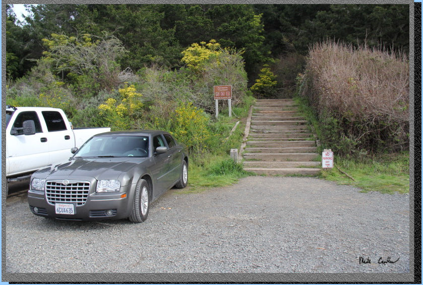
Here is the Palomarin Trailhead.
There are two pit toilets and both trash and recycle receptacles. There
is no water here. The trail starts up the stairs left of bathrooms in
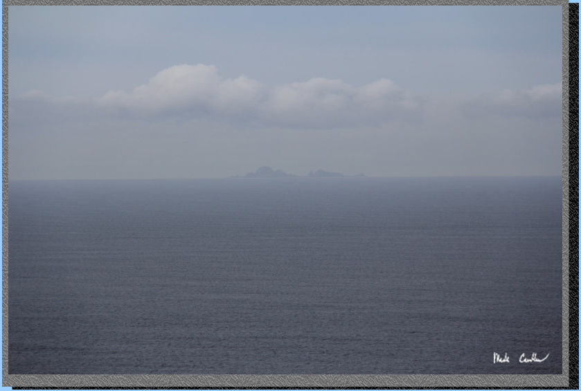
this shot. You can see the Farallon Islands on the road on the way in
if the weather cooperates.
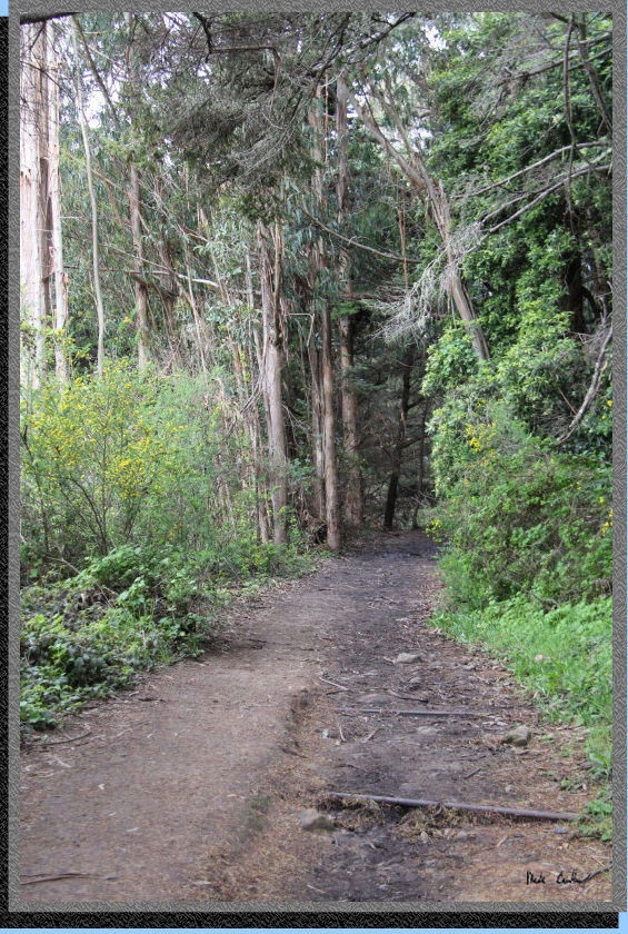
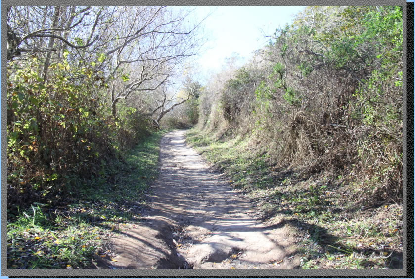
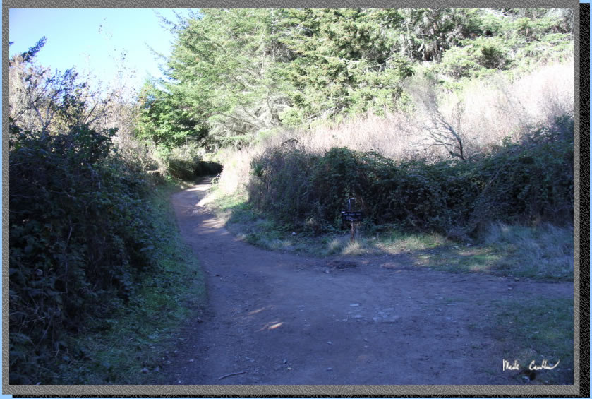
After you head up the stairs
from the parking lot, you take an immediate left. The trail travels
through some Eucalyptus trees that provide some nice cover. The trail
is level to slightly uphill. The first junction you will encounter is
for the Palomarin Beach Trail. The sign says the trail is 0.6 miles
to the beach. It seems like it would be closer than that, never tried
this trail though. You will continue straight on the Coast Trail.
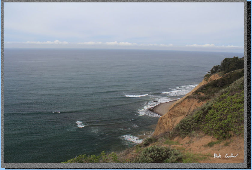
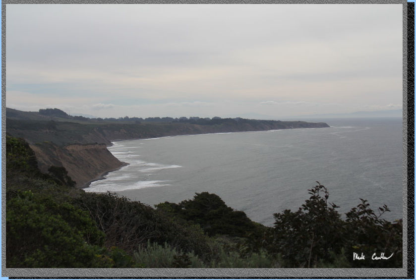
Eventually the trail opens
up and the reason it is called the Coast Trail becomes clear. Here is
a shot looking north.
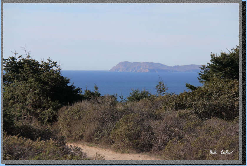
Here you are looking west
at the Farallon Islands.
And here you are looking south. All three shots were from this first
open section of trail. Although the weather wasn't perfect for visibility
it was perfect for backpacking.
The trail continues to wind
its way north along the coastline. There are some bridges along the
way to get you over the creeks that run through the canyons. There are
also some sections of trail that will take you in and then back out
of some canyons (not all of this trail has coast views). The
trail eventually turns inland and uphill. Most of the trail has some
cover, this next section has some shade as you enter a canyon as well.
Here is a shot showing this section of trail (picture from a previous
trip)..
Here is your next junction
(picture from previous trip). You will stay left at this junction to
stay on the Coast Trail, to the right is Lake Ranch Trail. You can see
some of the shade on the trail even in this somewhat open section.
Before you know it you are
at Bass Lake (and already hiked 2.8 miles). The trail around Bass Lake
is open again (which is good so you can see the lake). There is a use
trail to get down to the lake on the north side

One of the prettier wooded
sections.
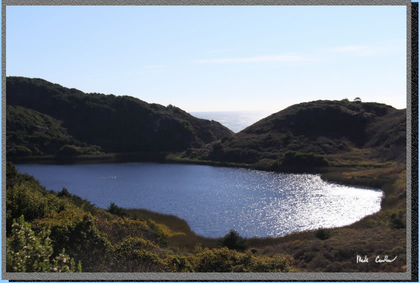
The next lake you see is
Pelican Lake. The trail stays above the lake, which allows you a nice
view of the lake and the ocean beyond (picture from previous trip).
The trail continues to be
covered and slightly downhill. You are close again the coast and the
trail is nice an open again past Pelican Lake. You have some good views
to the north (image from previous trip).
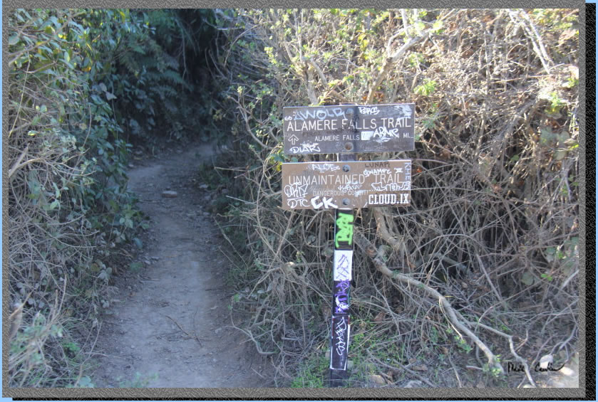
The next junction you come
to is for the use trail to Alamere Falls. There are signs stating this
is an unmaintained trail that has dangerous conditions (they would rather
you not use it). I have not taken this trail, but many people do. I
will say that the section you have to climb down/up on the beach side
is on steep eroding cliff faces. It looked easy to slip. Some hikers
opted to not hike down to the base, instead enjoy the view from the
top of the falls. See image of the trail junction below. It did not
look like a good option with a pack as the first section of trail is
overgrown and the steep section looked hard without a pack. We continued
straight on the Coast Trail as we planned to day hike back to falls
along beach after setting up camp. A ranger has told me that this section
of trail has a lot of poison oak and people climbing up and down the
cliff are injured all the time (image from previous trip).
There is a good bathroom
break spot ahead in a gravel open area with some evergreen trees (this
trail doesn't have a lot of good spots should you have to go). After
crossing a bridge over a creek you will come to a decision point. You
are almost to camp now and can either continue on the Coast Trail, or
take a left onto the Ocean Loop Trail. Both options are going to get
you back to the Coast trail and to camp. I went in on the Ocean Loop
Trail and out on the Coast Trail (the Coast Trail seemed less traveled).
The Ocean Loop Trail better as you had more ocean views (imagine that).
Both had about the same amount of ups/downs. Here is an image of the
junction. Left for Ocean Loop Trail, continue right/uphill on the Coast
Trail. (Image from previous trip)
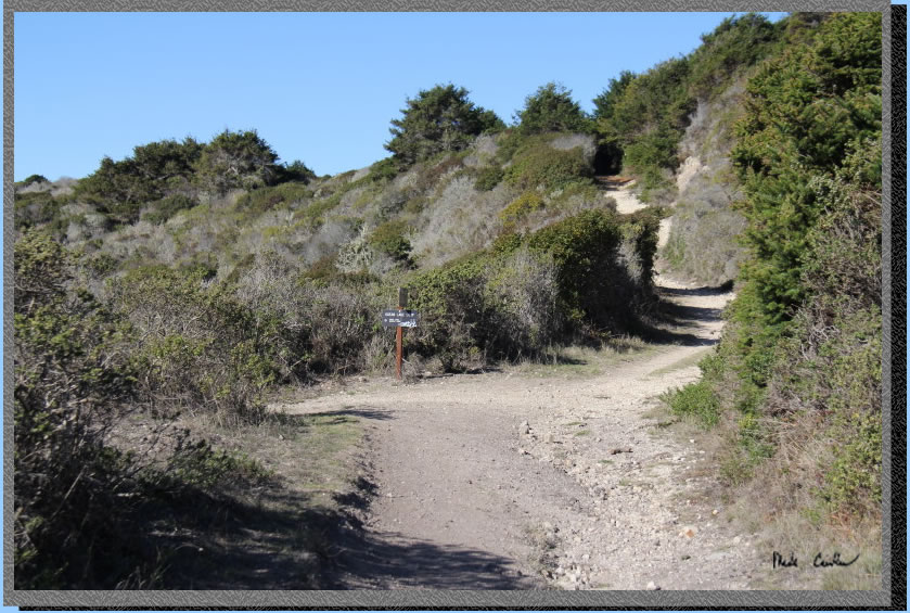
You will be at Wildcat Lake
next with the junction to the Ocean Lake Loop on the left just past
the lake. Continue on the Coast trail now the last tenths of mile to
Wildcat Camp. Here is shot looking down on Wildcat Camp from the trail
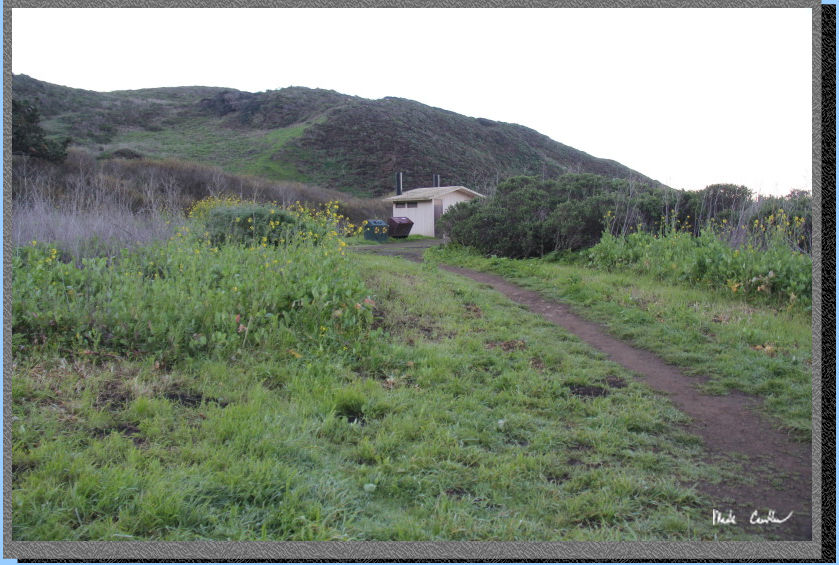
above. There are 2 nice pit toilets (yes, there are nice pit toilets),
trash/recycle cans and potable water. The beach is just down the trail.
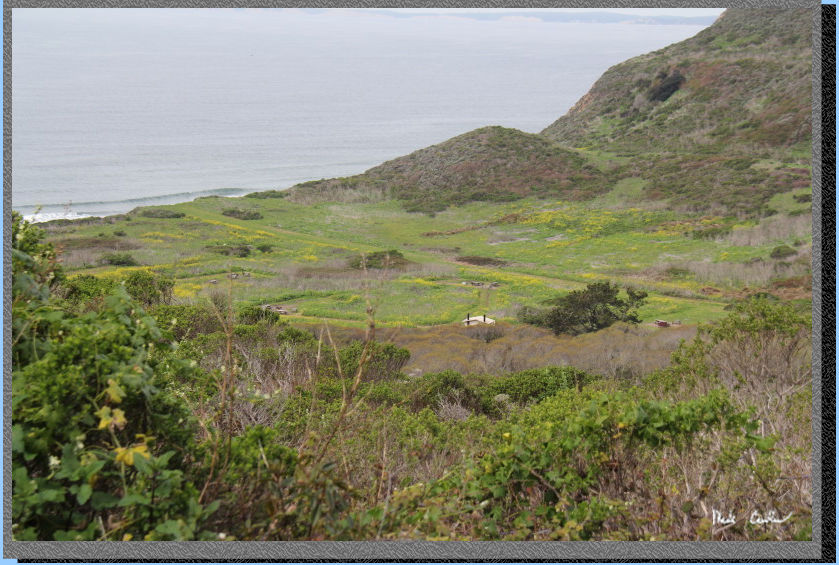
A picture to show the great spring conditions out there!
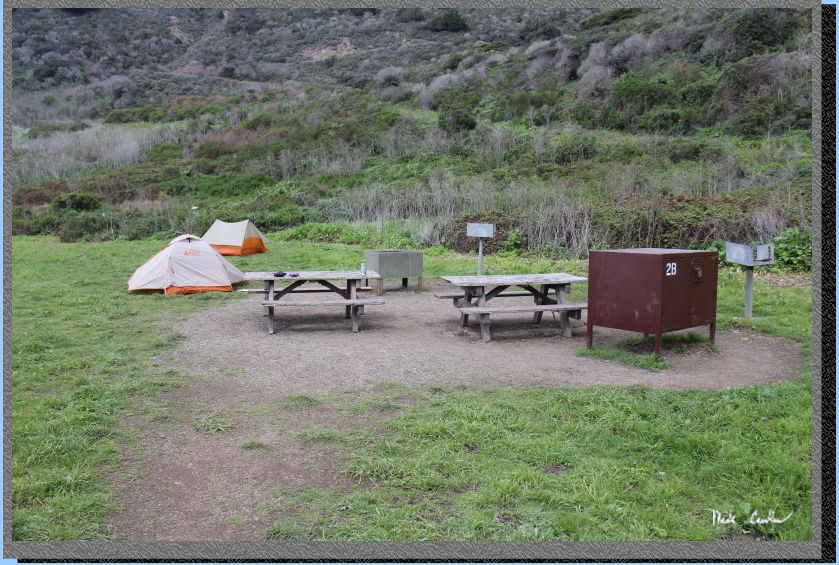
We setup camp at site #2AB.
This is a larger group site and is the closest to the bathrooms. It
would not be my first choice of sites but it is large and you can still
hear the ocean. My Scout UL 2 is setup in the distance with one smaller
food locker, one larger food locker, and two BBQs in the foreground.
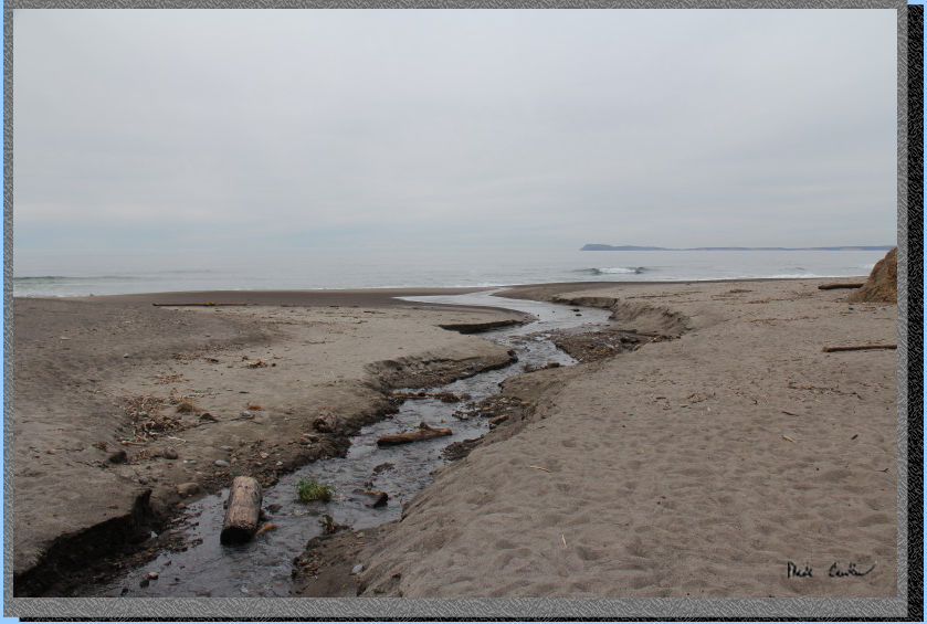
We setup camp before heading to Alamere Falls during low tide.
The trail to the beach is short, but dumps you off alongside the creek
outlet. This creek used to be the only water source out here, it was
recommended to filter water above the bridge that crosses it on the
way into camp.
There were not many people
at the beach (but plenty at the falls). You continue south on the beach
for about a mile to Alamere Falls. You can see evidence of how high
the tide was previously with the wet sand. We were hiking while we were
approaching a low tide, so we were safe from the water rising.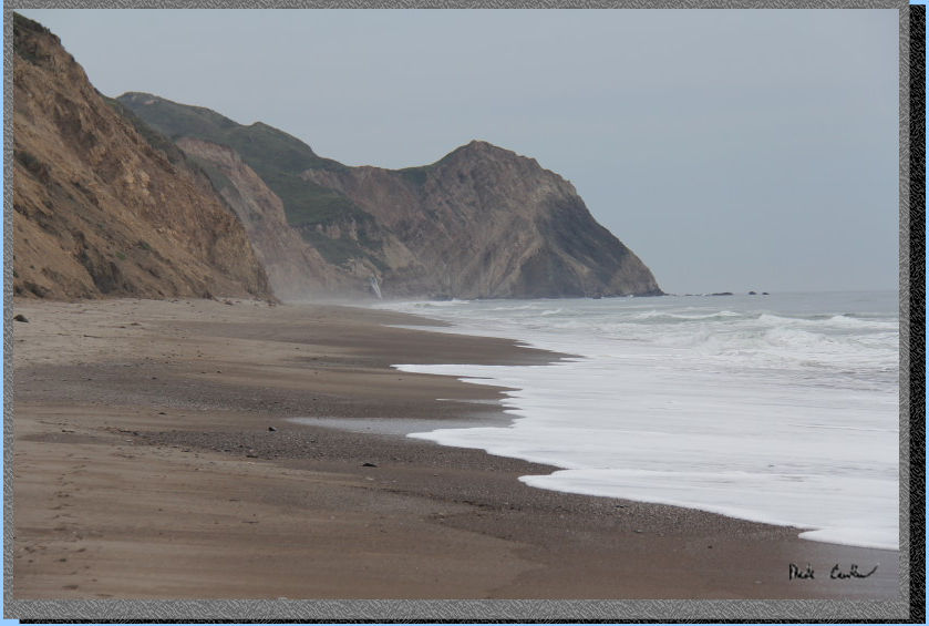
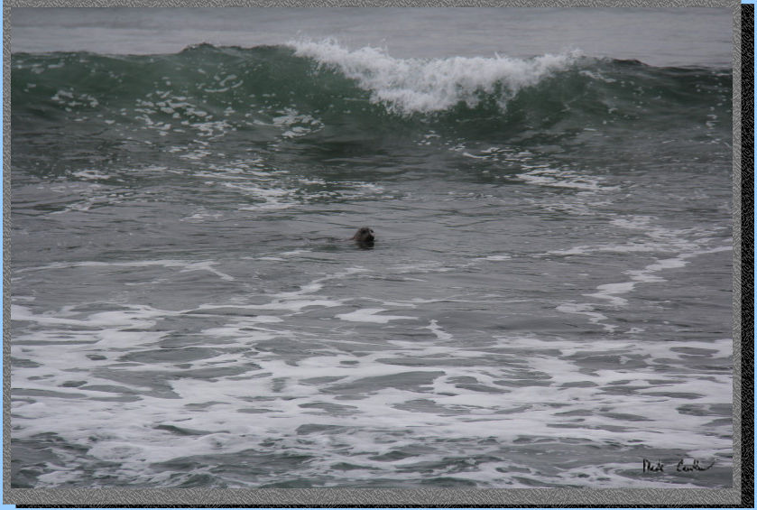
On our hike along the beach we had this seal peeking at us. It is always
great to see these animals out in the surf.
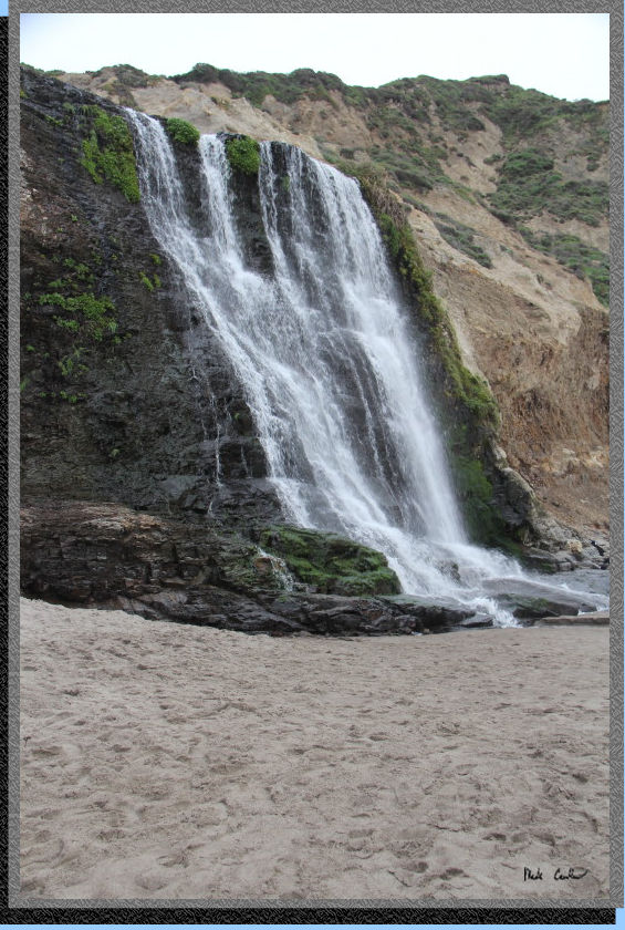
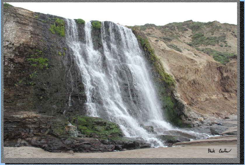
We finally made it
to the falls. The water was flowing nicely. There is something about
a waterfall right at the beach that has a magical feeling to it. Eric
and I watched quite a few photos being taken at the falls. There were
some being taken while people stood under the falling water. It was
too cold that day for me to even think about that. Eric and I watched
the progression of hikers up and down the cliff face using a makeshift
rope that someone had setup. After cringing at some slips happening
we decided to head back before high tide was an issue.
Eric and I had a good sights
sleep with the waves crashing in the distance to lull us to sleep. The
next morning we decided we would use the Coast Trail. Here is the trash/recycle
and pit toilet before we headed out..
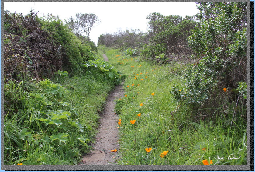
I will leave you with some of the shots I took on the way out...
Please watch your step on
the moist trail! I did not mention that there were a few puddles (but
conditions were not too muddy for this time of year).
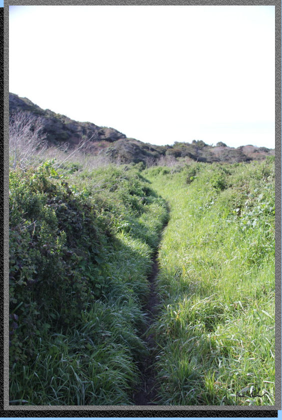
A narrow section
of trail (that got your pants wet with dew). Not the best picture but
it does capture the narrowness of the trail.
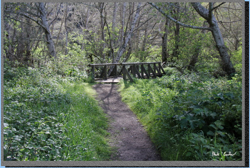
I tried to take some pictures
on the bridge of the creek below but was not happy with the results.
This picture of the bridge was nice though..
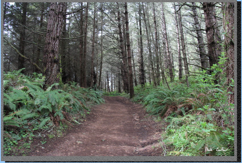
When I said the trail was
covered in spots I wasn't kidding. That black hole is actually the trail.
It was less scary in person but still a black hole until you went in
and your eyes adjusted to the low light due to the dense tree cover.

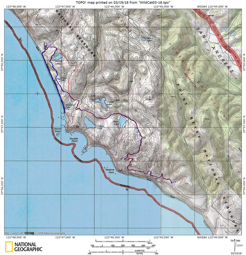
Blue line shows the path
we hiked from parked car at Palomarin Trailhead (TH on map) to Wildcat
Camp #2AB and then to Alamere Falls along the beach. Red dashed line
shows the path back to car on day two. Elevation profiles below map
(day one then day two). Click either for a larger
version.
(back to top)