


![]()
Leo
and I decided to head up to a new trailhead. I always do some family
camping at Pinecrest Lake off 108 and there is a great deal of Wilderness/Forest
space to explore in this area ,so we chose a spot not far from Pinecrest.
We decided to do a backpacking trip to Bear Lake in the Emigrant Wilderness.
I called up the ranger station at Pinecrest and they let me know that
no reservations or quotas currently exist in that Wilderness (209) 965-3434.
You must stop by and get a permit to camp in the Wilderness. There is
no fee for the permit. If you do not have a good map of the area you
can buy one at the ranger station for $11.00. A little steep, but it
is a nice weatherproof map (kind of large for trail use though). To
get to the ranger station from the bay area take highway 120 East until
the junction of 120 and 108. Stay straight to go onto 108. When you
see a right hand turn for Pinecrest slow down but do not turn right
quite yet. The Ranger station is at the "Y" where Pinecrest
Lake Road are and highway 108. Turn right into the ranger station just
past the right for Pinecrest Lake. We talked with a ranger who told
us most of the lakes that are close to a trailhead are popular during
the summer, but this year has been slow so far. The trailhead we left
from is called Crabtree Trailhead. It is a little ways from 108 but
not a bad road. Parts are unpaved but it was dry. I saw a Mazda Miata
in the parking lot of the trailhead, but I would bring something with
some more ground clearance (I am sure they scraped in a few spots).
To get to the trailhead (from the ranger station) head towards Dodge
Ridge by driving toward Pinecrest and take your first right (there is
a sign for Dodge Ridge Ski Area). Just before you get to the parking
lot of Dodge Ridge take a right onto a road labeled 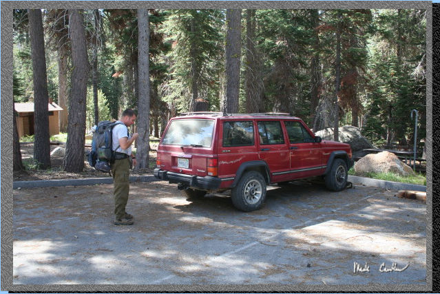 Crabtree/Gianelli
trailhead. This is the overflow parking area during the winter for Dodge
Ridge. Stay on this road until the first junction where you take a left.
Stay on this road heading west until a junction for the pack station.
Take a left and go past the pack station over the big speed bumps and
then watch for a sign for Crabtree trailhead on the right. The trailhead
has ample parking. One thing to note is you are only allowed one night
stays at some of the lakes in this region, so discuss your plans ahead
of time with a ranger if you want to stay more than one night without
breaking camp and moving to another lake. It is about 4.4 miles from
trailhead to the spot we camped on the far side of the lake. Here is
a shot of Leo doing his last minute hydration tube check before we hit
the trail. See map at end of trail description.
Crabtree/Gianelli
trailhead. This is the overflow parking area during the winter for Dodge
Ridge. Stay on this road until the first junction where you take a left.
Stay on this road heading west until a junction for the pack station.
Take a left and go past the pack station over the big speed bumps and
then watch for a sign for Crabtree trailhead on the right. The trailhead
has ample parking. One thing to note is you are only allowed one night
stays at some of the lakes in this region, so discuss your plans ahead
of time with a ranger if you want to stay more than one night without
breaking camp and moving to another lake. It is about 4.4 miles from
trailhead to the spot we camped on the far side of the lake. Here is
a shot of Leo doing his last minute hydration tube check before we hit
the trail. See map at end of trail description.
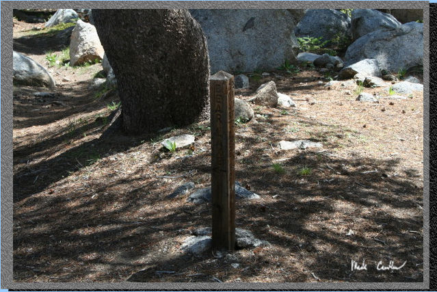
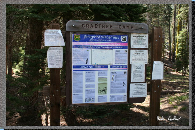 Here
is the trailhead sign. The trailhead is at the northwest side of the
parking lot. There are a few signs about bears, so I would make sure
to be prepared for bear bagging and with a plan should you encounter
one on the trail. If you are prepared you will probably never see one.
Here
is the trailhead sign. The trailhead is at the northwest side of the
parking lot. There are a few signs about bears, so I would make sure
to be prepared for bear bagging and with a plan should you encounter
one on the trail. If you are prepared you will probably never see one.
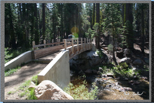 The
trail starts out going over a bridge over Bell Creek. The whole trail
seems well maintained and very well marked. I tried to take a picture
of all trail junctions as we hiked along.
The
trail starts out going over a bridge over Bell Creek. The whole trail
seems well maintained and very well marked. I tried to take a picture
of all trail junctions as we hiked along.
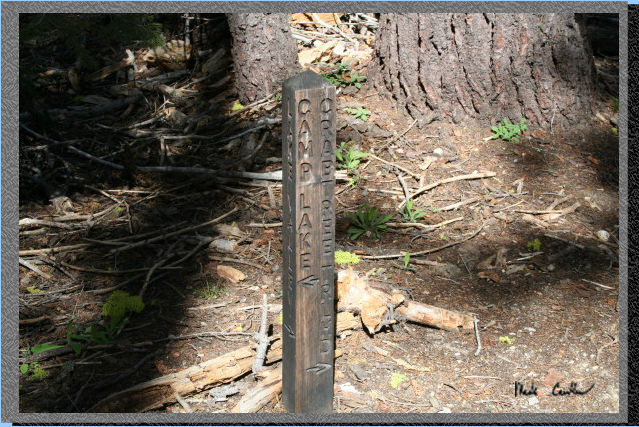 Here
is your first trail junction, right after the bridge. Stay straight
for Camp Lake (this is the lake before Bear Lake).
Here
is your first trail junction, right after the bridge. Stay straight
for Camp Lake (this is the lake before Bear Lake).
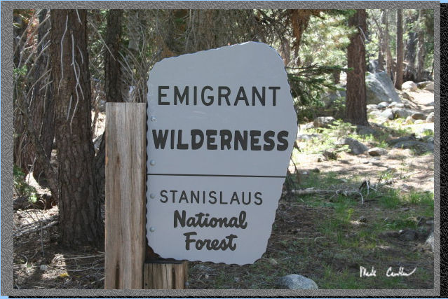 Here
is the Emigrant Wilderness sign on the way in. This is your reminder
to have a permit for your overnight stay.
Here
is the Emigrant Wilderness sign on the way in. This is your reminder
to have a permit for your overnight stay.
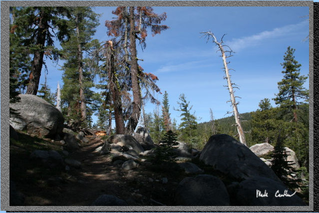 The
trail is beautiful on the way in. There are a few stretches of some
uphill, but I would say the trail in as a whole would be rated as easy.
The trail stays below tree line, so there are some good sections of
shade. The rock formations are amazing, so make sure you are not looking
at your feet the whole way in.
The
trail is beautiful on the way in. There are a few stretches of some
uphill, but I would say the trail in as a whole would be rated as easy.
The trail stays below tree line, so there are some good sections of
shade. The rock formations are amazing, so make sure you are not looking
at your feet the whole way in.
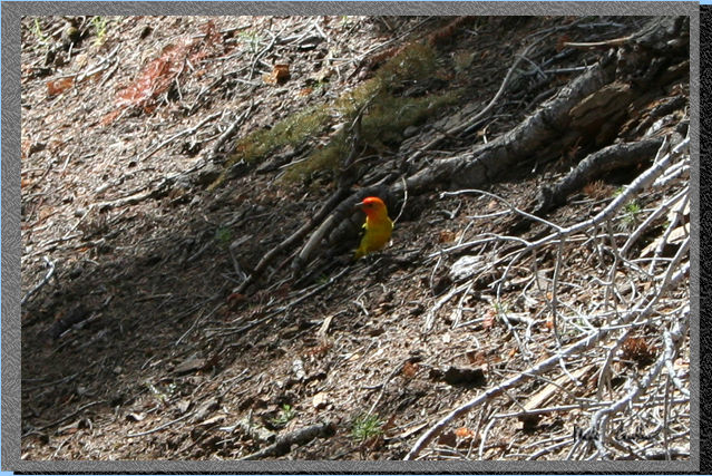 This
little guy was so brilliantly colored it was hard to miss him.
This
little guy was so brilliantly colored it was hard to miss him.
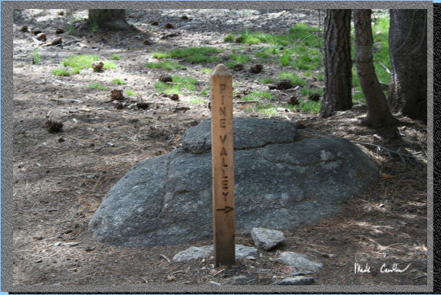 The
trail junction for Pine Valley is at about one mile in. From the overlook
at Camp Lake, Pine Valley looks like a neat place to explore but steep
to get out of.
The
trail junction for Pine Valley is at about one mile in. From the overlook
at Camp Lake, Pine Valley looks like a neat place to explore but steep
to get out of.
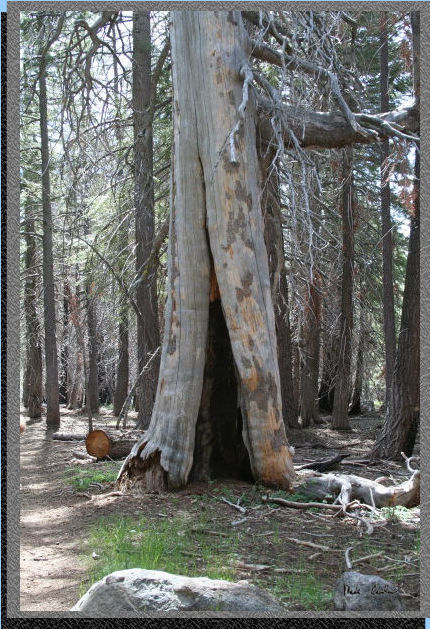 Here
is a tree that has been hollowed out by fire. Some parts of this trail
appear to be right on the edge of a past fire. Trees on one side of
the trail seem to be damaged while those on the other appear untouched.
I picture some brave firefighters making a stand from the trail.
Here
is a tree that has been hollowed out by fire. Some parts of this trail
appear to be right on the edge of a past fire. Trees on one side of
the trail seem to be damaged while those on the other appear untouched.
I picture some brave firefighters making a stand from the trail.
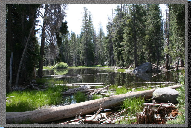 Here
is a pond on the way to Camp Lake. No swimming here but I am sure the
mosquitoes like it.
Here
is a pond on the way to Camp Lake. No swimming here but I am sure the
mosquitoes like it.
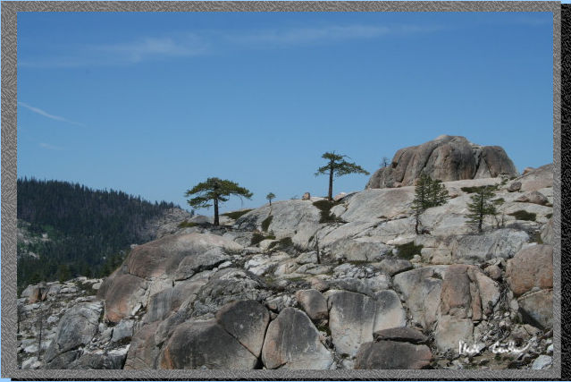
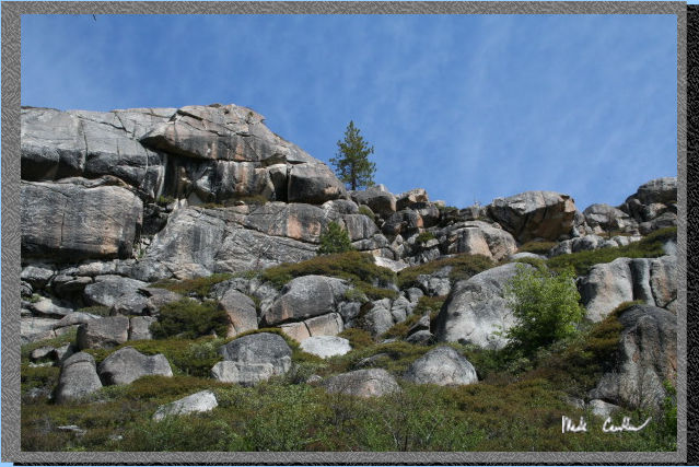 The
ridge along the trail has some magnificent rock formations. Make sure
you look around as you hike or you will miss these kind of views.
The
ridge along the trail has some magnificent rock formations. Make sure
you look around as you hike or you will miss these kind of views.
 Here
is Camp Lake. There are not many spots to camp around this lake.
Here
is Camp Lake. There are not many spots to camp around this lake.
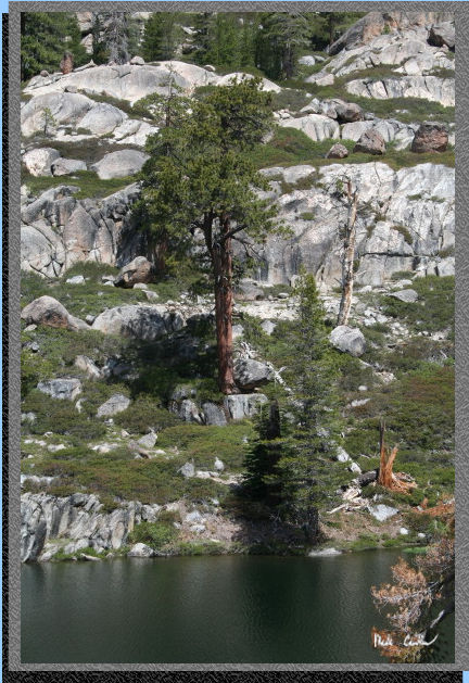 The
ability of trees to grow where there is little to no soil is amazing
to me. Here is a tree that appears to be thriving despite its precarious
position above Camp Lake. Of course I have no idea how long this tree
took to grow this much. Some of these trees are probably growing slowly,
so could be quite old.
The
ability of trees to grow where there is little to no soil is amazing
to me. Here is a tree that appears to be thriving despite its precarious
position above Camp Lake. Of course I have no idea how long this tree
took to grow this much. Some of these trees are probably growing slowly,
so could be quite old.
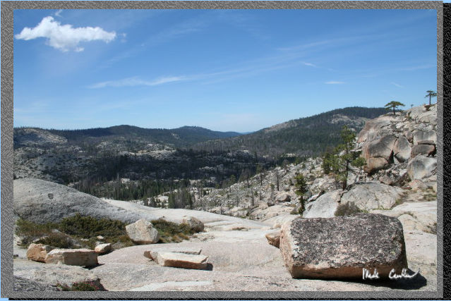 I
decided to venture up to the ridge overlooking Pine Valley to the south
of Camp Lake. There is a nice campsite that is above Camp Lake. Very
flat with this view a short walk away, and a view of the Lake to the
north. Big enough for 2 or 3 tents.
I
decided to venture up to the ridge overlooking Pine Valley to the south
of Camp Lake. There is a nice campsite that is above Camp Lake. Very
flat with this view a short walk away, and a view of the Lake to the
north. Big enough for 2 or 3 tents.
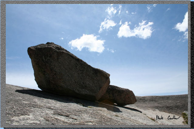 A
boulder at the same overlook as above.
A
boulder at the same overlook as above.
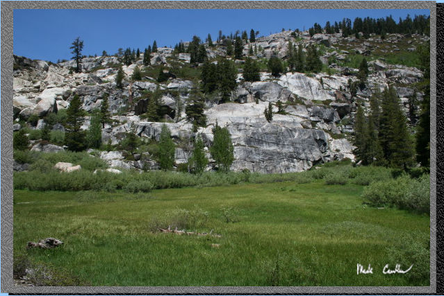
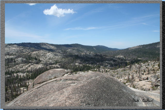 Another
look at Pine Valley and the amazing glacier polished granite.
Another
look at Pine Valley and the amazing glacier polished granite.
 Some
wind swept trees in the distance.
Some
wind swept trees in the distance.
 This
is the trail junction to Bear Lake. Hang a left at the sign. You are
less than a mile from the lake now!
This
is the trail junction to Bear Lake. Hang a left at the sign. You are
less than a mile from the lake now!
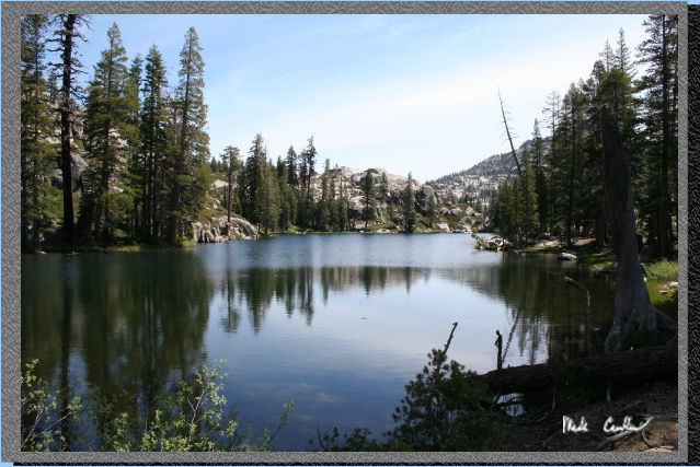
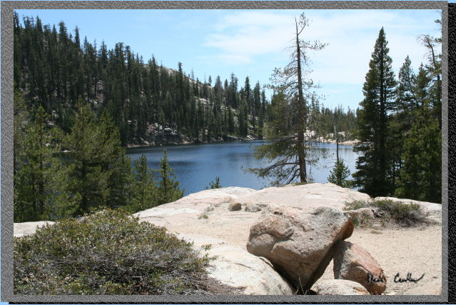
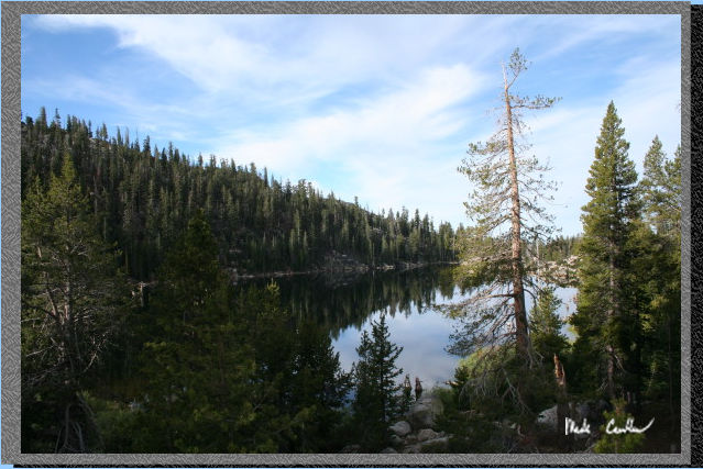
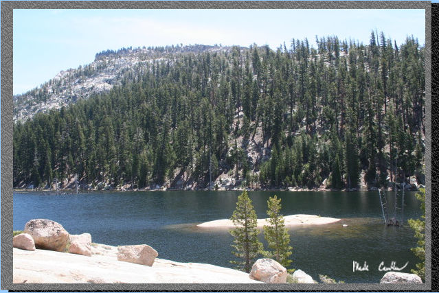 Here
is Bear Lake. Excellent swimming possibilities and numerous sites along
the south and west side of the lake. We headed to the far side of the
lake to see if we could find the site the ranger told us about.
Here
is Bear Lake. Excellent swimming possibilities and numerous sites along
the south and west side of the lake. We headed to the far side of the
lake to see if we could find the site the ranger told us about.
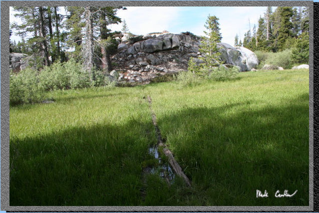
 You
have to cross this meadow to get to the site we picked. Someone setup
some fallen logs to help people cross the meadow and the small stream
that crosses it.
You
have to cross this meadow to get to the site we picked. Someone setup
some fallen logs to help people cross the meadow and the small stream
that crosses it.
 Here
is the view from the site we picked. Great flat spot for one tent and
an existing fire ring if you need to have a fire. Mosquitoes were bothering
us enough to make a fire.
Here
is the view from the site we picked. Great flat spot for one tent and
an existing fire ring if you need to have a fire. Mosquitoes were bothering
us enough to make a fire.
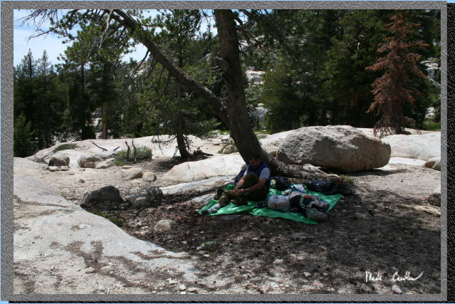 We
picked this tree to hang out under during the day to stay out of the
sun and provide us with a little wind break. Here is Leo checking out
his feet after the hike in.
We
picked this tree to hang out under during the day to stay out of the
sun and provide us with a little wind break. Here is Leo checking out
his feet after the hike in.
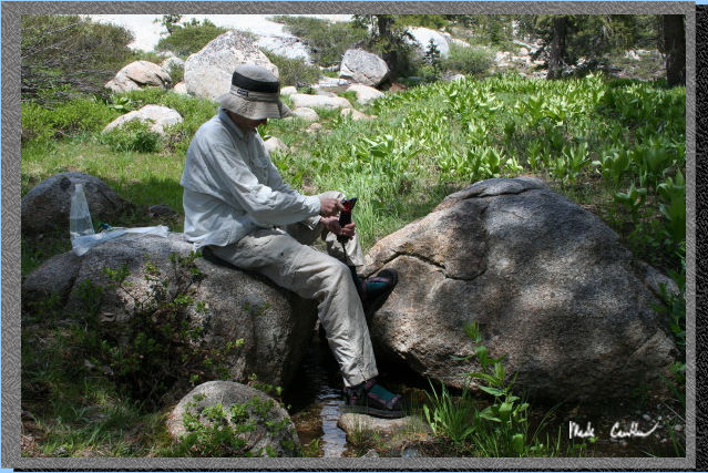 We
decided to pump water out of a stream just a little ways from camp.
The stream went through these two boulders and filled a small pool between
my feet in the picture. I don't think I could have designed a better
spot to filter water. There was even a spot to place the water bag you
were filling on the other side of me. Nothing beats fresh mountain stream
water.
We
decided to pump water out of a stream just a little ways from camp.
The stream went through these two boulders and filled a small pool between
my feet in the picture. I don't think I could have designed a better
spot to filter water. There was even a spot to place the water bag you
were filling on the other side of me. Nothing beats fresh mountain stream
water.
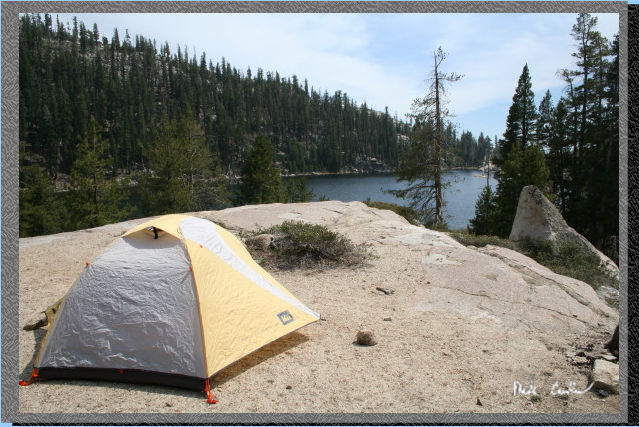 Here
is the tent all set up. There is actually enough dirt under the tent
to allow the tent stakes to be pushed all the way in. Well almost all
of them. The small rock is next to the one stake that could not be pushed
all the way in (to prevent someone from tripping in the middle of the
night).
Here
is the tent all set up. There is actually enough dirt under the tent
to allow the tent stakes to be pushed all the way in. Well almost all
of them. The small rock is next to the one stake that could not be pushed
all the way in (to prevent someone from tripping in the middle of the
night).
 Here
is Bear Lake in the morning. Besides the mosquitoes this was another
awesome trip. I managed to only get 3 bites, all on my feet when I was
only wearing my socks/sandals around camp (like a dummy I forgot to
spray my feet). Scroll down for some more shots on the way out, and
also for the map at the end.
Here
is Bear Lake in the morning. Besides the mosquitoes this was another
awesome trip. I managed to only get 3 bites, all on my feet when I was
only wearing my socks/sandals around camp (like a dummy I forgot to
spray my feet). Scroll down for some more shots on the way out, and
also for the map at the end.
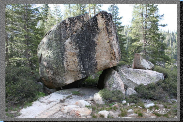 A
boulder near our camp. It was big enough under the boulder to sit up
and also to allow for you to sleep under it (if you are brave enough).
A
boulder near our camp. It was big enough under the boulder to sit up
and also to allow for you to sleep under it (if you are brave enough).
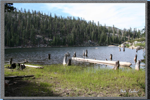 Here
is another view of Bear Lake.
Here
is another view of Bear Lake.
 This
shot shows the logs I was talking about earlier to allow for an easy
crossing of this very marshy meadow.
This
shot shows the logs I was talking about earlier to allow for an easy
crossing of this very marshy meadow.
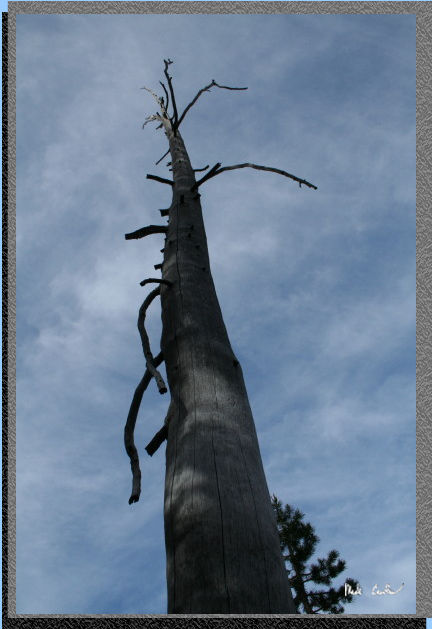 A
tree on the way out.
A
tree on the way out.
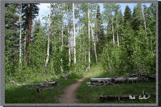 Beautiful
section of trail through some great foliage.
Beautiful
section of trail through some great foliage.
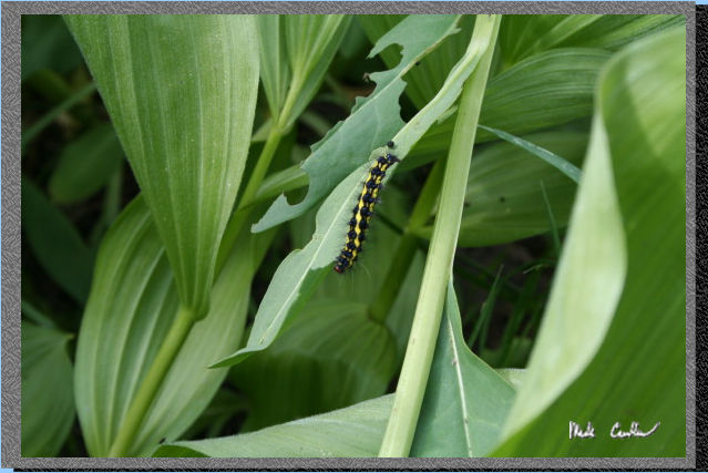 There
were a bunch of happy caterpillars on these plants, and even on the
trail in some spots.
There
were a bunch of happy caterpillars on these plants, and even on the
trail in some spots.
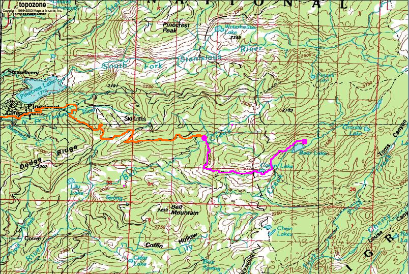
The orange line is the approximate route we took in the car. The Pink line is the trail we took. The two pink circles are the trailhead and the spot we camped. I tried to depict our side journey to the overlook of Pine Valley from the ridge to the south of Camp Lake by marking our path out some. Do not miss this overlook. It is just off the trail. (There is another road on the way in you can take from 108, but the ranger let us know the route described above is the quickest.)