


![]()
Sarah
and I have been to Angel Island a few times now, but never to the famous
Ridge Site #4. I was able to book the famous site by reserving it way
in advance, and midweek. Lucky for me, Sarah wanted to go backpacking
on her spring break and, even luckier, the weather cooperated. 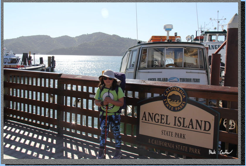 We also took one of my coworkers on this trip for his first backpacking
trip (I made sure to tell him that this is not your typical backpacking
trip). For other site descriptions use these links (see trip to Sunrise
site #8 in 2010, East Bay site# 2 in 2013
and East Bay site#1 in 2013 ). Sunrise
camp does have uninterrupted views, but East Bay site #1 is huge, away
from neighbors, and has shade and some shelter from wind. I think all
three East Bay sites rock compared to Sunrise on the whole. The Ridge
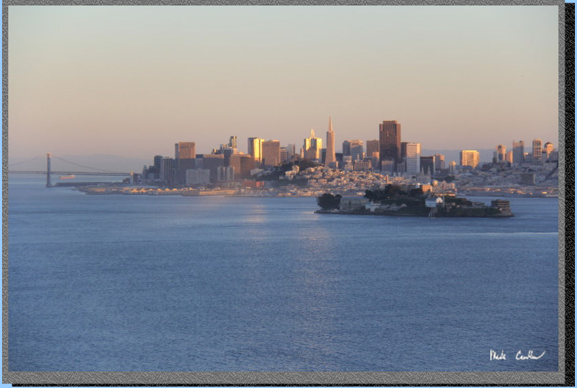
sites are the most exposed but have the killer views of the San Francisco
skyline. Ridge site #4 has the best views but no shade and no shelter
should the wind/weather head in. Each group of sites has a water faucet
and pit toilet. We did the Tiburon
Ferry as the pier one ferry from Blue
and Gold doesn't have as many options this time of year. We caught
the 10 am ferry out of Tiburon and if is about a ten minute ride. We
parked at one of the lots a couple blocks from the ferry. There is one
parking lot at Bank of America that is manned (but usually full unless
you get there early). The lot we used said no overnight parking (I have
used it twice now with no issues). Parking and the ferry are cash only
so hit the ATM after parking or plan ahead. Here is Sarah before we
lined up for the ferry. Trail Map is at bottom of
page.
We also took one of my coworkers on this trip for his first backpacking
trip (I made sure to tell him that this is not your typical backpacking
trip). For other site descriptions use these links (see trip to Sunrise
site #8 in 2010, East Bay site# 2 in 2013
and East Bay site#1 in 2013 ). Sunrise
camp does have uninterrupted views, but East Bay site #1 is huge, away
from neighbors, and has shade and some shelter from wind. I think all
three East Bay sites rock compared to Sunrise on the whole. The Ridge
sites are the most exposed but have the killer views of the San Francisco
skyline. Ridge site #4 has the best views but no shade and no shelter
should the wind/weather head in. Each group of sites has a water faucet
and pit toilet. We did the Tiburon
Ferry as the pier one ferry from Blue
and Gold doesn't have as many options this time of year. We caught
the 10 am ferry out of Tiburon and if is about a ten minute ride. We
parked at one of the lots a couple blocks from the ferry. There is one
parking lot at Bank of America that is manned (but usually full unless
you get there early). The lot we used said no overnight parking (I have
used it twice now with no issues). Parking and the ferry are cash only
so hit the ATM after parking or plan ahead. Here is Sarah before we
lined up for the ferry. Trail Map is at bottom of
page.
Here we are on the
island. After you take the quick 10 minute ferry ride across Raccoon
Strait you are going to check in with the ranger. The rules are typical,
leave no food outside of the food lockers, no wood fires, be mindful
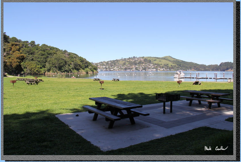
of wildlife and of course leave no trace. Here is the lawn area in front
of the visitor center. You can really tell it is spring, everything
is a nice shade of green. We decided to have an early lunch at the Angel
Island Cafe before heading out on the trail. It seemed a little
backwards to be having a cold beer and sandwich before the hike, but
it didn't take much convincing for me to go along with the plan. You
can tell from the shot below how crowded the island was that day...
We decided to take
the most direct route to the site today (given that you can make any
trip on the island a loop hike you always have a choice). We headed
up past the visitor center on to the paved Perimeter Road.
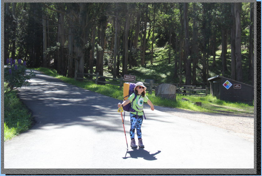
We let Sarah set the pace,
which allowed me to grab some great shots along the trail.
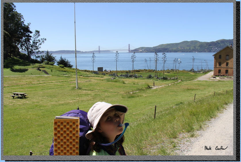
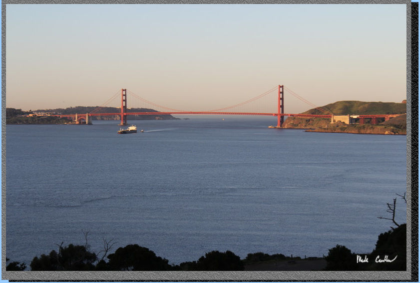
We decided to check out Camp Reynolds on the way in; It is really worth
walking out to. The views of the Golden Gate are superb and there are
a lot of historical buildings along the way. Here is the view of Sarah
staying hydrated on the way. There is a pretty nice bathroom to the
right of the building in this shot, should you over-hydrate.
While it looks like the building is in the water, I assure you it is
not. They did build it close the the water though...
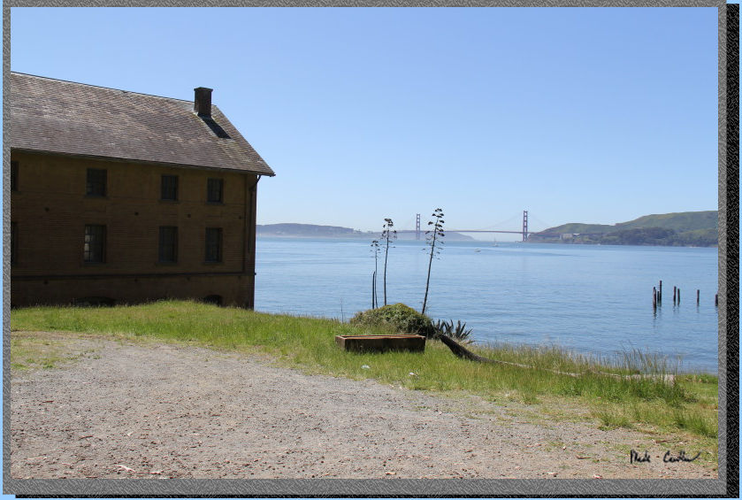
Pretty awesome
views down here. If you look close you can see there is a table you
could eat your lunch/snack at while taking it all in.
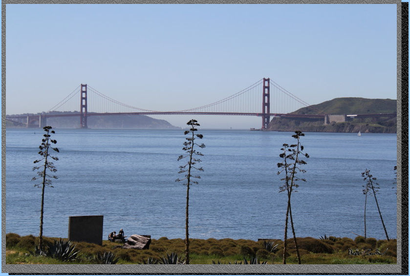
We really, really, got lucky on the weather. It was raining on either
side of this trip, but today it was clear, calm and warm. The weather
when you go may differ.
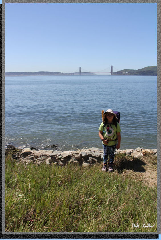
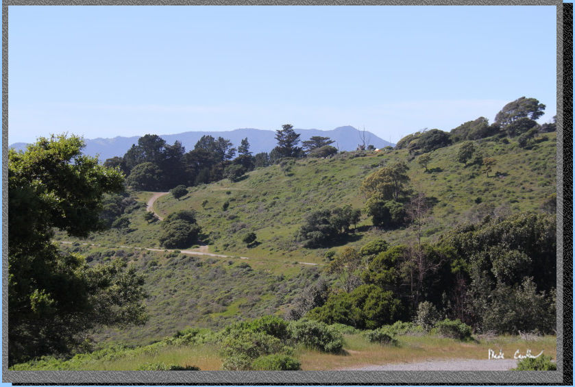
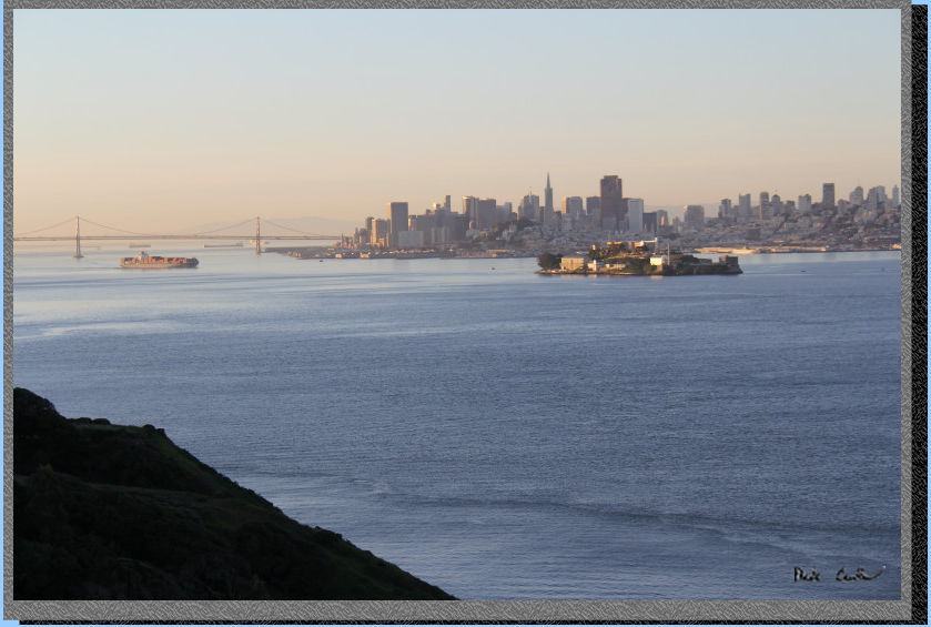
We rejoined
the Perimeter Road and started to enjoy vistas of San Francisco and
Alcatraz. There are
plenty of benches and tables along the road to allow you to take a break
and enjoy the views.
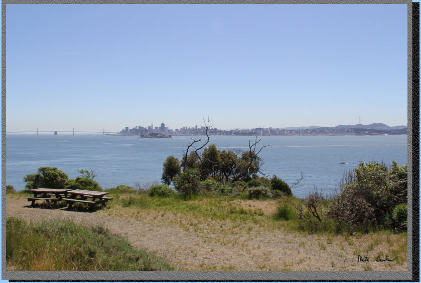
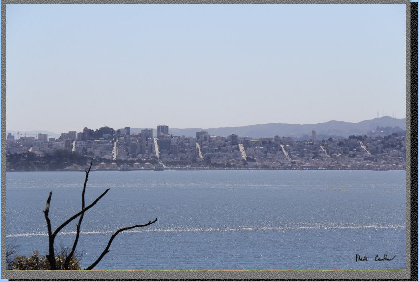
From this vantage point you
could really see the grid nature of the City - and also how steep those
hills are.
Here Sarah
is making sure that we exit the road and head UP to camp.
Here is camp. The water faucet is along the use path just to the left
of the table. The food locker is at the left end of the table. The site
is decently sized, but the ground is hard for staking the tents. We
found a decent rock to use and left it at the table. There is Poison
Oak around the sites (so stay on the trails or at least keep a keen
lookout).
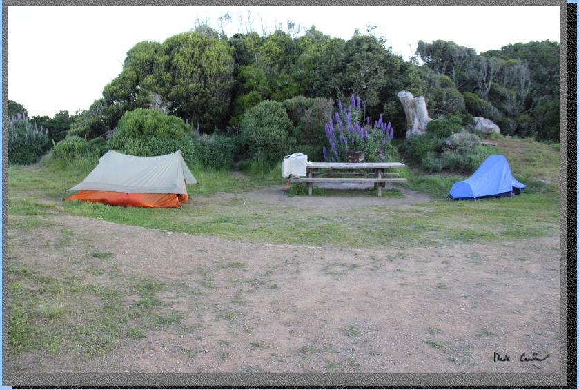
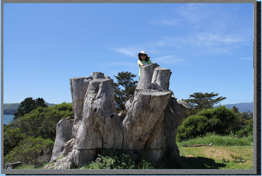
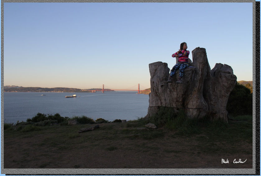
Here is Sarah's favorite part of the site, "The Stump". This
tree would have provided some nice shade for the site. We setup a tarp
off this stump for some shade. After "chilling" (it was much
too warm to "chill") for a little while we decided that we
should go explore Battery Drew before dinner.
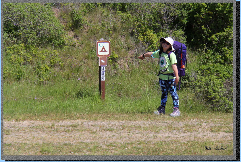
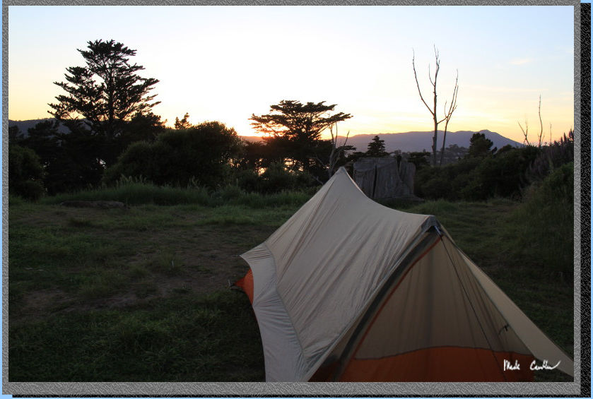
After hiking along the road for a bit I looked back to grab this shot
of the tent. The orange tent is mine at site #4 (the highest site on
the ridge). Sites 5 and 6 are in the trees to the left. Site 6 has the
bathroom at it and is the most sheltered. Site 5 had some good shade
and some decent views. I would not want site 4 on a really hot day,
you would cook out there.
We explored Battery Drew
for a while. You can go inside and check out the different concrete
rooms. This structure is where the gun was mounted. Yes, it was a rather
large gun. 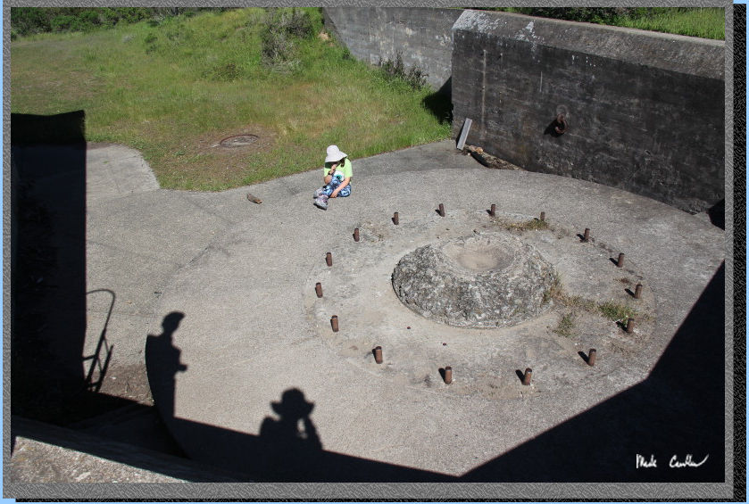
The ridge sites were built
around Battery Wallace, you can see some of the concrete structures
around sites 5 and 6, and also below site 4. Here is Sarah on the stump
thinking about how we can be so close to millions of people in the City,
but not hear any of them...
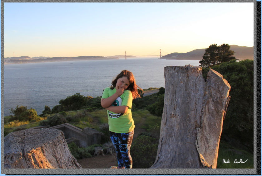
We had a nice dinner
and then watched the lights go down in the city, and the sun shine on
the bay... OK had to
do that. But seriously, how could you not want to watch the sunset out
here.
Here is my Scout UL2 tent,
still going strong. I have only a couple minor gripes about it, but
the weight savings make it my "go-to" tent for most trips.
After Sarah went
to bed I took a few longish exposures with the camera. It was hard not
to catch some aliens and rockets with the shutter open so long. 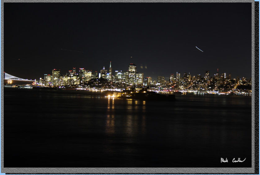
The views were cooler than I captured here. It was not hard to see why
these ridge sites book up fast.
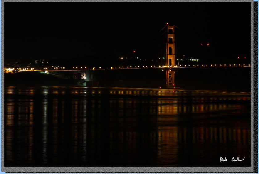
The next morning was clear and calm. Lots of ships
coming into and out of the bay.
It was fun for Sarah
(and Eric and I) to watch the ships travel under the Golden Gate under
the watchful eye of the tugboat captain.
Have to brush hair and teeth before we hit the trail after breakfast.
.
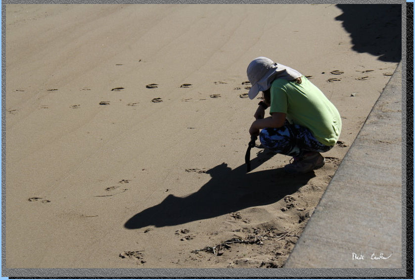
We headed back the way we came in. Sarah wanted to explore the beach
at Ayala Cove before we waited for the ferry back to Tiburon. There
were some neat foot prints to identify on the beach. Sarah's walking
staff has common animal prints identified on it, she is using it in
this shot to help out on the identification. I believe that raccoon
and deer won.
.
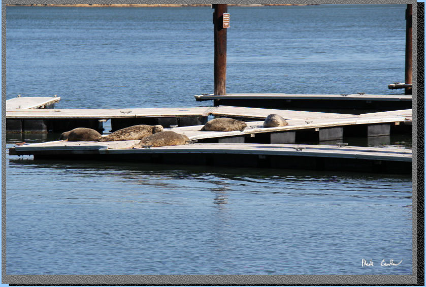
Harbor Seals hanging out
on the docks.
.
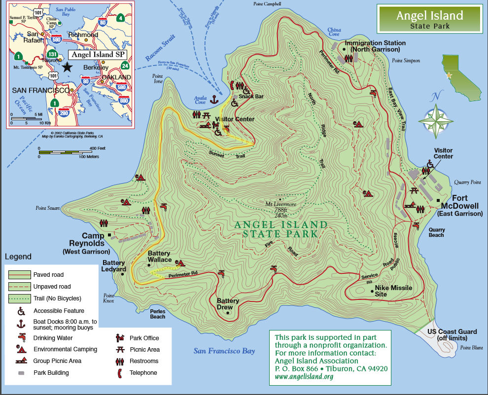
I didn't run my GPS on this
trip so I highlighted the most direct route on the official Angel Island
State Park Map in yellow. This is an easy 1.5 miles each way and doable
for even little hikers. Click on map to download full map.
.
(back to top)