


![]()
 This
a quick backpacking trip for me since I live in Pleasanton. I have done
this trip a few times now but it is through some neat terrain with plenty
of wildlife along the way. Although it was pretty brown this trip it
was still a fun trip. For another trip description see Sunol
to Del Valle in 2003 trips. On that trip I went straight through
to Del Valle. If you can arrange a pick up at Del Valle and don't mind
the ups and downs in that section of trail from Maggie's Half Acre to
Del Valle I would recommend it over the out and back trip described
here. You must get a permit to travel in the Ohlone Wilderness. The
permit doubles as the map and is only one dollar for a year. Campsites
are also by reservation only. You can either call in or take your chances
and get one form the ranger. Weekends are popular up here so if you
are traveling on a Friday or Saturday get a reservation. I have had
good luck on other day of the week just getting a permit from the ranger.
Call 510-636-1684 for reservations or for general info the ranger at
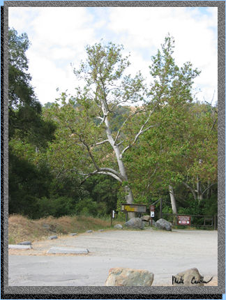
Sunol is 510-862-2244. This picture is of the parking area near the
trailhead. The gate on the right of the picture is the start of the
trail. See map.
This
a quick backpacking trip for me since I live in Pleasanton. I have done
this trip a few times now but it is through some neat terrain with plenty
of wildlife along the way. Although it was pretty brown this trip it
was still a fun trip. For another trip description see Sunol
to Del Valle in 2003 trips. On that trip I went straight through
to Del Valle. If you can arrange a pick up at Del Valle and don't mind
the ups and downs in that section of trail from Maggie's Half Acre to
Del Valle I would recommend it over the out and back trip described
here. You must get a permit to travel in the Ohlone Wilderness. The
permit doubles as the map and is only one dollar for a year. Campsites
are also by reservation only. You can either call in or take your chances
and get one form the ranger. Weekends are popular up here so if you
are traveling on a Friday or Saturday get a reservation. I have had
good luck on other day of the week just getting a permit from the ranger.
Call 510-636-1684 for reservations or for general info the ranger at
Sunol is 510-862-2244. This picture is of the parking area near the
trailhead. The gate on the right of the picture is the start of the
trail. See map.
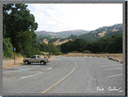 Looking
back here in this picture you can see my truck and the parking area.
It does have quite a few parking places and even on the busy weekends
I have been able to find a spot. Of course I usually hit this trail
early in the day because of the exposed ridge sections. If there is
a breeze it is not too bad but it can get hot out there. There are rattlesnakes
and poison oak in this area so keep an eye out. All of the main trails
seem to be free of poison Oak but if you venture down to any of the
creeks or off trail watch out.
Looking
back here in this picture you can see my truck and the parking area.
It does have quite a few parking places and even on the busy weekends
I have been able to find a spot. Of course I usually hit this trail
early in the day because of the exposed ridge sections. If there is
a breeze it is not too bad but it can get hot out there. There are rattlesnakes
and poison oak in this area so keep an eye out. All of the main trails
seem to be free of poison Oak but if you venture down to any of the
creeks or off trail watch out.
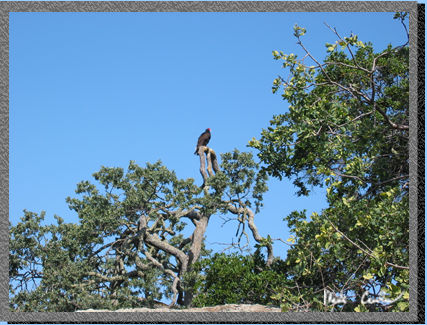 This
vulture was just sunning himself with his wings spread all the way out.
I was a little too slow with the camera to catch him before he tucked
his wings back in. He probably heard me breathing hard since this section
is the hill up to the Sunol Backpacking area.
This
vulture was just sunning himself with his wings spread all the way out.
I was a little too slow with the camera to catch him before he tucked
his wings back in. He probably heard me breathing hard since this section
is the hill up to the Sunol Backpacking area.
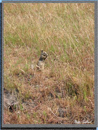 This
little guy was in the Ohlone Wilderness. He didn't seem to mind me taking
his picture. I am not sure what he is munching on. There are quite a
few squirrels in the area. There are also the things that eat these
guys (bobcats, mountain Lions and eagles). I have seen them all so they
are out here.
This
little guy was in the Ohlone Wilderness. He didn't seem to mind me taking
his picture. I am not sure what he is munching on. There are quite a
few squirrels in the area. There are also the things that eat these
guys (bobcats, mountain Lions and eagles). I have seen them all so they
are out here.
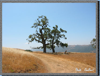 Here
is one of the many oaks along the way. Most of the scenery is better
when it is greener so if you can get this trip in before the hills turn
brown go for it. I thought that I would be ok in May, but the hills
seemed to get drier faster this year.
Here
is one of the many oaks along the way. Most of the scenery is better
when it is greener so if you can get this trip in before the hills turn
brown go for it. I thought that I would be ok in May, but the hills
seemed to get drier faster this year.
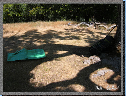 Here
is camp. All of the sites have some shade. You do have to move around
a bit to stay in it though. I stayed at site number three. It think
it is the best site for shade. The only nuisance around camp can be
ants but they left me alone this trip. Rose peak is only a little ways
from camp so I would recommend that after setting up camp take the trek
up there and enjoy the wind and the view. If you get up there on a clear
day the view is amazing. There used to be a sign in sheet up there.
Now there is a cable but I think someone decided to take off with the
box.
Here
is camp. All of the sites have some shade. You do have to move around
a bit to stay in it though. I stayed at site number three. It think
it is the best site for shade. The only nuisance around camp can be
ants but they left me alone this trip. Rose peak is only a little ways
from camp so I would recommend that after setting up camp take the trek
up there and enjoy the wind and the view. If you get up there on a clear
day the view is amazing. There used to be a sign in sheet up there.
Now there is a cable but I think someone decided to take off with the
box.
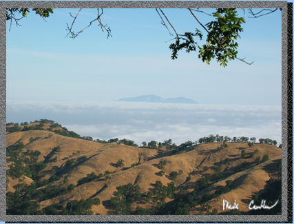 The
fog rolled into the valley that night so in the morning only the twin
peaks of Mount Diablo were peeking above the clouds. Here you get some
idea how high up you really are.
The
fog rolled into the valley that night so in the morning only the twin
peaks of Mount Diablo were peeking above the clouds. Here you get some
idea how high up you really are.
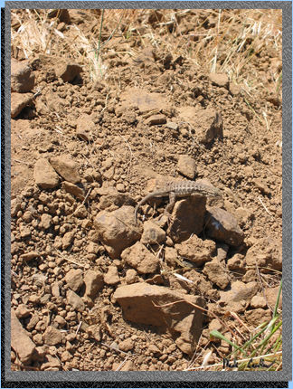 There
were a few critters on the way out as well. It seemed that all the lizards
were out trying to get warmed up for the day's activities.
There
were a few critters on the way out as well. It seemed that all the lizards
were out trying to get warmed up for the day's activities.
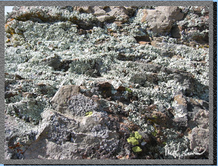 Sometimes
I just see a rock or a tree and nee to take a picture of it. Here is
a shot I took because of the different textures it had. It looks better
full size but this shot gives some idea what I was going for.
Sometimes
I just see a rock or a tree and nee to take a picture of it. Here is
a shot I took because of the different textures it had. It looks better
full size but this shot gives some idea what I was going for.
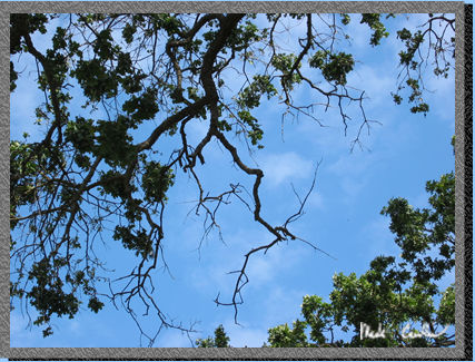 This
shot was taken at camp while I was relaxing and looking up into the
trees. This would be nice to have on my office ceiling. It is just peaceful
to look at.
This
shot was taken at camp while I was relaxing and looking up into the
trees. This would be nice to have on my office ceiling. It is just peaceful
to look at.
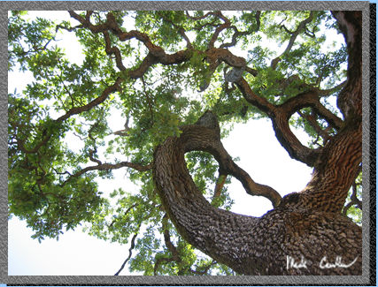 Another
shot that required laying down. It really doesn't
even look real to me in this picture. Oaks are amazing trees. This is
one of those trips that is the default backup plan. Sometimes it is
nice to not have to drive to the Sierras and this is almost in my backyard.
Scroll down to see the map.
Another
shot that required laying down. It really doesn't
even look real to me in this picture. Oaks are amazing trees. This is
one of those trips that is the default backup plan. Sometimes it is
nice to not have to drive to the Sierras and this is almost in my backyard.
Scroll down to see the map.
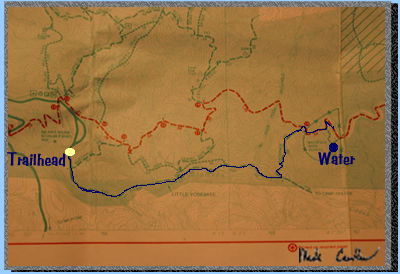 The
blue line is the course I took. The trailhead and the first "plumbed"
water source is also listed. After the blue line I took I continued
along the red line off the right side of the map to the left side of
the map below.
The
blue line is the course I took. The trailhead and the first "plumbed"
water source is also listed. After the blue line I took I continued
along the red line off the right side of the map to the left side of
the map below.
 The trip is between 9 and ten miles each way. To get to Maggie's Half
Acre you half to detour off the main trail before you get to Rose Peak
(elevation 3817 ft). Camp sites are at 3480 ft and you the trailhead
is listed at around 400 ft.
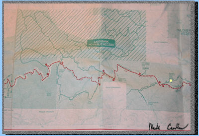
The little yellow dot marks camp. There is water but they recommend
filtering it anyway. There is also a trash can and pit toilet. The same
facilities are at the Backpacking area on the way in. You can really
make this trip even longer than my Sunol
to Del Valle trip by starting on the other side of Mission Peak
off Stanford Ave. (That turns this trip into 28 miles.) I haven't done
the section from Fremont to Sunol yet, if someone ends up doing it give
me an email with a description.
Thanks.
The trip is between 9 and ten miles each way. To get to Maggie's Half
Acre you half to detour off the main trail before you get to Rose Peak
(elevation 3817 ft). Camp sites are at 3480 ft and you the trailhead
is listed at around 400 ft.
The little yellow dot marks camp. There is water but they recommend
filtering it anyway. There is also a trash can and pit toilet. The same
facilities are at the Backpacking area on the way in. You can really
make this trip even longer than my Sunol
to Del Valle trip by starting on the other side of Mission Peak
off Stanford Ave. (That turns this trip into 28 miles.) I haven't done
the section from Fremont to Sunol yet, if someone ends up doing it give
me an email with a description.
Thanks.