![]()
Page 1
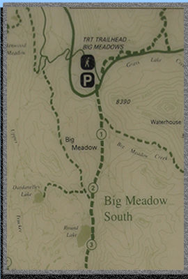
Round
lake is located about 3 miles from the Big Meadow trailhead on highway
89
(South of Lake Tahoe). See map at the bottom of this
page. You really have to watch for the trail and then the parking lot.
Just keep your eyes open when you start making the big bend and you
should first see the trail on the right and then the entrance to the
trailhead on the left. It goes down steeply making it easy to miss.
 I
have visited this lake many times but the hike seems different every
time. My friend Ray and I took off on this trip knowing that we were
going to encounter some snow... going early in the year after
a season with a lot of snowfall will cause that. Even though no wilderness
permit is required do stop at a ranger station to get a fire permit
(you need one even for your stove).
I
have visited this lake many times but the hike seems different every
time. My friend Ray and I took off on this trip knowing that we were
going to encounter some snow... going early in the year after
a season with a lot of snowfall will cause that. Even though no wilderness
permit is required do stop at a ranger station to get a fire permit
(you need one even for your stove).
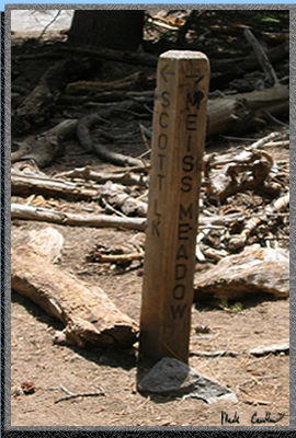
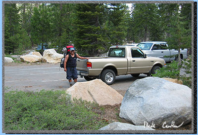
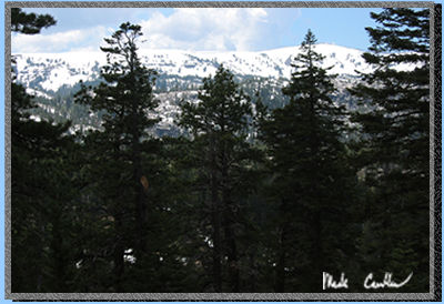
The trail actually starts on the other side of the highway, make sure you watch for traffic (you can't move that fast with a heavy pack on). The trail starts out pretty steep but it is a lot better than it used to be. Last year some volunteers redid the first section of the trail and it is really nice now. The picture to the left is at a trail junction before the meadow. I haven't made it to Scott Lake yet. You want to go right at this junction.
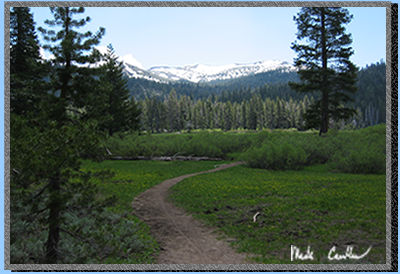 Once
you reach the meadow you are about a third of the way there. The water
was really high in the stream we crossed. In this picture it is just
around the bend. It is a really nice meadow with a stream winding its
way through one corner of it. There are a few sections that haven't
been raised up above meadow level yet so they can be muddy. Try to stay
on the trail if you can. Going through the mud in boots is supposed
to be part of the fun.
Once
you reach the meadow you are about a third of the way there. The water
was really high in the stream we crossed. In this picture it is just
around the bend. It is a really nice meadow with a stream winding its
way through one corner of it. There are a few sections that haven't
been raised up above meadow level yet so they can be muddy. Try to stay
on the trail if you can. Going through the mud in boots is supposed
to be part of the fun.
When you come to a steep and dusty downhill section make sure to enjoy the magnificent views. Watch out for mountain bikers racing down this hill as well. At the bottom of this hill is the junction for Dardanelle's Lake. It is smaller than Round lake but is quite nice as well. We bumped into a fellow backpacker who was on his way out from Dardanelle and he said that he had the lake to himself that Friday night.
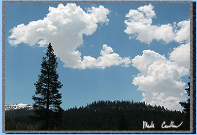 Ray
helped me not miss this strange cloud that looks like North and Central
America (the cloud on the left). It was a nice break from the heat when
a cloud would cover the sun for a bit. Temperatures were in the 70 degree
range this afternoon. Once you reach the trail marker for Dardanelle's
Lake you are more than 3/4 of the way to Round lake.
Ray
helped me not miss this strange cloud that looks like North and Central
America (the cloud on the left). It was a nice break from the heat when
a cloud would cover the sun for a bit. Temperatures were in the 70 degree
range this afternoon. Once you reach the trail marker for Dardanelle's
Lake you are more than 3/4 of the way to Round lake.
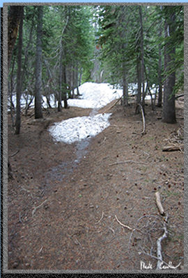
The trail is slightly up to Round Lake from the junction. Along the protected sections there were still some snow drifts. Luckily a lot of day hikers have ventured off to Round Lake so the snow was softened up quite a bit. We did see quite a few hikers on the way in and on the way out for this time of year. We also came across more than a few bikers. Most were more than courteous and shared the trail.

There were a few spots where the trail worn in the snow split. They always came back together though. Traveling through this section reminded me of when I went through it with Leo in the winter a couple years ago. (see that trip)
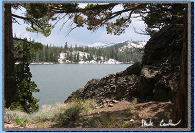
When you make it to Round Lake most of the campsites are on the North and North West side of the lake. You can tell by the picture that there is still quite a bit of snow left to melt on the South side of the lake.
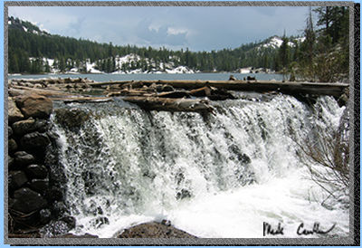 Water
was coming over the dam pretty good. The outlet stream was rushing at
a pretty good pace as well. We decided not to venture over to the other
side of the stream with our packs. We instead hiked slightly up to a
spot along the stream. We knew that our friends the mosquitoes would
be around soon, so if we got a little ways from the standing water we
thought it might help.
Water
was coming over the dam pretty good. The outlet stream was rushing at
a pretty good pace as well. We decided not to venture over to the other
side of the stream with our packs. We instead hiked slightly up to a
spot along the stream. We knew that our friends the mosquitoes would
be around soon, so if we got a little ways from the standing water we
thought it might help.