![]()
Desolation Wilderness is
popular 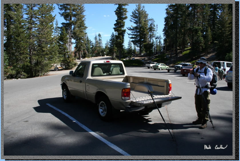 but
starting in October demand drops off, and there are no longer trailhead
quotas to worry about. We had some warm weather forecast with the possibility
of thunderstorms. Permits can be obtained from either the Pacific Ranger
District 4 miles east of Pollock Pines (530-644-6048) or the Lake Tahoe
Visitor Center 3 miles north of Highway 50/89 junction on Highway 89
(530-543-2674). Leo and I used the Echo Lake Trailhead. The hike in
is about 5.5 miles each way, see map and profile
below. You pass by both Lower and Upper Echo Lake and also Tamarack
Lake. Here are Leo and I getting ready to hit the trail about 11
am. We headed in on a Friday to avoid the possibility of crowded trails.
The trailhead is just south of Echo Summit on Highway 50. Take Johnson
Road (sign for snow park on the north side of the roadway for eastbound
Highway 50 and if you pass it you will see a sign for Echo Lake when
you are headed westbound). Echo Lakes are actually connected most of
the time (when water conditions are good). There is a water taxi available
during the summer that will take you all the way to the north end of
Upper Echo Lake. This cuts a lot of trail out, and will get you a jump
start on your trip. Check with rangers on when they are available. No
luck for us though as they stopped the week before. There is a parking
lot down by the dock (that fills fast) and also one above. There is
a trail from the upper lot down to the store/bathrooms. Store is closed
this time of year.
but
starting in October demand drops off, and there are no longer trailhead
quotas to worry about. We had some warm weather forecast with the possibility
of thunderstorms. Permits can be obtained from either the Pacific Ranger
District 4 miles east of Pollock Pines (530-644-6048) or the Lake Tahoe
Visitor Center 3 miles north of Highway 50/89 junction on Highway 89
(530-543-2674). Leo and I used the Echo Lake Trailhead. The hike in
is about 5.5 miles each way, see map and profile
below. You pass by both Lower and Upper Echo Lake and also Tamarack
Lake. Here are Leo and I getting ready to hit the trail about 11
am. We headed in on a Friday to avoid the possibility of crowded trails.
The trailhead is just south of Echo Summit on Highway 50. Take Johnson
Road (sign for snow park on the north side of the roadway for eastbound
Highway 50 and if you pass it you will see a sign for Echo Lake when
you are headed westbound). Echo Lakes are actually connected most of
the time (when water conditions are good). There is a water taxi available
during the summer that will take you all the way to the north end of
Upper Echo Lake. This cuts a lot of trail out, and will get you a jump
start on your trip. Check with rangers on when they are available. No
luck for us though as they stopped the week before. There is a parking
lot down by the dock (that fills fast) and also one above. There is
a trail from the upper lot down to the store/bathrooms. Store is closed
this time of year.
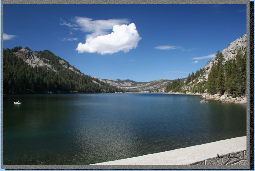
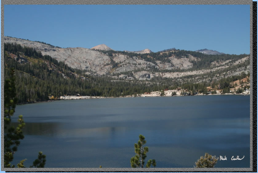
So here is the view from
the dam at the southern end of Lower Echo Lake. It was a great day for
backpacking with a slight breeze and temperatures in the upper 60's.
Afternoon thunderstorms had a 10 to 20 percent chance.
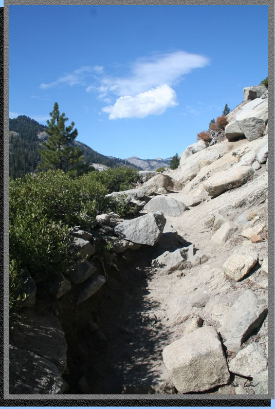
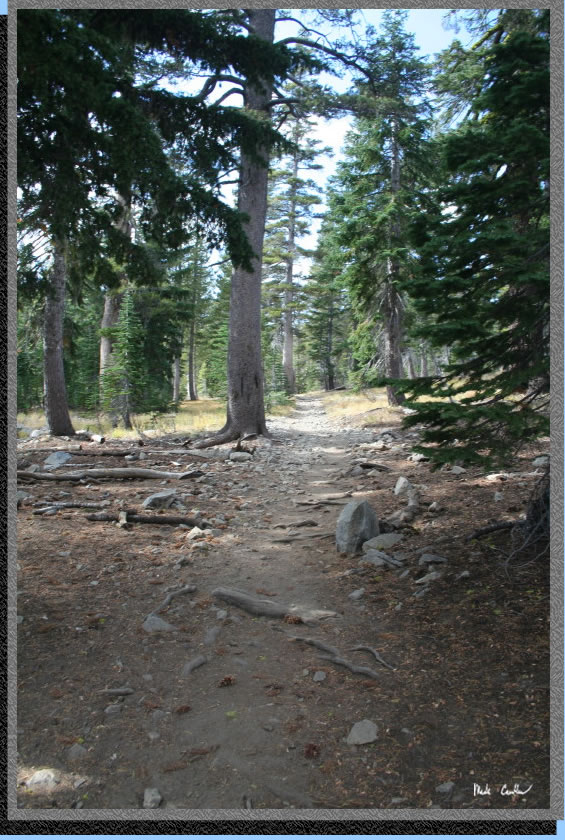
The trail is rocky and rough
in spots the length of both Lower and Upper Echo Lake. Not much elevation
gain or loss but rocky. The exception is of course the very beginning
where you gain some elevation through a short series of switchbacks.
Once you are above the lake you have some great views of the cabins
along the lake. We saw some rangers inspecting required repairs on the
way in. They told us that owner's of the cabins don't own the land and
are required to keep the cabins up to the requirements of the National
Forest Service.
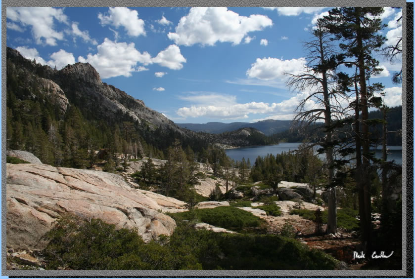
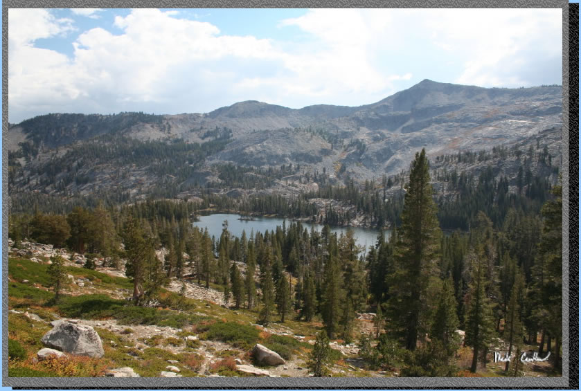
Another shot of the Lower Echo Lake with Pyramid Peak in the background.
Upper and Lower Echo Lake are connected by a small opening that is pretty
shallow so in low water years the taxi may not be able to get you all
the way to Upper Echo Lake
Another shot of Lower Echo Lake and the cloud cover rolling in behind
us. When we were talking to the rangers they said it looks like we would
be getting wet to them. I trust a ranger forecast much more than a meteorologist
for some reason.
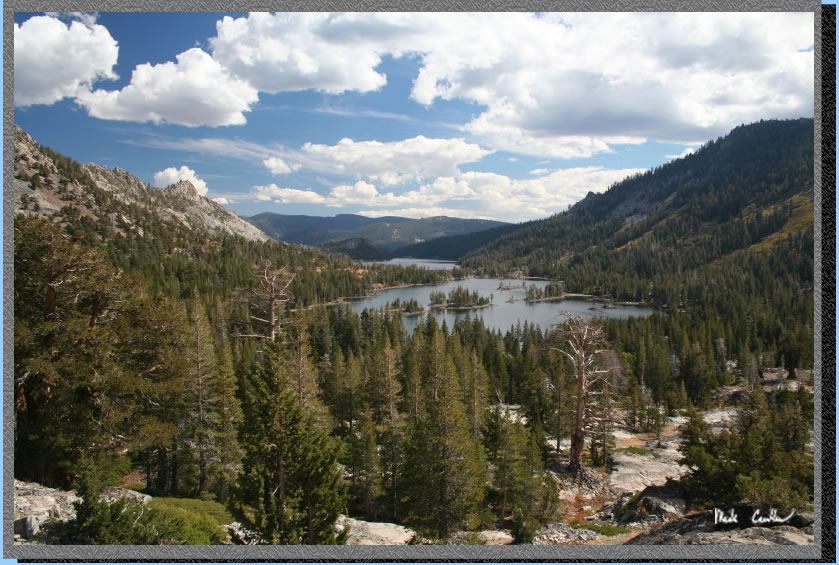
Now you can see Upper Echo Lake and how it connects to Lower Echo Lake
(well at least you can see how close they are. Once you get past the
shores of Upper Echo Lake the trail starts to head up. Your "level"
trail hiking is now over.
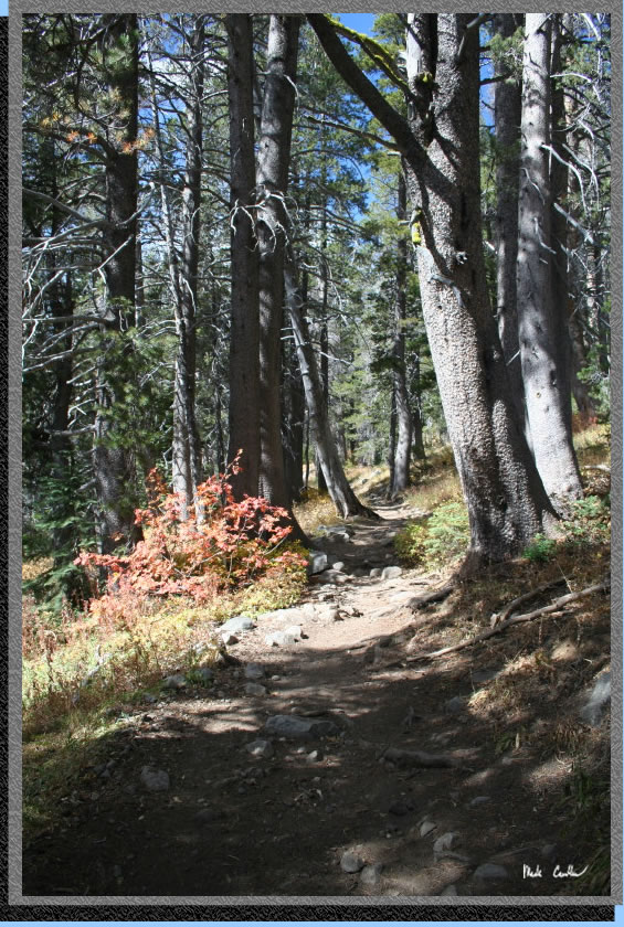
Trail conditions very on this section from rocky to smooth and from
exposed to sections like this with nice conifer cover. It was warm out
in the sun so when we did stop it was nice to have a few trees to duck
under.
Continue past the junction to Triangle Lake and past the junction to
Tamarack Lake (both are well marked) then take
a look back occasionally to see the the views you have gained through
your hard work. Tamarack is a great lake as well. If you are looking
to get someone out to the Sierras for the first time this may be a good
choice. Couple it with the water taxi and you can really make this a
short hike in.
Another shady spot on the trail. We could see some wet looking clouds
occasionally now but we were prepared to dig out the rain gear should
a cloud dump on us.
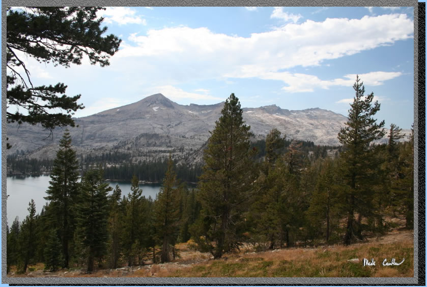
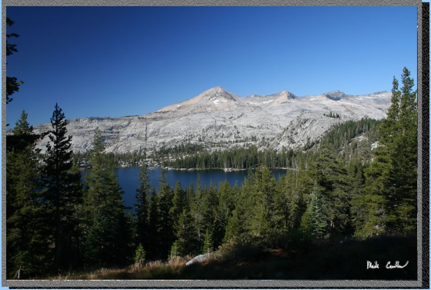
Here you can see the Crystal Range above Lake Aloha
in the distance with Lake of the Woods in the lower left. Trail junctions
are well marked. Once you pass the second Triangle Lake marker you will
make a left at the next junction (post says Lake of the Woods) and then
continue up the hill and then straight at the next junction (Ralston
Peak to left Lake Aloha to right).
Passed by this Blair Witch looking arrangement of sticks and rocks.
I made sure Leo didn't disturb the arrangement. 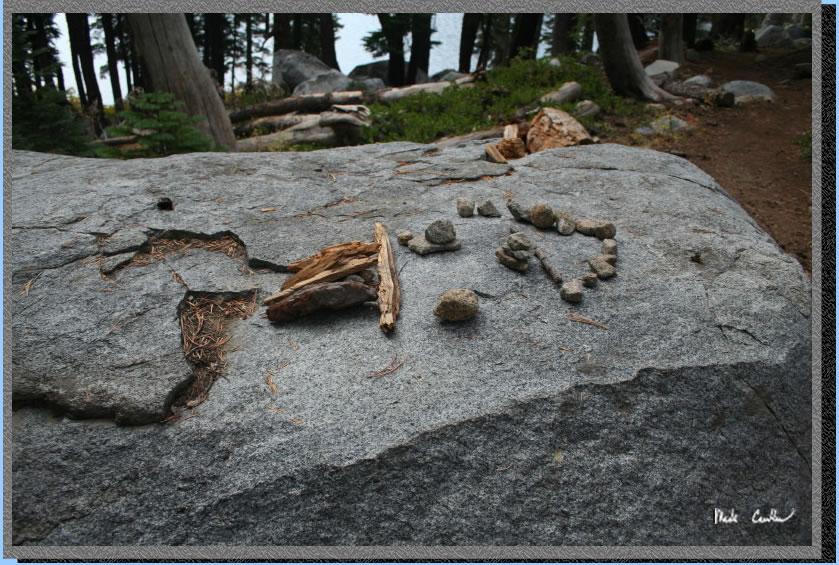
We set up camp as the clouds and distant thunder told us it might be
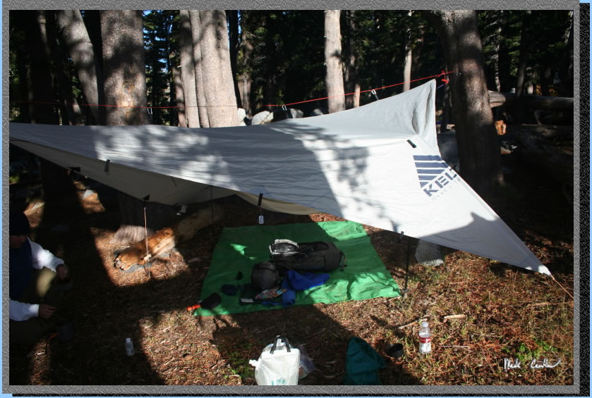
a good idea. I was using my Sierra Design Lightyear (an old one now)
and Leo was rigging his hammock with tarp for his shelter. After our
shelters were set up we decided to have a late lunch. Shortly after
that the wind picked up and the sky got a little dark so we decided
to move our gear (and ourselves) under the tarp of Leo's shelter. It
wasn't too long before the clouds opened up with some crazy rain with
thunder and lightning pretty much on top of us. I decided to dare the
weather gods with a "Is that all you got". The wind kicked it up a notch
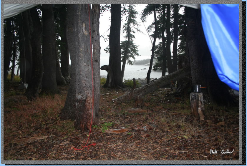
and then it hailed. Here is the shot from under our tarp. About this
time we noticed a lone backpacker coming down the trail. We talked her
into coming under the tarp with us and she said that her 2 friends were
just behind. When they showed up we made a little more room under the
tarp with a trekking pole and all watched the weather. I apologized
for daring the weather gods... It was great to be able to experience
this thunderstorm without having to be in it though.
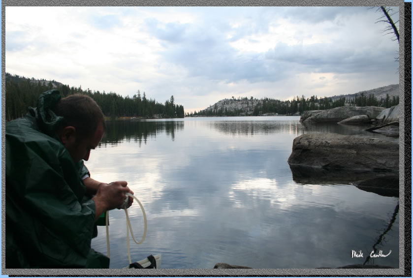
Once the rain stopped we decided that we should pump water while we
could stay dry doing it. Here is Leo out at the lake's edge. Shortly
after I took over the filtering duty I heard Leo chatting with someone
at camp. It turns out that some soggy rangers were out checking permits.
I was a bit surprised to have our permit checked on a late Friday afternoon,
but I was told by a ranger on the last trip out here that they have
been doing increased enforcement throughout Desolation Wilderness.
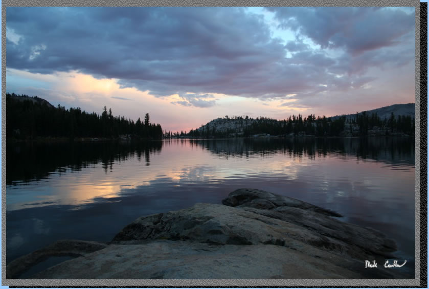
There was some great clouds and interesting colors to play with out
here once the sun starting going down. Here is the area of the lake
closest to camp (but not too close, we were at least 100 feet from the
lake's edge).
Here is Leo out on the granite point checking out the view. 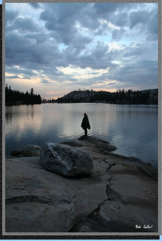
After I pushed Leo into the lake I took this shot (Hey he wouldn't move
and I needed a shot without any people in it).
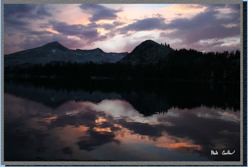
This picture shows Pyramid Peak with the sun just about gone now (as
is all of the light for pictures). Luckily there was a nice rock to
sit my camera on to take some long exposures.
That night had a bit of cloud cover and coupled with the tree cover
it was dark around camp. The trees dripped on us a touch that night
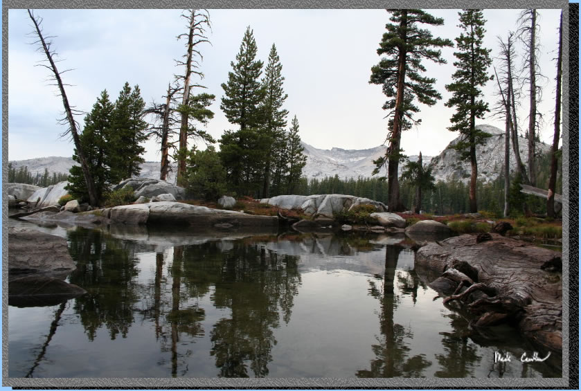
but I don't think it rained. The next morning was cool but very calm
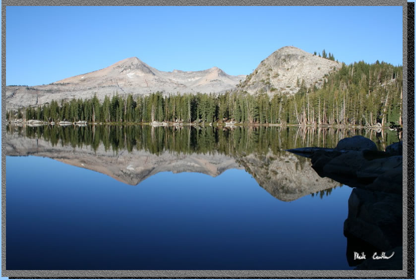
which made the lake look like glass.
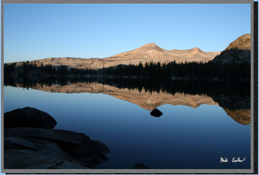
I had a hard time deciding which picture of the lake that morning I
liked the best.
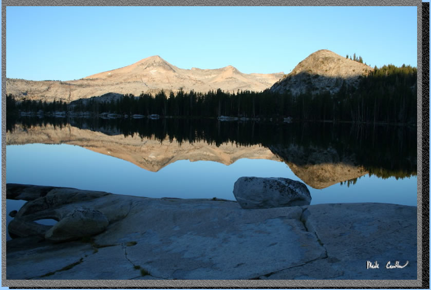
This one is pretty nice though. I had to wait a little while to let
the sun get high enough above the ridge to warm up the trees.
This is Leo's tarp/hammock
setup. He uses a bug net to keep out any mosquitoes and says he sleeps
great being off the ground. The angle on the tarp hides the hammock
setup.
So we packed up and headed out that morning. Thunderstorms were in today's
forecast as well. Although from this picture you wouldn't believe me.
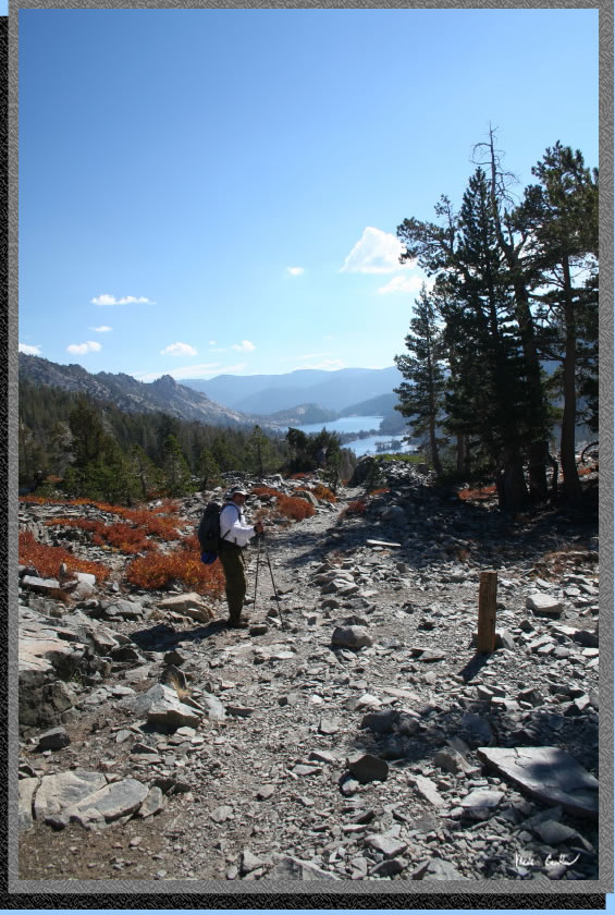
Here is a shot of the four way trail junction at the top of the ridge.
Continue straight to head back to Echo Lakes. Turning left here would
take you to Lake Aloha and turning right would be Ralston Peak.
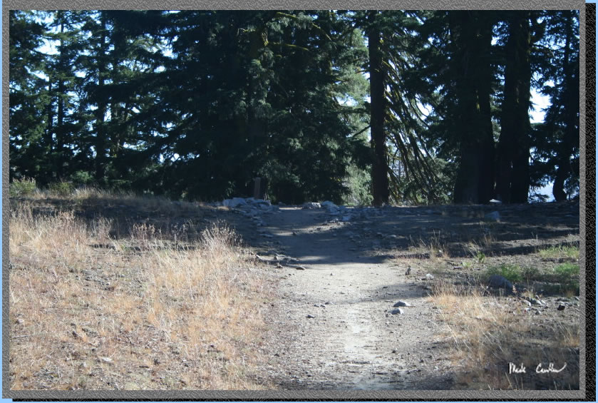
The trail down to the Tamarack Lake trail junction.
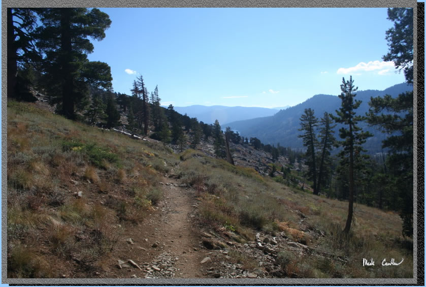
Leo next to the junction to Tamarack Lake with Echo Lakes behind him.
I expected with the rain the day before and wind there would be less
haze.
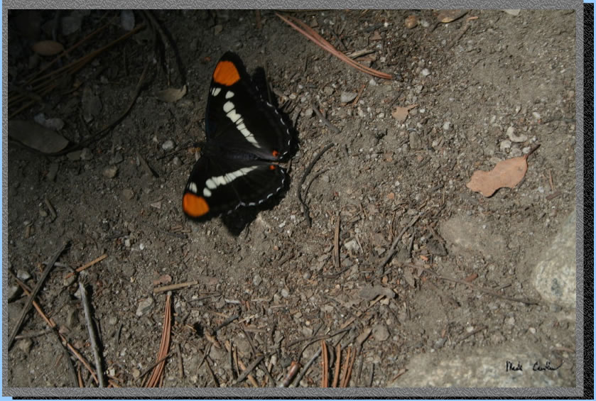
A butterfly near the end of the trail. This is a great lake to come
see and use as a jumping off point for a multi day trip. In the summer
you can take the water taxi to cut your mileage in half. There is much
to explore around this lake, and because of that the summer weekends
can get busy. We saw many day hikers on the way out and some of them
looked ill prepared for the forecast weather. I guess as long as they
are smart enough to get off the ridges when the lightning starts they
can head back to their cars soggy.
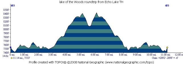
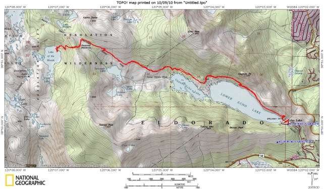
Trailhead is on the east side of the map above at Echo Lake. Our campsite
at Lake of the Woods is at the terminus of the red line to the west.
Profile below shows the roundtrip mileage and elevation. On the map
Lake Aloha is the big unlabeled lake to the northwest of Lake of the
Woods.
(back
to top)