![]()
 Permit
- A permit is required for all overnight stays at Portola Redwoods State Park. Permits
can be obtained using the park's website. You will need to check to see if there is space available at the trail camp for the dates you want on the online calendar, fill out the online form to request a site, then call to pay over the phone once you receive email confirmation you were given a spot.
Permit
- A permit is required for all overnight stays at Portola Redwoods State Park. Permits
can be obtained using the park's website. You will need to check to see if there is space available at the trail camp for the dates you want on the online calendar, fill out the online form to request a site, then call to pay over the phone once you receive email confirmation you were given a spot.
Parking - Overnight parking is located behind the Visitor Center down a narrow (but very short) authorized vehicles only driveway. You will need to check in at the Visitor Center before parking.
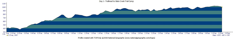
Mileage - We did ~3 miles on the way in (I am unsure of exact mileage due to GPS reception issue). Day hike to the "Lost World" (redwood grove at Peters Creek) was 7 miles (roundtrip) on day 2. We hiked out via Iverson Trail at ~4 miles on day 3. See map/profile below.
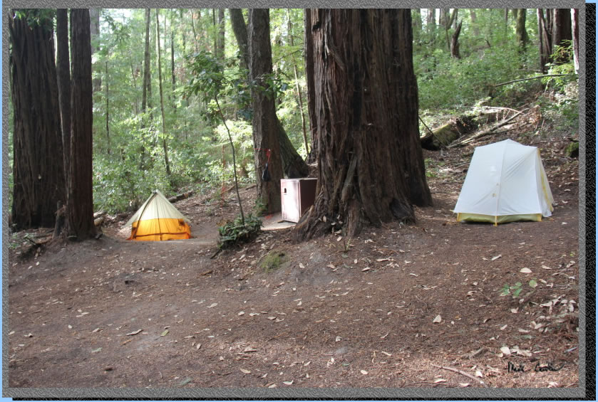
Camps/Water - There is no provided water at this camp! There is usually a running creek near camp you can filter/treat. It was barely flowing when we were there. We carried extra water in as we saw online the creek was nearly dry. There is a bathroom (pit toilet) and trash can for the camp. Each of the six sites has a large bear box and picnic table. Most sites have a good spot for one tent and a marginal spot for another. You can see in image above site we chose.
Cell Coverage - There is no cell coverage at the trailhead or at camp :-)
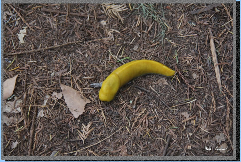
Hazards - Mice, raccoons, snakes, Poison Oak, angry squirrels, speedy banana slugs, and birds that sound like monkeys early in the morning. Nearest Ranger # (831) 338-8867 (always check with ranger ahead of time for current water/trail conditions).
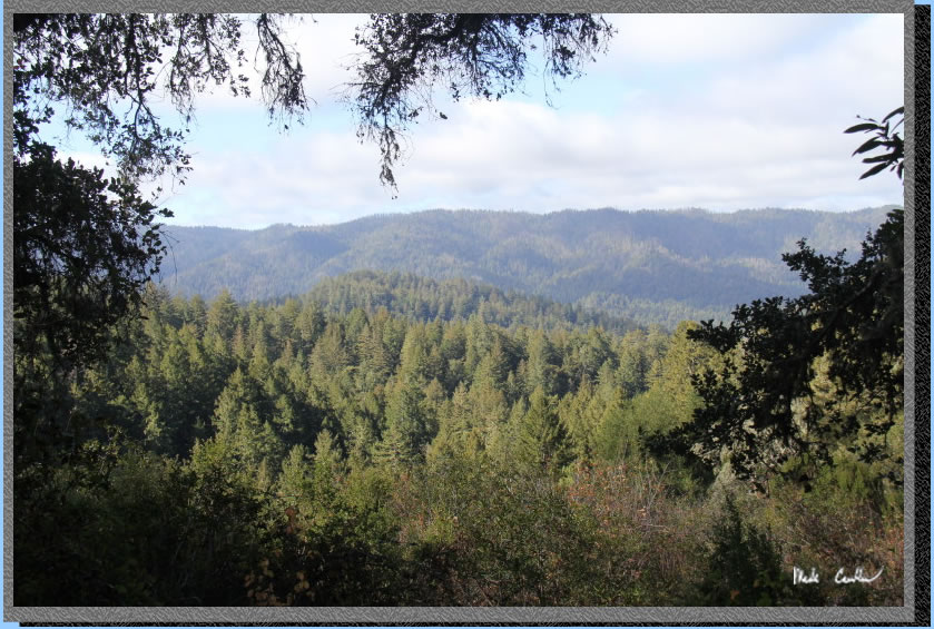
Dan and I made this trip to Slate Creek Trail Camp. We had an original plan to go to Lake of the Woods in Desolation Wilderness, the Mosquito fire made us alter that plan. Plan B was to go to Bull Run Lake in Carson Iceberg Wilderness as it looked like the smoke would not travel that far southeast. Dan checked the smoke map before we departed and the wind had shifted making us utilize plan C. We did not have a permit (see directions here on how to obtain one) so had to fill out the online form and wait. Since it looked like we should get a site, we drove to Mountain View to have lunch, and then waited until 1 PM when we could call and pay. We then headed the rest of the way to the trailhead. We thought the drive wouldn't take to long from Mountain View. However, we did not account for road construction that had the road closed for chip seal repair, getting re-routed only to encounter another crew doing road construction and having to wait some more. We eventually made it through the road construction and made it down the narrow road to Portola Redwoods State Park (1.5 lane road). I used the address of 2001 Portola State Park Rd, La Honda, CA 94020 to get my navigation to the trailhead. I think that address is actually the last house on the way in, but it works.
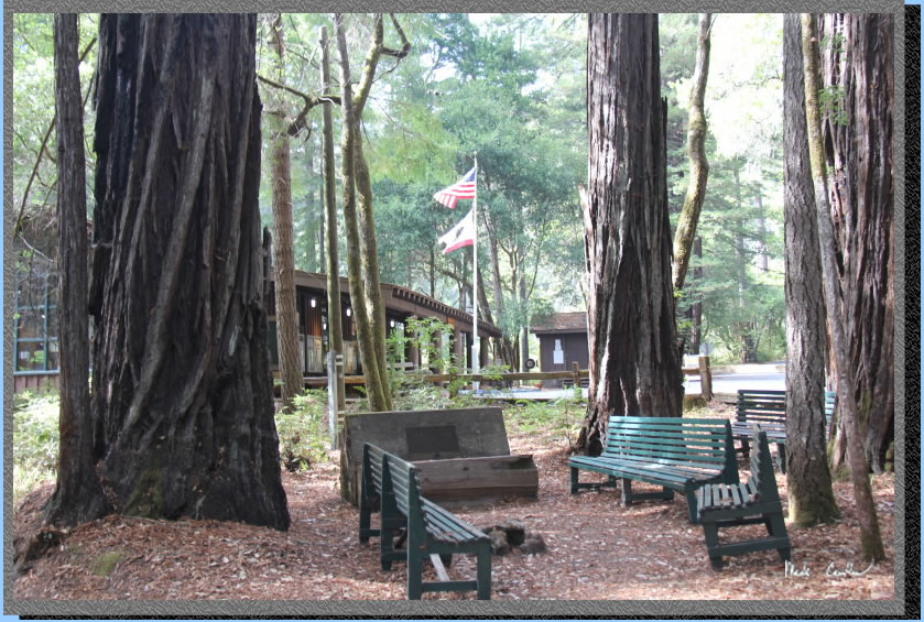
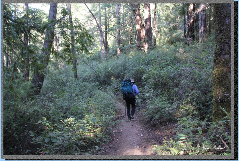
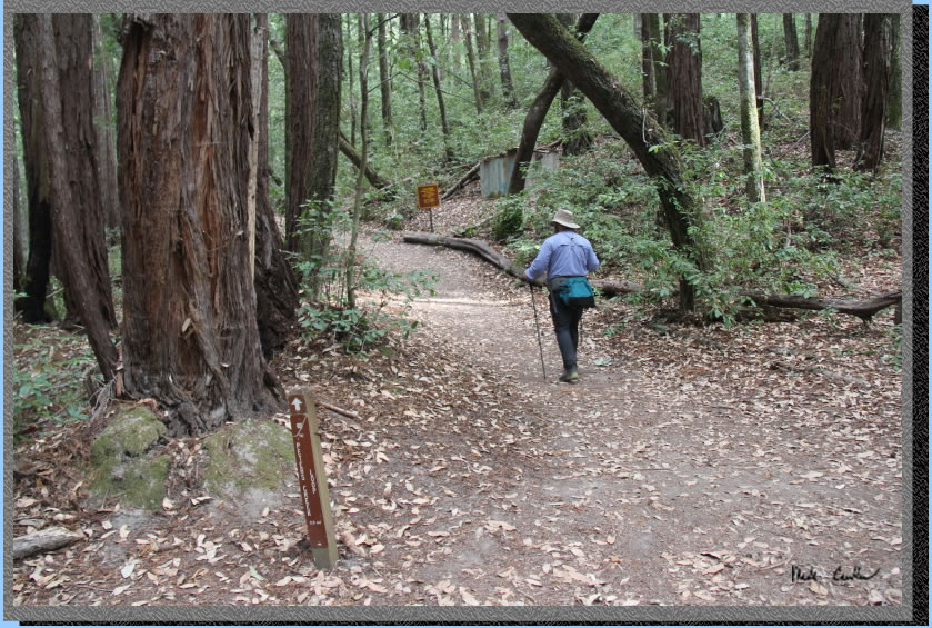
Luckily this is a short hike in as we needed to carry enough water for the two-night trip (water is heavy). Fortunately the temperature was forecast to be cool. We planned on leaving the trailhead hydrated and taking our time on the hike in. Here we are parked behind the Visitor Center almost ready to head out. We were going the most direct route to camp because of the heavy packs and late start. We hiked past the front of the visitor station and down across the bridge to the right to go further into the park past some parking spots on the right side of the roadway.
. 
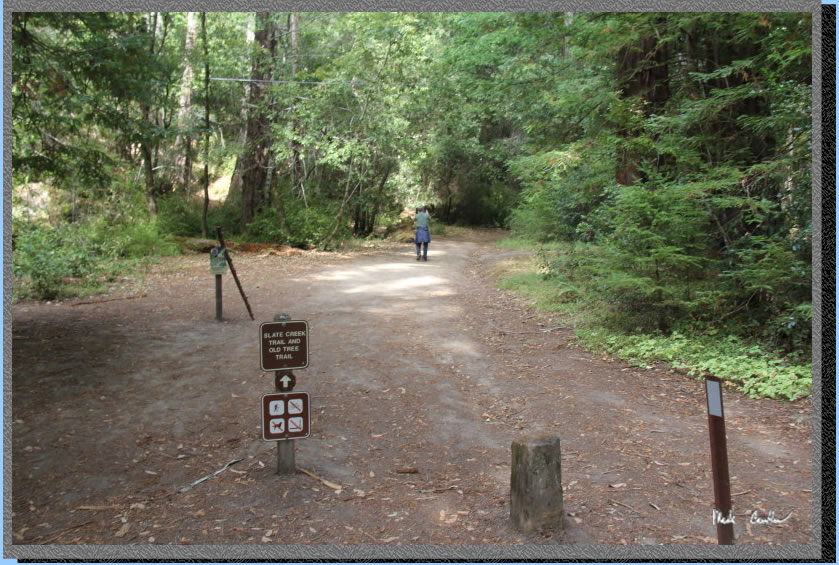
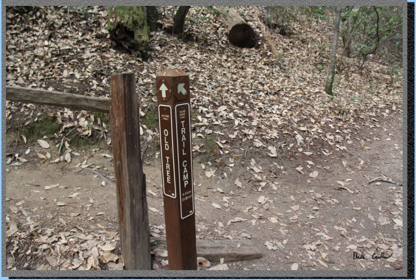
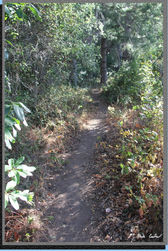
Trail is well marked on the left side of the roadway. We went up Old Tree Trail (easy grade) and then quickly came up to the first junction at Slate Creek Trail.
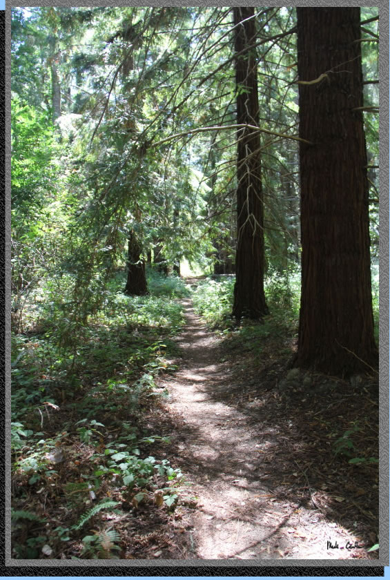
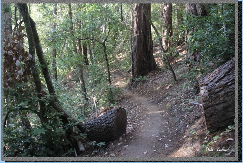
Hang a left here for Slate Creek Trail to camp. Normally I would comment about the tree cover on the trail. Let me just say now that there is tree cover for all the trails we were on. There were a few sections where the sun could come through, but too short and too few to worry about. If you like shade and quiet this trip is for you.
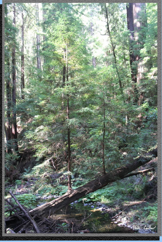
The trail continues up, at a gentle grade still. Notice the plethora of trees (tan oak, madrone, california bay, live oak and douglas-fir, and of course the mighty redwood). You will smell the california bay trees before you see them.
At the next junction take a right to stay on the Slate Creek Trail, left would take you to the north part of the park along the road you drove in on. The trail continues up with a little steeper grade in spots now, but still in the easy/moderate category.
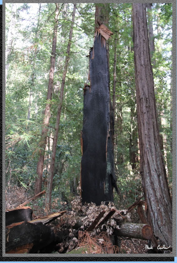
Some evidence of a past fire is all around, so be looking around.
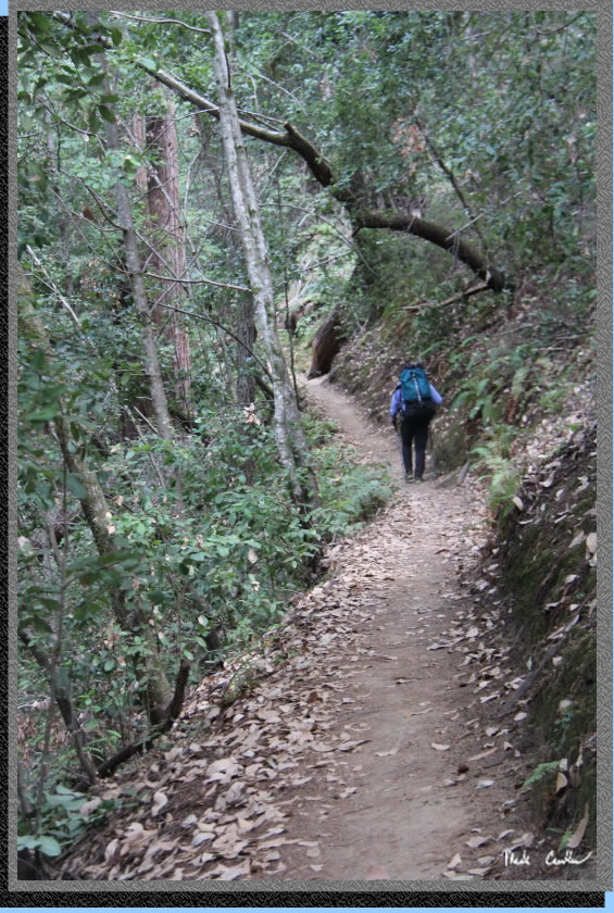
This is about as sunny as the trail got on the way in. It was a beautiful day to be out here and we almost has the entire trail to ourselves that day. The next junction is with Summit Trail on the right. Stay straight to keep on the Slate Creek Trail.
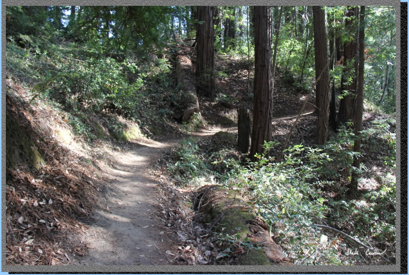
From the junction the grade is mild to camp. You are on the home stretch now. I took the shot below to show there is some variety in the trail conditions.
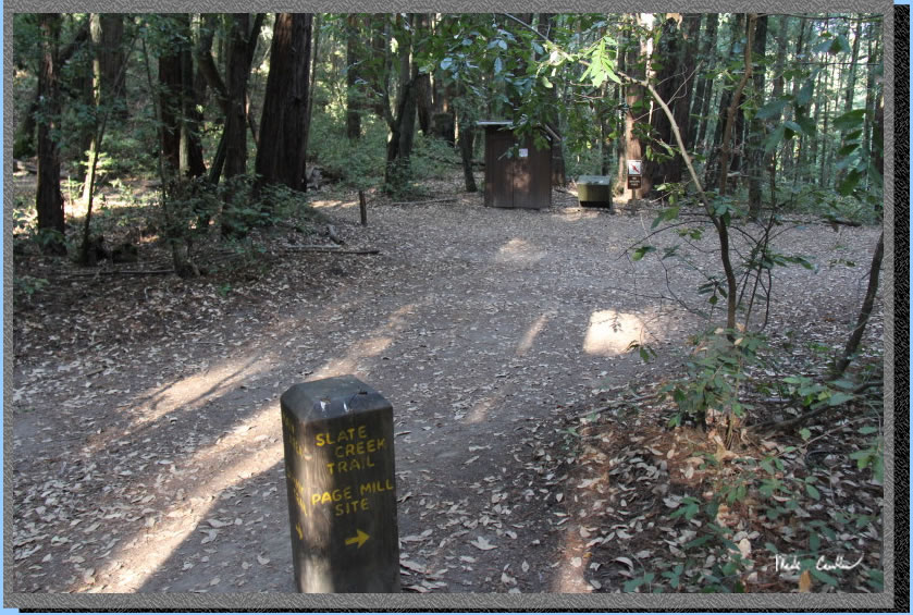
You can see from the long shadows that we were glad the trail was mild on the way in. We had about an hour before we would lose the light to set up camp. The pit toilet is visible in the image below with the trash can next to it. No fires are allowed of course. This is a four-way junction with one leg taking you down a private road (we never tried it), left takes you to Peters Creek Loop, straight leads to the creek and the Page Mill site, and right goes to the trail camp sites.
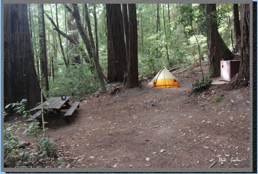
We quickly scanned the sites and picked site #5. All seemed nice, but we felt #5 worked best for our two tents. After setting up camp we had time to organize a little and pull out dinners makings before it got to be headlamp time. That evening was mild with only a few bugs that came out to see us. No other campers at the camp that night. Here is camp with my Scout tent lit up with the morning sun before we started on the day hike on day 2.
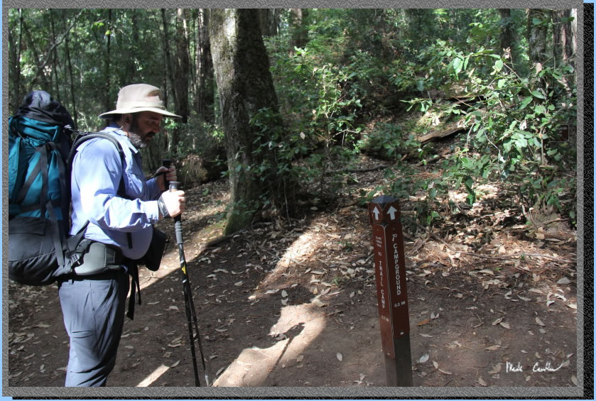
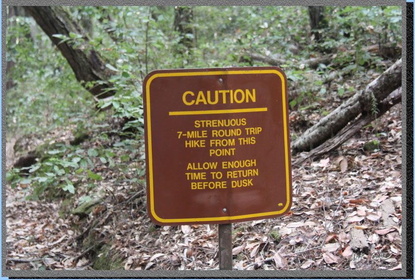
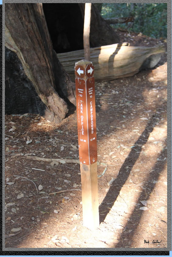
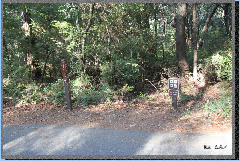
Day 2 was going to be a 7 mile roundtrip with some more moderate elevation gains/loses (it is roundtrip). We brought only the essentials and lunch on the day hike. You head out on Bear Creek Trail just past the pit toilet to be greeted with this sign.
Now with a full pack I would say strenuous, but with having all day (if needed) and only day packs it was more of a moderate hike. The trail starts out gentle and wide but becomes more steep and narrow in spots as you go up and over a ridge with views to the southwest.
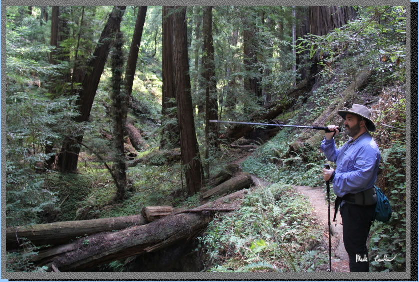
You can see the general up direction of the trail past Dan in this shot.
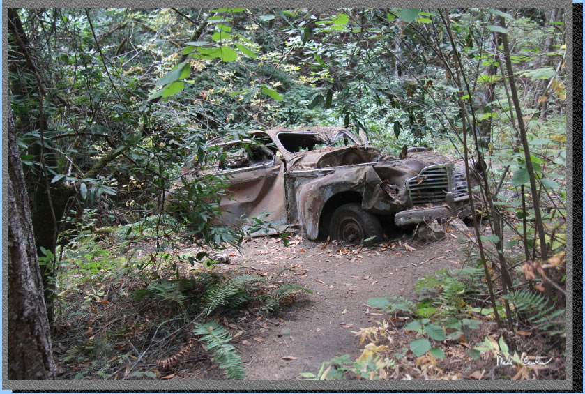
One of the more curious things you will see along the trail. We are guessing that the trail was a road at some point in the past (based on the vehicle vintage it may have been quite a while ago).
Here is the view I mentioned. We had a partly cloudy day with a little breeze.
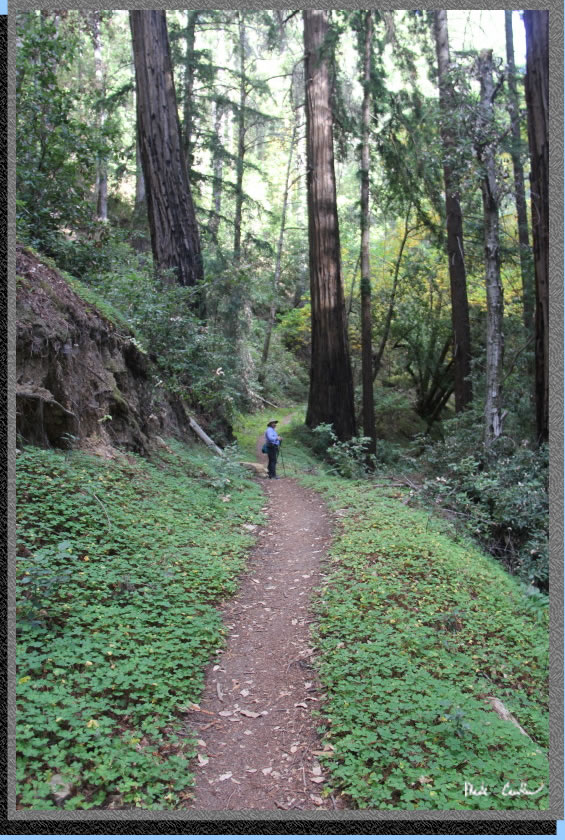
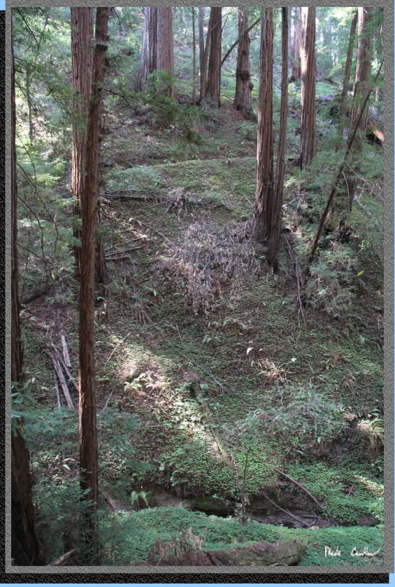
The trail continues down now and gets overgrown in spots. It would behoove you to know how to identify Poison Oak for this section of trail. It is abundant and grows amongst all the other native plants to blend in well. This section it was passable as long as you knew what plants to touch and what to not.
After all the down you will come to the Peters Creek Loop Trail and have a big decision to make (you have to decide to if you want to go left or right). We went right.
You can make out the trail above us we used on the way into this creek drainage.
There was still some water in the creek. I had to take a picture of these tree "branches"... not sure when a branch qualifies as a tree...
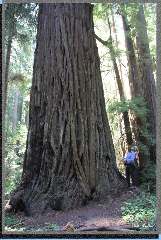
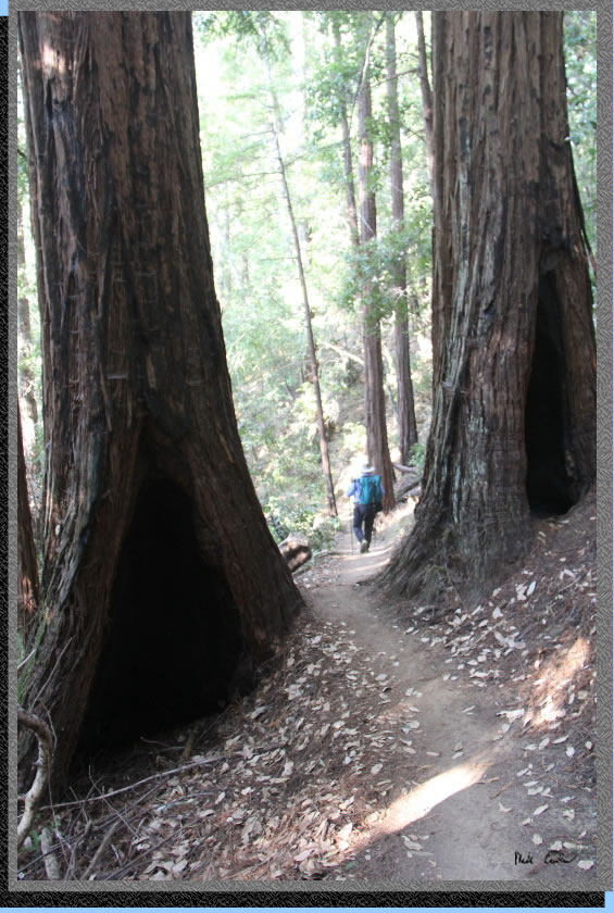
So, this was the biggest tree we saw. I did not have a tape measure but hugged my way around it to estimate it at at least 50 feet in circumference. We continued around the loop at a leisurely pace.
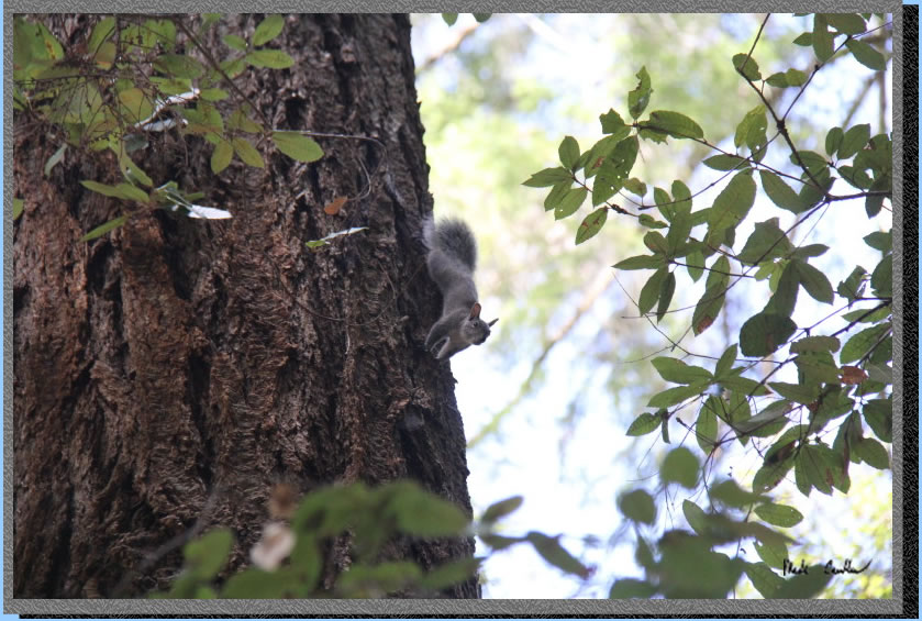
Here is the angry gray squirrel we encountered. Thanks to Dan for making it mad enough to challenge us to climb his tree. We did not dare go near his tree, he seemed serious, and we wanted to safely make it to lunch.
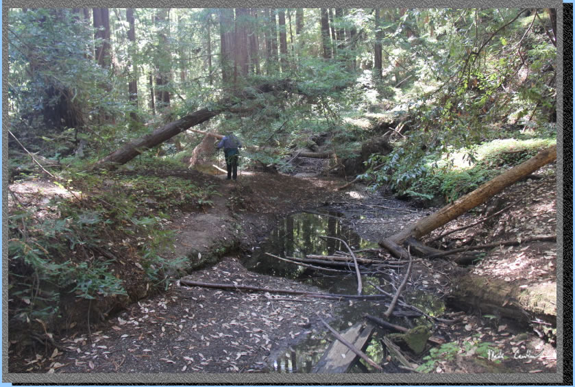
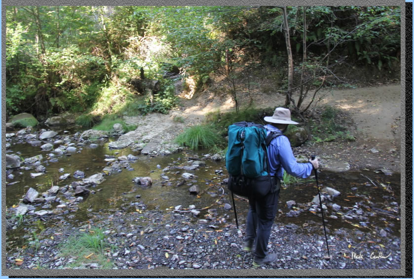
We made our way over the creek. I can imagine in wet conditions you don't get to walk the other side of the creek.
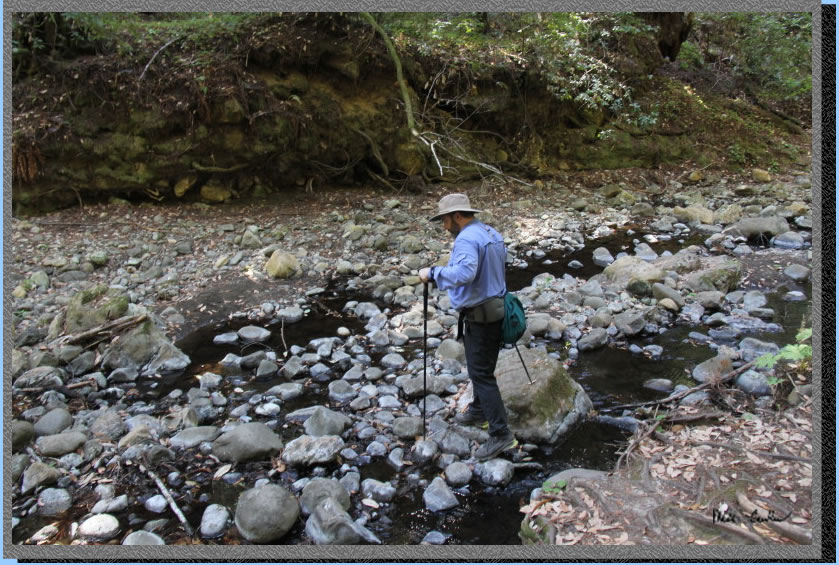
Unless you are willing to get creative I guess. Seriously though, I would not recommend crossing on a fallen tree.
We had lunch near the head of the creek before making out way back to camp. The creek was running enough to provide some background babbling. We saw one other person on the trail today. Here is one shot I took on the way back.
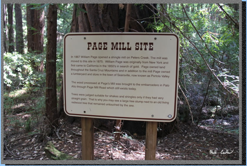
After we regrouped at camp Dan wanted to head down the the Page Mill Site. We made the very short hike down the trail to the creek/site. Here is the sign, there was no other evidence/structures of the mill.
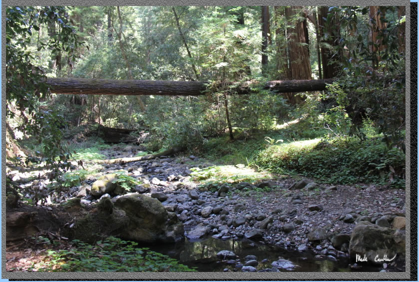
Here is the creek. There was some water flowing up river that looked better to filter from. We didn't bother as we had just packed enough water for the trip. It would likely have some "organics" in it. We explored a bit before heading back to camp so I could rest my tired feet. The night was a little cooler than the one before.
We packed up that morning and headed back down the Slate Creek Trail. I almost stepped on this guy, better that a snake anyway (that almost happened too) The narrow trail is almost level to the Summit Creek junction.
Here is a shot of this section on the way out that morning.
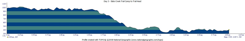
Here is the junction with Summit Trail. We took a left here and went up a short but steep section up and then levels off before some more steeper downhill. If you look at the profile for day 3 you can see that the general direction is down.
Here is Dan splitting some trees on the way down.
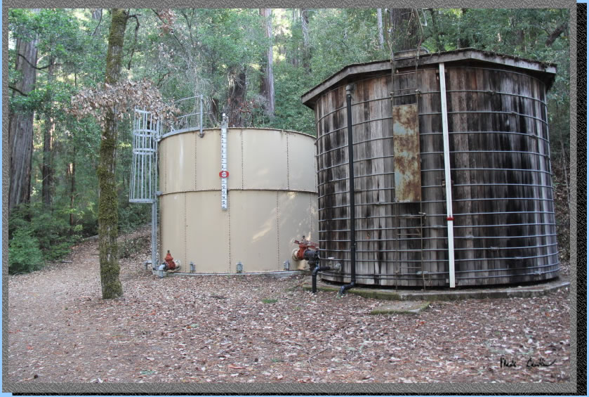
Just before you get to the campground road you will see these two water tanks.
Our plan was to cross the road and stay on the Summit Trail along the creek (you are actually above it). We would then link back to the road and then go down the trail to Tiptoe Falls. All junctions are marked well.
Here is Dan crossing Pescadero Creek. We were hopeful there would be some water at the waterfall ahead.
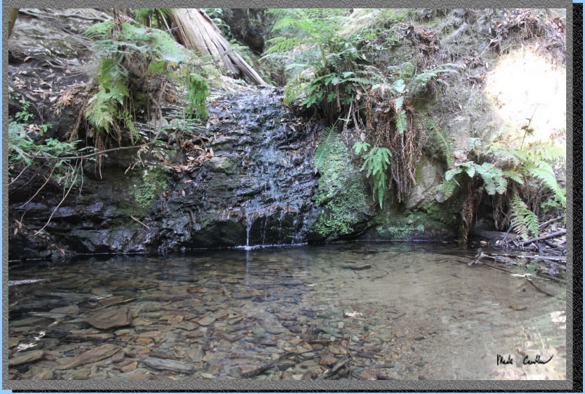
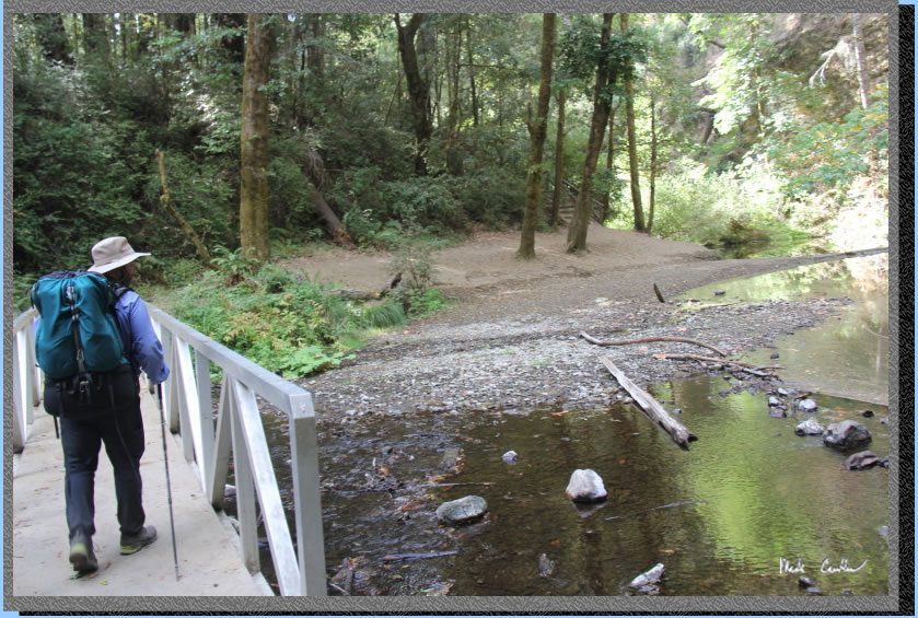
We were pleasantly surprised to find some water flowing at the falls. We continued back to the Iverson Trail so we could head back over the "seasonal bridge" to the Visitor Center (and our car).
Here is Dan on the bridge. It is very short walk back up to the car from here. This is a great area to explore. We made a semi-loop option that added a little mileage on day 3, but it seems worth it to see a waterfall. Besides the extra water weight and the road construction encountered on the drive in the trip was just about perfect.
GPS on this
trip shows the trek from the car to camp in white (3.2 miles - I think this is too high, tree canopy/GPS reception problem, as the listed distance is more like 2.9), day two day hike to Peters Creek and loop in blue (7 miles roundtrip) and day three 3 camp to car in red via Iverson Trail/Tiptoe Falls (~4 miles). Click on the map to see the larger version .
.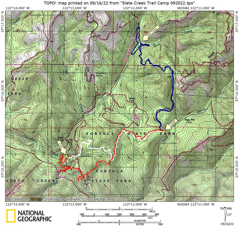
Day 1 - Car to camp.
Click on profiles to see full size.
Day 2 - Day hike to Peters Creek and we did the loop (level section in middle of profile). 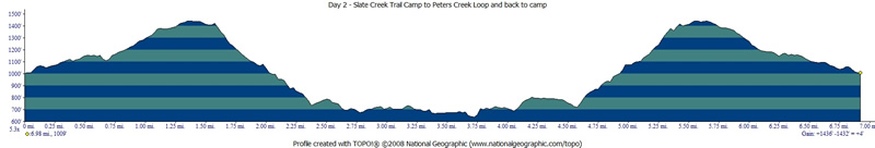
Day 3 - Camp to car via Iverson Trail and went by Tiptoe Falls.