![]()
 Permit
- A permit is required for all overnight stays on Angel Island. Permits
can be obtained using the state park website at www.reservecalifornia.com.
Permit
- A permit is required for all overnight stays on Angel Island. Permits
can be obtained using the state park website at www.reservecalifornia.com.
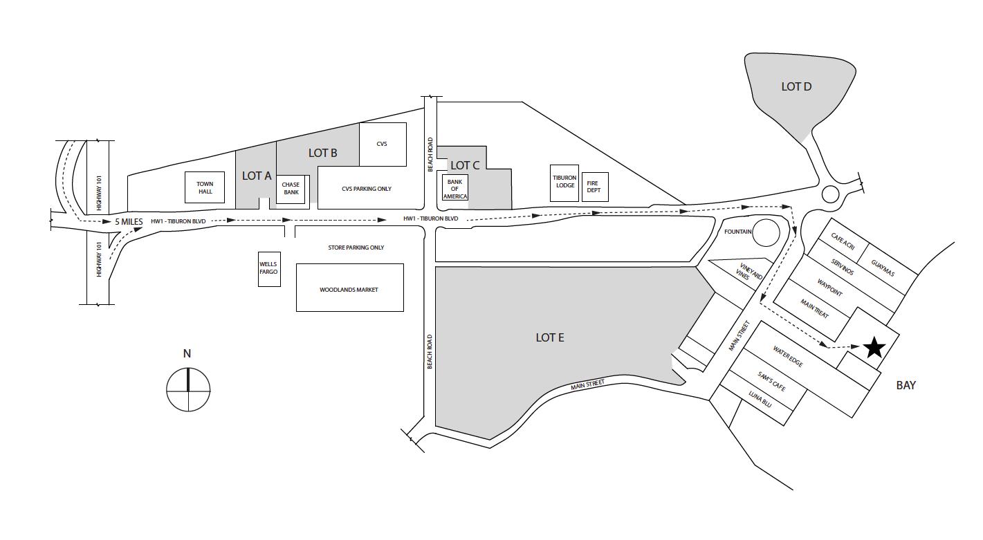
Transportation/Parking - Your options include private charter, Tiburon Ferry or Blue and Gold. Be sure to check the ferry schedules prior to making your reservation. Ferry service is limited in the off season. For parking in Tiburon see map below map/profile. Parking and Tiburon Ferry are cash only.
Mileage - We did 1.4 miles on the way in and ~1 mile on the way out. Your mileage may vary depending on route/exploring selection. See map/profile below. Trail map is here.
Camps/Water - There is a bathroom (pit toilet), trash can, and water at each group of campsites. Once you check-in with ranger after reaching dock there is a bathroom and restaurant (seasonal).
Hazards - Mice, raccoons, Poison Oak, missing your ferry. Nearest Ranger # 415-435-1915 (always check with ranger ahead of time for current water/trail conditions).
Sarah and I
have been to Angel Island a few times now, but we decided to head back
since we enjoy it so much.
For other site descriptions use these links (see trip to Ridge
Site #4, Sunrise site #8 in 2010, East
Bay site# 2 in 2013 and East Bay site#1
in 2013 ). Sunrise camp does have uninterrupted views, but East
Bay site #1 is huge, away from neighbors, and has shade and some shelter
from wind. I think all three East Bay sites rock compared to Sunrise
on the whole. The Ridge sites are the most exposed, but have the killer
views of the San Francisco skyline. Ridge site #4 has the best views
but no shade and no shelter should the wind/weather head in. Each group
of sites has a water faucet and pit toilet. We used the Tiburon
Ferry on this trip. We caught the 1 PM ferry out of Tiburon and
it is about a ten minute ride to Angel Island. We parked at one of the
lots a couple blocks from the ferry. There is one parking lot at Bank
of America that is manned (but usually full unless you get there early).
Parking and the ferry are cash only so hit the ATM after parking (there
is one near the bathrooms at the ferry dock too) or plan ahead. Here
is Sarah when we parked near Town Hall (Lot "A"). 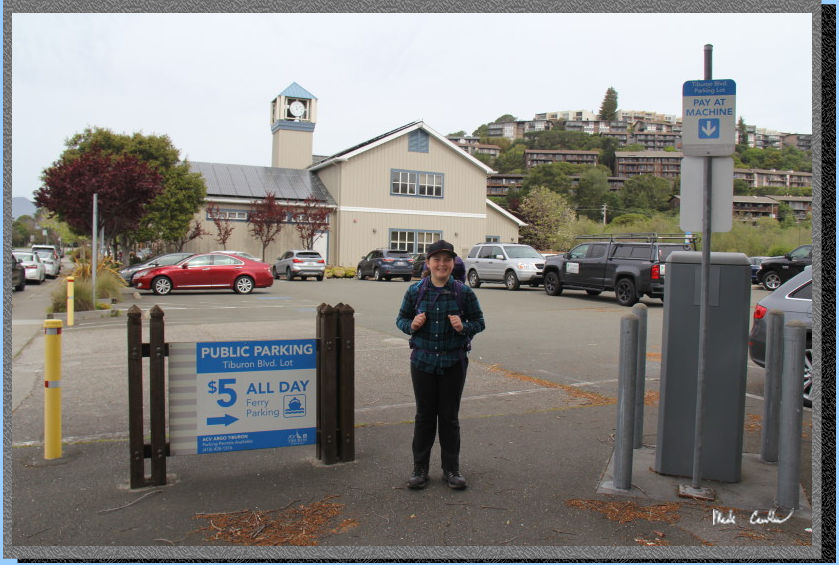
Here we are on waiting
for the TIburon Ferry. We had decided that we would need to leave too
early to make the 10 am ferry on this trip (and drive through commute
traffic), so we aimed for the 1 PM ferry (this time of year there is
limited ferry service to the island). We got to Tiburon early enough
that we had time to have lunch at New Morning Cafe. I had Chilequilles,
very good dish they make. Food and service were great. We also went
through the ice cream/candy store. The other food option I have used
is Angel Island
Cafe, which is on Angel Island. Be sure to check ahead of time if
you decide to count on them being open for a meal. They have limited
hours in the off season. The
Cafe was open when we were there.
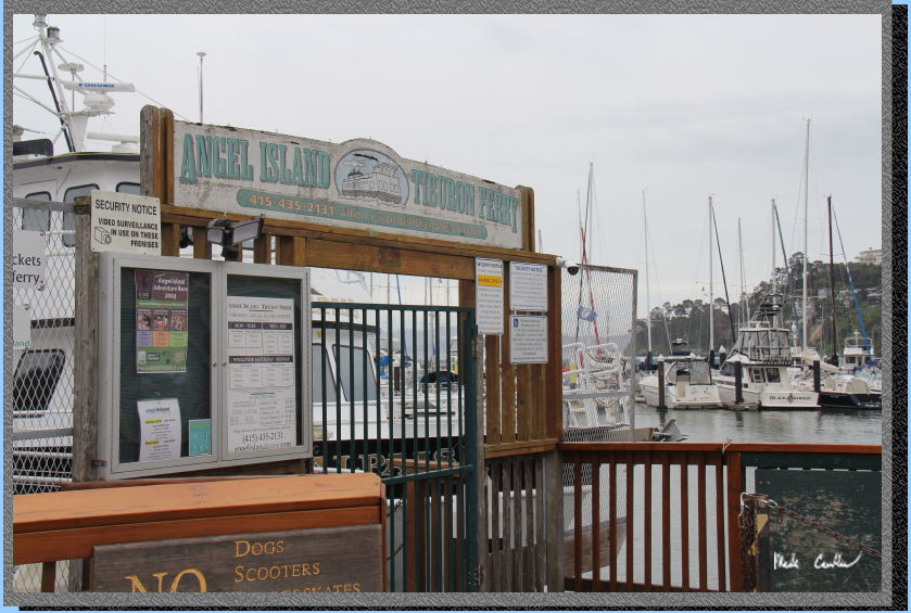
We watched a few
people come and go at the dock waiting for the ferry (there were some
people that figured out unless you were camping on the island it did
not make a lot of sense to take the last ferry over there). There were
a few people that decided to pay only $5 to take a ride there and back
(not allowed to get off the boat). I guess that is a way for the ferry
service to make a few bucks, since they have to take the ship over there
anyway. It is a quick 10 minute trip across Raccoon Straight. Once you
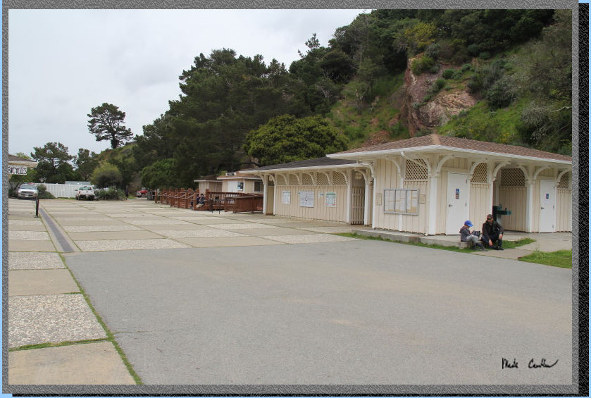
get off the ferry and head up
the walkway a ranger will be waiting to direct you to the kiosk to check-in.
The ranger will go over the rules. All the rangers I have encountered
out here are great so if you have a question or looking for a tip go
ahead and ask. Once the last ferry leaves for the day it is just you
and the rangers.
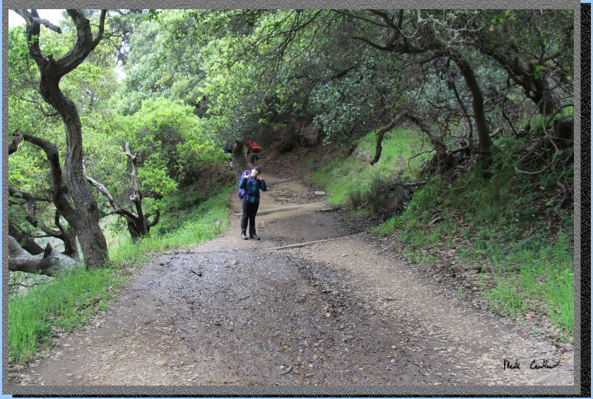
So Sarah wanted to go a more
direct route to camp today. It sounded like a good idea with the weather
forecast threatening rain by the afternoon. We
headed past the bathrooms, past the service dock and to the stairs.
Here is Sarah as we headed up the trail toward the stairs. Sarah counted
155 stairs to the Perimeter Road.
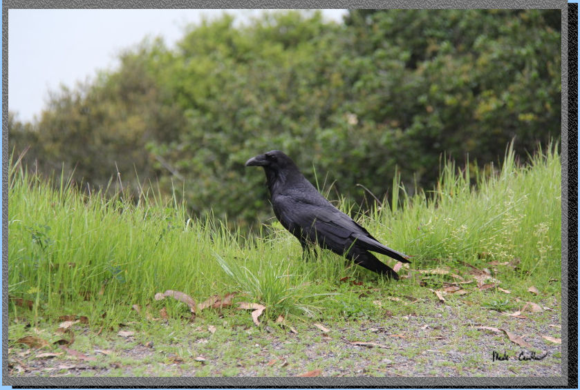
We were greeted by this raven once we got to the Perimeter Road. Your
choice is to either go straight across and remain on the North Ridge
Trail or take a left on the Perimeter Road toward the Immigration Station.
Sarah decided we would stay on the road today, so we took a left.
There are some nice view
of Tiburon and out to the Richmond bridge along this section of the
Perimeter Road. Keep an ear out for traffic (construction as they are
constantly restoring buildings out here). They also use this road to
get around the island when there are driving tours. The road has a few
slight uphill/downhill parts. However, if you look at the profile you
can see that the elevation gain/lost is all very minor. Before you know
it you will be at the Immigration Station. You would take a left down
to it just past the signs. If you have not checked it out before (or
even if you have) it is worth the walk down there. There is "beach"
access (no sand and small) and a bathroom with running water. Continue
on the Perimeter road to get to camp.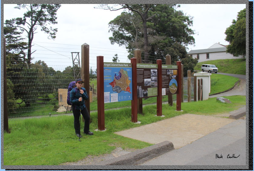
Take a right
at the junction with the Fire Road (where there are a couple buildings
(one is the old fire house and one is the maintenance building). The
Fire Road also makes a loop around the island (just higher up than the
Perimeter Road). The next junction will be another right when it directs
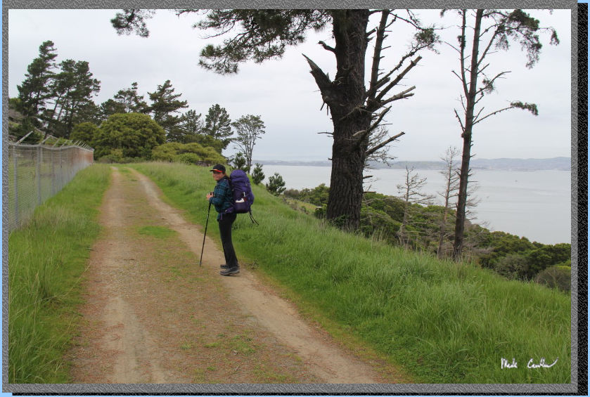
you to the East Bay Campsites. You will go up a little to the water
tank protected by a long fence. See the fence on the left in the picture
below. Also notice the views now to the north. Continue on until the
next junction when you will make a right to the actual campsites. A
left at this junction will have you headed back toward Ayala Cove.
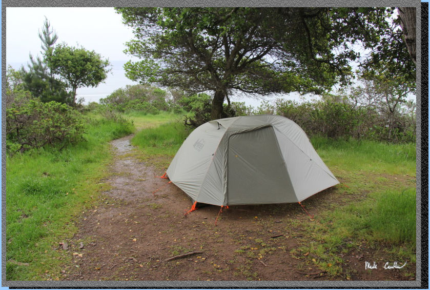
We started setting up the tent at site #1 immediately as it was one
of those days where you could just feel that the rain was about to start
at any moment. We were able to get the tent setup and the essentials
in it before it started raining. I hunkered down under an umbrella (with
the forecast I decided to bring one along) to wait out the worst of
the rain while Sarah remained in the tent setting things up. Eventually
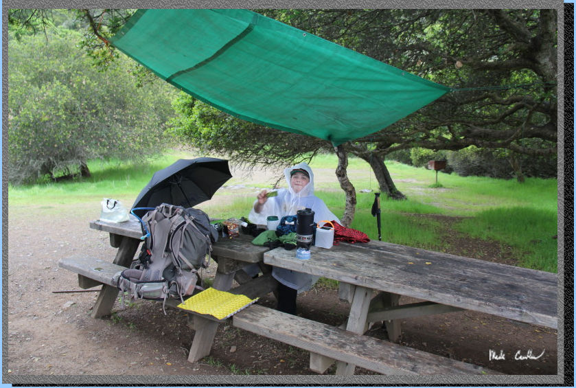
I got tired of waiting under the umbrella and setup a tarp.
Here is the
tarp setup over the table once Sarah joined me. The rain did not last
long, Sarah and I played some cards until it stopped. We left it setup
as it was nice to have some shelter setup should the wet weather return.
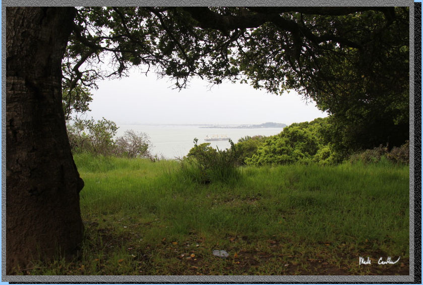
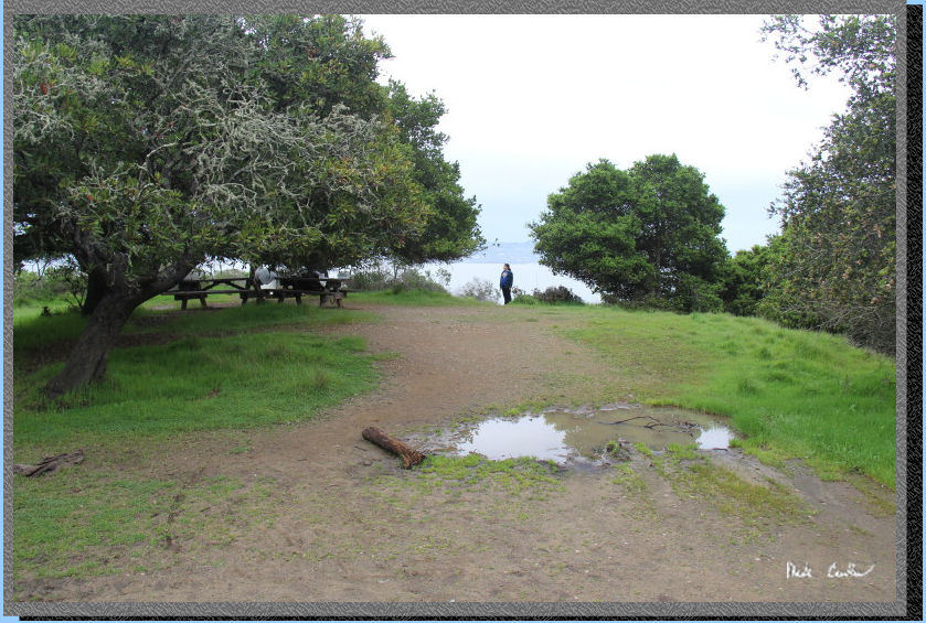
Here is one of the views
from this campsite toward the northeast.
Here is the
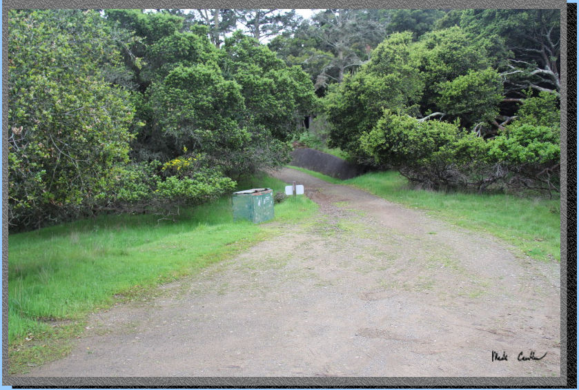
view toward the trash cans as you come into site #1. I forgot to mention
the the bathroom is closest to site #2 and when you walk into camp you
walk by the platforms for the old water tanks.
Here is camp looking north. The tent is past the two table. You can
see there are some smaller trees for shade (or to climb if you are a
kid) and the views to the north. It is amazing how many large ships
you can see pass through once you are sitting still long enough to notice.
We decided to save our hike to Mount Ida Livermore until after dinner
(to make sure the rain was done).
We headed out after dinner with some warm clothes, some rain gear, and
most importantly some lights. We hiked along the Fire Road past the
Sunrise Sites to Ida Trail, which goes straight up the mountain. Here
is the trail as you just start up the steep section (in the picture
I am looking down at the junction we had already made our right turn
at..
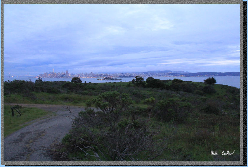
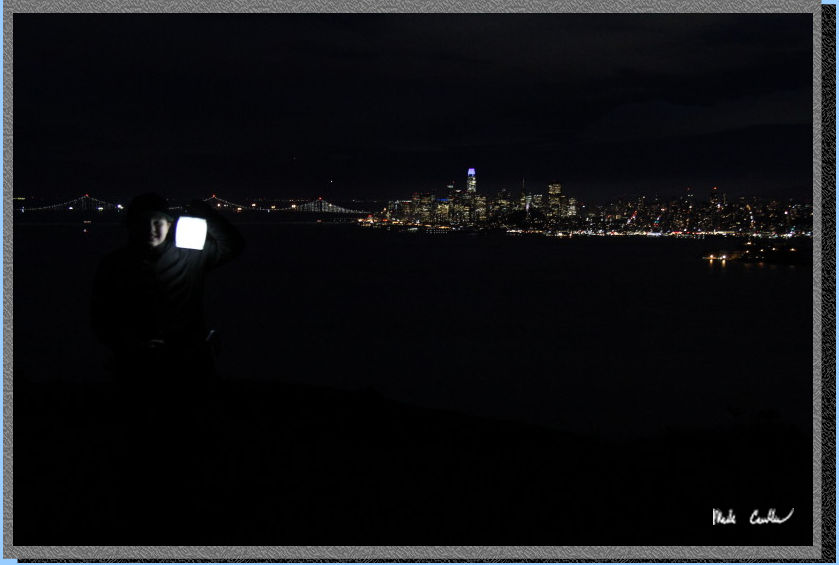
The trail quickly climbs with killer views of the San Francisco skyline.
If I knew how lucky we were going to get on the weather I would have
brought my tripod.
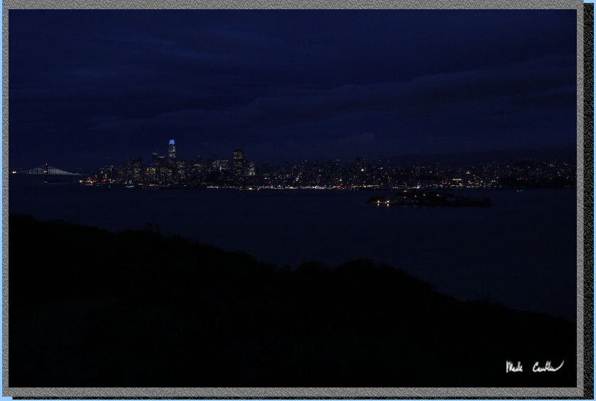
We didn't make it all the
way to the top, we did make it high enough to see all the sights though
before turning back to camp, and our warm tent.
We made it safely back to
camp and were able to get in the tent before the rain started again.
It was a nice peaceful rain that made falling asleep easy that night.
The next morning was wet, with it being too wet to leave the camera
out for pictures. We utilized our tarp setup to pack up out of the rain.
We hiked out the quick route utilizing the Fire Road to North Ridge
Trail to stairs to dock. See map/profile. I enjoy
the Northridge Trail as it is an actual trail ,not a road. We made the
10 am ferry back to Tiburon. It seemed like most of the backpackers
on this island were on that first ferry (likely because of the wet weather).
It was another great trip, even with the damp conditions. I will leave
you with "Spooky Sarah" on our night hike. Make sure you make
it out to this historical island (even if it is only a day trip).
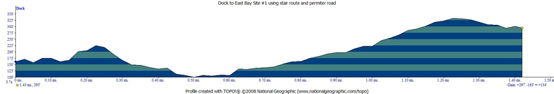
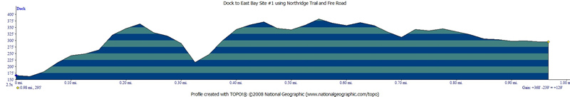
GPS on this trip shows the
trip in at under 1.5 miles using the stairs (North Ridge Trail) to Perimeter
Road to Fire Road on the way in, and under a mile using the Fire Road
to North Ridge Trail on the way out. Click on map to download full
trail map.
.
Profile on the way to camp..
Click on profile to see full size.
Profile on the from camp
to cove... well technically this profile shows from cove to camp (I
reversed it somehow and couldn't switch it back). Click on profile to
see full size.
(back to top)
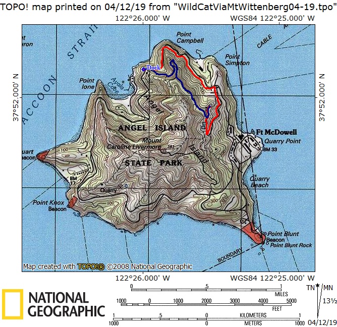
Overnight parking
is allowed in lots A, B, C, D (pricing makes you want to avoid D as
of 04-2019). The star on this map is the dock for the Tiburon Ferry.
Click on map to see larger version.