![]()
The BIG map and profile page
(take me back to trip description)
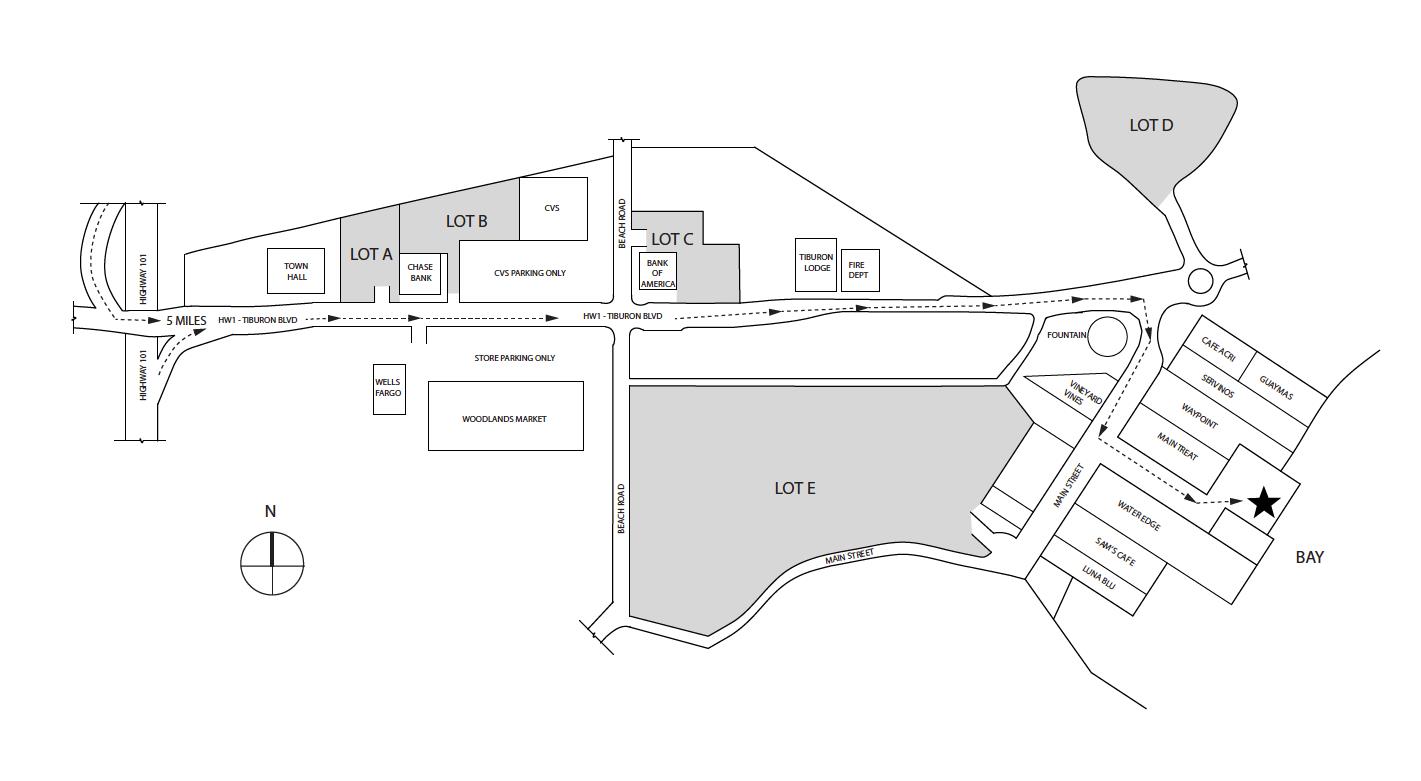
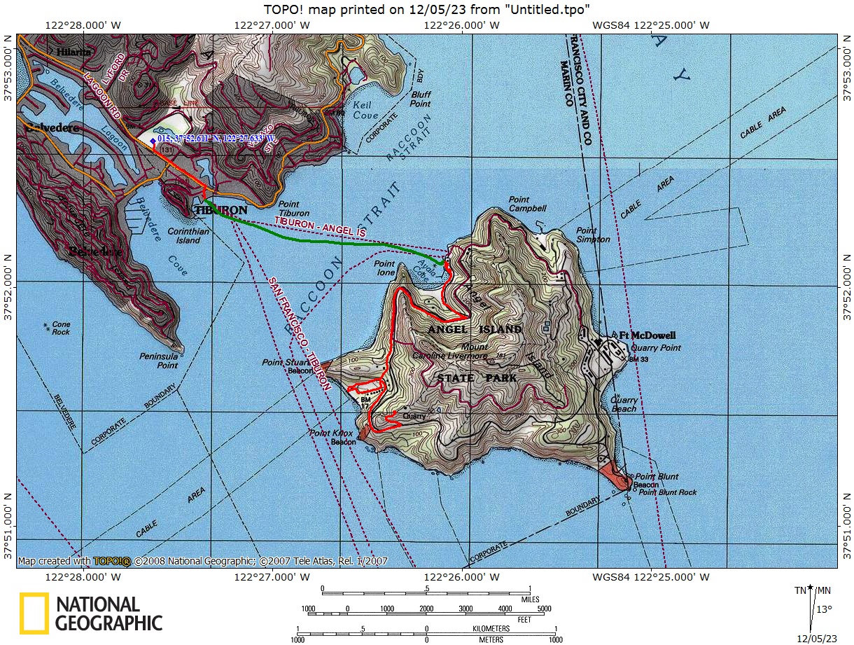
Green line shows the ferry trip. The short red line is the short walk from Lot A to the dock. The longer one on the island is the ~1.6 miles from the dock on the island to Ridge Site #4. The route below shows a detour to explore Camp Reynolds (West Garrison) from a previous trip. Click on map
to download the offical Angel Island map.
.
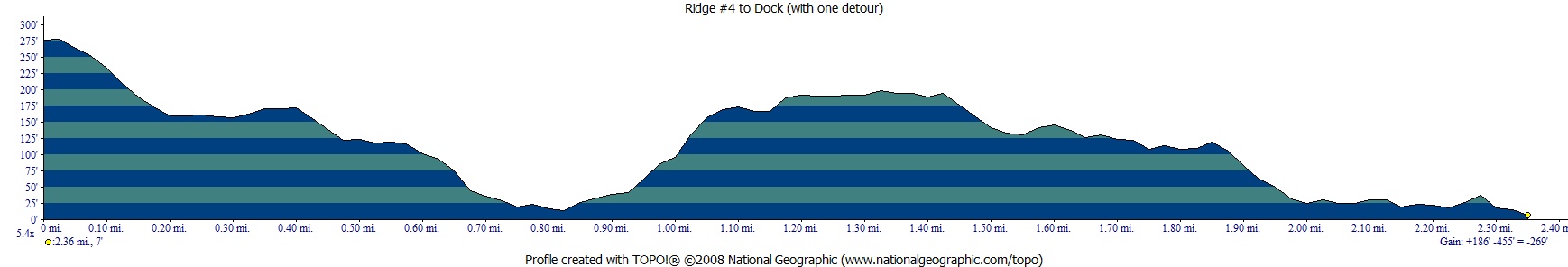
Profile from Camp At Ridge Site #4 to Camp Reynolds beach then dock via paved road (not stairs )from a previous trip.
Hike out via using the stairs from a previous trip. 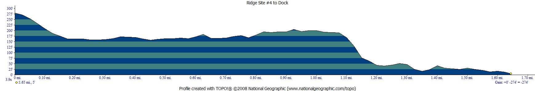
(back to top)
Overnight parking
is allowed in lots A, B, , D. The star on this map is the dock for the Tiburon Ferry.