


![]()
 Permit
- Permits can be obtained through www.reserveamerica.com.
Permits must be picked up from the Bear
Valley Visitor Center (located at 1 Bear Valley Road Point Reyes
Station, CA 94956, 415-464-5100) on your way in. If you are arriving
outside of the visitor center's hours they will post permit outside
for you. Sites run $20 per site per night (up to 6 people per site)
Permit
- Permits can be obtained through www.reserveamerica.com.
Permits must be picked up from the Bear
Valley Visitor Center (located at 1 Bear Valley Road Point Reyes
Station, CA 94956, 415-464-5100) on your way in. If you are arriving
outside of the visitor center's hours they will post permit outside
for you. Sites run $20 per site per night (up to 6 people per site)
Mileage - Coast Camp is a short 3.1 miles each way via the Coast Trail or a really short 2.1 miles via the Laguna Trail/Fire Lane Trail. Or you can make this a 5.3 mile loop trip. We did the loop on this trip. See map/profiles below.
Camps/Water - Coast Camp has 14 sites (some of them are group sites). Sites 1-7 are closest to beach access. Nice pit toilets are near sites 9 and 10. Each site has a metal locker, picnic bench and barbecue. Potable water faucets are provided near sites 8 and 12.
Hazards - Poison Oak, ravenous raccoons, Coast Dragon (use the locker for food storage).
DAY 1
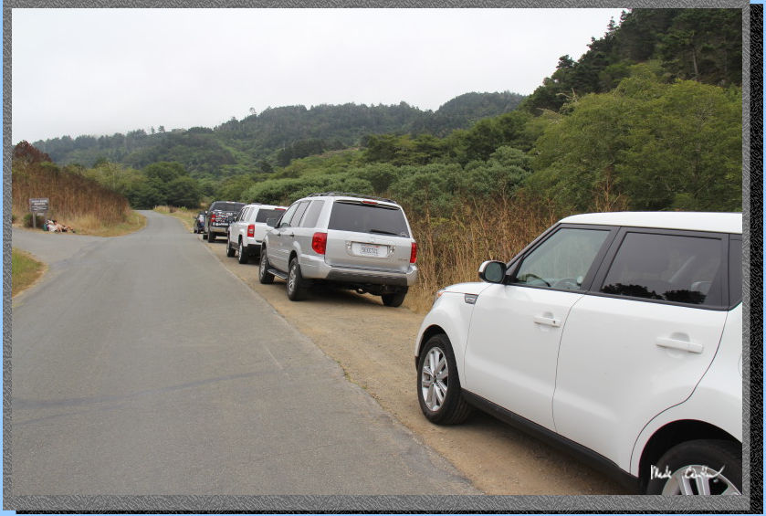
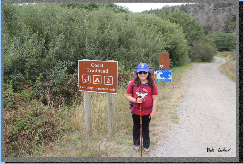
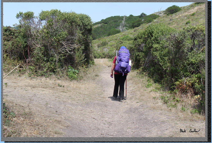
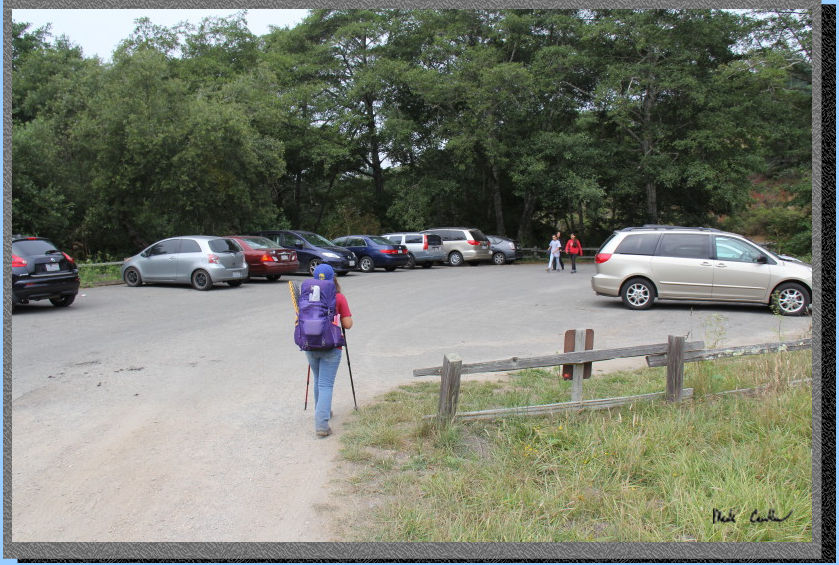
Sarah and I decided to get in one last backpacking trip before school started. This is one of her favorite places to go, who could blame a kid for loving a campsite almost on the beach. Sites here can book out way ahead of time, especially in the summer It is also very popular with families as the hike is easy. We checked in at the Visitor Center and obtained our permit for parking/camping and picked up a fire permit in case we wanted to brave the wind on the beach to have a fire. Getting to the trailhead is easy. After you leave the Bear Valley Visitor Center take a left onto Limantour Road. Look for a sign for the Hostel/Laguna Trailhead on the left. Take the left onto this one lane road and you will see the Coast Trailhead on the right (just before the Hostel on the left). Parking at Coast Trailhead is limited (you must park off the roadway or you will get ticketed). Here is our car parked at the Coast Trailhead. On busy weekends you are likely not going to get a spot at the Coast Trailhead. If no parking is available drive further down the road to the dirt overflow lot just before the entrance to the Laguna Trailhead parking lot (or park in that lot, your parking pass is good for either option).
Here is the official start
of the Coast Trail. It is wide and composed of gravel (mostly). Horses
and rangers can be on this trail, so keep an eye/ear out for each. The
trail is mainly exposed but you are very close to the ocean and the
cooling influences it has.
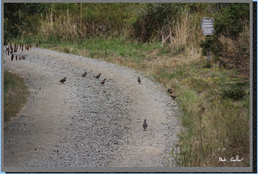
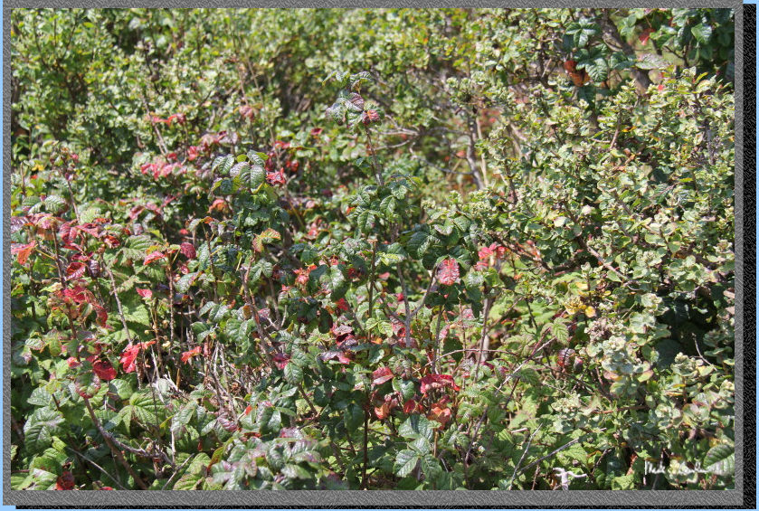
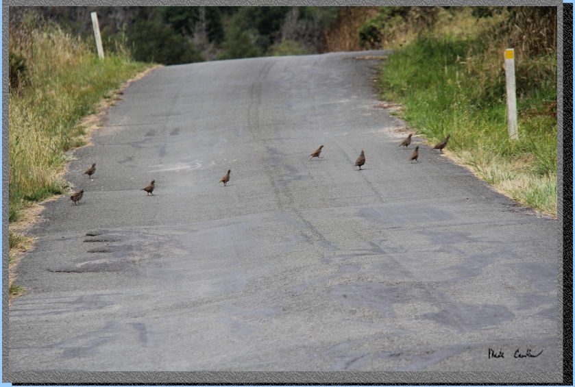
We were quickly greeted by
a plethora of quail. There were many deciding to cross the trail/road
in front of us. Poison Oak abounds in this vicinity. You should stay
on the trail and try not to walk to close to the edge. I tried to warn
the quail but they just "flew" right into a big patch of it...
The trail feels very level, although if you look at the profile it is
actually slightly downhill, but the elevation gains/losses on the Coast
Trail are very minimal. We saw two families using wagons to haul their
gear on this trail. Not a bad option to get out there with a bunch of
gear. I am pretty sure that I have taken this exact picture a couple
times now. Once of these times I should look up its name!
It is hard to tell in this
shot, but there is actually water on either side of the trail. I am
not sure if the creek that runs through here has a name, no name is
given to it on my map. Sarah and I decided that the marshy area that
it creates is likely home to the Coast Dragon... We will call it Dragon
Creek and hope the dragon is of the friendly variety.
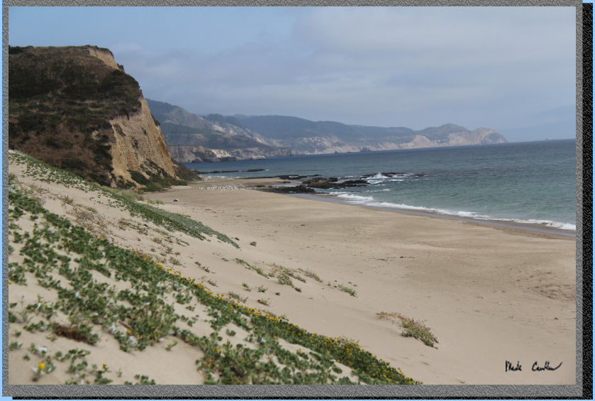
Eventually you will travel
far enough to catch a glimpse of the ocean. There was a bit of wind
but it was welcome. It was forecast to almost hit 80, and it felt warm
in the sun when the wind wasn't blowing. From this point you can either
head down to the beach and hike in the sand the rest of the way, or
stay on the Coast Trail. We went out onto the sand and then returned
to the trail. It turns out that sand is more difficult to walk on than
the trail. We also ran into some horses (with some humans on them).
We directed them back to the trail (they had been traveling along the
beach).
Here is shot looking back
at the views to the west. It is a little weird but when you are traveling
to the beach out here you are traveling south. The trail is very open
and has some grand views, when there is no fog. You can see out to Chimney
Rock (point on the left) in this shot. When you check-in with the ranger
you can get a free paper map. It will work but check out there other
map options as well. There are some nice weather resistant color ones
that are superior to the free one.
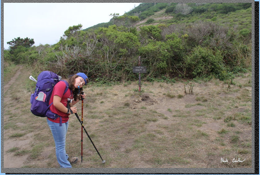
We passed the junction to
the Laguna Trail/Fire Road and then down over the creek and back up
to camp. Here we are walking up to our site #7, at the end. There was
someone in one of the sites on the way in, but otherwise pretty quiet.
All sites were booked that evening per the ranger. If you look just
ahead of Sarah you can make out the brown fuzzy lump getting ready to
hop away...
I know that I have already
mentioned this before, but just look at this picture. Stay on the trail
and stay out of the Poison Oak. They have it trimmed back as best as
they can from each site, but it is still right there waiting for you.
Urushiol = BAD. It was an opportunity to point out how to identify the
plant to Sarah. I saw the green variety, the red variety, the leafless
variety and even the berry variety. OK, so they are all the same plant,
but it can vary in appearance so know what to look for.
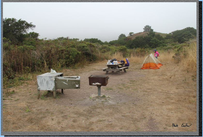
Here is Coast Camp site #7. There was enough room for 2 to 3 tents.
The tent sites are mostly level with some small dirt mounds. We did
see an active gopher the next morning, with evidence around camp that
he had been working hard for a while now on his tunnel system. He was
shy every time I got the camera out.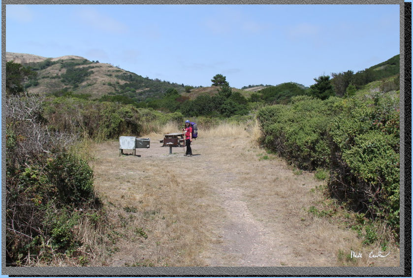
We set up camp and ate a
little snack before heading to the bathrooms. There are another 7 sites
here that are along the trail to the east. All the sites at Coast Camp
have no shade, which isn't really an issue out here most days. Sarah
wanted to head down the the beach, after checking out the rope swing
first.
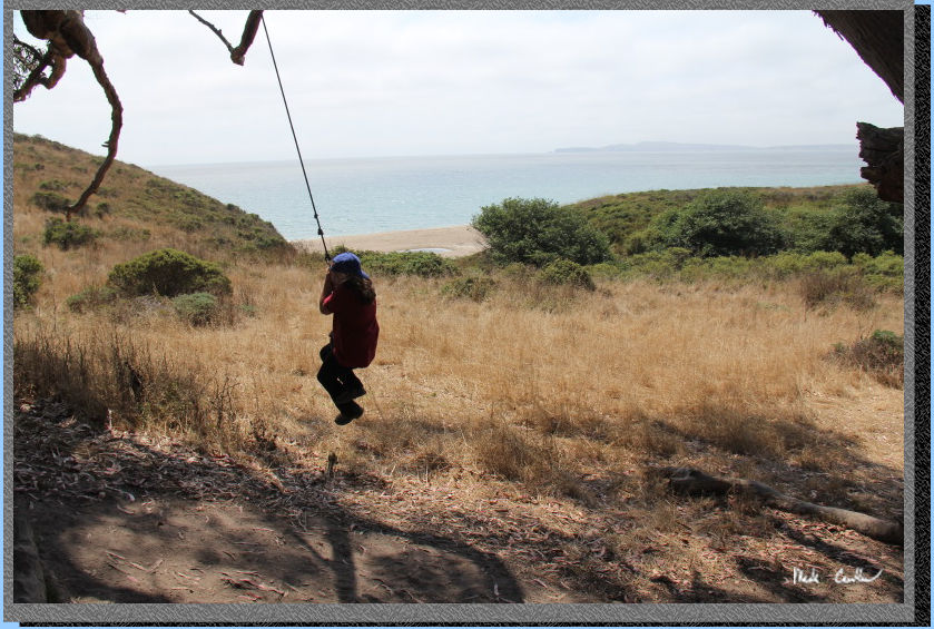
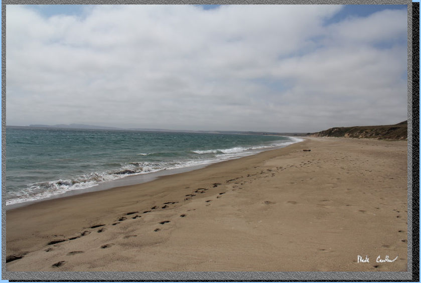
So it was pretty crowded out on the beach... OK so maybe it wasn't too
bad. There were a few other people around, just not in my shot here.
This section of beach is accessible during high tide, but if you are
traveling further east you should be mindful of the tide table.
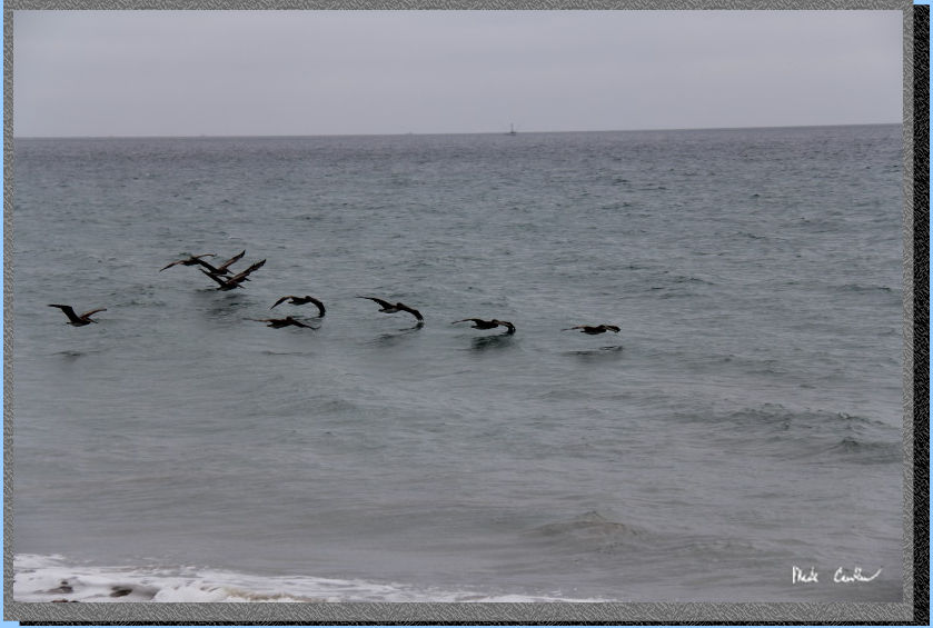
We saw a seal and then lots
of the feathered animal varieties out there. Here is a shot of some
pelicans expertly skimming the water.
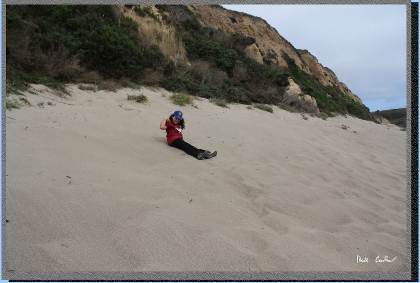
There is some great sand
out here. Sarah decided to test it out by rolling down this hill. She
said it was great!
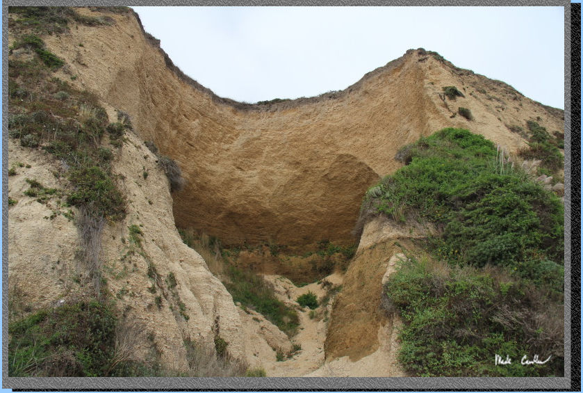
There was some cool areas
of erosion that I could point out to Sarah. This carved out section
actually was concave and eroding under the cliff face, a good reason
to never get too close to a cliff face at the beach.
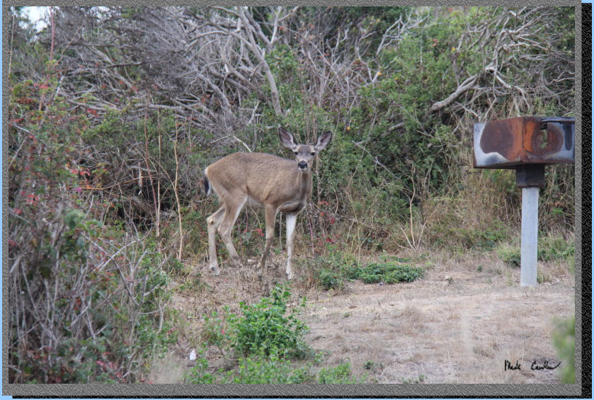
We decide to head back to
camp for dinner (after going on the swing again). On the way to camp
we saw this Mule Deer. They have figured out that people are not a big
deal. It checked us out and then went on with its foraging.
Sarah and I had a great dinner
and then went out to the beach to check it out. The wind really picked
up that evening and with no driftwood we decided to not have a beach
fire. There was one group that was trying to get a fire started when
we left. The air and ground are damp, so it can be hard to get one going.
I had brought some charcoal so we had a little fire in our BBQ pit.
The wind eventually died down that night, but not until we were in the
tent. The next morning was a little damp from the fog. Here is Sarah
helping to take down the tent that morning. We did a quick trip down
the beach before many had walked on it.
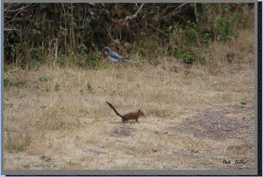
The wildlife was watching
us pack up that morning. In addition to the camera shy gopher there
was a Sonoma Chipmunk and Western Scrub-Jay.
We finished packing up and
checking the site to be sure we left it better than we found it (which
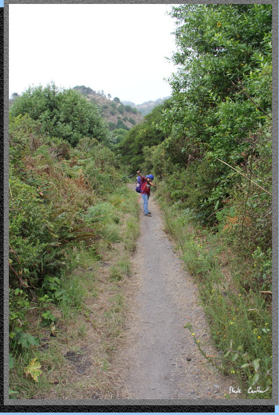
was tough because that site was very clean). We decided to use the shorter,
uphill, Laguna Trail on the way out. You go over the creek and then
take a right at the junction to start going up the hill. Elevation gains
are still slight, but much more than the Coast Trail. Here is the trail
after the junction. This section is much narrower, and actually a trail.
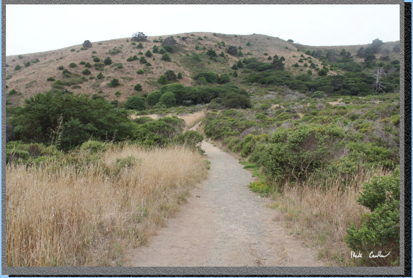
You head up to the junction with Fire Lane Trail to Sky Camp. Stay left
here and continue on the Laguna Trail.
Here is Sarah leading the
way back to the car. The fog was still hanging on, which made the hike
out, even with the uphill sections, very pleasant.
There was only one steep section that showed some damage from the previous
wet winter. I suspect that this section will have to go through so trail
rebuilding in the near future. Before we knew it we were at the Laguna
Trail. It was Friday so more people were headed in, instead of out.
Here is Sarah as we walk past the ranger housing and into the Laguna
Trailhead parking lot.
We followed the road back to the car at the Coast Trailhead. We ran
into another large group of quail... or were they the same quail from
the day before?
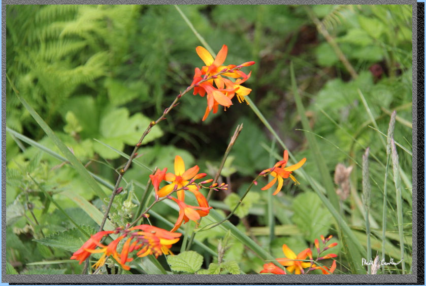
Great trip and highly recommended for anyone. I will leave you with
another flower picture from the way out.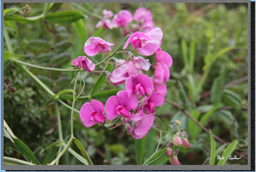
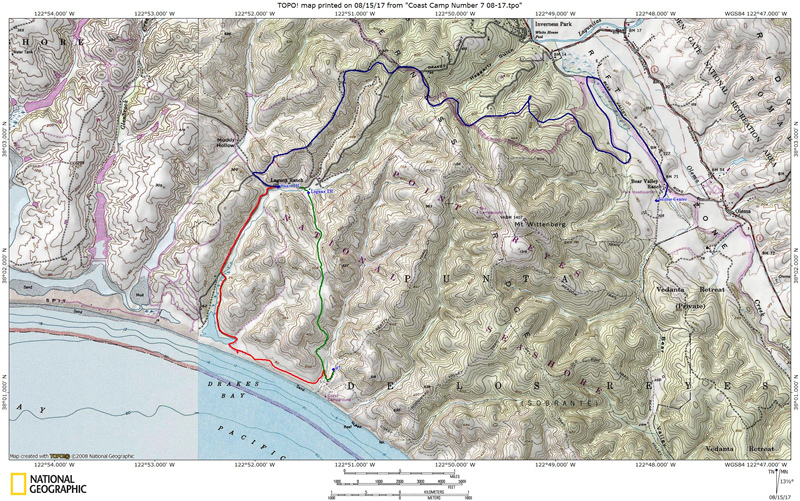
Scroll down for map and elevation profile.
Blue line shows the
road in from Visitor Center to Coast trailhead.
Red line is hike in via the Coast Trail and the green line is the hike
out the next day via Laguna Trail.
Elevation profiles below map.
Click on map or profile for larger version.
.
(back to top)
Elevation
profile below shows Coast Trailhead to Coast Camp #7 via Coast Trail.
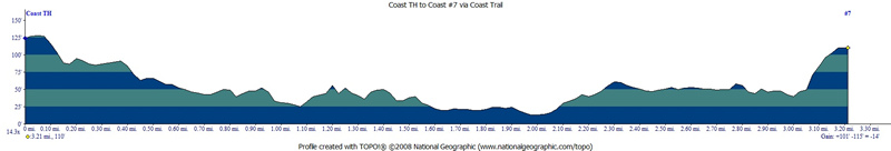
(back
to top)
Elevation
profile below shows Coast Camp #7 to Laguna (and then Coast) Trailhead
via Laguna Trail.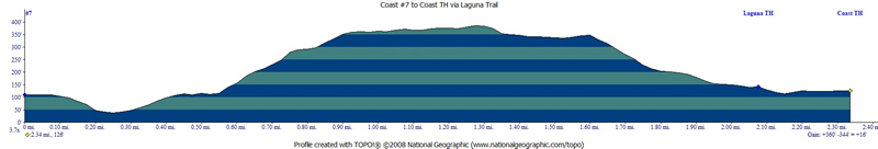
(Back
to top)
(take me back to trip description Day 1