![]()
The BIG map and profile page
(take me back to backpacking trip description)
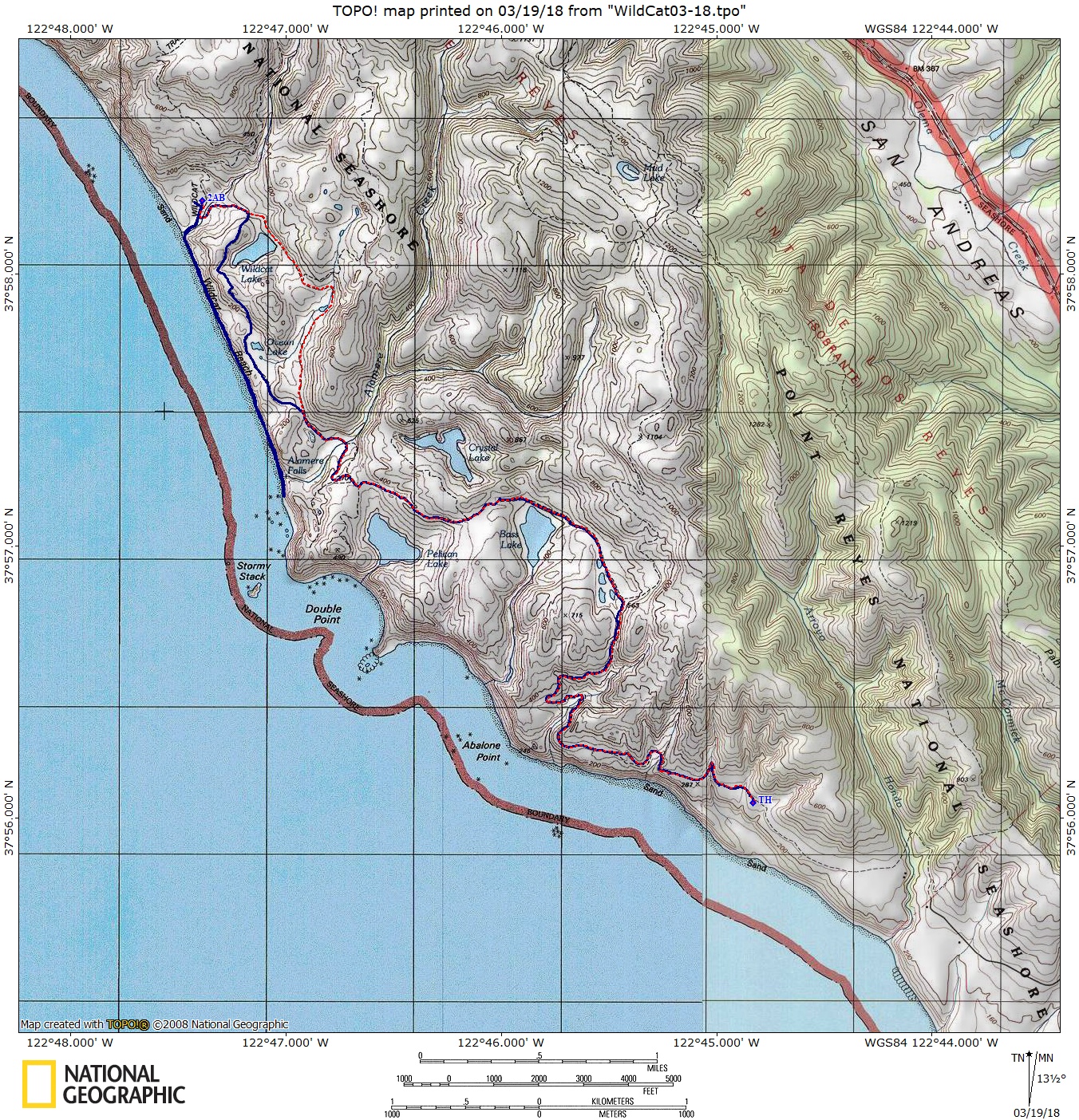
Blue line shows the path
we hiked from parked car at Palomarin Trailhead (TH on map) to Wildcat
Camp #2AB and then to Alamere Falls along the beach. Red dashed line
shows the path back to car on day two. Elevation profile below map.
. 
(back to top)
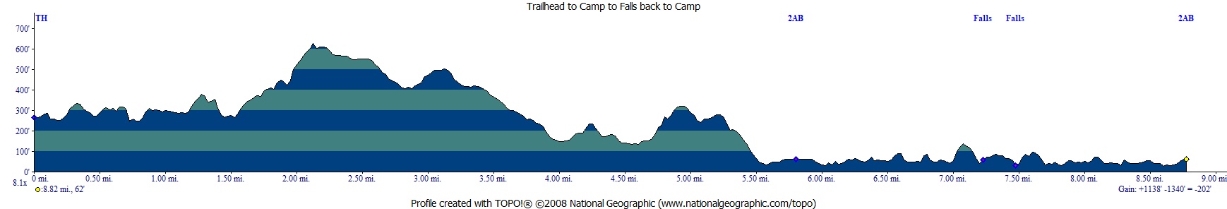
Elevation profile below shows trip from Palomarin Trailhead to Wildcat Camp #2AB, then to Falls, then back to camp (basically day one). The up and down at the falls was me hiking slightly past the falls to peak around the corner (climbed some rocks)
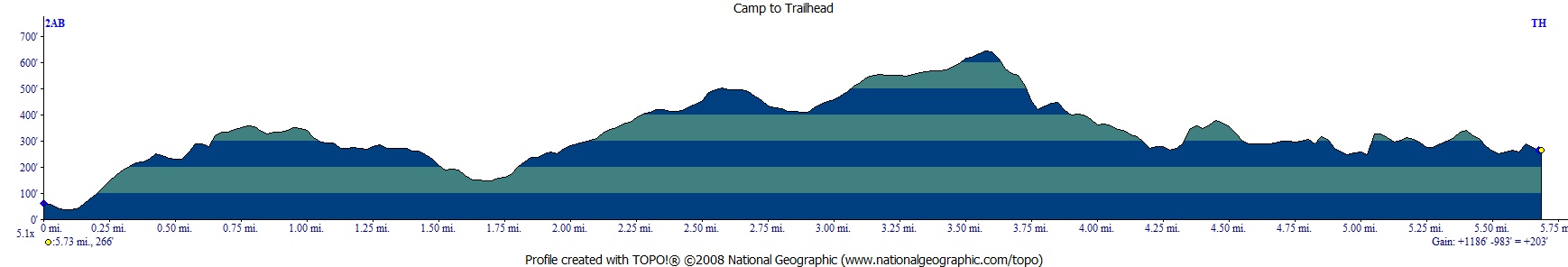
Elevation profile below shows from Wildcat Camp to trailhead (day two).