


![]()
 Permit
- Permits can be obtained through www.reserveamerica.com.
Permits must be picked up from the Bear
Valley Visitor Center (located at 1 Bear Valley Road Point Reyes
Station, CA 94956, 415-464-5100). If you are arriving outside of the
visitor center's hours they will post permit outside for you. Sites
run $20 per site per night (up to 6 per site). There are also a few
group sites with prices starting at $40 per night (7-14 per site).
Permit
- Permits can be obtained through www.reserveamerica.com.
Permits must be picked up from the Bear
Valley Visitor Center (located at 1 Bear Valley Road Point Reyes
Station, CA 94956, 415-464-5100). If you are arriving outside of the
visitor center's hours they will post permit outside for you. Sites
run $20 per site per night (up to 6 per site). There are also a few
group sites with prices starting at $40 per night (7-14 per site).
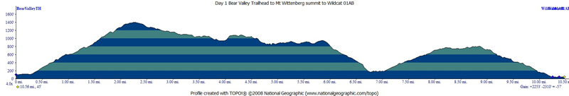
Mileage - Wildcat Camp is approximately 5.8 miles each way from the Palomarin Trailhead, or 6.5 via the Bear Valley Trail (see map and profile below). Alamere Falls is another mile from camp, each way. You must know when high tide is before setting off on this hike, or you could get trapped against cliffs by waves (not good)
Camps/Water - Wildcat Camp has 7 sites (three of them are group sites). Sites 6 & 7 are closest to ocean. Nice pit toilets are near site 2 (yes, some can be nice). Each site has a metal locker, picnic bench and barbecue (group sites have 2 of each). A potable water faucet is provided near site 2. There are also trash/recycle receptacles.
Hazards - High tide, Poison Oak, MICE, and ravenous raccoons (use the locker and a bear canister in the locker). The raccoons actually haven't bothered me out here a few trips in a row now, but the mice will get in the lockers and eat stuff. Rangers currently recommend bear canisters.
Tyler and I
decided to go on this trip to Wildcat Camp, by using the Bear Valley
Trail to Mount Wittenberg first, and then an attempted day hike to Alamere
Falls (pictured above). Be aware that this option adds significant mileage/elevation
gain/loss. I have done this trip a few times now (2018,
2015 and 2003),
but always from the Palomarin trailhead. Use the links to view the old
trip descriptions. Originally this was going to be a Troop 998 Scout
trip, with the weather and the germs going around only Tyler and I were
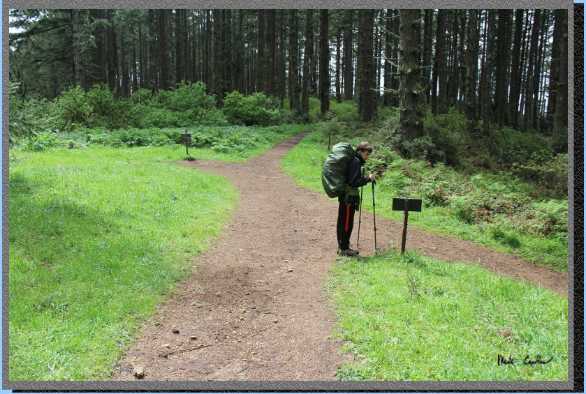
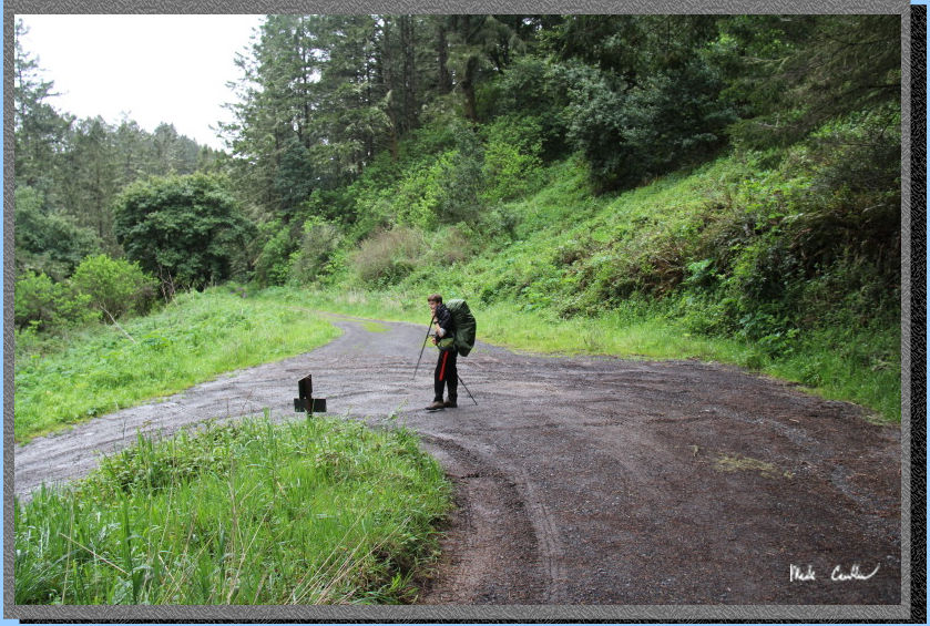
able to make it. Here is the view from the parked car at the Bear Valley
Trailhead. There is water in the Visitor Center and bathrooms at both
the Visitor Center and the trailhead. The trail is on the left (it is
a wide gravel road nature to start).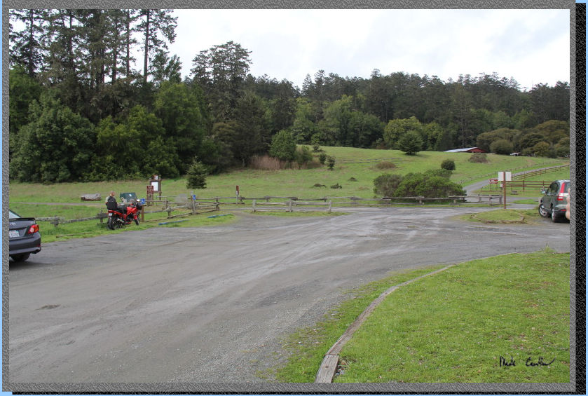
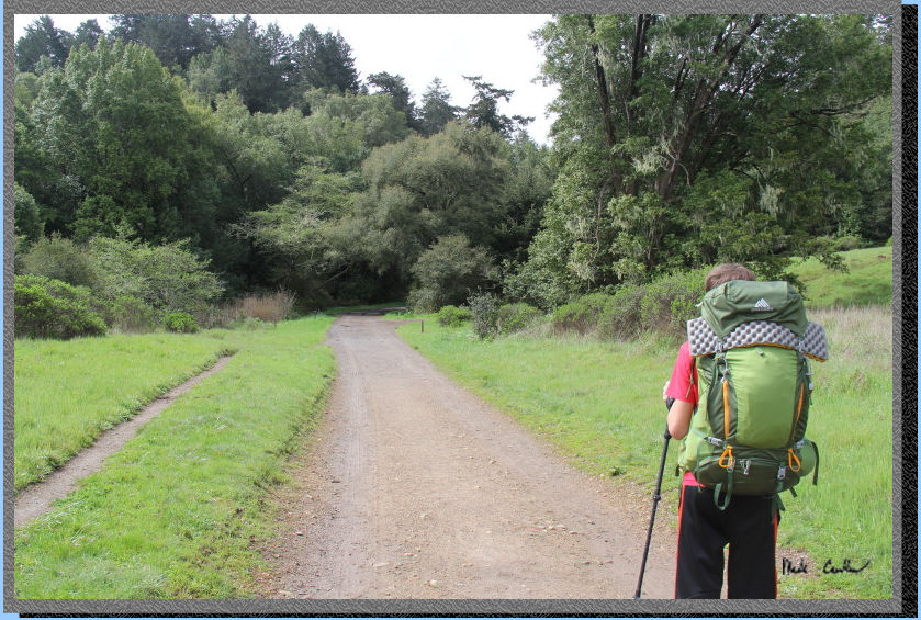
The forecast
was for a chance of rain by afternoon, with some heavier stuff forecast
overnight and into the next day. We started hiking about 11 am and wanted
to make it up to Mount Wittenberg (1,407') by lunch. The trail starts
off level, wide and open. Before you know it you will be at the first
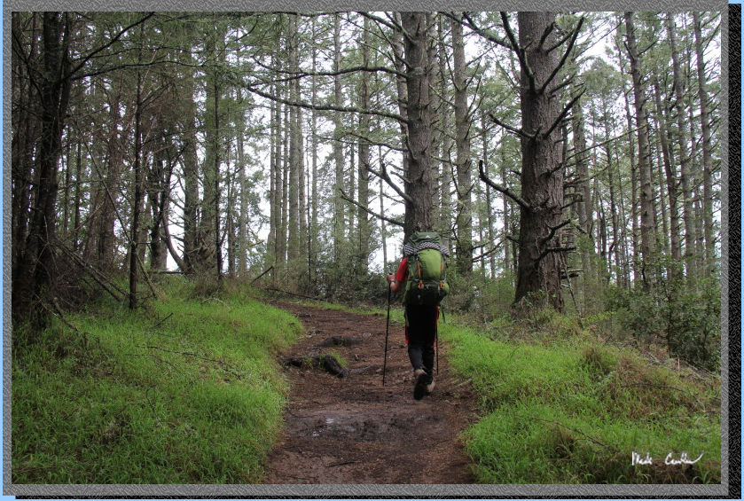
junction, Mount Wittenberg Trail. We took a right onto this trail and
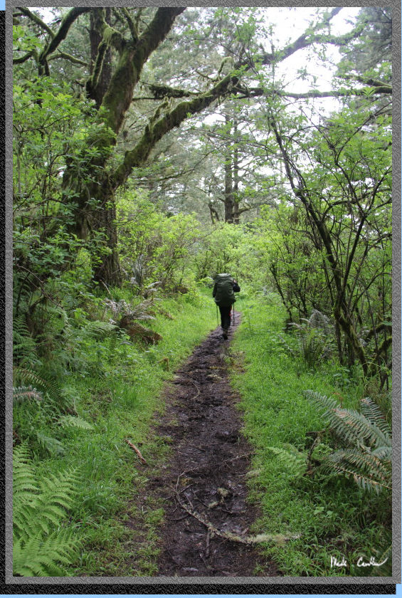
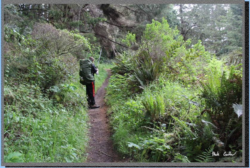
started the ascent. Here is Tyler headed to the trail junction just
ahead.
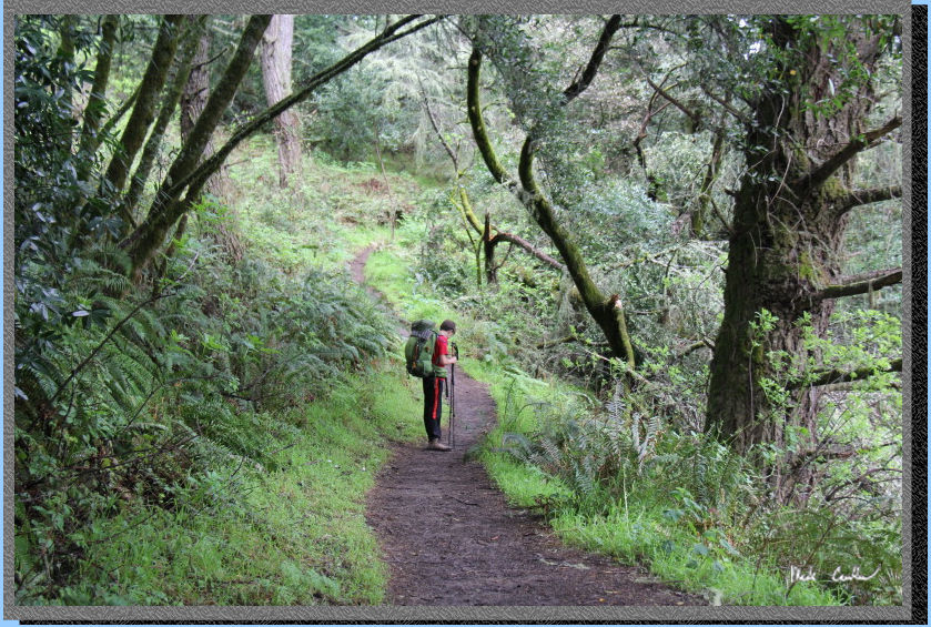
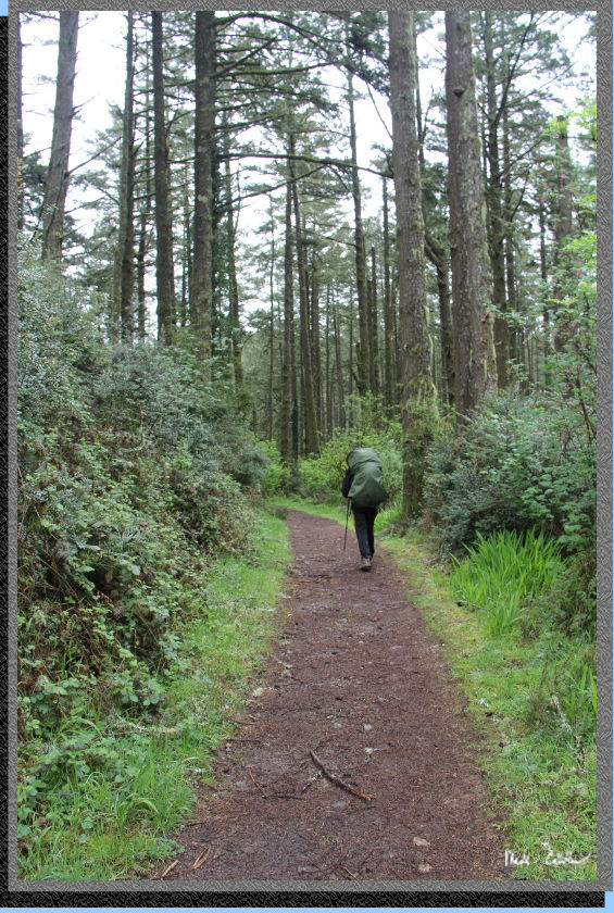
After the junction the ascent
starts. There are some steep section but the trail is mostly covered
and more like a trail now. Poison Oak is abundant in this area, so stay
on the trail and watch for any encroaching on the trail. This time of
year can be tough with the mixture of Poison Oak with and without leaves
(it doesn't have to have leaves to "get" you).
Another shot as we headed
up to the next junction. You can see on the profile at the bottom of
this page that you ascend roughly 1,300 feet in a couple miles. With
the cool temperatures and overcast skies we made good time.
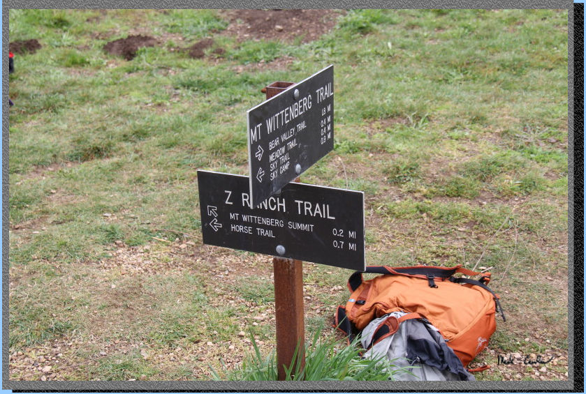
Here is the junction, well
the signs at the junction. It opens up here and there was an outdoor
education camp that was along this section of trail. I tried to keep
them out of the shot (that is one of their backpacks). Take a quick
right and head up to the summit. Stay on the main trail to a small clearing
with the official summit marker on the ground on the left. There is
no view from the summit, so be sure to take in the views from the junction
(you have to head back down to that junction anyway).
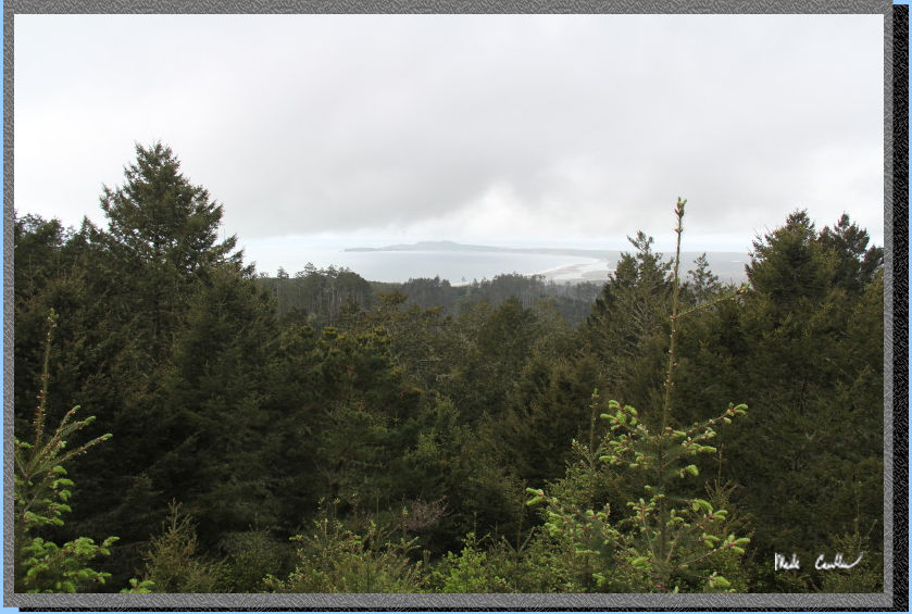
Here is the view of Drakes Bay and Point Reyes in the distance. We decided
to stop here for a quick lunch before hitting the trail in the correct
direction now to Coast Camp (Mount Wittenberg is not exactly on the
way).
After lunch we continued
on the Mount Wittenberg Trail toward Sky Trail (I think it turns into
the Sky trail at the junction with Sky Camp).
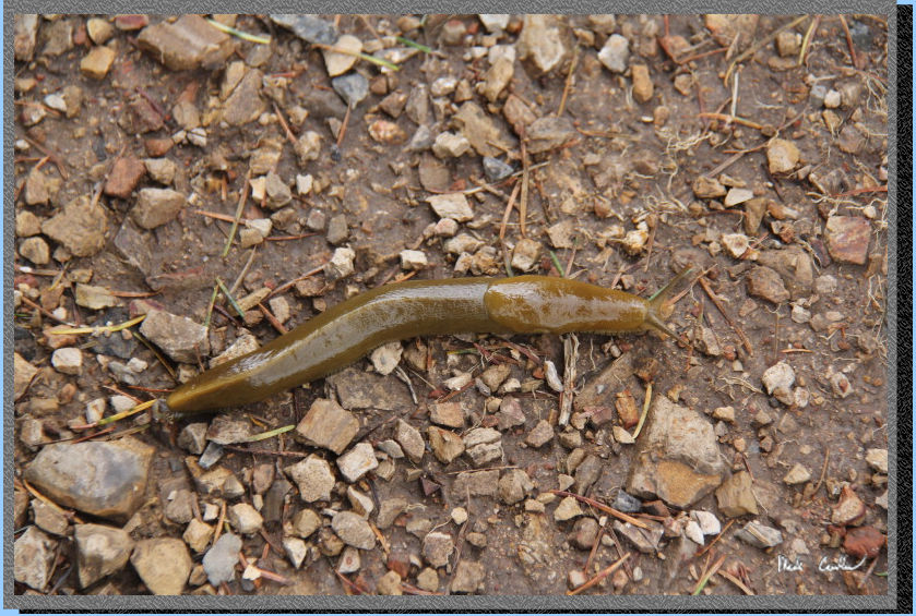
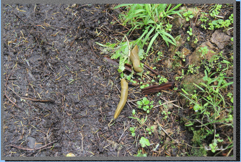
We started to see some of the Banana Slugs enjoying the moist trail
conditions. Tyler and I decided that we would keep track of how many
we saw on the way in to Coast Camp - it was quite a few.
Here is your next junction.
Stay straight onto Sky Trail . The trail on the right takes you to Sky
Camp and the one on the left is Meadow Trail. The rain had started,
hence Tyler with the pack cover on his backpack now.
It was nice to be headed
downhill now (well is was mostly downhill/level). Trail is still mostly
covered. At the next junction (Woodward Valley Trail) stay straight.
Woodward Trail will be on the right. Picture below is before the junction
in one of the more level and open sections.
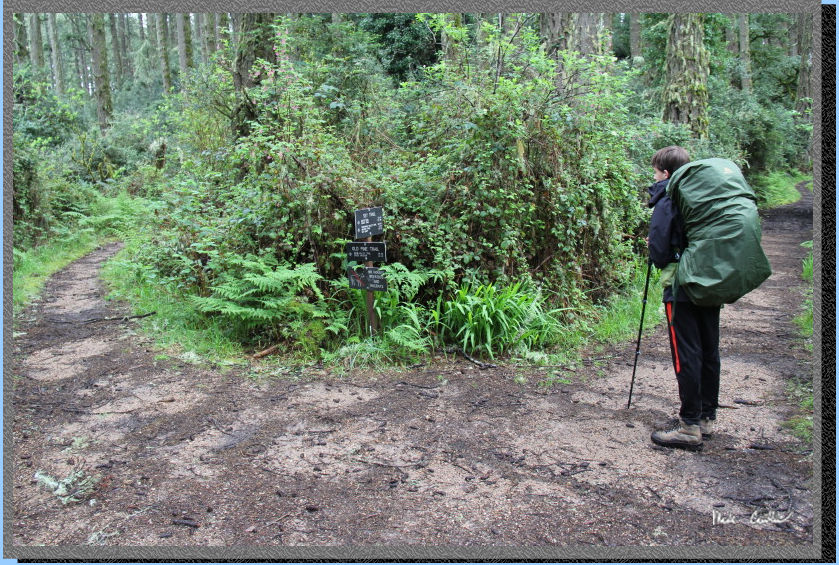
Trail remains mainly downhill
with it mostly covered to the next junction, Old Pine Trail. There were
some seriously muddy sections through this patch, so if you hike it
in the wet season be ready for mud/puddles. I do wish that I brought
my gaiters on this trip. Even being careful to go slow and deliberate
in the muddy sections my pants got pretty dirty. Stay right at this
junction to stay on the Sky Trail. See Tyler in picture below at the
junction.
The trail remains mostly
downhill the next 1.3 miles to the junction with Baldy Trail. It narrows
to a single track and is very muddy again in spots. Our Banana Slug
count was nine by the time we reached the junction. Trail remains mostly
covered and damp on this drizzly day. Here is a picture of one potential
good view along the way, hard to tell with the weather.
Here is a shot showing the
typical trail conditions through this stretch. Staying in the middle
of the trail was the best option. It is almost always better to try
to stay in the middle of the trail in these types of muddy, spring growth
conditions. It give you the best chance to stay safe from Poison Oak,
and also cuts down on trail erosion. Walking around the puddles/mud
only makes the trail infringe on the adjacent plants. A good pair of
waterproof boots makes you able to walk right through most mud/puddles
like it is no big thing.
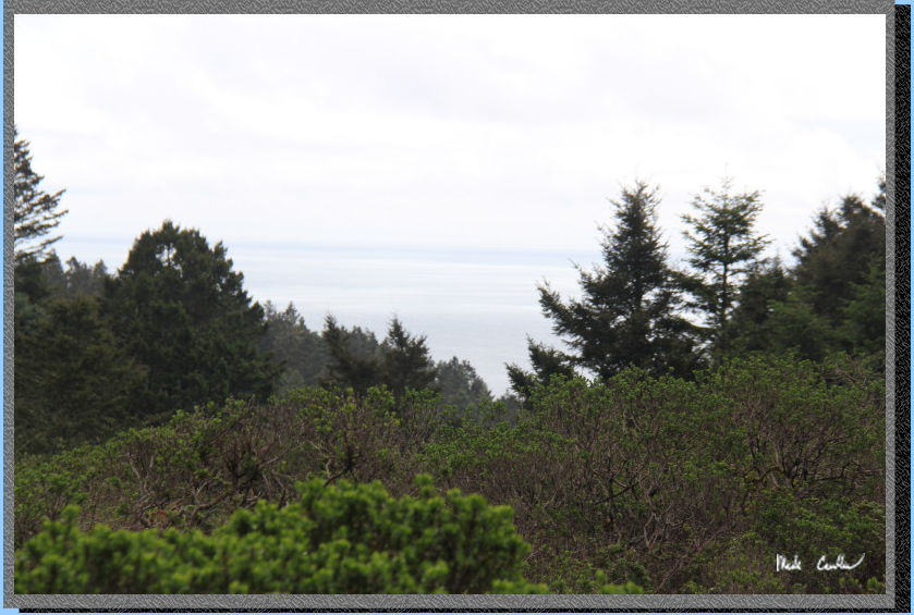
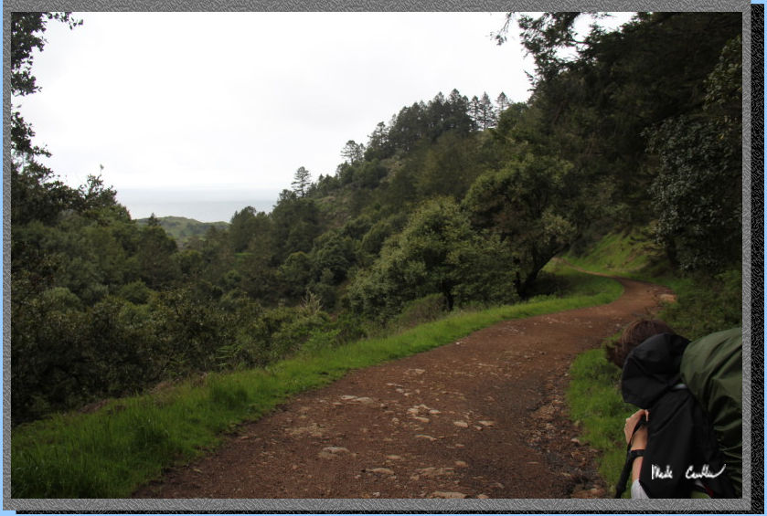
The trail opens up before
the junction to give you views of the ocean (on a clear day). You can
make out some of the view in the picture below. At the junction with
Baldy Trail take a left off of Sky Trail and onto Baldy Trail now toward
Bear Valley Trail.
The next section is all
downhill, some a little steeper than previous sections. The Banana Slugs
were plentiful in this section, we were up to 22 by the next junction.
Here is a shot of two together on the trail's edge. You will here the
creek as you approach the junction with Coast Trail/Bear Valley Trail.
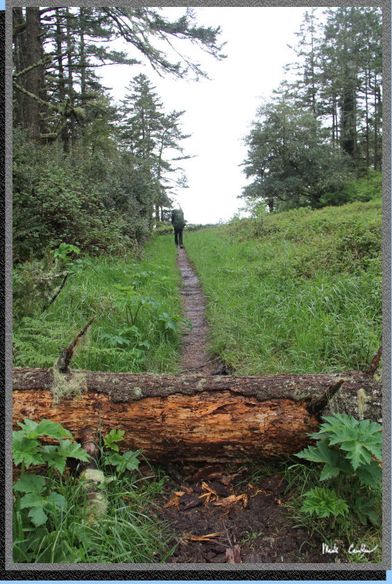
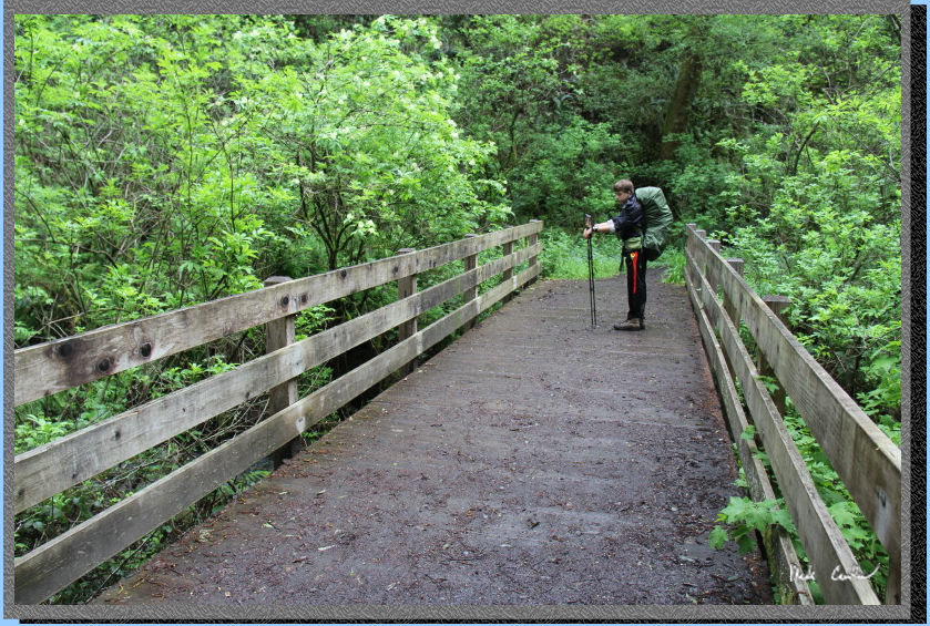
At the junction you will
see the Bear Valley Trail is more of a road, but has a nice bench should
you want to stop and catch your breath, or change your socks like I
did. I have been following the advice of Tyler's Scoutmaster and changing
my socks more on the hike in (swapping between two pairs). It does seem
like I can go more miles before I feel any foot discomfort. At the junction
pass the log and go over the bridge to Glen Trail. Here is Tyler on
the bridge with a Coast Creek flowing well.
The sign said 3.1 miles left to Coast camp from here, which seems about
right based on the GPS. The trail is mainly uphill now, which seemed
better on my joints, at first. Bear Valley Trail follows the the creek,
so it is a rather low spot on the trail. If you look at the profile
it stands out. Here is Tyler knocking down some cobwebs. Although it
was spring break, there were not many other hikers out here.
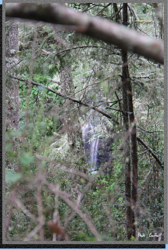
Stay right at the next junction,
Glen Loop to Glen Camp. Trail continues uphill and mainly covered. You
can hear a waterfall in the distance. I tried my best to take a picture
of it though the trees.
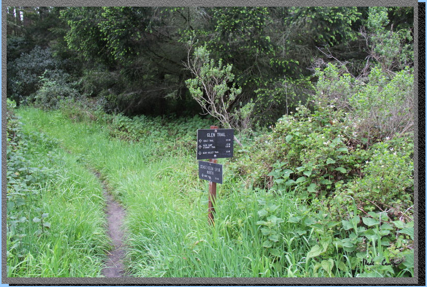
We decided to stay on the
Glen Trail to Stewart Trail. This section can be a little confusing
if you aren't paying attention, as there are a few options to get where
you are going. Here is the junction with the connecting (spur) trail
to Coast Trail. We stayed left on Glen Trail. We had counted an unbelievable
29 Banana Slugs at this point.
Here is Tyler at the next
junction where Glen Trail turns into a road (we saw two rangers out
here driving in their trucks). You take a right onto this road and end
up at the next junction to the other Coast spur trail before you know
it. Stay on the road (Glen Trail) at next spur junction and head down
to the junction with Stewart Trail. 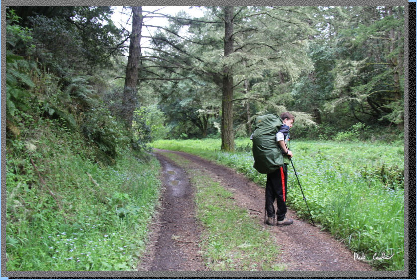
Here is the junction with Stewart Trail. You can see from the tire tracks
the rangers were out and driving about. Be sure to keep an ear out for
them, and try not to step into Poison Oak when they need to pass. Stay
straight onto Stewart Trail (1.2 miles left per sign). .
Continue downhill on exposed
road. See shot below of road/views. Getting closer now. We counted 34
Banana Slugs in total on way to camp.
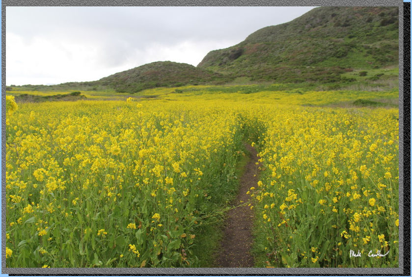
So there is bit of wild mustard
plant growing around Wildcat Camp You can make out the narrow trails
through the mustard by the breaks of green. You can also see the beauty
of this campsite with the proximity to the beach/ocean.
So it was a little challenging
to find our camp, as you have to hike to the bear lockers before there
are any site numbers. It was pretty cool out here with the height of
the mustard plants.
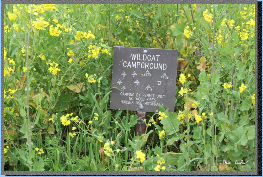
Here is the map
of the camp... It leaves a little bit to be desired, since it shows
no trails. When the plants are low it is no big deal, but on a day with
everything tall and blooming it can be an adventure finding your site.
There are two pit toilets, water and trash nearest site 2AB. Both 1AB
and 3AB are about the same distance from the bathroom (water glass icon
on map).
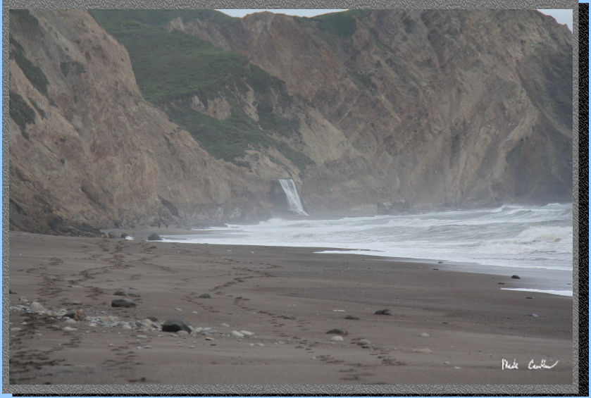
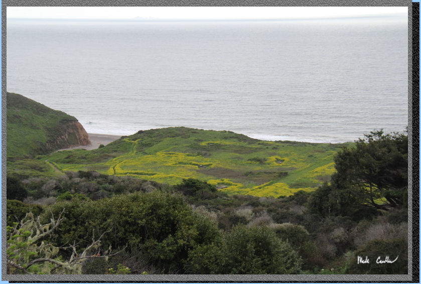
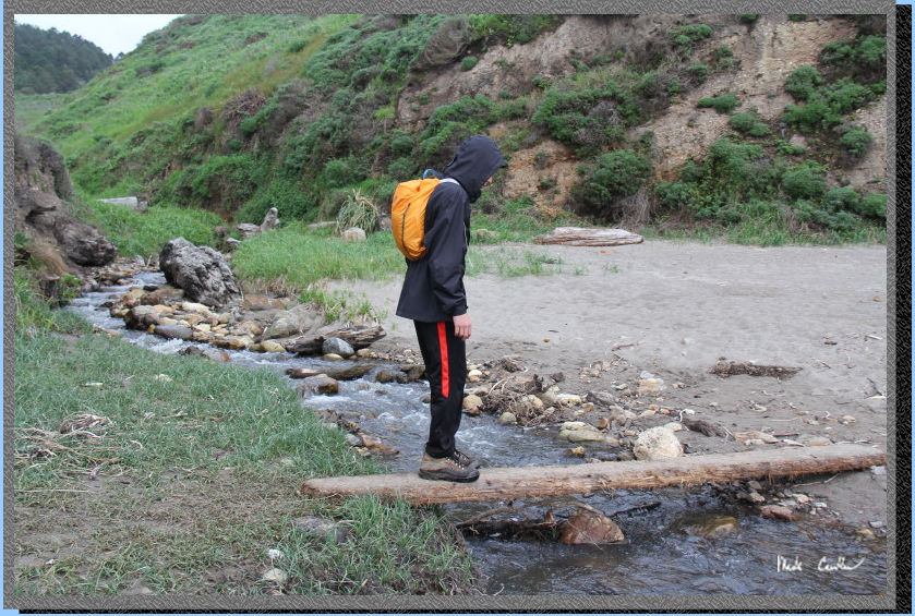
We decided to try to make
it to Alamere Falls as it was just after low tide. Unfortunately we
almost made it the mile to the falls before having to turn around because
of the high storm surf breaking at a pinch point with rocks. We decided
to not tempt the ocean that day and turned back. Here is Tyler crossing
the creek at the beach access at Wildcat Camp at the start of our beach
hike.
We got to a point where the
waves were breaking on some rocks in the distance in this picture (right
up against the cliff). In previous trips I was able to make it to the
falls with relative ease at low tide. I think the beach was narrowed
but the storm coming in that night, and also the fact that the cliffs
had eroded and reduced the available beach. The beach is always changing
with the constant erosion.
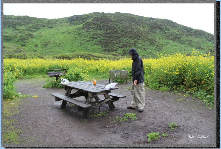
We collected some dry wood on the way back from our Alamere Falls attempt and then went back to camp for dinner. After dinner we decided to try our luck at having a beach fire. We had obtained the optional beach fire permit in case we found something dry to burn. We were able to get a nice little fire burning down on the beach. Be sure you follow the rules on fires out here. This time of year everything is pretty moist but in late summer the conditions are much different.
That night the wind and rain
tested my new REI Quarterdome SL2. I had staked it out tight with the
windy forecast. It held up well and kept us dry. I am not sure I would
have wanted it to get to much windier as the rainfly was flexing quite
a bit. In hindsight I should have guyed out the optional guyout points
higher up the fly. Here is Tyler the next morning as we started packing
up for the wet hike out. This being a large group site there are two
tables, BBQs and bear lockers. We lost some food to the mice, that were
still hanging out in the locker in the morning, right Tyler. The rangers
recommendation of using a bear canister is a must next time.
It was a great trip even
with the inclement weather. We headed back that morning using the more
direct route of Stewart Trail to Glen Trail to Bear Valley Trail. The
first section is uphill on the exposed road, Stay left for Glen Trail
(uphill). The Trail goes up a bit more before heading downhill to first
Coast Spur junction. There must have been over a hundred worms on the
trail in the first few sections. We did our best to not step on any,
but did not try to count them, Stay right and then look for Glen Trail
on left as it crosses over creek (creek goes under trail in culvert).
Glen trail has a short uphill then gentle downhill to next Coast Spur
Trail. Stay right and continue downhill. Continue down single track
trail and stay straight at Glen Loop junction. Downhill to Bear Valley
Trail. Right at Bear Valley trail with gentle uphill grade and partially
covered following Coast Creek. It is uphill to Divide Meadow where there
is a bathroom and trash cans. After the meadow and junction with Old
Pine Trail the trail is mostly downhill. Trail stays mostly, to partially,
covered as it follows the creek to the junction with Meadow Trail (stay
on road) and then Wittenberg Trail. Having already summited this mountain
yesterday we stayed on Bear Valley Trail to the trailhead. I am so glad
that Tyler talked me into this Mount Wittenberg option, While the view
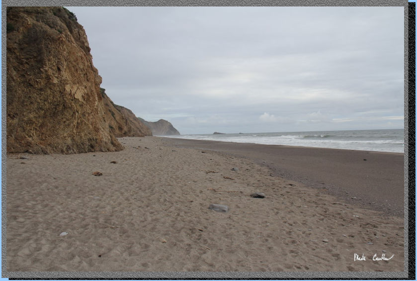
from Wittenberg was not great the amount of trail we covered made this
a rewarding trip. I will leave you with an apology for no pictures on
the way out (rain kept my camera in my pack), but I did take this great
beach shot the day before.
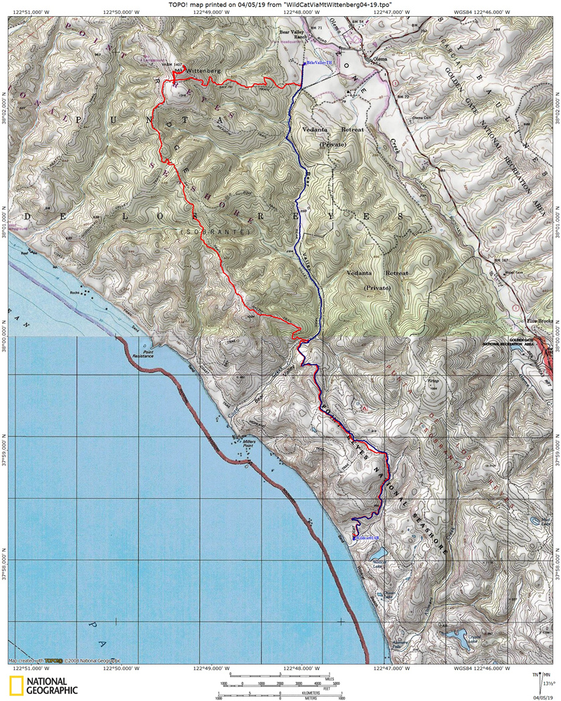
Red line shows the path we
hiked from parked car at Bear Valley Visitor Center Trailhead to Wildcat
Camp #1AB (via Mount Wittenberg). Blue line shows the path back to car
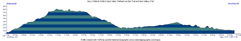
on day two. Elevation profiles below map (day one then day two).
Click either for a larger version.
(back to top)
DAY 1
(back
to top)
Day 2
(back
to top)