![]()
The BIG map and profile page
(take me back to backpacking trip description)
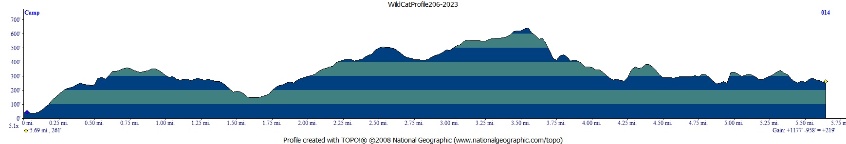
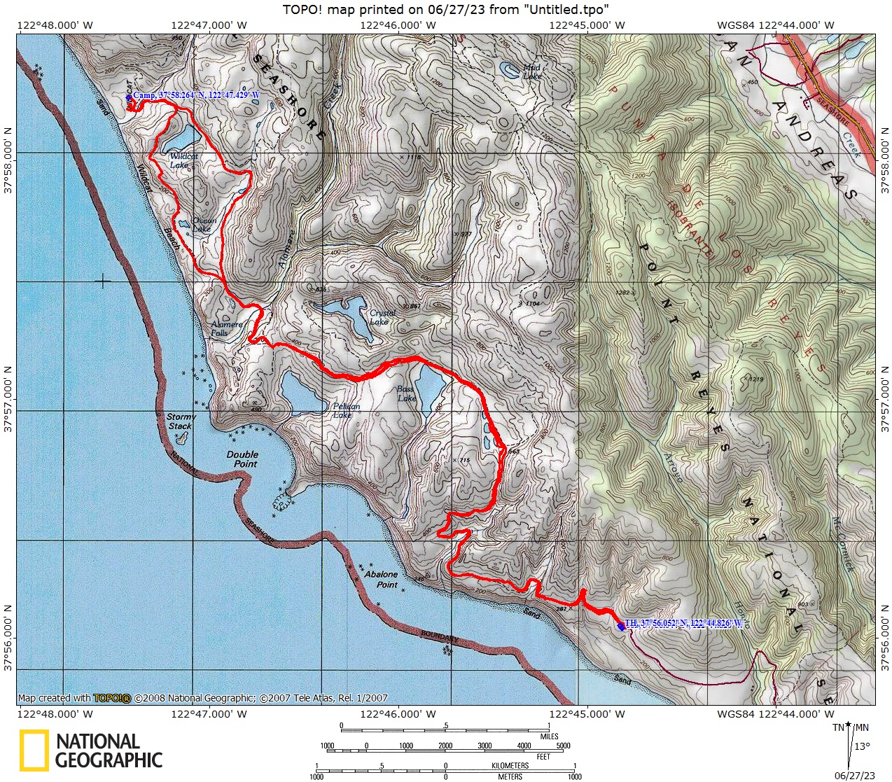
Red line shows the path we
hiked from parked car at Palomarin Trailhead to Wildcat Camp (and back the next day).
I didn't run my GPS on this trip (lazy) so am using a previous trip's map/profiles. On this trip we used the coast side (Ocean Loop) on day 1 and the inland way (Coast Trail) on the way out. The profiles below show the reverse. The trail along the coast is more fun, a little steeper, but has great views if the weather isn't too gray.
. 
(back to top)
Day 1
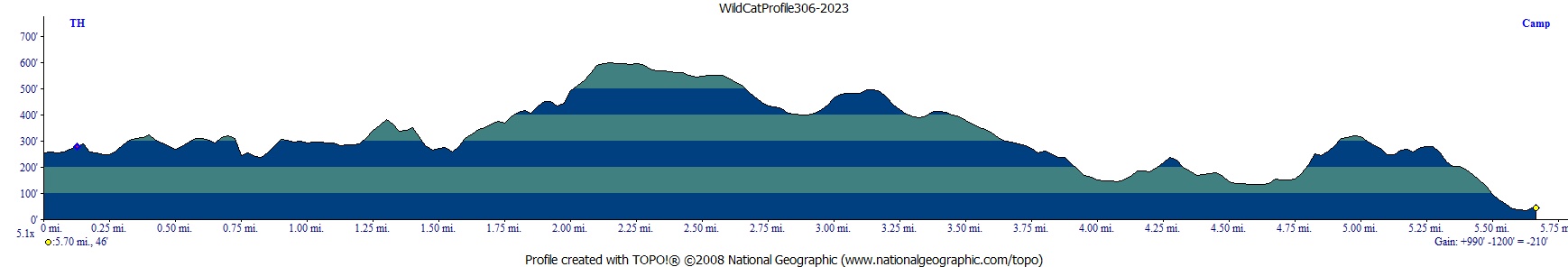
Day 2