![]()
I
really enjoyed the backpacking trip to Long Lake
so I decided that I should venture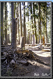 out to one of the other lakes in the area. With trails like the one
on the right it isn't hard to see why I went back. I did this trip in
late August and it was another spur of the moment, one night, lone trip.
For directions to trailhead and trail description see the Long
Lake page.
out to one of the other lakes in the area. With trails like the one
on the right it isn't hard to see why I went back. I did this trip in
late August and it was another spur of the moment, one night, lone trip.
For directions to trailhead and trail description see the Long
Lake page.
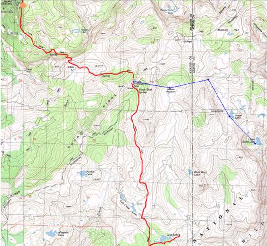
On
the map I hiked the same route that I did for Long
lake (red line) until I reached Squaw Ridge and then I took a left (blue
line). The trail was just as I had left it about 3 weeks earlier. One
thing that I noticed on the way in was that there is a spur trail for
a hundred yards to a great spot with a glorious view. It breaks left
right before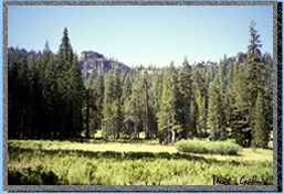 the trail to Granite and Hidden Lake (if you are heading toward Squaw
Ridge). Beebe Lake is 3 1/2 miles form the Ridge according to a sign
there. I think it is pretty accurate though.
the trail to Granite and Hidden Lake (if you are heading toward Squaw
Ridge). Beebe Lake is 3 1/2 miles form the Ridge according to a sign
there. I think it is pretty accurate though.
After
traveling along the ridge you break right down to the Wilderness boundary.
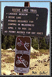 It
isn't too far to Ladeaux Meadow (1/2 mile according to the sign).
It
isn't too far to Ladeaux Meadow (1/2 mile according to the sign). 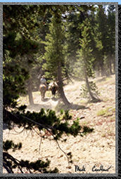 There
were some serious cowboys when I was traveling through this section
that made it quite dusty (see picture on left). These cowboys were putting
up a new fence around Ladeaux meadow. Amazingly they put up almost the
entire fence in one day! If you travel through here you will see what
a feat that was. Of course I was disappointed they didn't make a gate
of some kind where the trail crosses the fence... but the new fence
was low enough to make it easy to cross over it.
There
were some serious cowboys when I was traveling through this section
that made it quite dusty (see picture on left). These cowboys were putting
up a new fence around Ladeaux meadow. Amazingly they put up almost the
entire fence in one day! If you travel through here you will see what
a feat that was. Of course I was disappointed they didn't make a gate
of some kind where the trail crosses the fence... but the new fence
was low enough to make it easy to cross over it.
Unfortunately
the cattle have not treaded softly on the section between Ladeaux Meadow
and Beebe Lake. I am hoping that this new fence was designed to keep
them out rather than in Ladeaux Meadow. 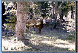 There
are numerous cow trails that go alongside, across, and crisscross the
main trail. In some sections I really couldn't tell where the main trail
was. Luckily the cows all head away form Ladeaux Meadow and over the
ridge toward Beebe Lake. This cow shot was actually taken much earlier
on the trail. Before Squaw Ridge.
There
is a nice open section with some rust colored 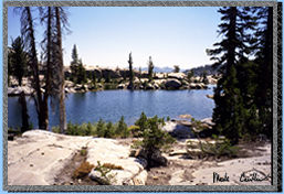 rock.
Follow the ducks and there should be no problems finding your way to
the lake. The picture on the right was taken basically from camp facing
East toward the lake.
rock.
Follow the ducks and there should be no problems finding your way to
the lake. The picture on the right was taken basically from camp facing
East toward the lake.
Make
sure you travel to East side of the lake for 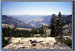 some
great views of the canyons below. Do Not make the mistake that I did
by traveling all the way down to Lower Beebe Lake with your pack. There
is No Lower Lake Beebe! There was at one time, but it is no longer.
It has almost completely filled in and even in Spring run off I would
think that it would be a good place to get water and bitten by mosquitoes.
There is no trail down to Lower Lake Beebe
some
great views of the canyons below. Do Not make the mistake that I did
by traveling all the way down to Lower Beebe Lake with your pack. There
is No Lower Lake Beebe! There was at one time, but it is no longer.
It has almost completely filled in and even in Spring run off I would
think that it would be a good place to get water and bitten by mosquitoes.
There is no trail down to Lower Lake Beebe 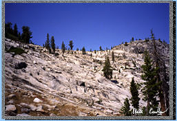 and
almost all of it involves steep sections on granite and coming to places
that are impassable (especially with a pack). The picture on the right
was taken about two thirds of the way to Lower Lake Beebe. Yes, I lost
a heck of a lot of elevation (where the dip is in the rocks above is
where Beebe Lake is).
and
almost all of it involves steep sections on granite and coming to places
that are impassable (especially with a pack). The picture on the right
was taken about two thirds of the way to Lower Lake Beebe. Yes, I lost
a heck of a lot of elevation (where the dip is in the rocks above is
where Beebe Lake is).
I ended
up camping on the west side of the lake. 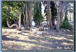 There
are numerous nails in the trees around the lake and also a new looking
rope for attaching a horse I assume. The lake provides OK swimming.
It is pretty algae covered on the rocks but it was refreshing to jump
in and swim for a while. I did have this lake to myself. In fact the
only people I saw are this trip were the cowboys and 2 day hikers (or
maybe they were ultra-ultra-light backpackers. In summary it was a sweet
trip. I will probably come back. It would be nice to make it to Munson
Meadow or maybe even Mokelumne Peak. I camped at the following coordinates:
N 38 36' 18.9" W 120 03' 38.2". Here are some more pictures:
There
are numerous nails in the trees around the lake and also a new looking
rope for attaching a horse I assume. The lake provides OK swimming.
It is pretty algae covered on the rocks but it was refreshing to jump
in and swim for a while. I did have this lake to myself. In fact the
only people I saw are this trip were the cowboys and 2 day hikers (or
maybe they were ultra-ultra-light backpackers. In summary it was a sweet
trip. I will probably come back. It would be nice to make it to Munson
Meadow or maybe even Mokelumne Peak. I camped at the following coordinates:
N 38 36' 18.9" W 120 03' 38.2". Here are some more pictures:
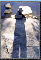
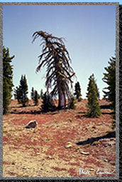
I had to get creative to take a picture of myself on the shore of Beebe Lake. Have you ever seen a sadder looking tree!