


![]()
I
decided to head up to a Crabtree Camp trailhead again to visit Grouse
Lake and Pine Valley. The ranger station is at Pinecrest and currently
there are no reservations or quotas currently in Emigrant Wilderness,
(209) 965-3434. You must stop by and get a permit to go backpacking
in the Wilderness. There is no fee for the permit. If you do not have
a good map of the area you can buy one at the ranger station for $11.00.
A little steep but it is a nice weatherproof map (kind of large for
trail use though). To get to the ranger station from the bay area take
highway 120 East until the junction of 120 and 108. Stay straight to
go onto 108. When you see a right hand turn for Pinecrest slow down
but do not turn right quite yet. The Ranger station is at the "Y"
where Pinecrest Lake Road are and highway 108. Turn right into the ranger
station just past the right for Pinecrest Lake. The trailhead is called
Crabtree Trailhead. The road is a little rough in spots but last time
I saw a Mazda Miata in the parking lot of the trailhead, but I would
bring something with some more ground clearance (I am sure they scraped
in a few spots). To get to the trailhead (from the ranger station) head
towards Dodge Ridge by driving toward Pinecrest and taking your first
right (there is a sign for Dodge Ridge Ski Area). Just before you get
to the parking lot of Dodge Ridge take a right onto a road labeled 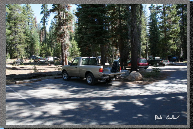 Crabtree/Gianelli
trailhead. This is the overflow parking area during the winter for Dodge
Ridge. Stay on this road until the first junction where you take a left.
Stay on this Road heading West until a junction for the pack station.
Take a left and go past the pack station over the big speed bumps and
then watch for a sign for Crabtree trailhead on the right. The trailhead
has ample parking. It is about 4.2 miles from trailhead to the spot
I camped in between the 2 lakes called Grouse Lake. The streams in Pine
Valley were all dried up this time of year so I would recommend going
earlier in the season or visiting Bear Lake for
better water. Here is a shot of my truck at the trailhead. See map
at end of trail description.
Crabtree/Gianelli
trailhead. This is the overflow parking area during the winter for Dodge
Ridge. Stay on this road until the first junction where you take a left.
Stay on this Road heading West until a junction for the pack station.
Take a left and go past the pack station over the big speed bumps and
then watch for a sign for Crabtree trailhead on the right. The trailhead
has ample parking. It is about 4.2 miles from trailhead to the spot
I camped in between the 2 lakes called Grouse Lake. The streams in Pine
Valley were all dried up this time of year so I would recommend going
earlier in the season or visiting Bear Lake for
better water. Here is a shot of my truck at the trailhead. See map
at end of trail description.
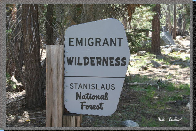
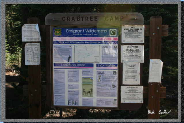 Here
is the trailhead sign. The trailhead is at the NW side of the parking
lot. There are a few signs about bears so I would make sure to be prepared
for bear bagging and with a plan should you encounter one on the trail.
Hunting season had just opened this weekend so I was glad I decided
to do A Sunday/Monday trip as most of the hunters I saw were on their
way out. I did see quite a few backpackers headed out as well. Most
of the backpackers were out for a few days.
Here
is the trailhead sign. The trailhead is at the NW side of the parking
lot. There are a few signs about bears so I would make sure to be prepared
for bear bagging and with a plan should you encounter one on the trail.
Hunting season had just opened this weekend so I was glad I decided
to do A Sunday/Monday trip as most of the hunters I saw were on their
way out. I did see quite a few backpackers headed out as well. Most
of the backpackers were out for a few days.
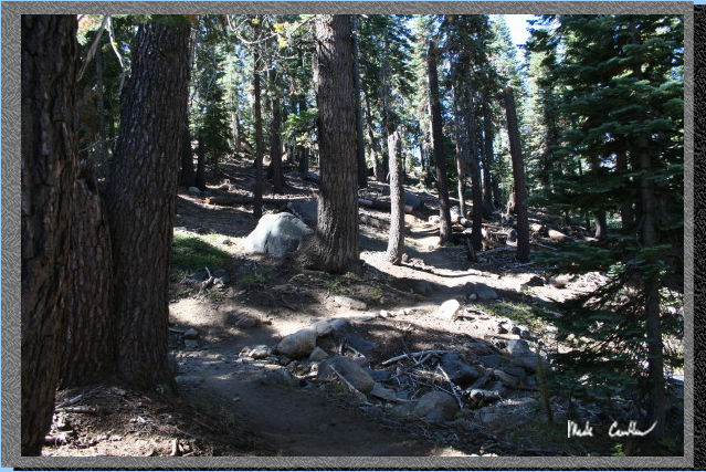
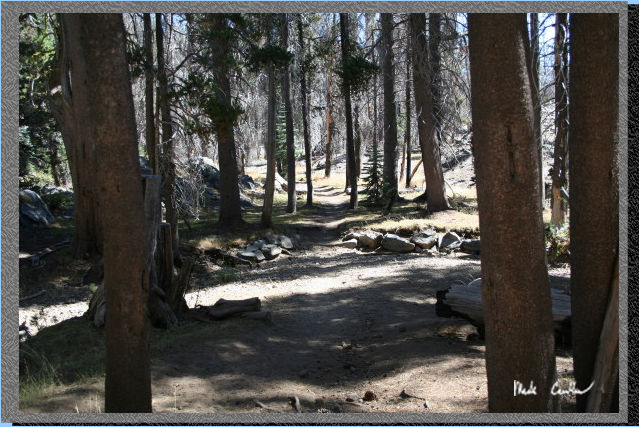
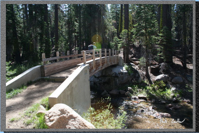 The
trail starts out going over a bridge over Bell Creek. The whole trail
seems well maintained and very well marked. I tried to take a picture
of trail junctions as I hiked along. This shot is actually of the time
Leo and I went to Bear Lake.
The
trail starts out going over a bridge over Bell Creek. The whole trail
seems well maintained and very well marked. I tried to take a picture
of trail junctions as I hiked along. This shot is actually of the time
Leo and I went to Bear Lake.
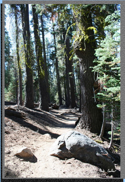 The
first trail junction is for Chewing Gum Lake. Stay straight for Grouse
and Camp/Bear Lake. You will head up a hill to an Emigrant Wilderness
sign. Not the actual boundary of the Wilderness though. I am not sure
why this sign is so far from the Wilderness boundary. Here is a shot
of the trail conditions to start with. Nice tree cover.
The
first trail junction is for Chewing Gum Lake. Stay straight for Grouse
and Camp/Bear Lake. You will head up a hill to an Emigrant Wilderness
sign. Not the actual boundary of the Wilderness though. I am not sure
why this sign is so far from the Wilderness boundary. Here is a shot
of the trail conditions to start with. Nice tree cover.
 Here
is the Emigrant Wilderness sign on the way in. This is your reminder
to have a permit for your overnight stay. Picture taken on trip to Bear
Lake in June.
Here
is the Emigrant Wilderness sign on the way in. This is your reminder
to have a permit for your overnight stay. Picture taken on trip to Bear
Lake in June.
 Here
is a great tree on the way in. There was a great breeze and it made
the sky a beautiful shade of blue (no signs of smoke). There are some
great ridges to explore in this area . The trail to Camp Lake goes right
along one. This trip will venture down into Pine Valley when you have
almost reached Camp Lake.
Here
is a great tree on the way in. There was a great breeze and it made
the sky a beautiful shade of blue (no signs of smoke). There are some
great ridges to explore in this area . The trail to Camp Lake goes right
along one. This trip will venture down into Pine Valley when you have
almost reached Camp Lake.
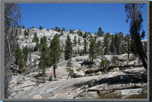
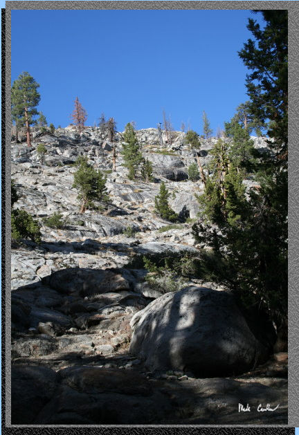
 There
are some great boulders in this area left behind by those glaciers so
long ago. Some boulders are the size of houses. The rock formations
are one of the many reasons why the Sierras are so heavily visited.
There
are some great boulders in this area left behind by those glaciers so
long ago. Some boulders are the size of houses. The rock formations
are one of the many reasons why the Sierras are so heavily visited.
 The
trail is a little dusty in spots because of the frequent equestrian
travelers in this section. I saw my share of them. It was windy enough
that if I kicked up any dust I was having to walk in my own dust. You
are not supposed to have to worry about dust when you are hiking by
yourself and no one else is around!
The
trail is a little dusty in spots because of the frequent equestrian
travelers in this section. I saw my share of them. It was windy enough
that if I kicked up any dust I was having to walk in my own dust. You
are not supposed to have to worry about dust when you are hiking by
yourself and no one else is around!
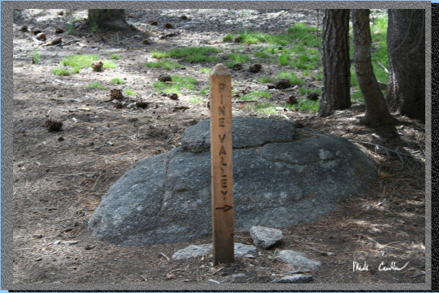 The
trail junction for Pine Valley is at about 1 mile in. So here is the
junction that you take a right at. Picture was taken on previous trip.
I ran across some mountain bikers that were having a good time out here.
It is mainly up to this junction with only one steep section. After
this junction you will be heading down into Pine Valley and then slight
up the whole way to Grouse Lake (the trail follows the stream from the
lake the whole way).
The
trail junction for Pine Valley is at about 1 mile in. So here is the
junction that you take a right at. Picture was taken on previous trip.
I ran across some mountain bikers that were having a good time out here.
It is mainly up to this junction with only one steep section. After
this junction you will be heading down into Pine Valley and then slight
up the whole way to Grouse Lake (the trail follows the stream from the
lake the whole way).
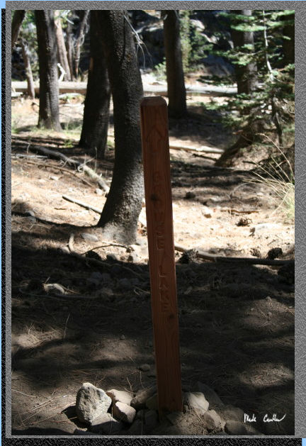 I
talked with some backpackers camping near Mud Lake and they said good
water was scarce in Pine Valley. I had talked to the ranger and he said
the stream would be all but dried up and these backpackers confirmed
that. I was hoping that Grouse Lake still had some good water to filter.
Stay left at the next junction. If you went right you would head to
Bell Meadow. Here is the junction sign.
I
talked with some backpackers camping near Mud Lake and they said good
water was scarce in Pine Valley. I had talked to the ranger and he said
the stream would be all but dried up and these backpackers confirmed
that. I was hoping that Grouse Lake still had some good water to filter.
Stay left at the next junction. If you went right you would head to
Bell Meadow. Here is the junction sign.
 Here
is the stream from Camp Lake. It was completely dry through this section.
It looks like it could be flowing pretty good in Spring.
Here
is the stream from Camp Lake. It was completely dry through this section.
It looks like it could be flowing pretty good in Spring.
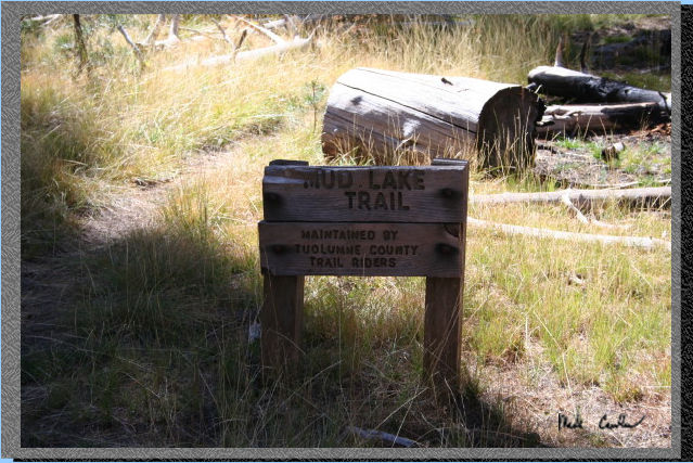 Stay
straight/left for Grouse Lake at this junction. Head right to Mud Lake.
You can see that all the wild flowers have been gone for a while and
even the grasses are starting to turn this late in the season. As it
turned out it was snowing out here the next weekend. At least according
to the weather people.
Stay
straight/left for Grouse Lake at this junction. Head right to Mud Lake.
You can see that all the wild flowers have been gone for a while and
even the grasses are starting to turn this late in the season. As it
turned out it was snowing out here the next weekend. At least according
to the weather people.
 If
you hiked up this ridge on your left you could head to Camp and Bear
Lakes. I would use the trail though (even though it is more miles).
There are a few good views of this ridge on the way in.
If
you hiked up this ridge on your left you could head to Camp and Bear
Lakes. I would use the trail though (even though it is more miles).
There are a few good views of this ridge on the way in.
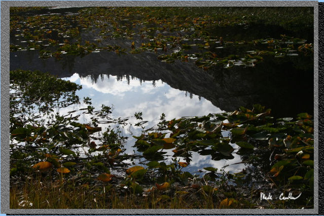
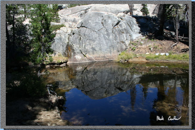 Here
is a pond along Lily Creek. Some of these ponds that I would rather
not swim or drink in provide the best reflections.
Here
is a pond along Lily Creek. Some of these ponds that I would rather
not swim or drink in provide the best reflections.
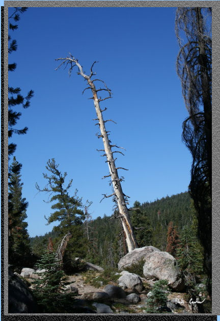
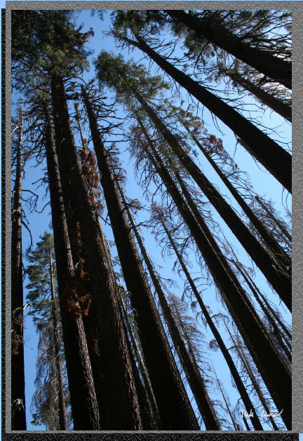 Here
is my reminder to look up occasionally. There are some wonderful trees
in this section of trail. A fire went through this area and it is amazing
how some trees were spared while others were not. Even the ones that
are burned will try to stand as long as they can.
Here
is my reminder to look up occasionally. There are some wonderful trees
in this section of trail. A fire went through this area and it is amazing
how some trees were spared while others were not. Even the ones that
are burned will try to stand as long as they can.
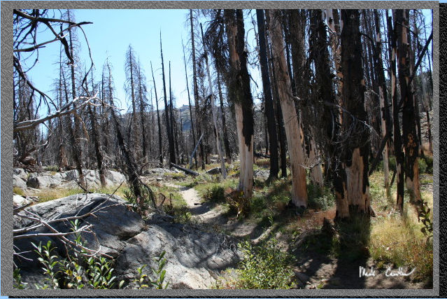 Here
is a shot of a grove that was burned pretty good. I will have to come
back to this trail in 5 years to see what new growth has happened. I
am sure the wildflowers are abundant in spring with the lack of many
trees competing for the sunlight.
Here
is a shot of a grove that was burned pretty good. I will have to come
back to this trail in 5 years to see what new growth has happened. I
am sure the wildflowers are abundant in spring with the lack of many
trees competing for the sunlight.
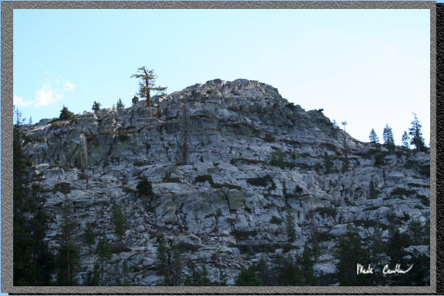
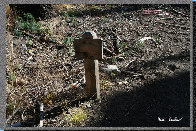
 Here
is the ridge behind the site I camped at. There are a couple sites that
are too close to the lake so please do not camp at them. Two of them
have marking posts that say no camping. There are another couple sites
right on the trail so pick one that is 100 feet from the trail. (There
are a couple.) I had a good time watching the clouds blow by in the
strong winds on this trip.
Here
is the ridge behind the site I camped at. There are a couple sites that
are too close to the lake so please do not camp at them. Two of them
have marking posts that say no camping. There are another couple sites
right on the trail so pick one that is 100 feet from the trail. (There
are a couple.) I had a good time watching the clouds blow by in the
strong winds on this trip.
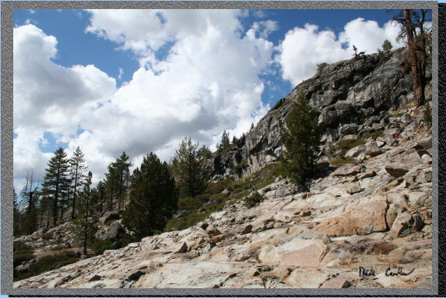
 Here
is a shot of the ridge on the South side of Grouse Lake. The lighting
was changing fast this afternoon with the cloud conditions varying from
minute to minute.
Here
is a shot of the ridge on the South side of Grouse Lake. The lighting
was changing fast this afternoon with the cloud conditions varying from
minute to minute.
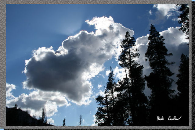 Here
is what I am talking about. Some of these clouds had some good moisture
in them but I managed to get lucky and avoid any rain.
Here
is what I am talking about. Some of these clouds had some good moisture
in them but I managed to get lucky and avoid any rain.
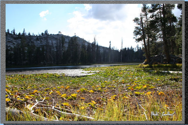
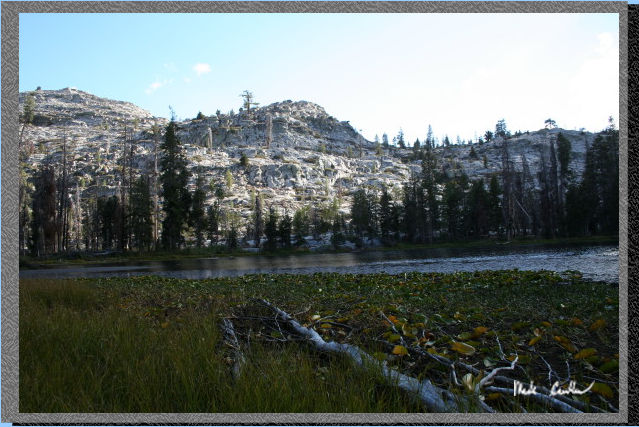 Well
I suppose I should include a couple shots of Grouse Lake, There is quite
a bit of plant growth in them. The water was clear though and not terribly
low, considering how late it was in the season. I am not sure I would
go swimming in this lake. Many fish were jumping but hard to see with
the plant growth.
Well
I suppose I should include a couple shots of Grouse Lake, There is quite
a bit of plant growth in them. The water was clear though and not terribly
low, considering how late it was in the season. I am not sure I would
go swimming in this lake. Many fish were jumping but hard to see with
the plant growth.
 Here
is a shot looking the other direction. I saw a couple good breaks in
the plant growth so you can pump water without traipsing through the
plants. In spring I bet you could pump water from one of the small streams
that feed this lake.
Here
is a shot looking the other direction. I saw a couple good breaks in
the plant growth so you can pump water without traipsing through the
plants. In spring I bet you could pump water from one of the small streams
that feed this lake.
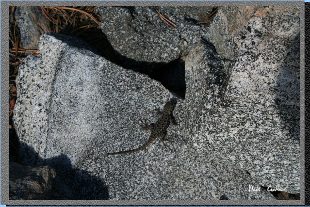 I
saw a lot of lizards around my camp. Here is one that was kind enough
to stay still for a picture.
I
saw a lot of lizards around my camp. Here is one that was kind enough
to stay still for a picture.
 Another
shot of the ridge behind my camp (to the North side of Grouse Lake).
Another
shot of the ridge behind my camp (to the North side of Grouse Lake).
 Reflections
can be so cool sometimes. This is Grouse Lake and the ridge around it.
Reflections
can be so cool sometimes. This is Grouse Lake and the ridge around it.
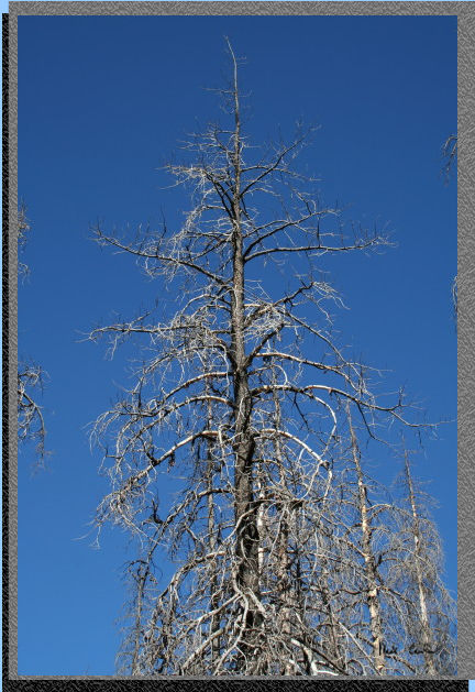 Here
is a tree on its way out. There were many that were in this state.
Here
is a tree on its way out. There were many that were in this state.
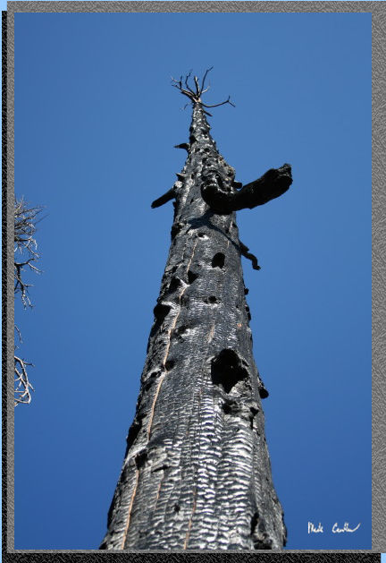 This
tree burned pretty good in the fire but continues to stand tall. I would
not recommend camping near it though. No sense in tempting fate in that
way.
This
tree burned pretty good in the fire but continues to stand tall. I would
not recommend camping near it though. No sense in tempting fate in that
way.
 I
took this shot on the way out but I think it is supposed to be the Wilderness
Boundary sign. Not positive though as I didn't pull out my map to check.
I
took this shot on the way out but I think it is supposed to be the Wilderness
Boundary sign. Not positive though as I didn't pull out my map to check.
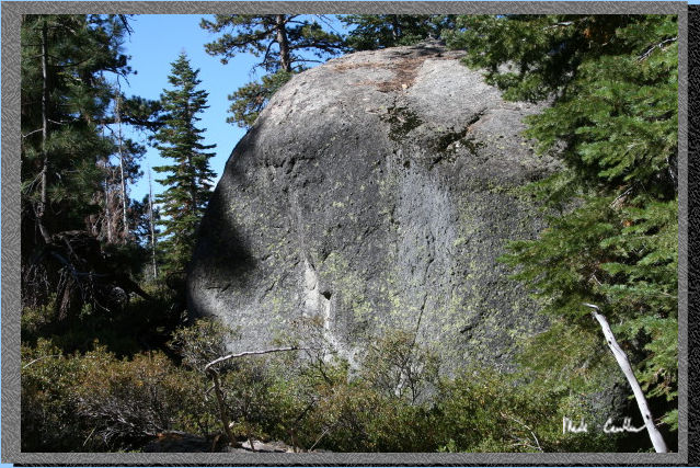
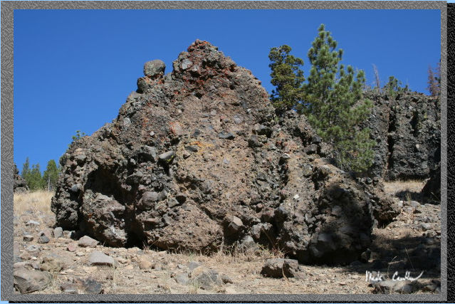 Here
is great boulder on the way out. There are a few giants like this one
in the steep section after the Camp lake junction on the way in. Climbers
love these things because of the hand and foot holds they naturally
have.
Here
is great boulder on the way out. There are a few giants like this one
in the steep section after the Camp lake junction on the way in. Climbers
love these things because of the hand and foot holds they naturally
have.
I would have to say that this was a good trip but I think it would be better in Spring or early Summer to have better scenery. For swimming Bear Lake is a much better choice.
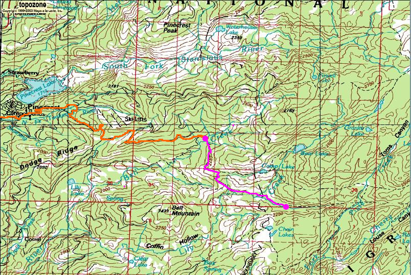
The orange line is the approximate route I took in my truck. The Pink line is the trail I took. The two pink circles are the trailhead and the spot I camped between the two lakes called Grouse Lake, not sure why it isn't Grouse Lakes. (There is another road on the way in you can take from 108 but the ranger let us know the route described above is the quickest.)