![]()
The BIG map and profile page
(take me back to trip description)
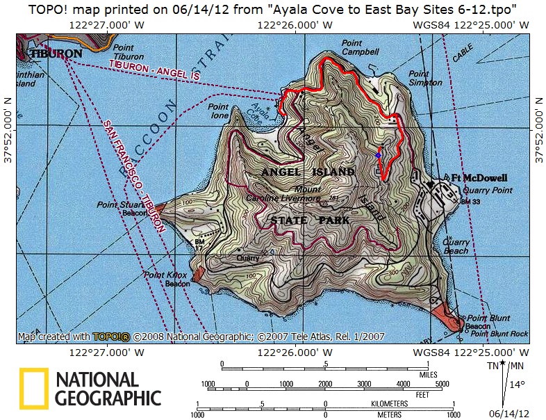
Red line show hike from ferry dock to East Bay Site #1 . Click on map
to download the official Angel Island map.
.
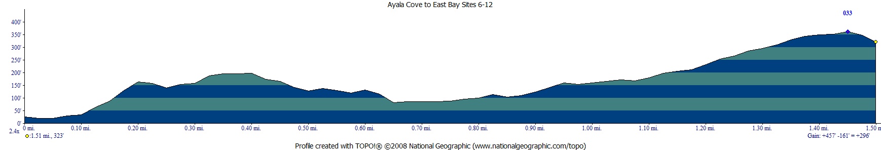
Profile on the way in from the dock to camp.
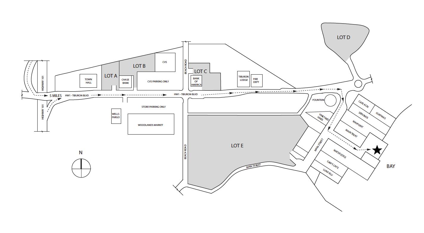
Overnight parking
is allowed in lots A, B, , D. The star on this map is the dock for the Tiburon Ferry.