![]()
The BIG map and profile page
(take me back to trip description)
Red line shows the hike from Camp to Immigration Station and then continuing around island on the Permiter Road in a clockwise fashion (stopping to explore on the way). We then head out from camp again to the top of Mt Livermore after dinner. The green line is the hike out on day 2 via the fire road and North Ridge Trail. Click on map
to download the offical Angel Island map.
.
Profile from Camp to Immigrtion Station and the continuing around island on Permiter Road in a clockwise fashion (stopping to explore on the way). We then head out from camp again to the top of Mt Livermore after dinner.

Hike out via the trail on day 2. 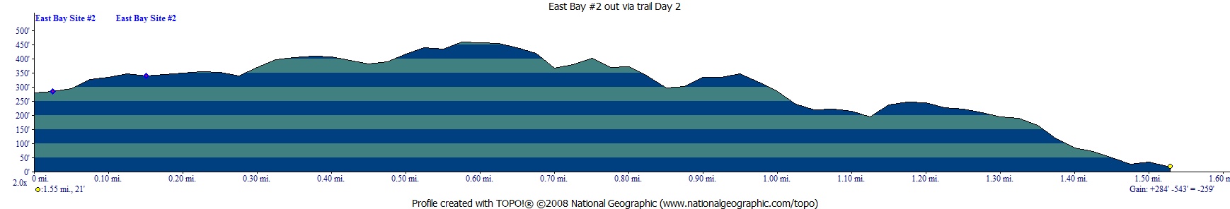
(back to top)
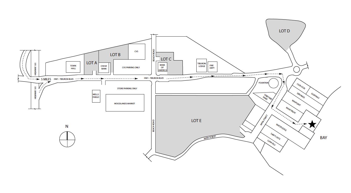
Overnight parking
is allowed in lots A, B, , D. The star on this map is the dock for the Tiburon Ferry.