![]()
The BIG map and profile page
(take me back to trip description)
GPS on this
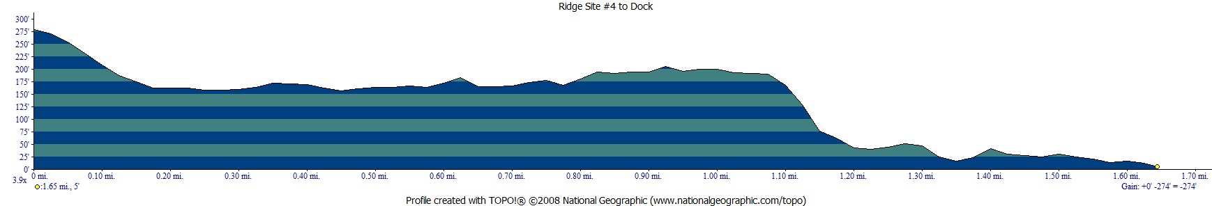
trip shows the trek from the car in lot "A" (see map at bottom of page) to dock in yellow (0.6 miles) and then the ferry ride in red (~1.25 miles) and then the walk from the dock to Ridge #4 using the stairs SW of Visitor Center in green (~1.6 miles). Click on map
to download the offical ANgel Island map.
.
Profile on the way from camp to the dock on the way out.
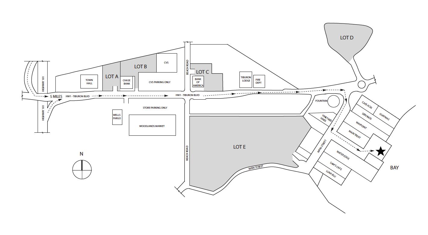
Overnight parking
is allowed in lots A, B, , D (pricing makes you want to avoid D as
of 07-2021). The star on this map is the dock for the Tiburon Ferry.