


![]()
 Permit
- Permits can be obtained through www.reserveamerica.com.
Permits used to be picked up from the Bear
Valley Visitor Center (located at 1 Bear Valley Road Point Reyes
Station, CA 94956, 415-464-5100). Covid has changed things though. Now you can just print your email confirmation to use as both your parking pass and the permit. Sites
run $30 per site per night (up to 6 per site). There are also a few
group sites with prices starting at $60 per night (7-14 per site).
Permit
- Permits can be obtained through www.reserveamerica.com.
Permits used to be picked up from the Bear
Valley Visitor Center (located at 1 Bear Valley Road Point Reyes
Station, CA 94956, 415-464-5100). Covid has changed things though. Now you can just print your email confirmation to use as both your parking pass and the permit. Sites
run $30 per site per night (up to 6 per site). There are also a few
group sites with prices starting at $60 per night (7-14 per site).
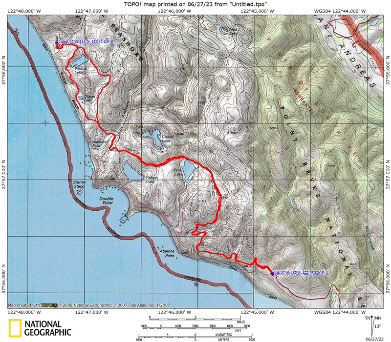
Mileage - Wildcat Camp is approximately 5.7 miles each way from the Palomarin Trailhead (see map and profile below). Alamere Falls is another mile from camp, each way. You must know when high tide is before setting off on this hike, or you could get trapped against cliffs by waves (not good)
Camps/Water - Wildcat Camp has 7 sites (three of them are group sites). Sites 6 & 7 are closest to ocean. Nice pit toilets are near site 2 (yes, some can be nice). Each site has a metal locker and picnic bench (group sites have 2 of each). A potable water faucet is provided near site 2. There are also trash/recycle receptacles.
Hazards - High tide, Poison Oak, MICE, BEAR (one confirmed thus far), and ravenous raccoons (use the locker and a bear canister in the locker). The raccoons actually haven't bothered me out here a few trips in a row now, but the mice will get in the lockers and eat stuff. Rangers currently recommend bear canisters.
I have done this trip a few times now (2020, 2019, 2018,
2015 and 2003),
usually from the Palomarin trailhead. Use the links to view the old
trip descriptions. To get to the Palomarin trailhead from the Bear Valley Visitor Center travel south on Highway
1 for about 25 minutes. Look for a wooden sign that says "Dog Town"
in a Eucalyptus grove and then make your next right at HorseShoe Hill
Road (it sneaks up on you, so if you miss it just take your next right
onto Olema-Bolinas Road, it will get you there too, and then make a
left onto Horseshoe Hill Rd when you dead end into it). You will make
another right from Horseshoe Hill Road onto Mesa Road at a three-way
stop (up the hill in another Eucalyptus grove). Stay on Mesa Road now
past the fire station, and then past the Coast Guard communications
station. The road is gravel for the last 1.2 miles to the Palomarin
Trailhead. It is not rough but not very wide. Eventually you end up at the trailhead. 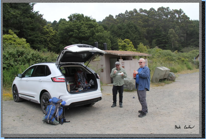
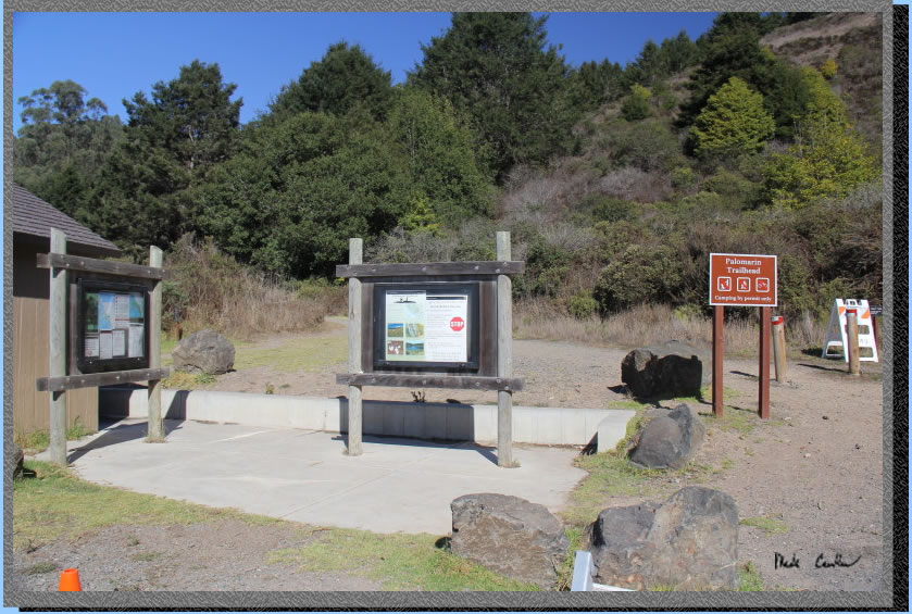
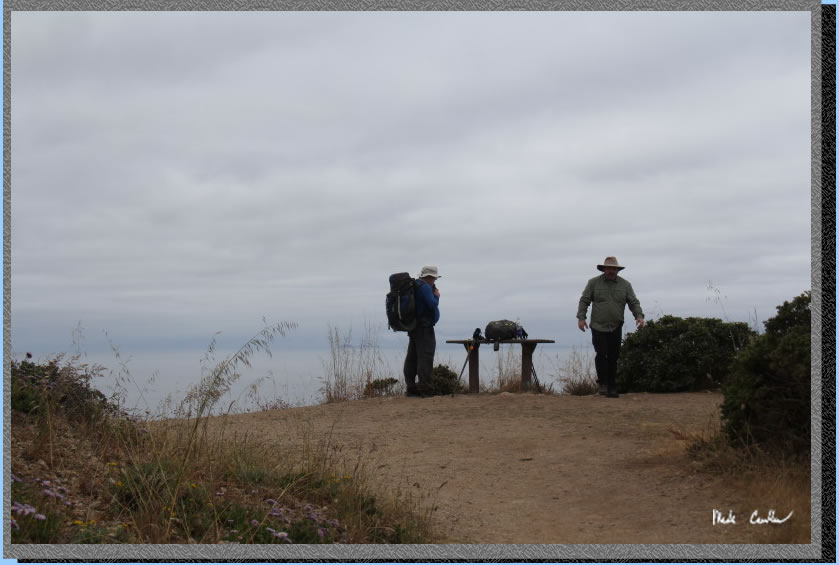
The trailhead has pit toilets and trash cans. There is no water here so plan ahead. Parking can get crowded on busy weekends and I have seen a ranger out here several times making sure you have a permit. Print two copies and put one in your windshield and carry the other in case you are asked for it. .
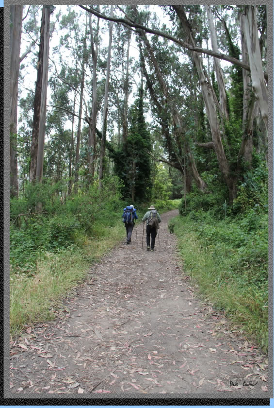
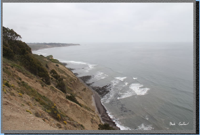
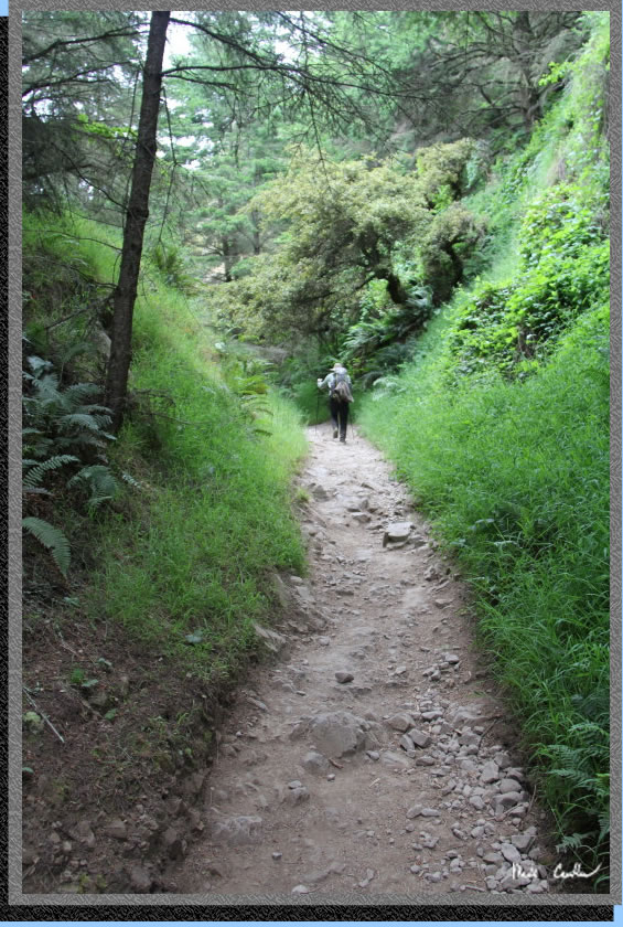
The trail starts in the shade of some Eucalyptus trees. You take a short uphill section to views of the Pacific Ocean..
The views of the Pacific Ocean. The weather was forecast for gray with a high of 52 and a low of 50. We were prepared for either end of the giant temperature swing.
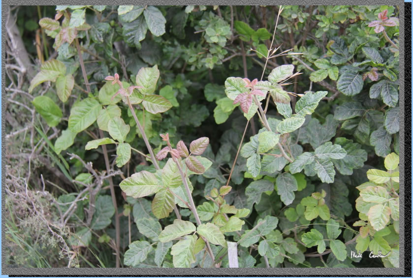
Be mindful of where you step and what you touch. Everything was growing well after the wet winter and the mild summer so far. The Poison Oak was no exception. I am pretty sure that Poison Oak is the devil in plant form.
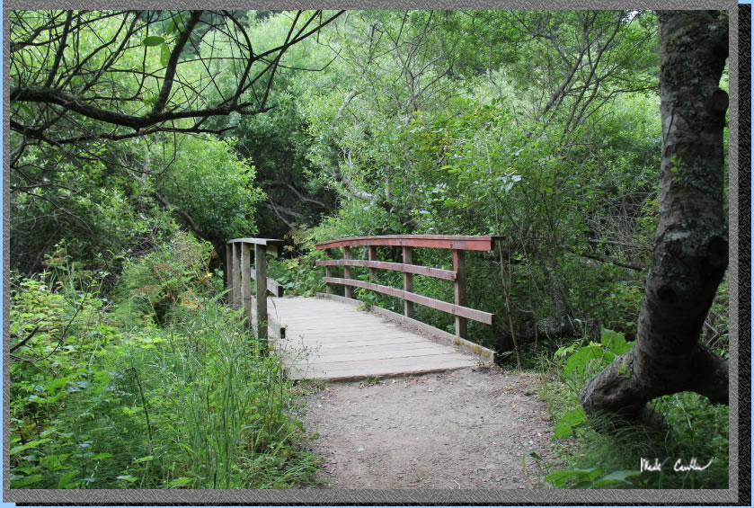
Eventually the trail breaks inland and you will likely feel like you are headed in the wrong direction. Crossing the bridges you will hear the creeks you are crossing. I was amazed at the amount of happy birds you could hear through this section. Take a minute to stop on the bridge and look and listen.
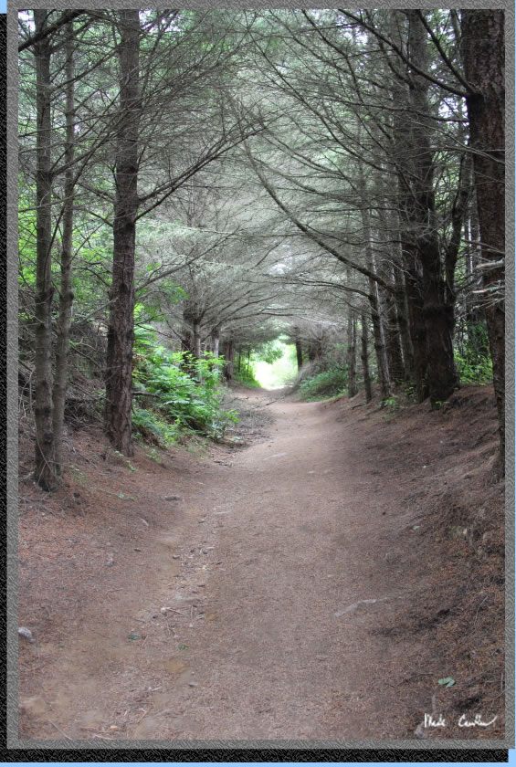
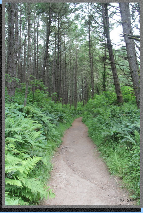
I had to take a picture through this "dead" section of trail. These trees do a good job of blocking the light so there are no competitors for the resources through here.
Another green section of trail on the way in.
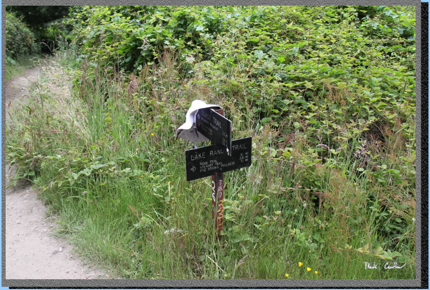
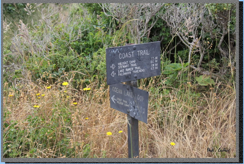
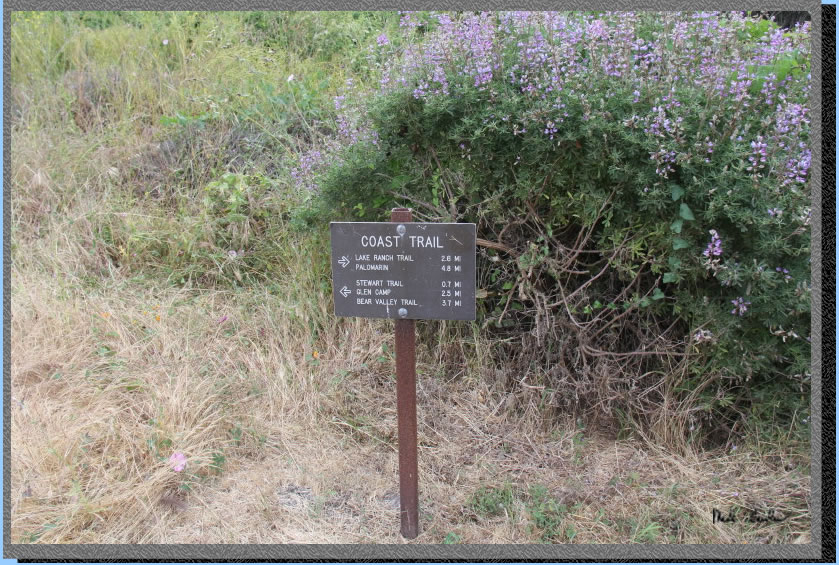
Junction with Lake Ranch Trail. Continue straight on. Only 3.3 miles left, if you believe signs (probably close).
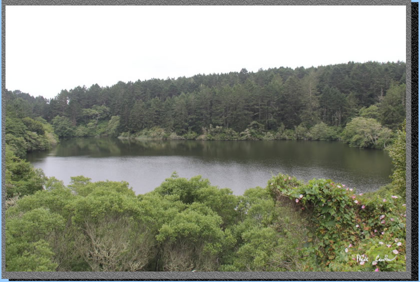
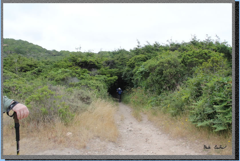
Bass Lake. We heard a group out at the lake but never saw them. There is a spur trail you pass that appears to access the lake. The trail continues uphill past Bass Lake. Trail is wider and covered again before it goes slightly down to next lake.
Here is the covered uphill section. Nothing too steep.
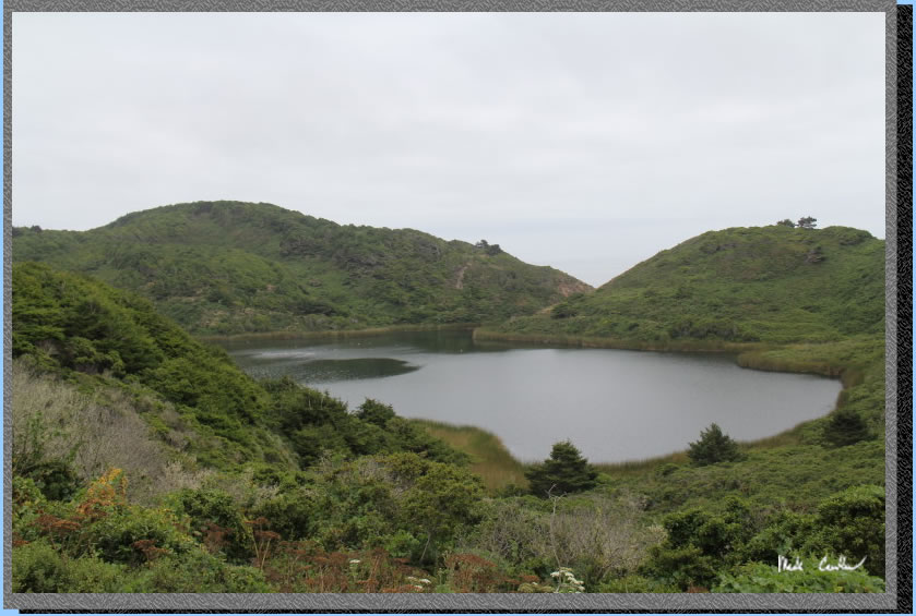
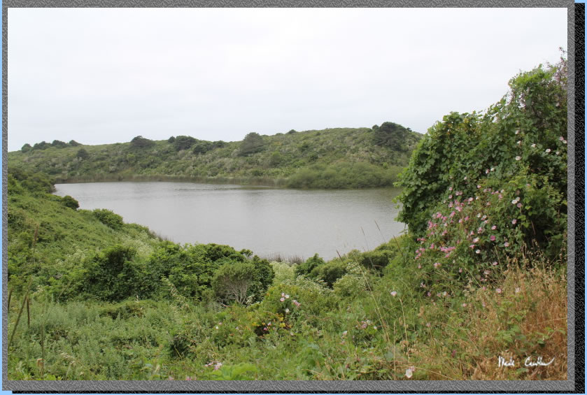
Here is the slightly down, exposed part with ocean views and Pelican Lake. The trail opens up again before heading downhill through covered dark (and scary) forest.
The picture below is not of the dark and scary forest. You can see Eric successfully navigating his way out. After the dark and scary forest the trail opens up again and is more rocky.
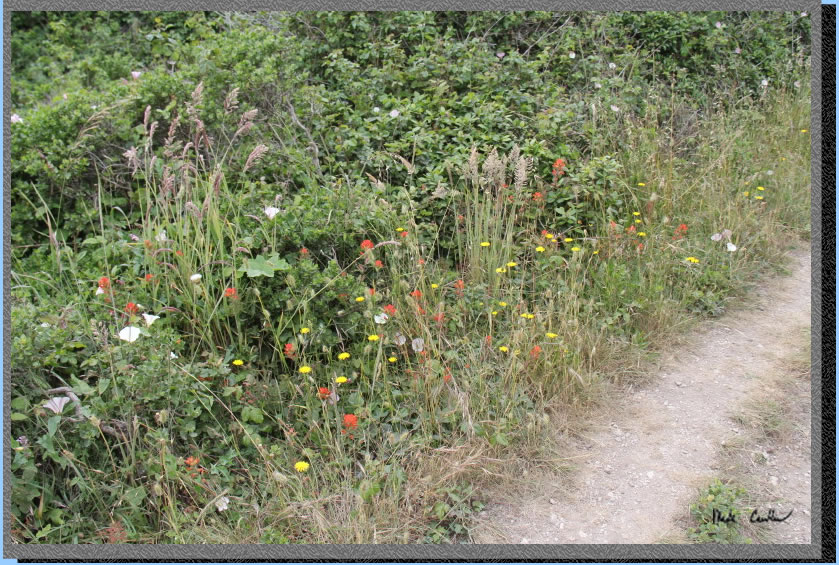
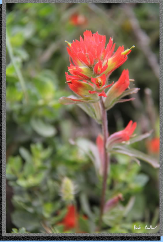
There were so many flowers along the trail. I did try to take some close ups of all the varieties. I will put those at the end of the trip description. Here is a sampling of some of them along the trail.
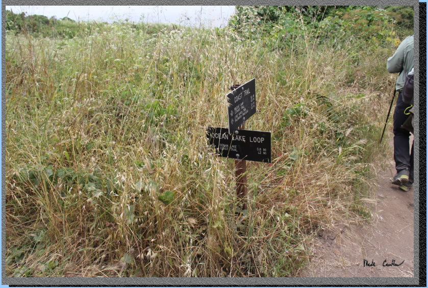
You will next find yourself at a crossroads. You will have the decision to go left and get to Wildcat Camp, or take a right, and get to Wildcat Camp. We went right along the Coast Trail. I recommend doing the Ocean Lake loop for the better views on at least one leg of your trip.
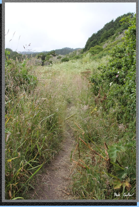
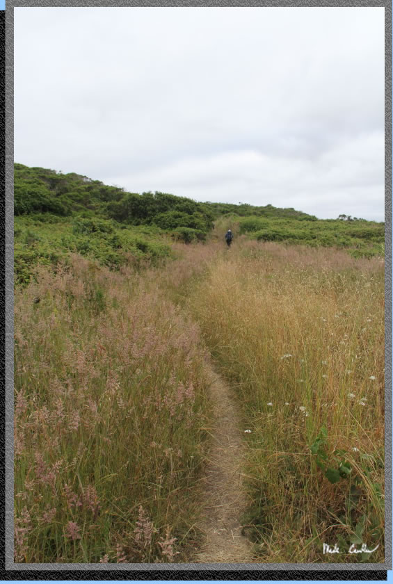
The trail through here got really overgrown. It is a little hard to see the trail through here in this image, and it got worse from here. I was using one hand to keep the grasses/weeds from hitting me in the face as I walked along the trail. I was also trying to make sure I wasn't walking through any of the devil plant. Luckily, there was not much Poison Oak through this section.
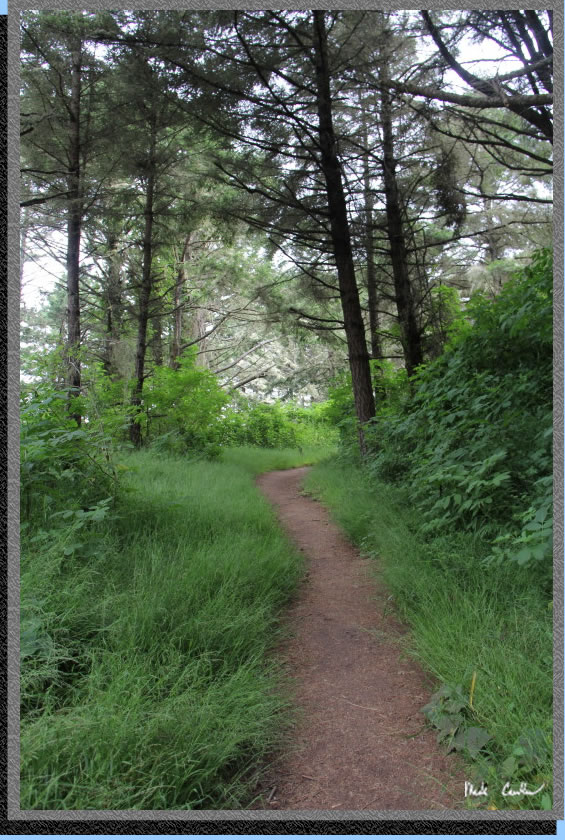
The trail sections that weren't overgrown were better appreciated now.
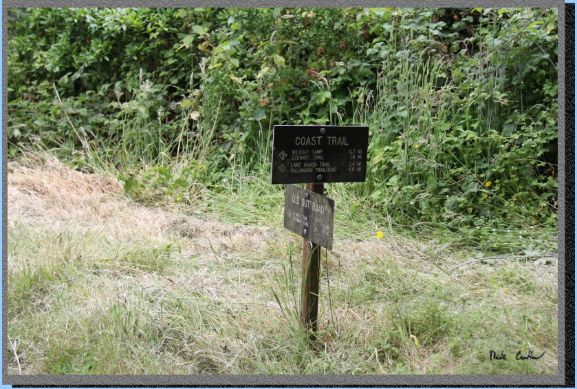
At this junction with the Old Out Road continue straight along the Coast Trail.
Here is Wildcat Lake as you hike along it's eastern shore.
You will meet up with the Ocean Loop Trail now and you are almost to Wildcat Camp.
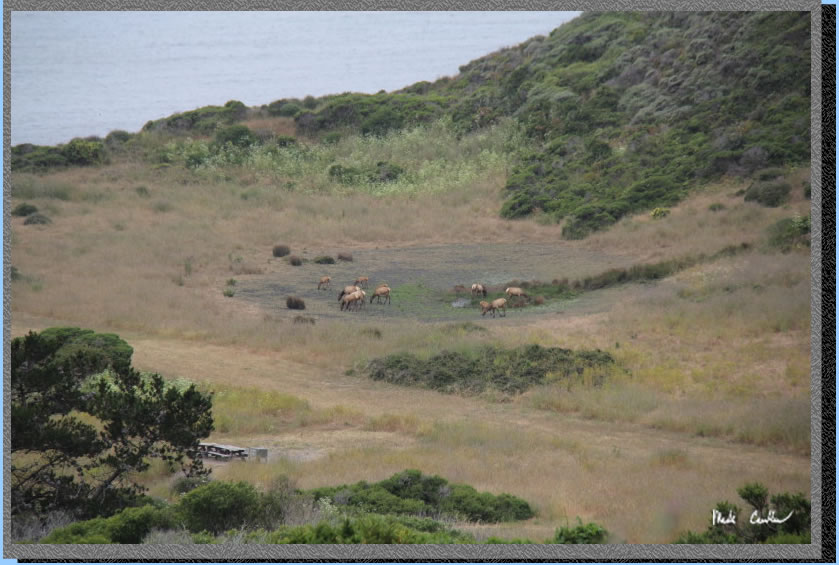
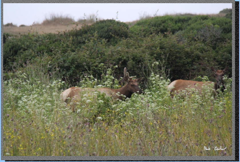
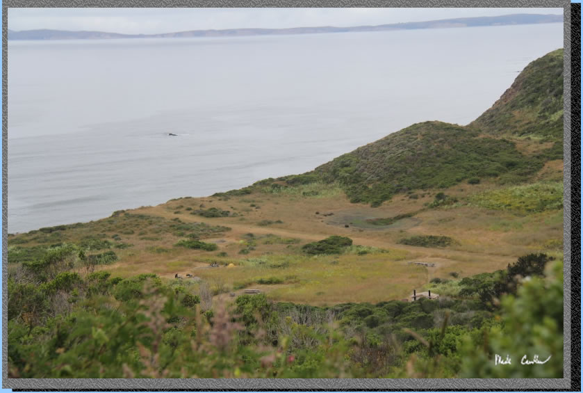
As you descend along the semi-paved trail down to camp you can see both the ocean and camp. We had some Tule Elk about camp for the whole trip.
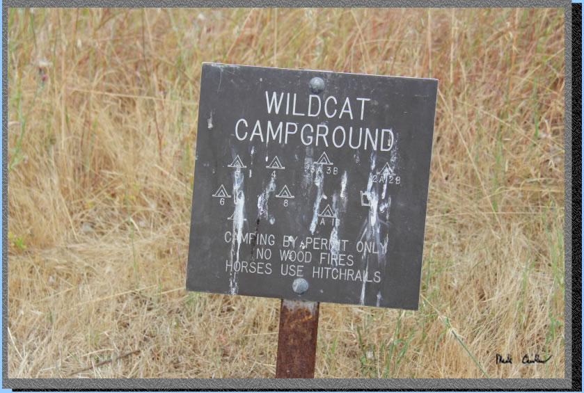
Here is one of the camp site signs. I am not really impressed with either one (the other one is at the bathroom). The online map here is better. The sites can be easy to see the numbers on the bear lockers when the plants/grass is low. However, when the plants/grass are tall you have to either know where the sites are or take a walk along the paths until you find your site..
After you take too many pictures you will head down the to this junction with Coast Trail and head left again. You only have 0.2 miles left per the sign. I did not check it, but probably correct. The trail is down to camp.
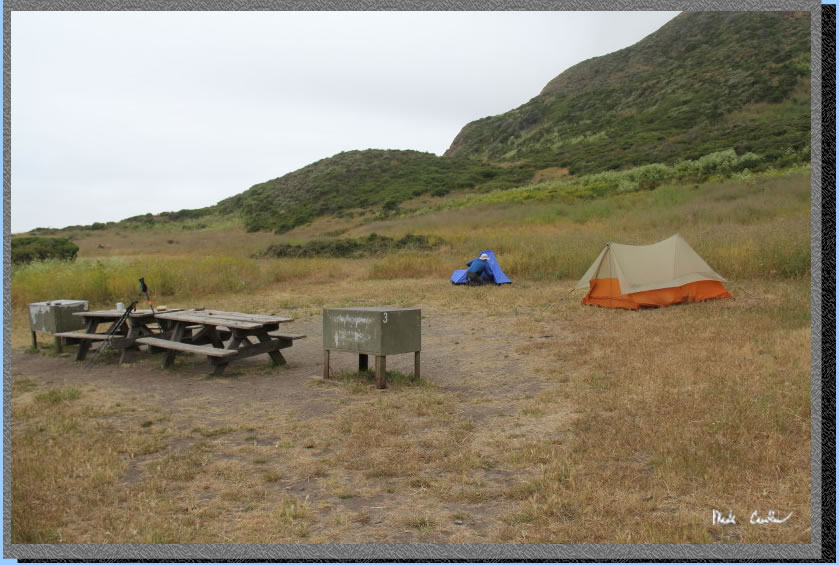
Potable water, pit toilets and trash receptacles are located a short distance from the group sites.You can see in this picture the limited visibility when the vegetation is tall. pi toilets and trash are in the distance.
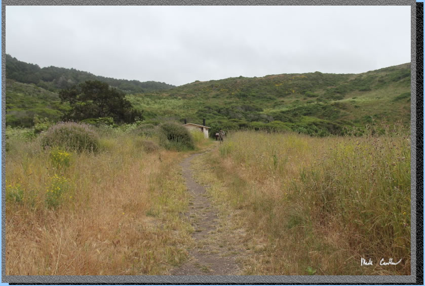
Beach access is a short trek down the trail toward the crashing wave sounds. The water was a little mucky in spots but the logs/rocks made traversing it easy.
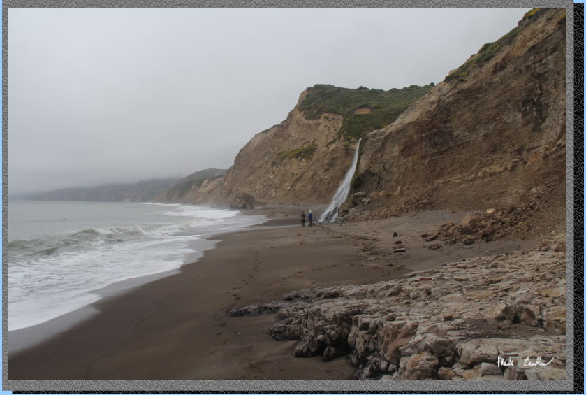
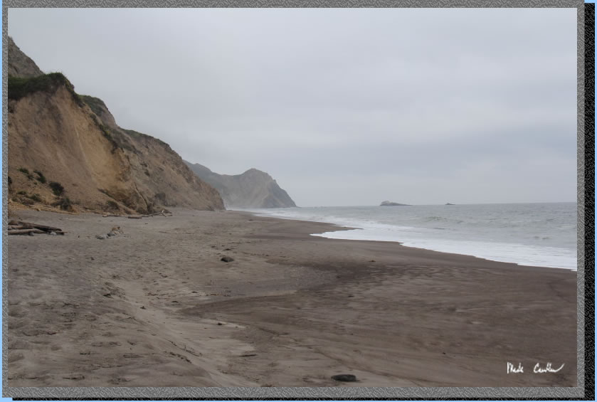
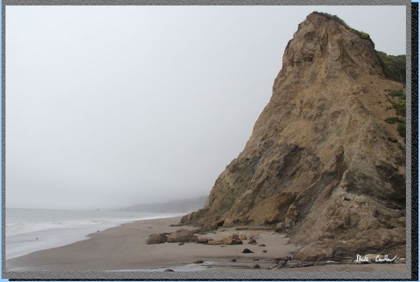
You can see in this shot the hoards of people we had to contend with on the way to the falls. The falls are about a mile down the beach. However, I must stress that knowing the tides is crucial through here to prevent you from getting wet or potentially getting stuck. We had started our hike just after high tide so took our time heading down to the falls to let the water recede as much as possible.
. 
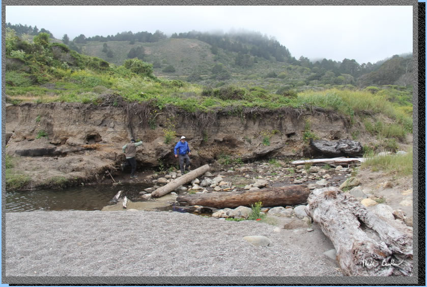
The area here is the tricky spot. We had to time the waves to get past this point while staying dry. After we hung out at the falls the waves were a little easier to avoid on the way back. You wouldn't want to have the reverse situation.
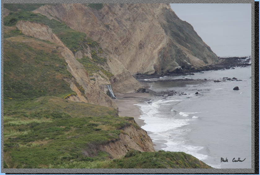
Alamere Falls up close.
I took a short video as well. I will get that posted and add a link here.
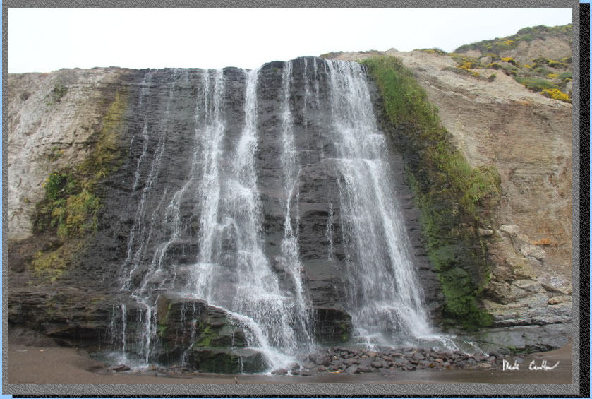
I took this picture looking back the way we came. Having Dan and Eric in the shot gives you some idea of the scale of the waterfall. It is impressive in person and honestly neat to experience even when it is not flowing that much.
Headed back to camp now. We took our time and I took a bunch of pictures along the way.
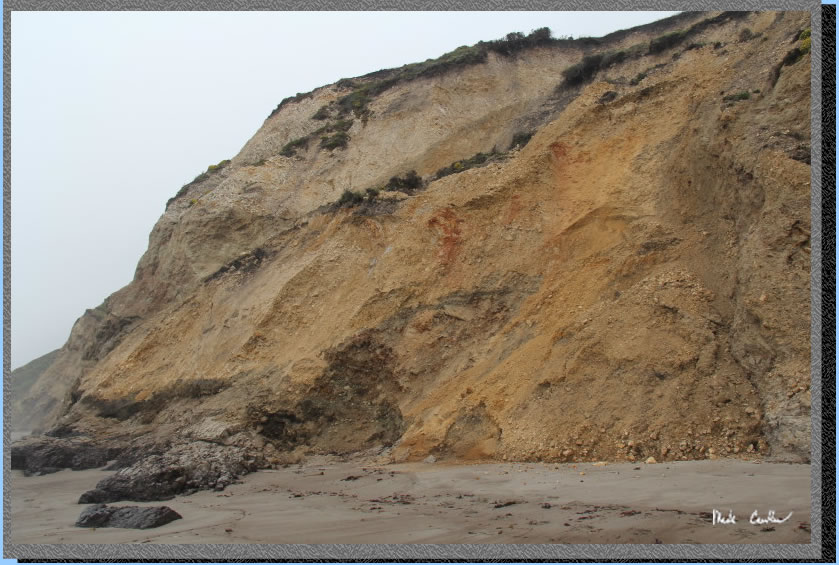
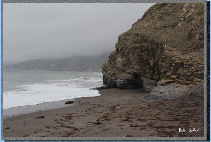
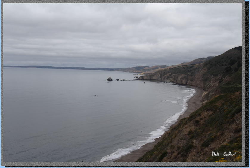
The gray was not letting up. The cliff face appears to have a face to me.
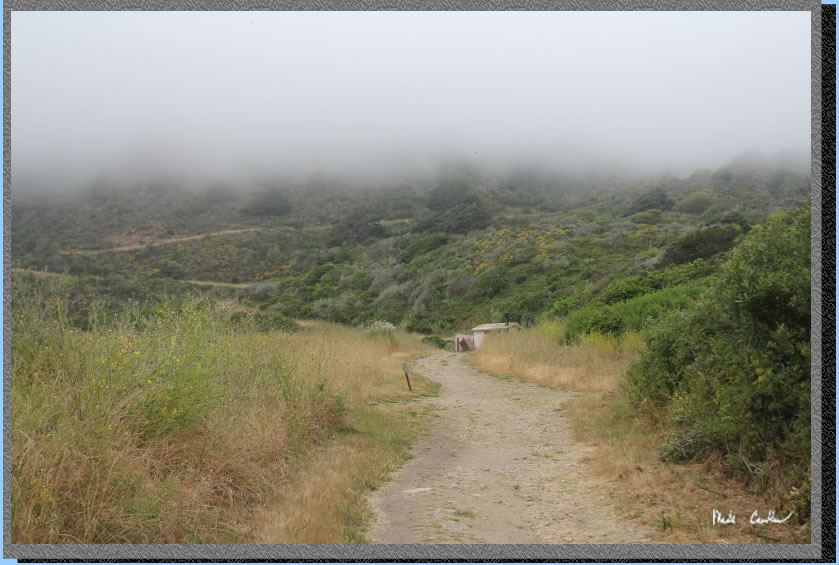
The fog was just above us on the way back to camp. Had to take a picture as it looked more like smoke than fog to me.
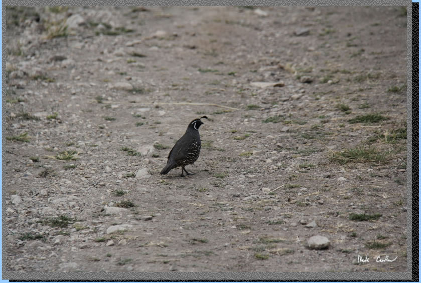
We had a Quail escort on the way back to camp. For whatever reason this guy only wanted to walk on the trail, and only a little bit in front of us. He would look back at us and then scamper off ahead until we caught up.
We had the TUle Elk to keep us company at camp. They were munching away all day and into the evening. Here is "One Antler" taking a peek at us over the brush. They didn't seem to mind coming decently close to us while we were sitting at the table.
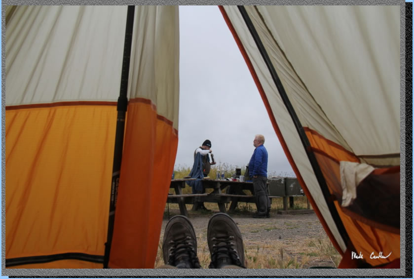
After a great night's sleep I decided to put on my boots and head out of the tent. I grabbed this shot before vacating the tent. I also wanted to ask my fellow campers if the sounds of hoofed animals running through camp early that morning was real or just a dream. It turns out the Tule Elk were in camp and when Dan woke up they decided to run through camp, luckily around the tents/guy-lines. That night we also heard some coyotes that sounded pretty close, love the sound of them howling.
We packed up and headed back the way we came in, well mostly. We decided that we would do the Ocean Loop trail on the way out. Here is the junction sign at camp.
You head uphill along the semi-paved trail. I would say it is more of a a long time ago it was paved and some of that remains if you look close. This picture is looking back at camp.
The trail is uphill to the Old Out Road, then downhill, then level and finally a small up and over to the junction with Ocean Lakes Loop. Overall the Coast trail has less view, but also less steep up. Both options are mostly open. I will leave you with some more shots of the way out and the flower pictures. i will also mention that this was another awesome trip out here. I think it would be difficult to not have a great time on this trip. The image below is on the Ocean Loop Trail that was not quite as overgrown as the Coast Trail.
The Ocean Loop trail goes right up to the face of the cliff.
You are rewarded with some great views to the north.
And also to the south. You can see Alamere Falls and Ocean Lake in this shot.
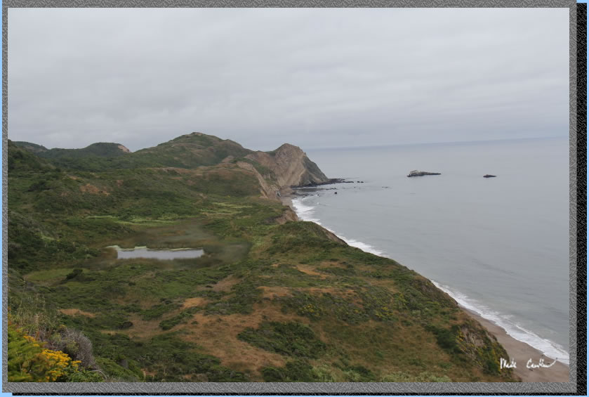
Zoomed in more on Alamere Falls.
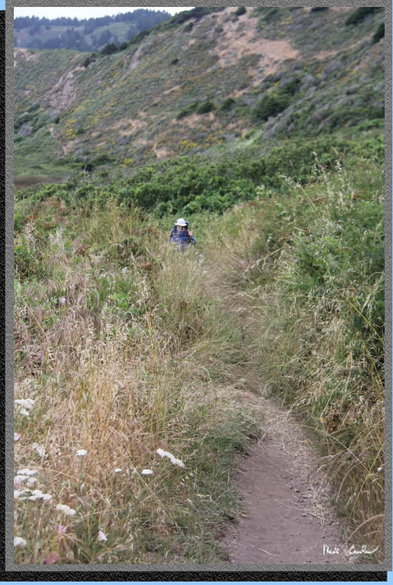
Eric making his way through the tall stuff. Did I mention check yourself for ticks and I always spray a little deet on my entry points.
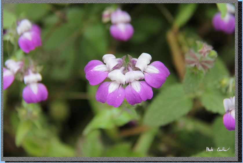
The breeze made these shots more challenging than normal. Flowers do not stay still when told.

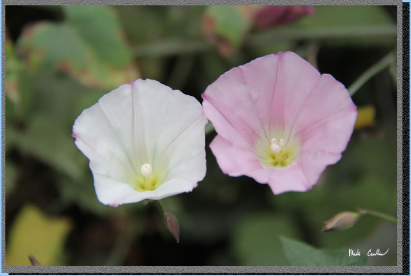
Some flowers are pretty detailed once you get close to them.
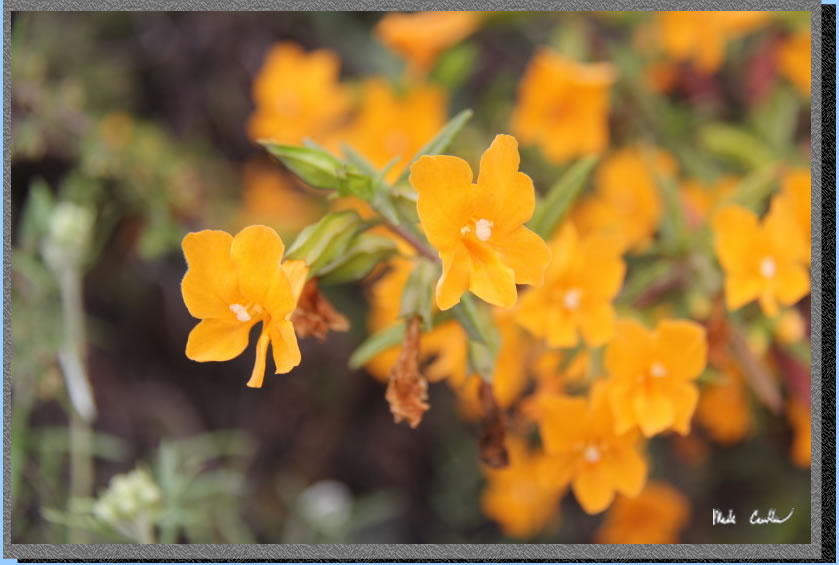
Eric and I think this was the Sticky Monkey plant/flower.
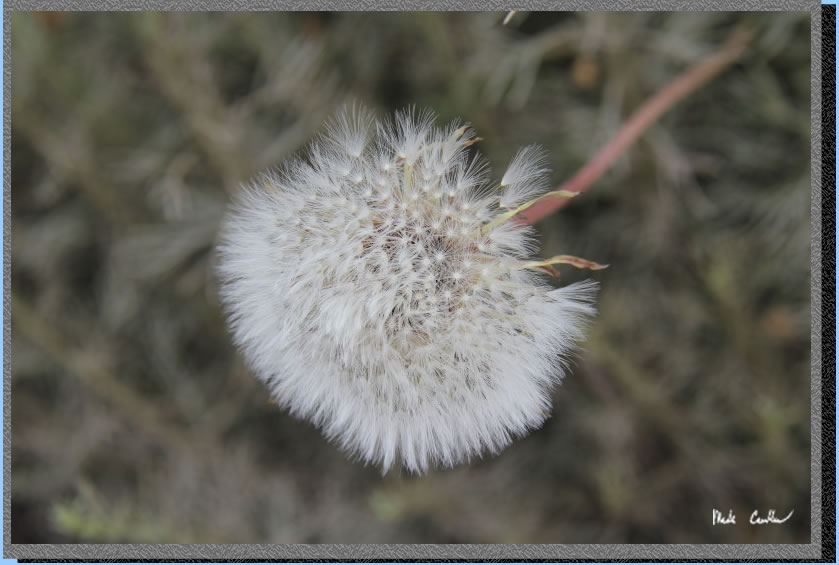
Ok, so not technically a flower but it was so fuzzy (and held still).
I needed a bee in this shot. They also do not cooperate with my directions.
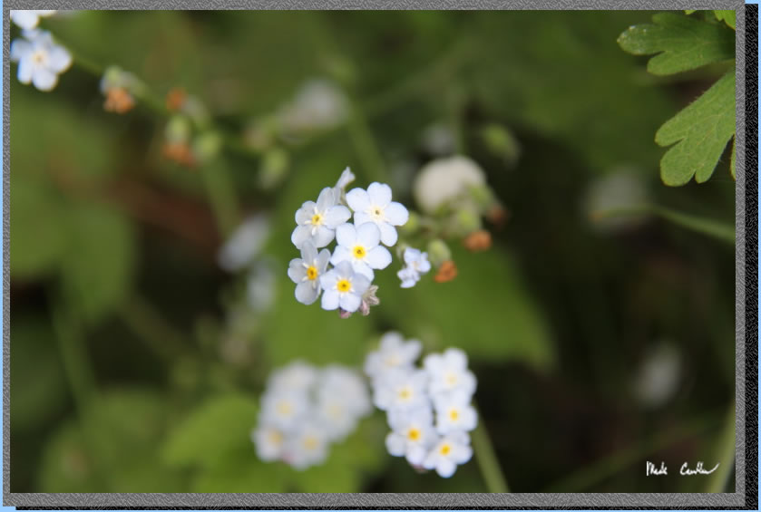
Another small detailed flower you have to get close up to in order to appreciate it.
One day I should learn my flower names. I avoided botany in school.
Red line shows the path we
hiked from parked car at Palomarin Trailhead to Wildcat Camp (and back the next day).
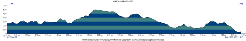
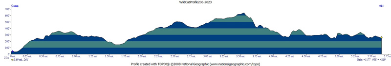
We stayed inland on the way to camp on day one (Coast Trail) and stayed on the coast side on the way out (Ocean Loop). Elevation profiles below map (day one then day two).
Click any image below for a larger version.
(back to top)
DAY 1
(back
to top)
Day 2
(back
to top)