


![]()
Eric and I
ended up going 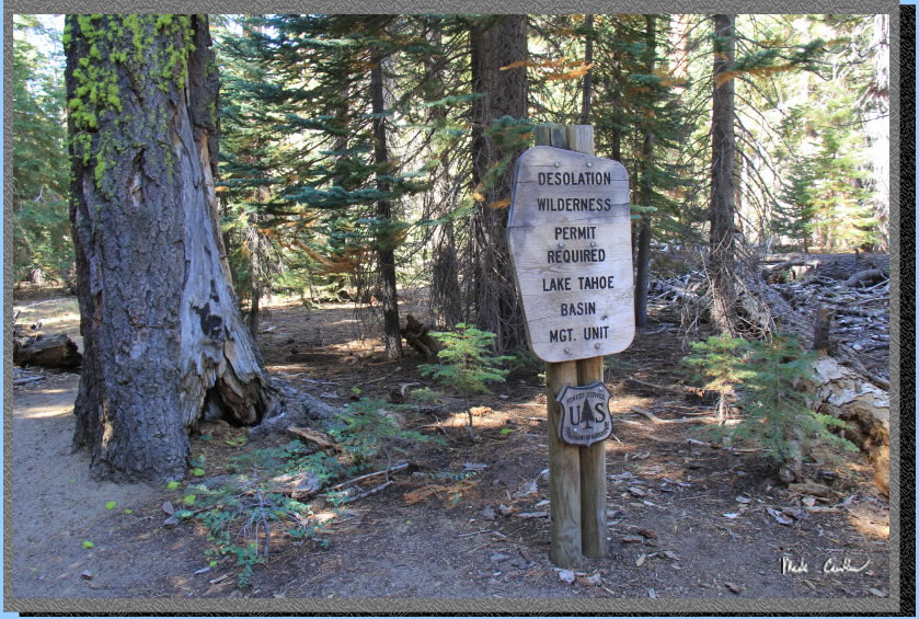 on
this 3 night backpacking adventure on the east side of Desolation Wilderness.
We decided that we would start at Emerald Bay off Highway 89 on the
west side of Lake Tahoe and end up at the Meeks Bay Trailhead 4 days
later. We would be traveling on portions of the PCT, TRT, and TYT (Pacific
Crest Trail, Tahoe Rim Trail and the Tahoe Yosemite Trail). Desolation
Wilderness is on a zone quota system from the Friday before Memorial
Day to September 30th. Your first nights stay determines the zone you
will be in. Half of each zones quota can be obtained through the online
reservation system at www.recreation.gov,
the other half are obtained the same day from the ranger station (two
miles east of the Highway 50/89 junction in South Lake Tahoe on Highway
50) or the Taylor Creek Visitor Center (three miles north of the Highway
50/89). They ask for the rest of your plan and names of people traveling
with you. Try to give your best guess on the rest of your trip as it
could help a rescue party. We ended up sticking to our planned itinerary,
but only your first night is really set in stone. The rangers are out
there and will check for permits and how closely you are camped to water
sources (100' away is the requirement but they like 200' or more). Permit
price is $5 per person for the first night or $10 per person for 2 to
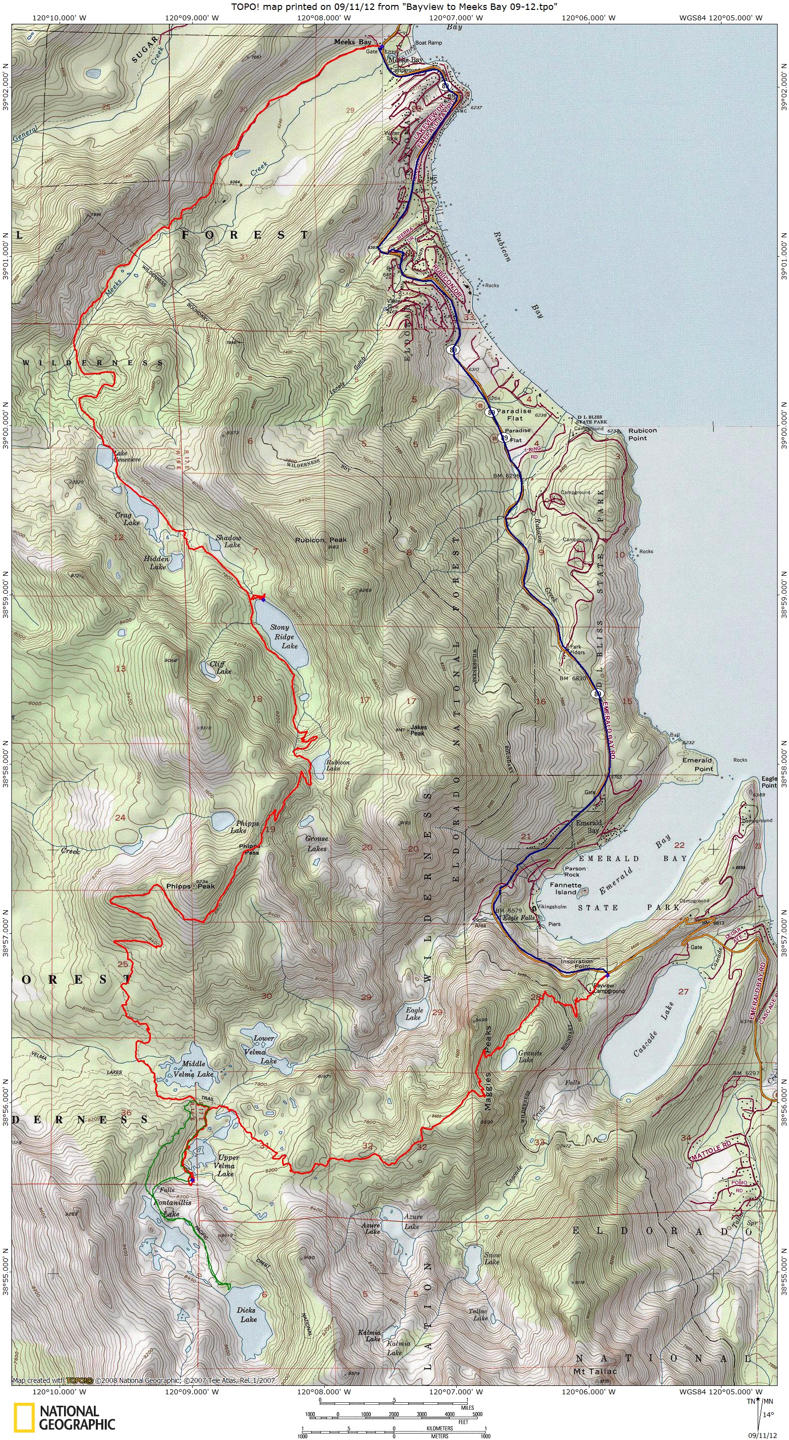
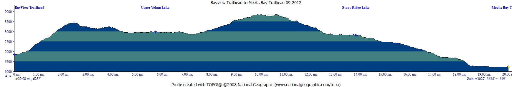
14 nights (sorry 2 week maximum). Here is the map and
profile .
on
this 3 night backpacking adventure on the east side of Desolation Wilderness.
We decided that we would start at Emerald Bay off Highway 89 on the
west side of Lake Tahoe and end up at the Meeks Bay Trailhead 4 days
later. We would be traveling on portions of the PCT, TRT, and TYT (Pacific
Crest Trail, Tahoe Rim Trail and the Tahoe Yosemite Trail). Desolation
Wilderness is on a zone quota system from the Friday before Memorial
Day to September 30th. Your first nights stay determines the zone you
will be in. Half of each zones quota can be obtained through the online
reservation system at www.recreation.gov,
the other half are obtained the same day from the ranger station (two
miles east of the Highway 50/89 junction in South Lake Tahoe on Highway
50) or the Taylor Creek Visitor Center (three miles north of the Highway
50/89). They ask for the rest of your plan and names of people traveling
with you. Try to give your best guess on the rest of your trip as it
could help a rescue party. We ended up sticking to our planned itinerary,
but only your first night is really set in stone. The rangers are out
there and will check for permits and how closely you are camped to water
sources (100' away is the requirement but they like 200' or more). Permit
price is $5 per person for the first night or $10 per person for 2 to
14 nights (sorry 2 week maximum). Here is the map and
profile .
Instead of doing
the usual car shuttle to accomplish this thru hike we decided to use
a shuttle. The usual trolley type shuttle doesn't operate much after
Labor Day so we had to hire a shuttle. We picked a company called Shuttle
It that came recommended by the usual nifty
50 trolley shuttle (530-541-7149). I arranged with Tahoe
Joe to pick us up at 2 pm (530-318-9294), I figured we could make
it out by then, on the fourth day, no problem. The route
we picked had us leaving at Bayview Trailhead across from Inspiration
Point at Emerald Bay. There is free parking along the street on the
west side and also parking at the trailhead which is past/through the
Bayview campground. We parked on the road and hit the trail after traveling
through the campground using a dirt road above it on the south side.
Here is Eric heading back to the car after checking out Inspiration
Point. There are trash cans, pit toilets and lots of tourists at Inspiration
Point. 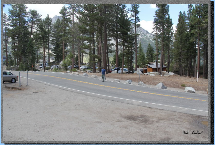
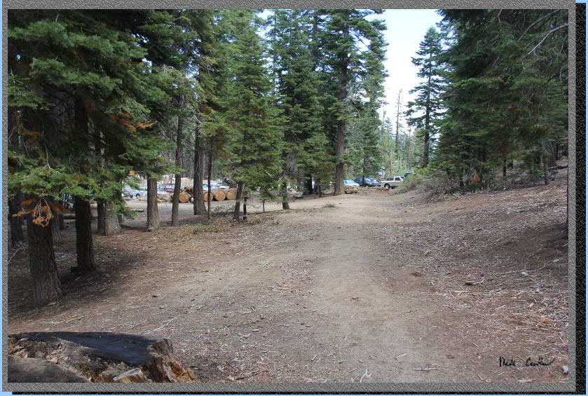
This is the dirt road leaving
Highway 89 above and to the south of the campground. The campsites look
pretty tight together but only a few occupied this early Friday afternoon.
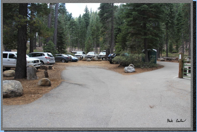
Here is the official trailhead.
Parking was full here already by noon. There is a port a-potty and water
at the trailhead. There is also a small horse corral. I imagine that
this lot and the street parking is jammed during the peak summer months.
We saw a few horses on the trail and evidence that they frequent the
trail.
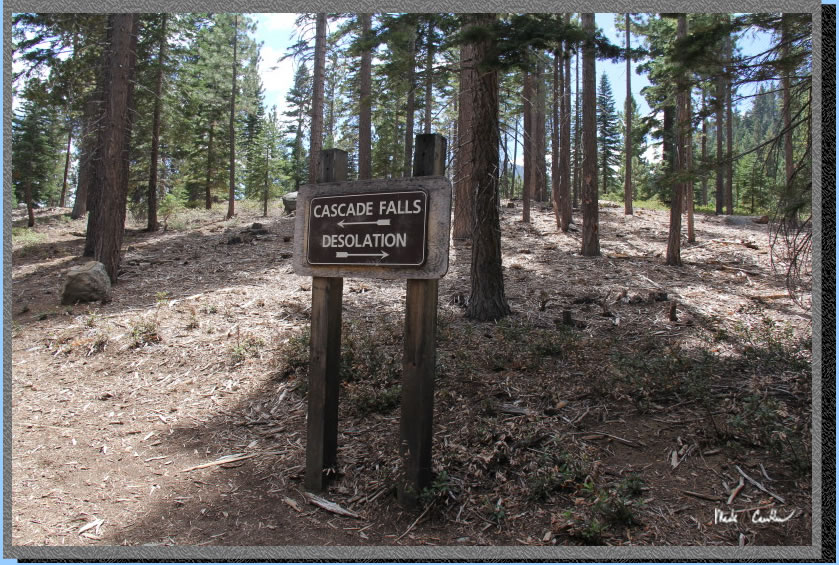
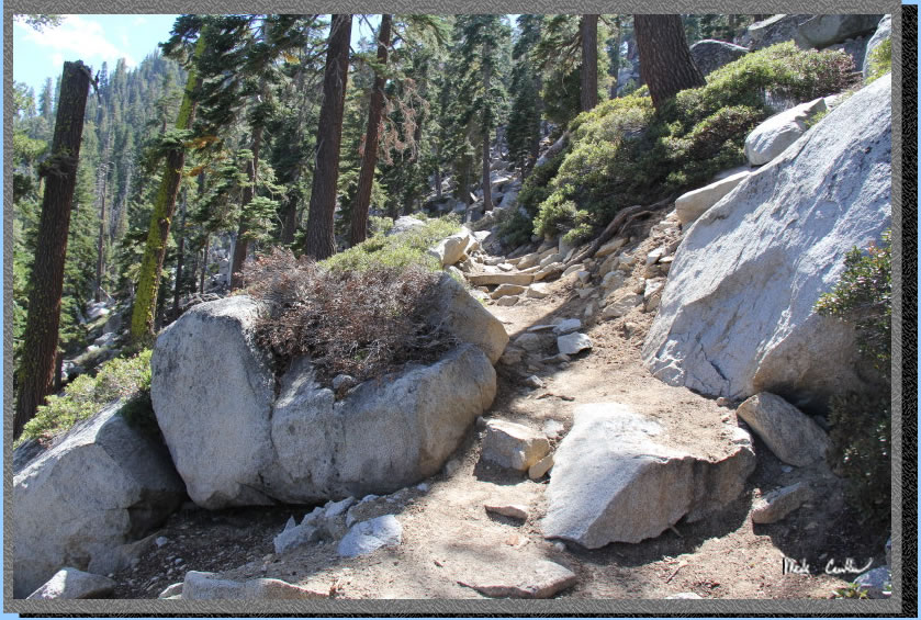
Continue past the sign here to Desolation Wilderness. The trails are
marked well but do pay attention to where you are and where you want
to be. People can get lost on the best marked trails given the right/wrong
conditions. Make sure that you get a permit even if you are just doing
a day hike. The rangers are out here and will check for your permit.
The permit is free so you will have no good reason to not get one!
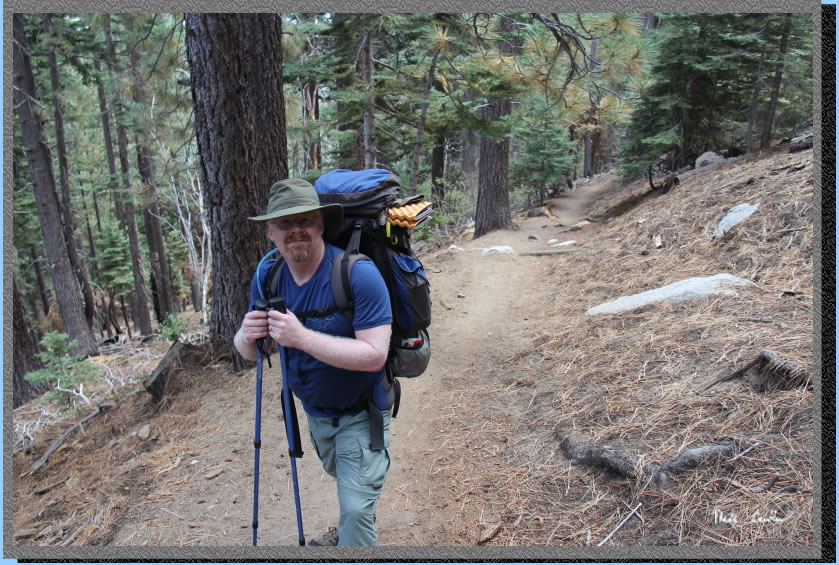
The trail is mainly up to
just before Granite Lake. Here is Eric letting me stop and take more
pictures..
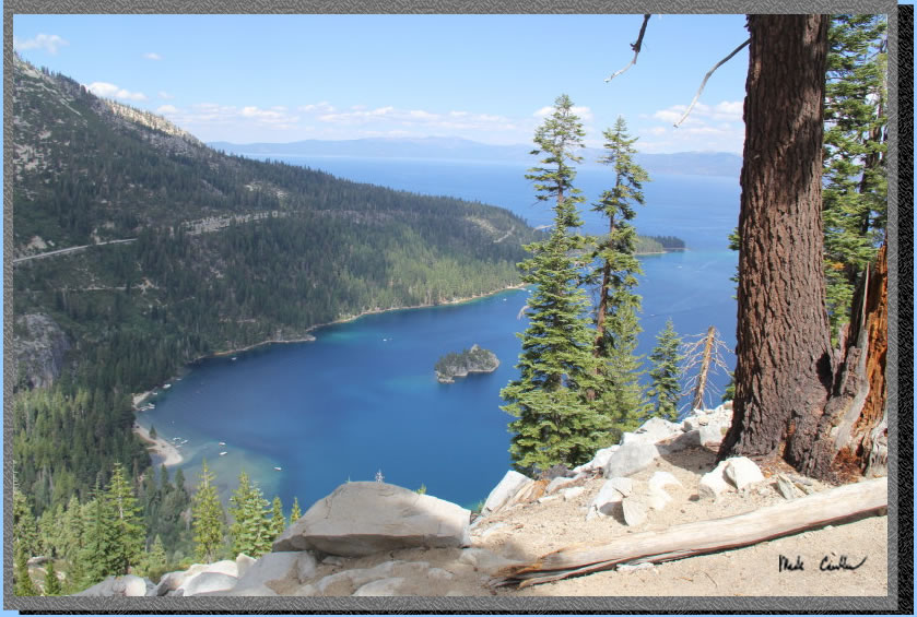
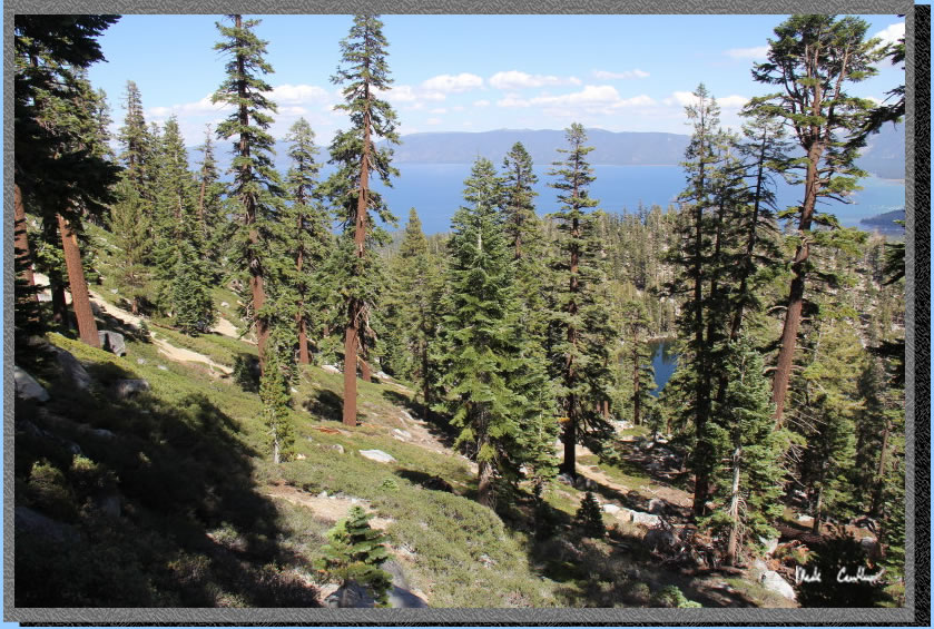
The views on the way to Granite
Lake were amazing. There had been a tropical system that brought thunderstorms
to the area earlier in the week but today was beautiful and clear. You
can see Emerald Bay down below with some boats anchored..
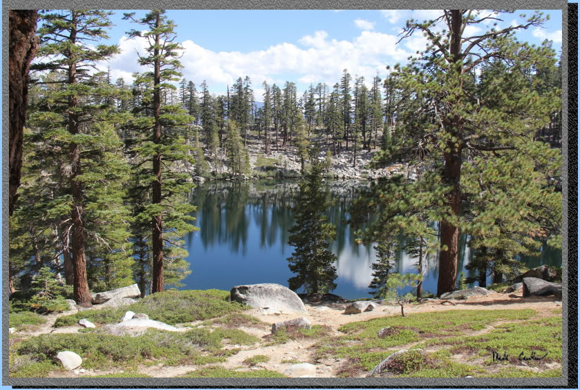
Granite Lake looked perfect. This would be a tremendously easy dayhike
to a great granite lined lake. The views of Tahoe alone are worth doing
the hike to here. The trail levels out just before the lake with some
nice tree cover.
You ascend now up a ridge.
See a portion of Granite Lake below through the trees.
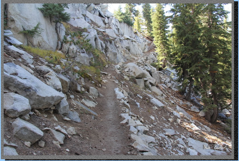
The trail is a little more
strenuous now with some more exposed granite sections.
The beauty of the open sections of course are the views. I believe the
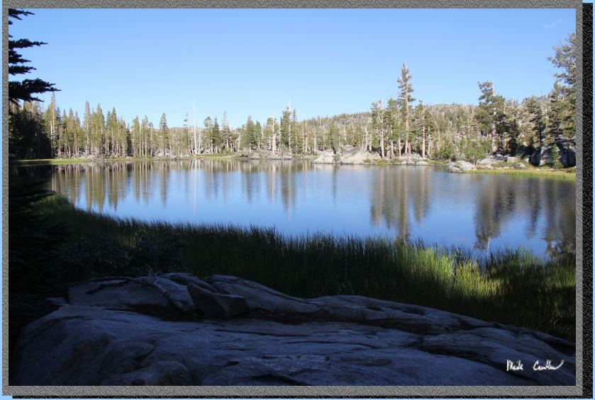
lake here is Fallen Leaf. 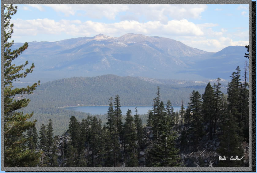
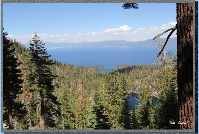
This is one of those trails
you need to turn around to see how your hard work is paying off. Granite
Lake down below with Emerald Bay far in the distance now.
Another"up" section.
Once at the top of the ridge
you can see Eagle Lake. Another trailhead starting point is Eagle Falls
trailhead which would put you down in the valley in this shot. Eric
did that section of trail last year and told me that the trail has some
steep granite step sections.
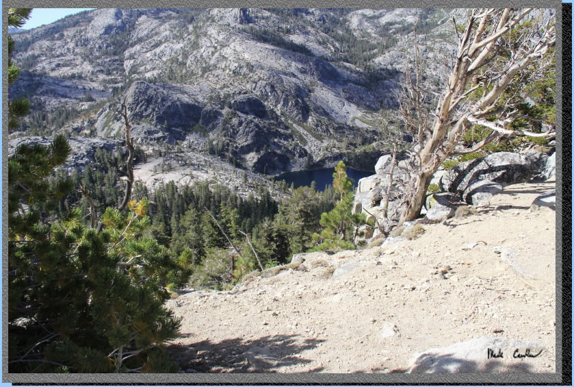
The peak on the left is Phipps Peak. We head through the low point between
the two peaks (the one on left and the one on the right almost out of
the frame) on the third day. The trail winds behind the spiny ridge
staying above Grouse Lakes before dropping down to Rubicon Lake. But
that is all day 3 so for now it is head up
some more towards Velma Lakes..
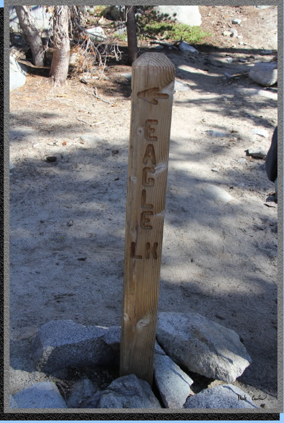
Take a left/straight at the
junction with Eagle Lake. This shot is looking back at the post. My
Desolation Wilderness map shows a trail to Azure Lake before this trail
junction to Eagle Lake. I do not remember seeing one so it may be slight
or I might have missed it.
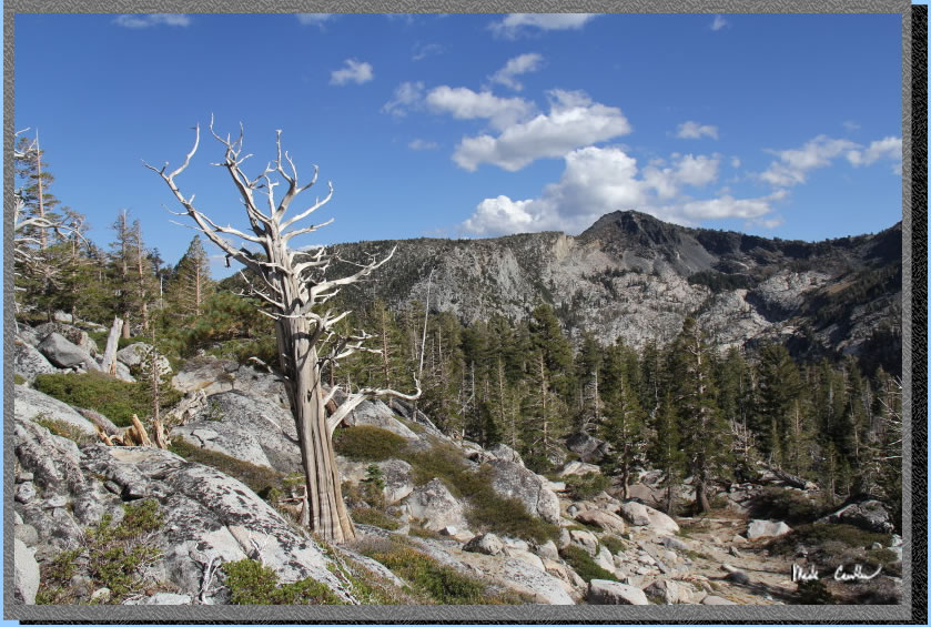
There is a little valley
here with a perfect dead tree that captured my attention.
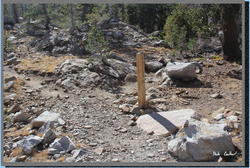
The next junction is right
towards Velma Lakes. If you go straight/left here you end up At Dicks
Lake (we head there tomorrow on a day hike).
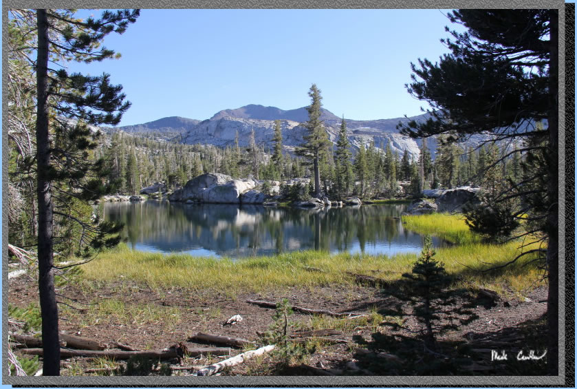
Upper Velma Lake is really
a few Lakes. Here is the first portion you see along the trail to Middle
Velma Lake.
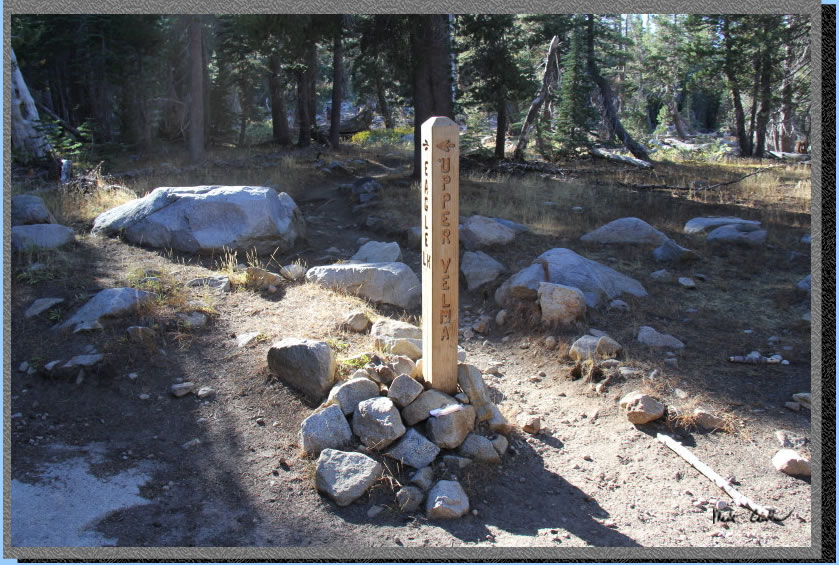
Here is the next junction
to Upper Velma Lake. Take a left to get to Upper Velma or go straight
to Middle Velma.
Camping spots along Upper Velma Lake were scarce. There was already
one group camping at the site closest to the inlet to the lake, which
is arguable the best site. We ended up on the south side of the lake
on the east side of the stream that feeds into the lake. We camped in
the only flat, no granite, section we could find. I believe we were
camping in a small dried out pond. Overall an excellent hike in. I would
venture to Middle Velma for more campsite options. GPS put us around
5.3 miles and 1700' elevation gain on the day. Crystal clear night with
no moon (until 3 am or so) so perfect start gazing. I saw a few satellite
passes and some shooting stars.
Continue to Page 2 by
clicking here. Scroll down for map and elevation
profile.
Red line shows the
section we hiked with packs.
Green line is day hike on day 2.
Blue line is shuttle back to car.
Elevation profile below map.
Click on map or profile for larger version.
.
(back to top)
(take me back to trip description Day 1, Day 2, Day 3, Day 4 )