


![]()
Today
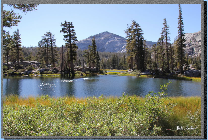
was going to be our longest, and probably hardest day. Luckily we had
thinned out our pack some since we had stayed 2 nights at Upper Velma
Lake (see goodbye picture below). We were also fully acclimated to the
altitude (technically not ,as it takes a couple weeks, but at least
our sea level bodies weren't in shock anymore). We were traveling 8
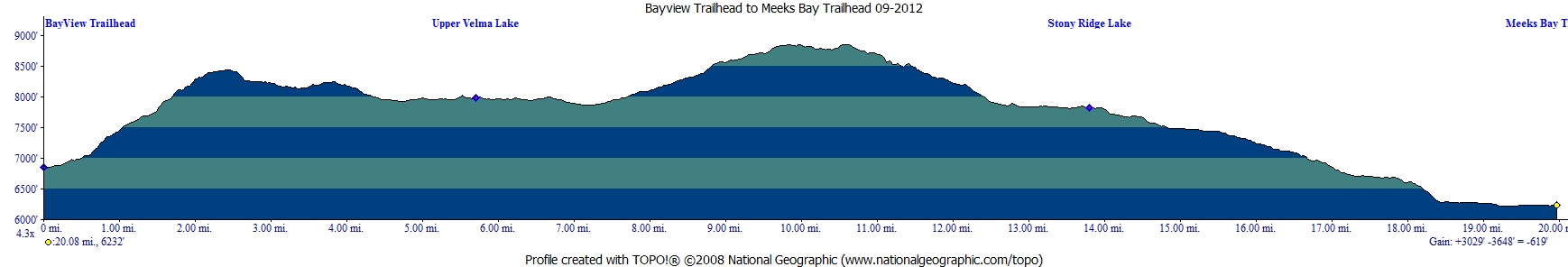
miles from Upper Velma Lake, up and over Phipps Pass, to Stony Ridge
Lake today (don't tell Eric though, as I just told him it would be 100
yards or so). See map below.
We hiked out towards Middle
Velma Lake and took a left at the junction. Then at this junction (same
one we traveled from yesterday) we stayed
straight towards Phipps Pass..
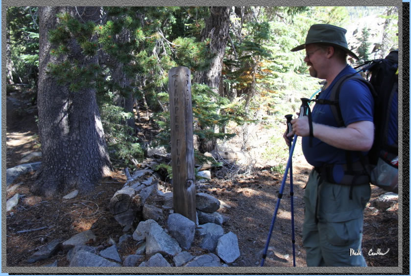
The trail continues along
the southern edge of Middle Velma Lake, and then you meet this junction
to Camper Flat. Take another right hear towards Phipps Pass. The trail
starts heading up now. Camper Flat is in an area of Desolation I would
like to explore next summer. There seems to be a nice loop you can do
to hit 5 or 6 lakes on the western side of Desolation.
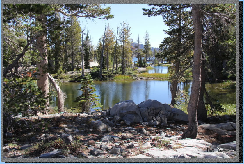
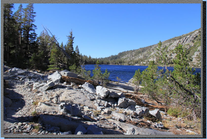
Middle Velma Lake is big
and has some fingers that appear separated from the main lake because
of the low water level.
The trail through here was
beautifully maintained. I think the fact that some of the trail through
here has 3 names (PCT, TRT, TYT) helps a bunch.
The trail through this section
is well covered for the majority with the small open sections giving
some great views of the surrounding Valleys. While the direction is
up to Phipps Pass, the grade is done well to keep you from getting too
winded, as long as you slow your pace. Here is some moss on a limb near
the trail in an open section.
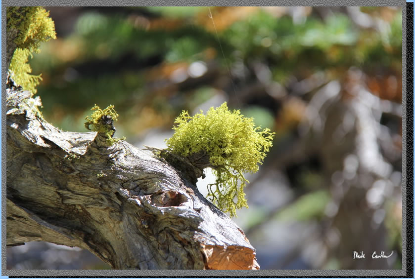
We noticed some curiously growing moss on this section of trees. We
have named it ring moss of course, and have the hypothesis that the
moss grows where the branches usually come out of the trunk because
it is easier for it to hang on there.
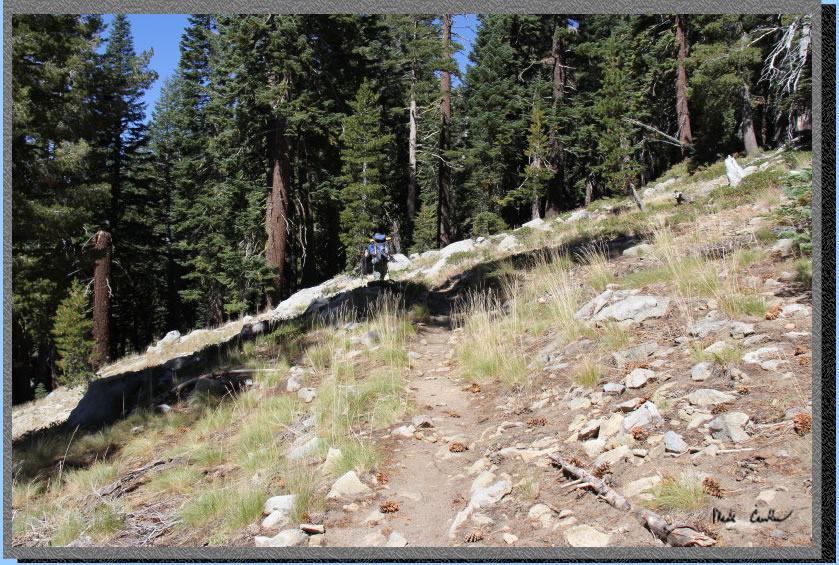
Here is Eric leaving me in
the dust. There was more dust in this section, but with only two of
us the dust was not a problem.
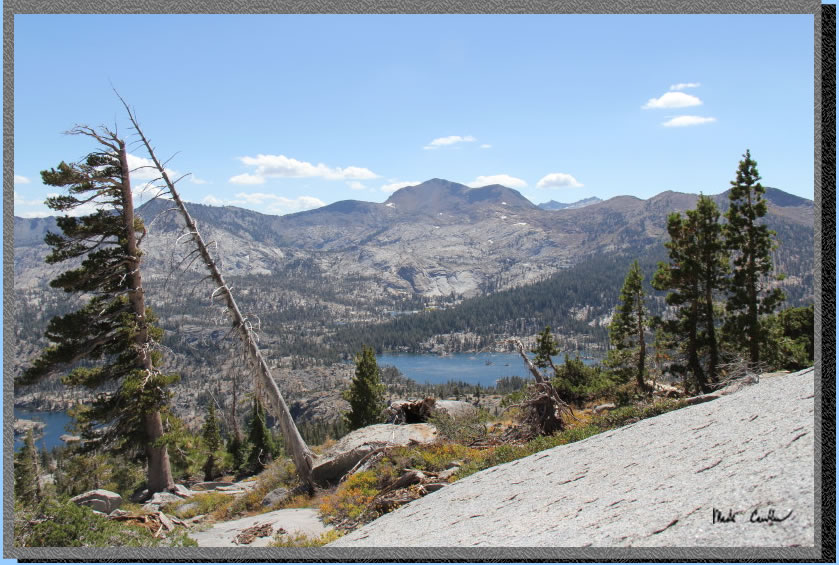
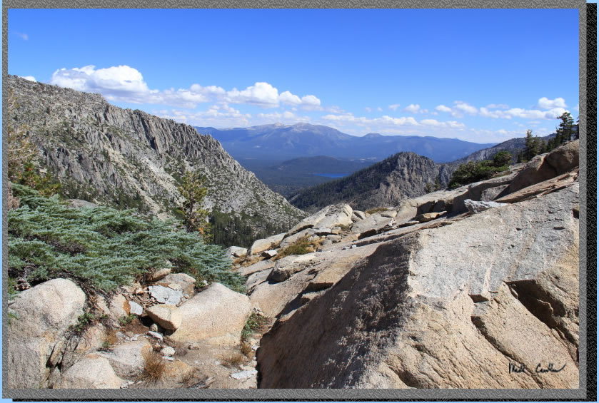
We stopped for lunch below
Phipps Pass to enjoy the view. It was little windy but we were careful
to not let anything, or anyone, blow away. We were able to send texts
from this point. We are not exactly sure why the phones worked here.
We are assuming that the ski resort on the north side of Lake Tahoe
might have a tower on its slopes, as that was the only man made objects
we could see. Phones did not work from the ridge above Fontanillis Lake
the day prior, even though my phone said it had coverage. The shot shows
Lower Velma to the extreme left and Middle Velma in the middle. Upper
Velma is harder to see, but it is the chain of lakes above and slightly
left of Middle Velma. In the full size version of this photo you can
make out Fontanillis Lake and the bowl where Dicks Lake is. It was nice
to sit back and see where we had been hiking the past few days.
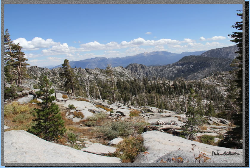
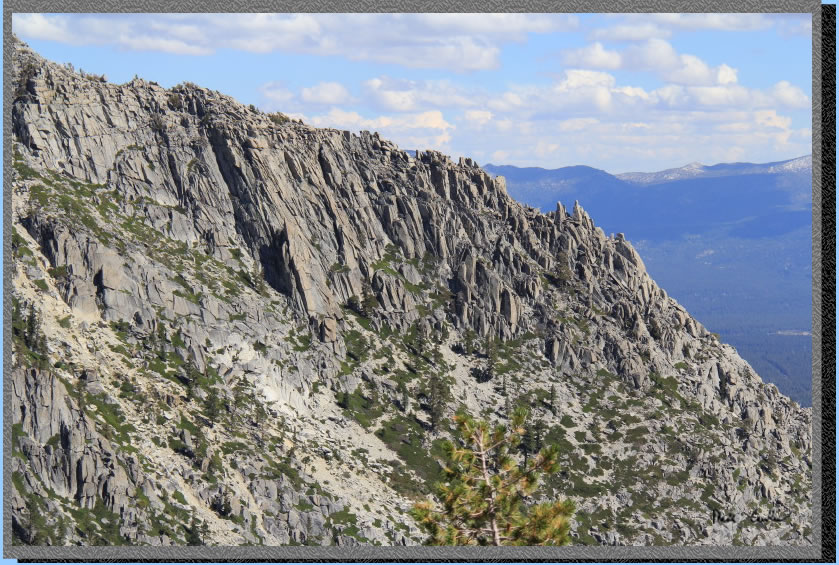
Another view of the Valley
further down the trail, but still below Phipps Pass.
I need to look into trail building techniques because I don't see how
someone could have built this section without dynamite, or many troubled
youths...
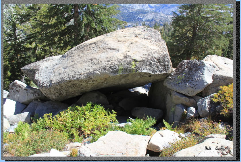
Phipps Peak, in image below,
is a bunch of granite boulders just waiting to crush you at Phipps Pass
below. We didn't linger through here.
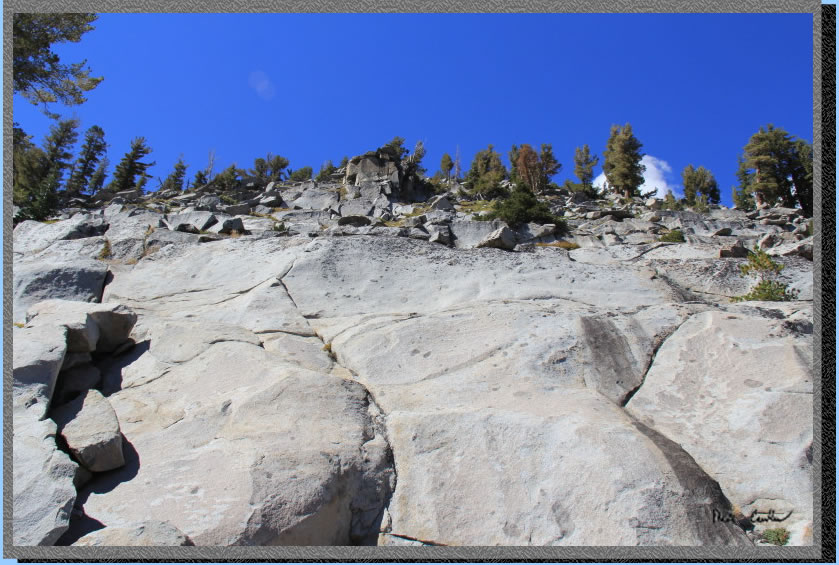
Many boulders have fallen
in this section leaving some interesting, and precarious looking setups.
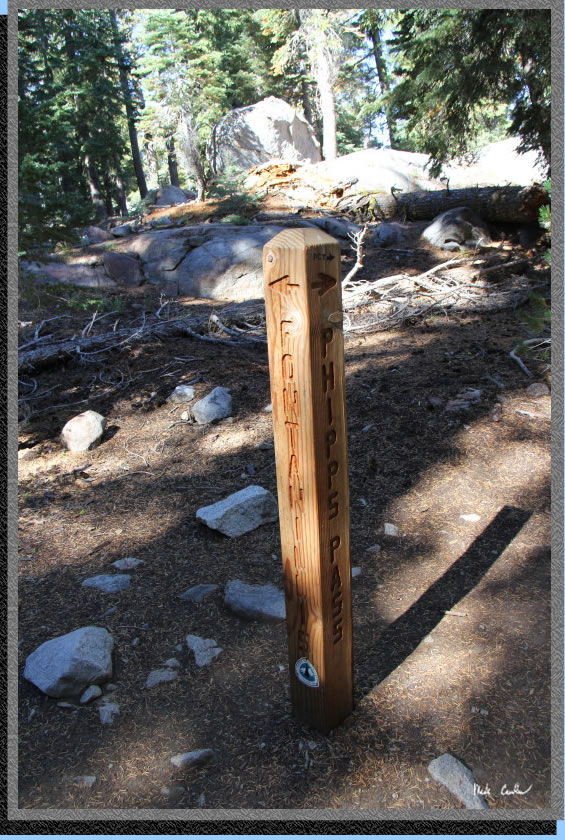
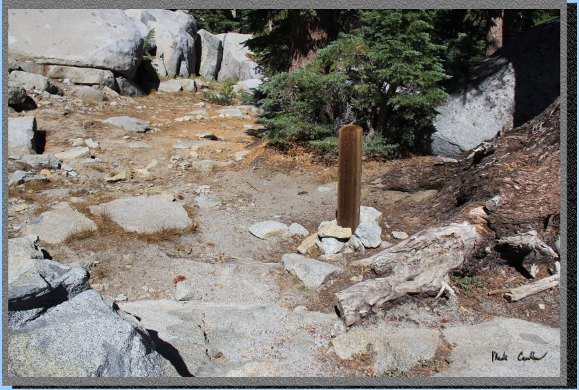
This marker is the actual
Phipps Pass marker. You will swear that Phipps Pass is sooner than it
is (we did).
It is downhill now to Rubicon
Lake (thank goodness).
We had one trail runner pass us through this section. Crazy that someone
even thought of creating a trail through this section of granite. You
have to hike it to believe it. Fallen Leaf Lake can be seen in the distance.
I took this shot of the ridge
we saw beyond Eagle Lake the first day. So much granite out here.
Grouse Lakes can
be seen below. The trail stays above them as Rubicon sits above them
and to the left of this shot. 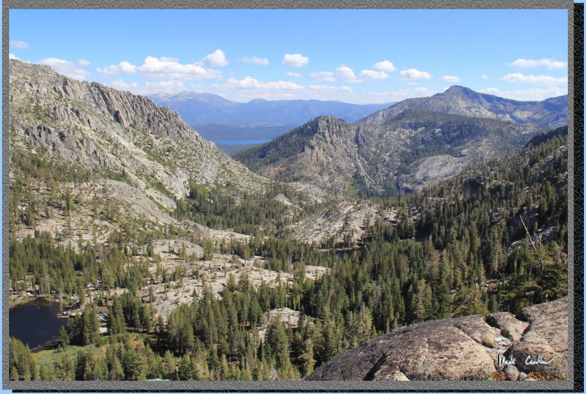
We finally got out
of the granite, giving our feet a much needed break. It
was certainly nice to be amongst the trees again. 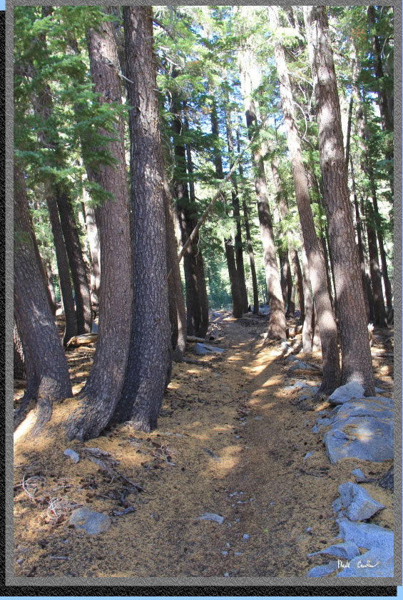
Rubicon
Lake is close now. Not a lot of sites around this small lake. I have
camped at it many years ago and found my site on the west shore slightly
above the lake. There is a decent sized site on the southwest shore
as well. This is a smaller lake, but offered me some nice warm swimming
on my last visit here. 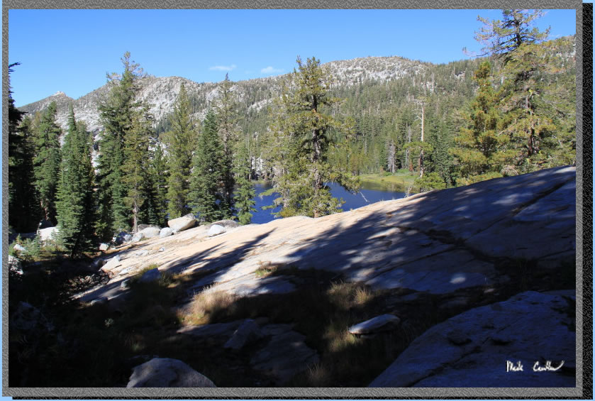
We
quickly passed Rubicon Lake and headed down to Stony Ridge Lake. Unfortunately
the good sites for Stony Ridge lake are on the northeast side of the
lake, so we still had a ways to go. I told myself it would make for
a shorter hike out on day 4... You
can see Rubicon Peak above the Lake. 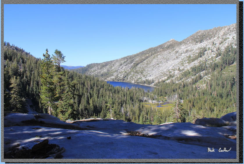
Stony
Ridge Lake up close now. Once
you get down the switchback section between this and Rubicon Lake you
are on a much more gently sloped trail. The wind had really picked up
and was forming white caps on the lake. I had already convinced myself
that a swim was needed on this trip and today would be the last real
chance.
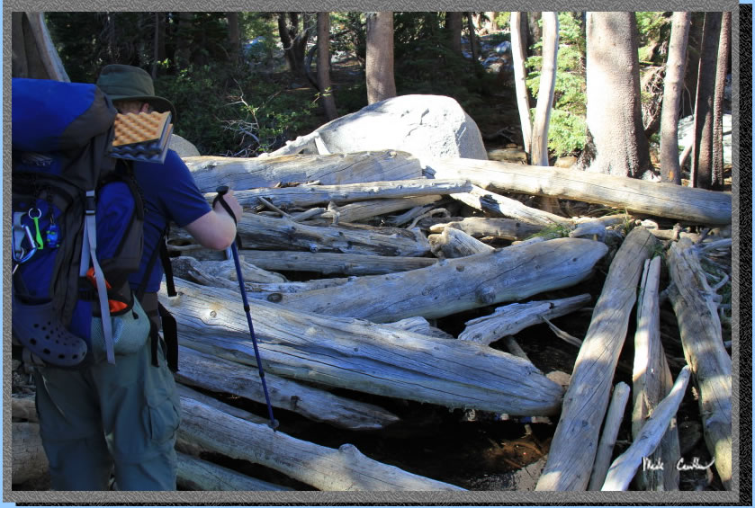
We
decided against crossing on top of the dam as the center had a large
boulder incorporated in it right smack in the middle. The boulder is
sheer on one side, so a little hard to traverse for two weary backpackers.
Instead we did a log crossing on something that resembled a large scale
beaver dam.
We
found a barely legal site above the lake on the northeast side. We did
a quick swim but didn't stay in long because of the wind. The lake wasn't
exactly warm either but it was nice to wash off the past 3 days trail
dirt. No, we didn't use soap but simply rinsed. We had to drink this
water later! We were able to get a site that had a sheltered spot to
sleep out of the wind, without the tarp. Besides a squeaky tree, and
a few ants that preferred to sleep in sleeping bags, it was a good night.
Very windy at times throughout the night. Here is the lake that afternoon
before the swim. 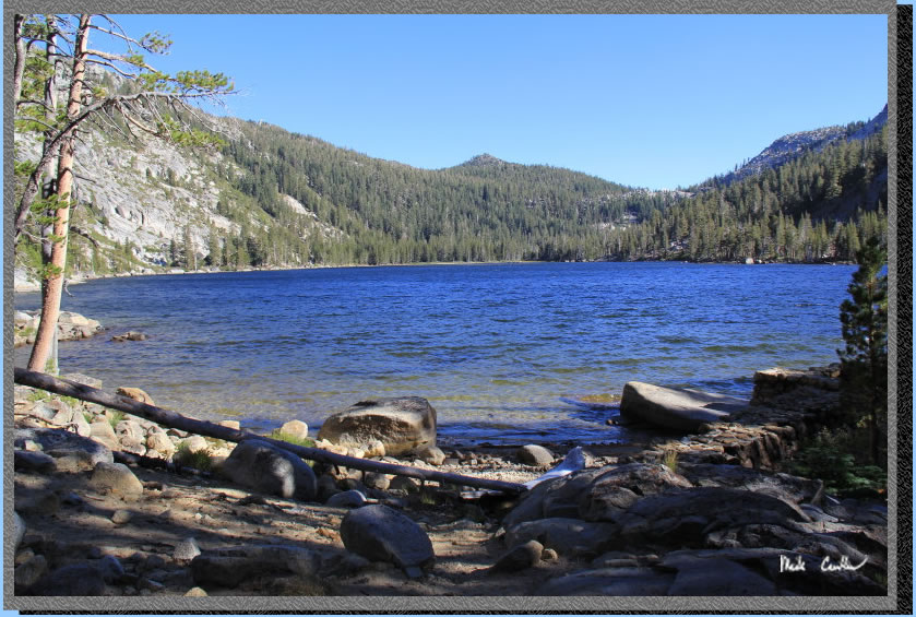
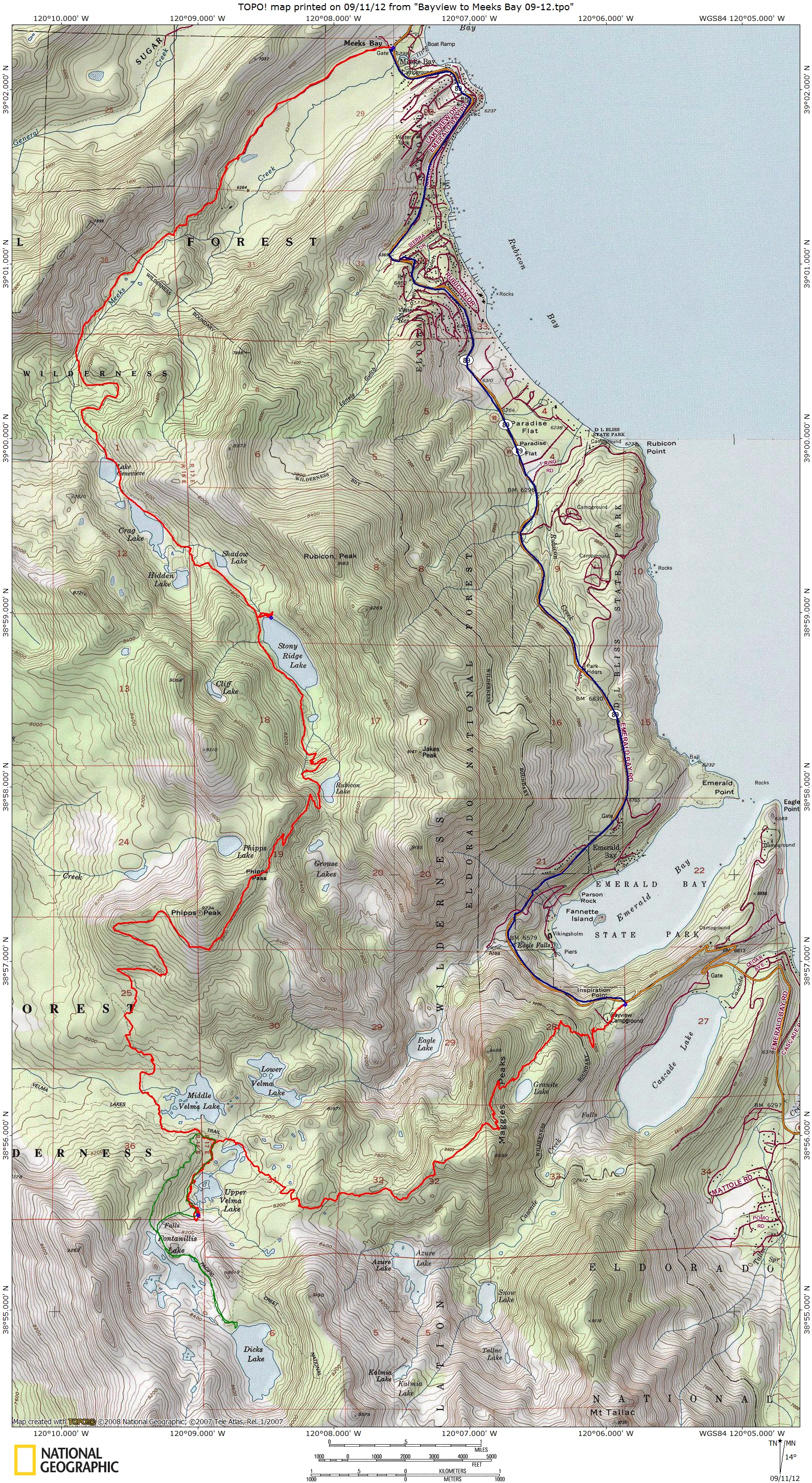
Continue to Page 4 by
clicking here. Scroll down for map and elevation
profile.
Red line shows the
section we hiked with packs.
Green line is day hike on day 2.
Blue line is shuttle back to car.
Elevation profile below map.
Click on map or profile for larger version.
.
(back to top)
(take me back to trip description Day 1, Day 2, Day 3, Day 4 )