![]()
Leo and I were
long overdo for a backpacking trip. It always seems hard to get away
for a trip during the holidays but we wanted to get a February trip
in since a snow trip was not looking like a possibility this year. As
I am writing this the Sierras are getting snowed on, finally, but still
not enough snow if you want to carve out a kitchen or a snow shelter.
I wanted to do something not too far 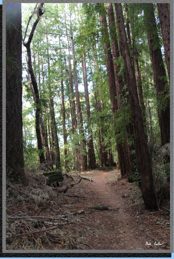 from home, but something new, so I found The Forest of Nisene Marks
State Park after some online searching. The few reviews I found of the
trail seemed good, but getting details from a ranger proved difficult.
I looked at other options in the area as backup plans but could only
find Castle Rock. It seems that all of the
other trail camps in the area are closed for the season. I left a message
for a ranger at 831-763-7064 and a nice ranger called me back on the
weekend. She took my information to give to the ranger in charge of
the Forest of Nisene Marks SP since I would be parking overnight but
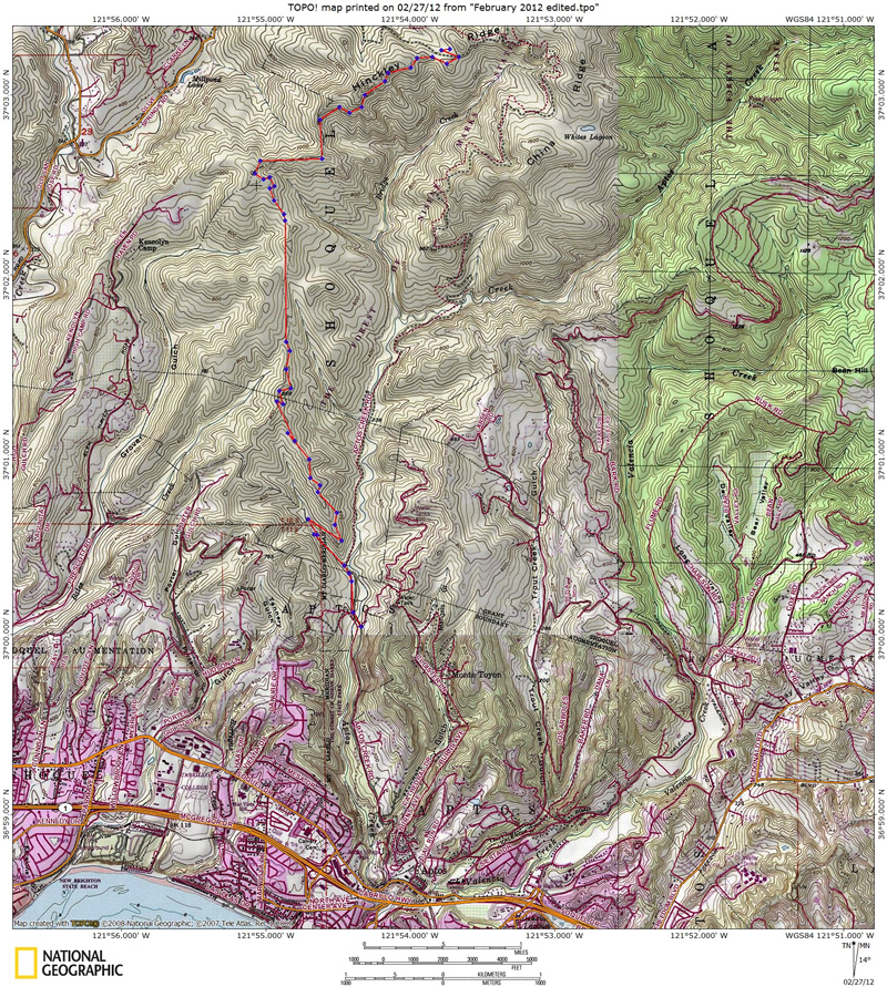
reservations are not required. The trip from trailhead to camp was about
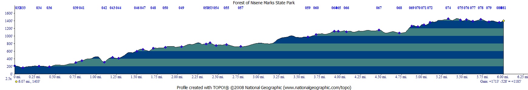
6 miles, see map below. The direction to camp is
generally up and well covered it second growth redwoods. We had a forecast
that included the likelihood of rain that night. (Dave, not just redwoods
dripping on us but actual rain.) This is a dry camp with no real water
possibilities along the way (except for a creek almost at the start
of the trail). We packed in extra water for that evening at camp and
the way back out. We both packed too much but you don't want to be short
on water 6 miles in either. The trail camp lists 6 spots in the official
map/guide but a tree took out site #5 and site #6 is missing (or
really hard to find). Tables are provided at each of the 4 sites still
remaining with an outhouse and trash can for the camp and trail goers.
There is one site right on the outhouse and the others spaced around
it. Site #4 is the one furthest away. All sites are sloped slightly
but the entire trail camp has great redwood tree cover. Reviews online
cited the trail to be overgrown in spots. It is slightly overgrown in
spots but I did not see any poison oak (although not the best time of
year for it) so not a big deal. The one downside to this trail is that
bikes are prohibited from using the trails (signs posted) but many choose
to use the trail against the rules. The trail is predominately a narrow
single track with many sections steep on both the uphill and downhill
side so if a fast moving bike approaches there is no where to safely
get out of the way. All the bikes we saw were headed downhill (from
the trail camp). Bikes are allowed on the fire road and trails in the
demonstration forest to the north so this trail is a cut-through for
them that I am sure gives them an adrenaline rush, especially when dodging
the hikers using the trails. :-(
from home, but something new, so I found The Forest of Nisene Marks
State Park after some online searching. The few reviews I found of the
trail seemed good, but getting details from a ranger proved difficult.
I looked at other options in the area as backup plans but could only
find Castle Rock. It seems that all of the
other trail camps in the area are closed for the season. I left a message
for a ranger at 831-763-7064 and a nice ranger called me back on the
weekend. She took my information to give to the ranger in charge of
the Forest of Nisene Marks SP since I would be parking overnight but
reservations are not required. The trip from trailhead to camp was about
6 miles, see map below. The direction to camp is
generally up and well covered it second growth redwoods. We had a forecast
that included the likelihood of rain that night. (Dave, not just redwoods
dripping on us but actual rain.) This is a dry camp with no real water
possibilities along the way (except for a creek almost at the start
of the trail). We packed in extra water for that evening at camp and
the way back out. We both packed too much but you don't want to be short
on water 6 miles in either. The trail camp lists 6 spots in the official
map/guide but a tree took out site #5 and site #6 is missing (or
really hard to find). Tables are provided at each of the 4 sites still
remaining with an outhouse and trash can for the camp and trail goers.
There is one site right on the outhouse and the others spaced around
it. Site #4 is the one furthest away. All sites are sloped slightly
but the entire trail camp has great redwood tree cover. Reviews online
cited the trail to be overgrown in spots. It is slightly overgrown in
spots but I did not see any poison oak (although not the best time of
year for it) so not a big deal. The one downside to this trail is that
bikes are prohibited from using the trails (signs posted) but many choose
to use the trail against the rules. The trail is predominately a narrow
single track with many sections steep on both the uphill and downhill
side so if a fast moving bike approaches there is no where to safely
get out of the way. All the bikes we saw were headed downhill (from
the trail camp). Bikes are allowed on the fire road and trails in the
demonstration forest to the north so this trail is a cut-through for
them that I am sure gives them an adrenaline rush, especially when dodging
the hikers using the trails. :-(
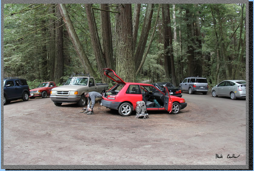
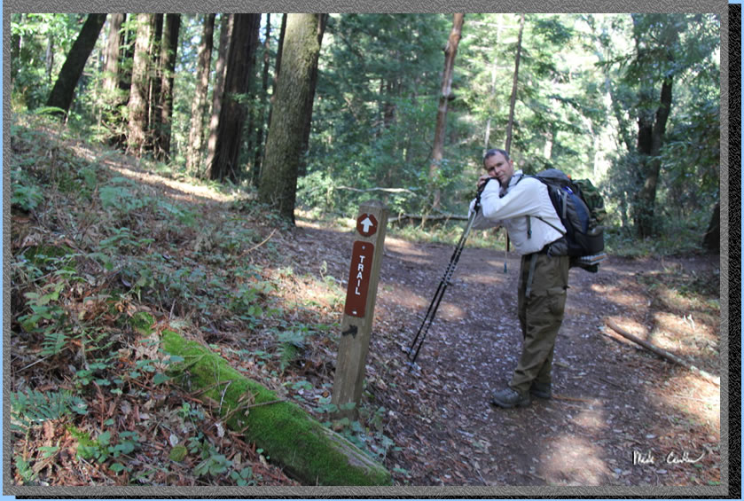
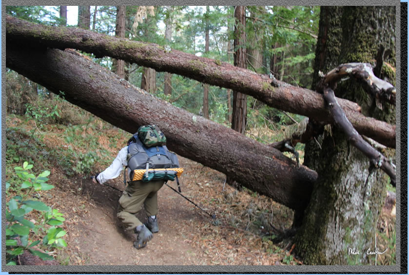
We took Leo's
red Mazdaratti on this trip as it hadn't been out of the garage in a
while. Here is Leo gearing up for the trail ahead. The trailhead was
a little difficult to find (partly because I was too busy talking to
properly navigate). To get to the trailhead from Santa Cruz travel south
on highway 1 to the town of Aptos. Take the State Park Drive exit and
take a left so that you are headed north towards Soquel Drive. Take
a right on Soquel Drive and after you cross some train tracks look for
Aptos Creek Rd and a sign for The Forest of Nisene Marks State Park
on the left. It looks more like a driveway, or entrance to shopping
center, than a road but you cross over the tracks past a bike shop and
head past some homes on your way to the park entrance. There is one
hairpin curve before the entrance. We chatted with a ranger at the gate
who actually knew less about the trail camp then we did (This was our
first time here). He had us read over the rules for the trail camp but
did not actually make us fill out anything even after we asked him if
we should since the rules we were reading had previous campers information
at the bottom of it. Rules were typical: leave no trace, no fires, camp
stoves only, no water at camp so bring some, . nothing out of the norm.
We were going to ask the ranger more questions but after he showed us
how little he knew about the camp we decided that further questions
were pointless. We paid our $5 each for the night and another $5 for
a map. Decent map for the price. Parking was pretty limited due to the
popularity of this trailhead on a Sunday.
So this time of year they
have the "winter gate" locked so you have to park at George's
Picnic Area. There is a pit toilet but nothing else at this trailhead.
We decided to take the most direct route to camp since we were carrying
quite a bit of extra weight in our packs so we chose to use the West
Ridge Trail. To get there you have to head north on Aptos Creek Road.
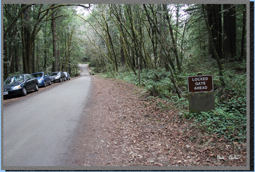
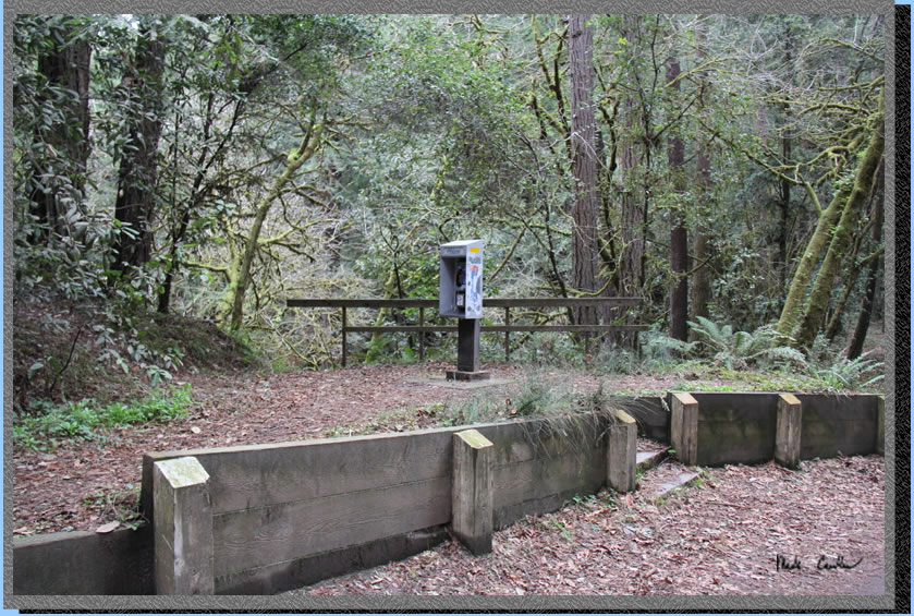
Before the locked gate, but
after the bridge over Aptos Creek, you come to a payphone. I decided
that it was worth taking a picture of this dying breed.
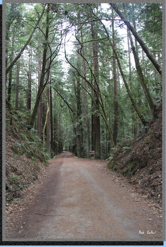
Here is a shot of the road after the locked gate. We were happy to see
that there was a gate and that it was locked. Although we both enjoy
backpacking it would have made our packs seem heavier if we came to
the gate and discovered that we could have parked closer to the trail
we were seeking. You can tell by this shot that the trail is well covered.
This whole area was clear cut between 1883 and 1923 and then "allowed"
to re-grow. Most of the trees are second growth redwoods with some eucalyptus,
oak, madrone and manzanita mixed in. One recent event that happened
here was the Loma Prieta earthquake centered in Aptos Canyon in 1989.
You can take a trail right over to it. Sadly it is kind of out of the
way so it was not on our itinerary for this trip
Assuming you don't get engrossed
in conversation and end up going too far to the north along the road
and find yourself at Mary Easton Picnic Area just to have to turn around
and head back, you should see the trailhead on the left after you cross
over a small creek. In our defense the sign is off the road some so
you could miss it. Notice the sign on the left stating no bikes, dogs,
fires or smoking.
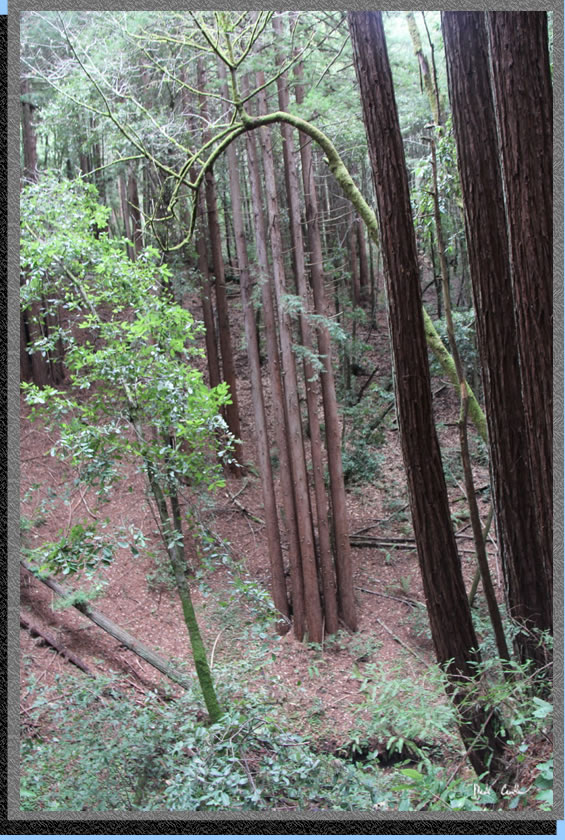
The trees along this creek
were amazing. Redwoods can re-grow from the stumps of old trees through
a process called sprouting. The offspring are genetically identical
to the original tree and the usually form a ring around the original
trees location. Here you can see that taking place with some erosion
underneath.
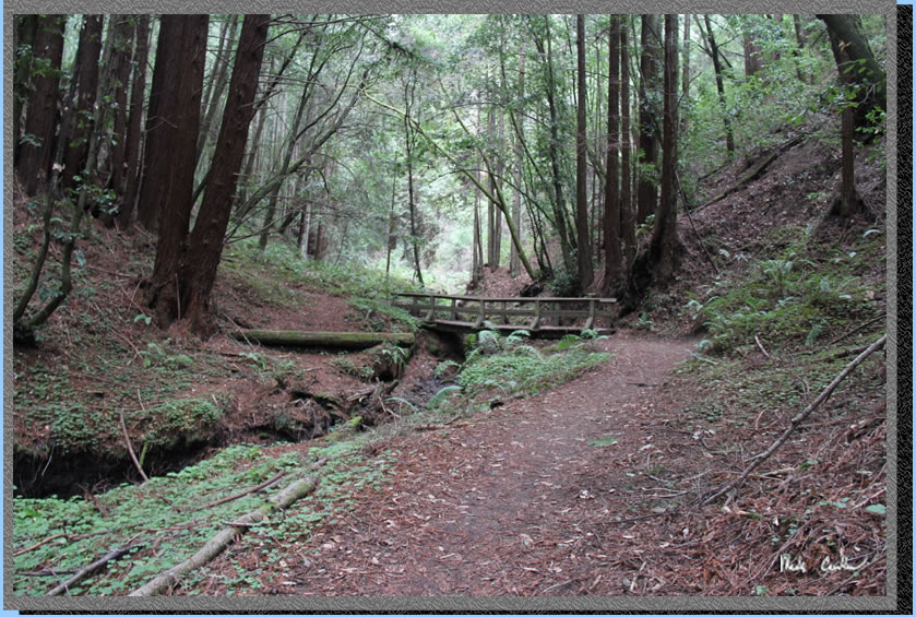
The trail follows the creek with a bridge to help you over. The creek
was more of a trickle on the way in but was flowing much better on the
way out after just a little rain that night and the next morning. I
imagine that a bridge could be needed when it really is wet up here.
Here is another shot of a
second growth (sprouted) ring of trees. The trail actually goes right
though a different ring but it was hard to capture it on film. Some
things you just have to experience in person.
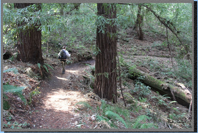
The trail continues in a
gentle up for the most part. Here is one of the more open sections.
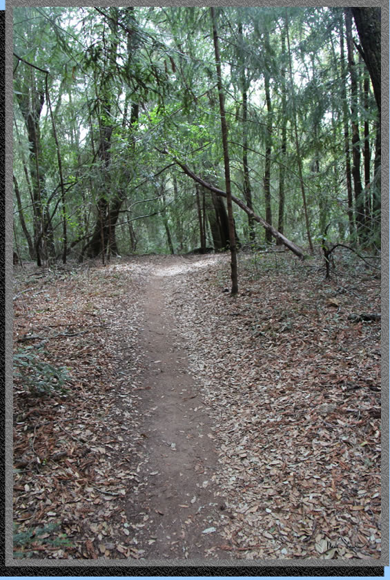
Most of the trail is through redwoods and this shot gives you an idea
of what the majority of the foliage looks like. Hiking in the redwoods
is amazing but I can't help but wonder what it looked like before it
was clear cut. It must have been a lot of work to get big trees out
of these canyons as well.
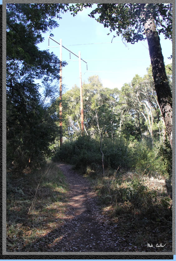
One spot where the forest opens up is where there are some power lines
that go right through the middle of this park. It looks like a lot of
work to keep the trees trimmed around these lines..
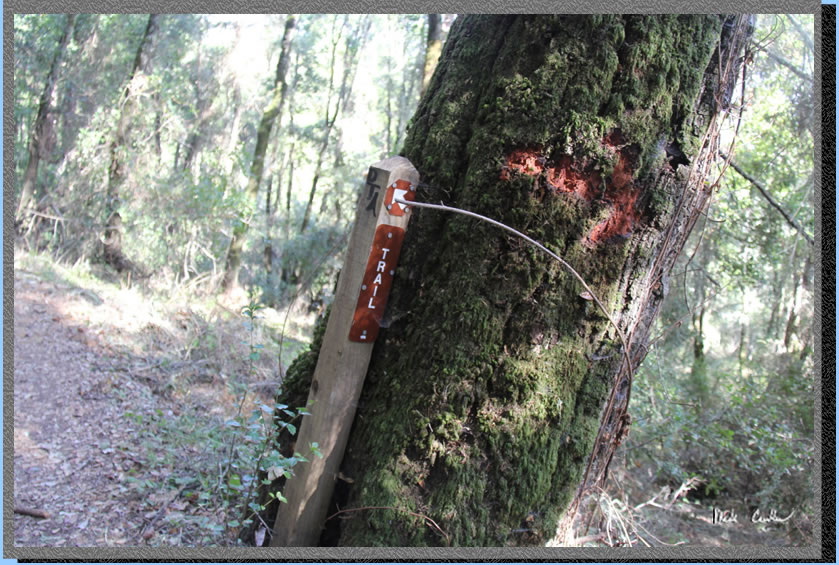
The trail is well marked and pretty clear. You can tell that there has
been some re-routing of the trail over the years so do watch for the
signs so you are using the new path and not the old one..
We made decent time on the way in and encountered many hikers on that
Sunday afternoon. We also encountered many bikes flying down the trail.
I don't understand why the bicyclists are willing to break the rules
when there are many other miles of trails they are allowed on in this
park. There are many sections that they would simply take out a hiker
and many more spots they are wrecking the trail..
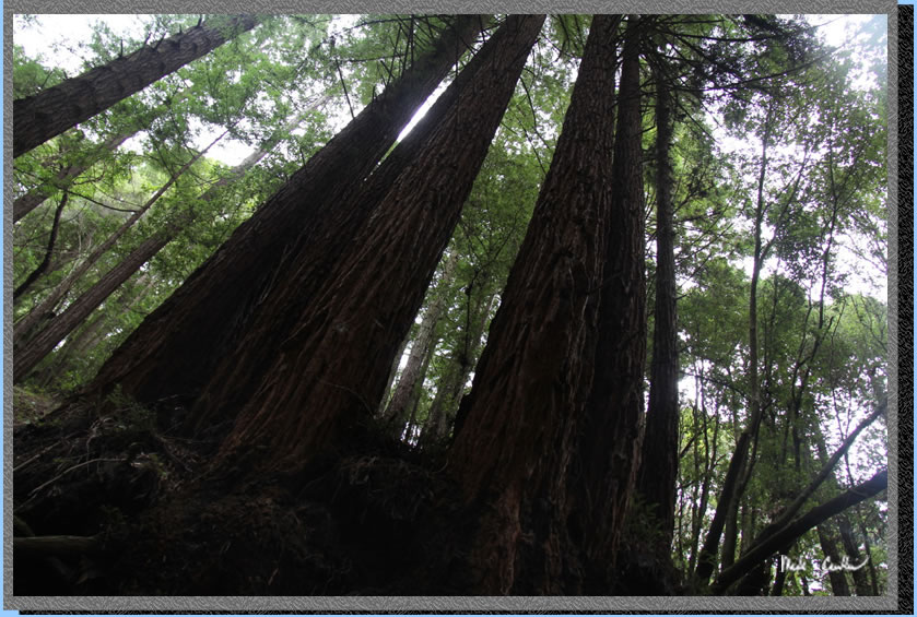
This shot shows the size of some of the second growth in this park.
Simply amazing testament to the resilience of the redwood trees..
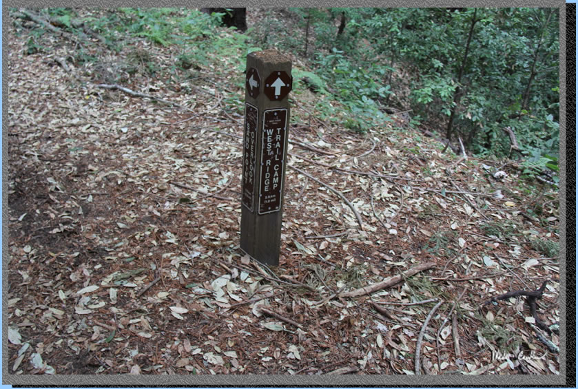
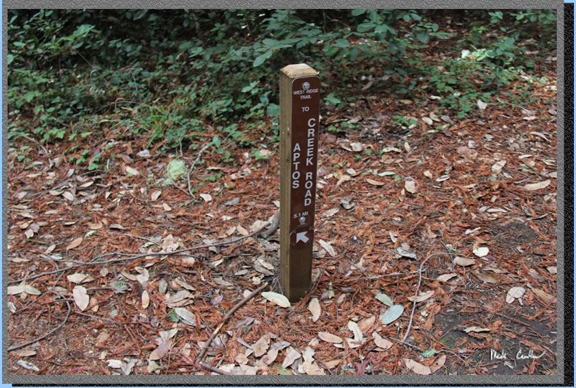
Here is the junction with
Ridge Connection Trail. Stay left at this and the next junction if the
trail camp is your destination.
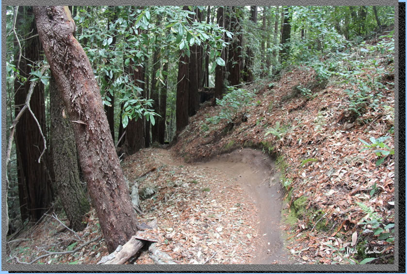
The trail is in good condition
for the most part. There was this tree that could be worked on at some
point this spring to make hiking a little easier.
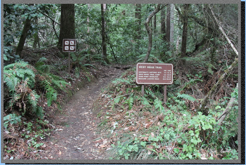
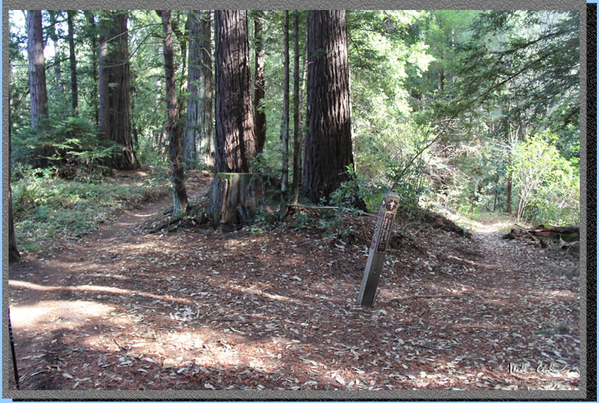
So this is the next junction
with Big Stump Gap Trail. Stay on the West Ridge Trail going towards
the Trail Camp and Sand Point Overlook beyond it.
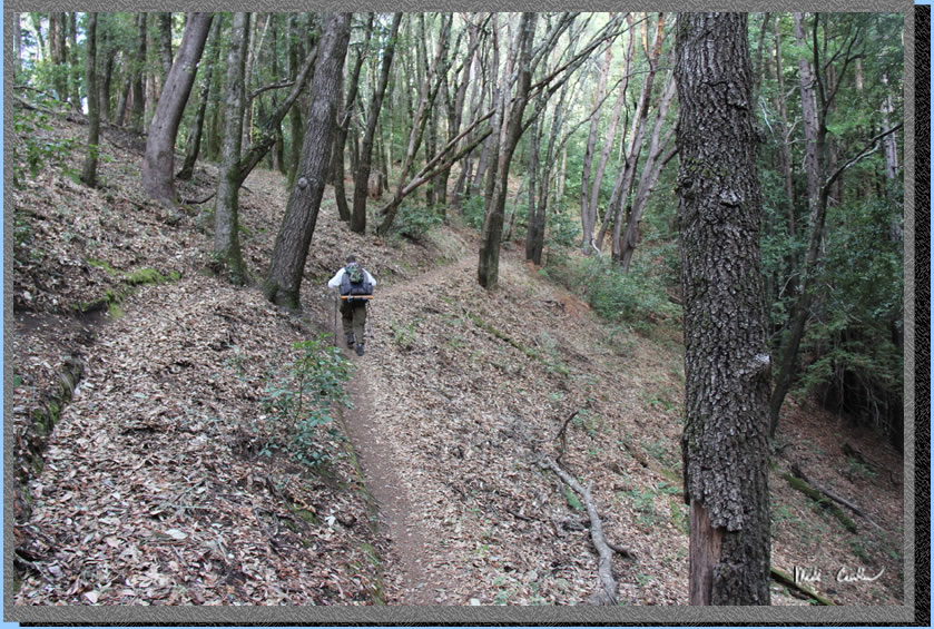
You can see the narrow trail
and steep terrain does not lend itself to fast mountain bikes.
Here is some evidence of
what the bikes are doing to the trail. The trail is actually so narrow
in spots that there are marks on the trees from bike handlebars on the
trees that the trail winds it way through.
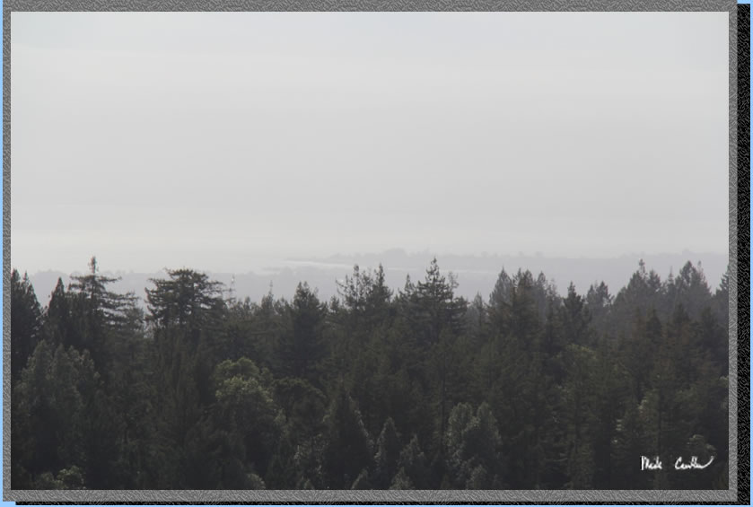
It was a little overcast
that Sunday with rain forecast for that evening so the views were not
ideal. You can make out the coastline though in the distance even through
the clouds. I imagine on a clear day you could see quite a bit of the
coastline.
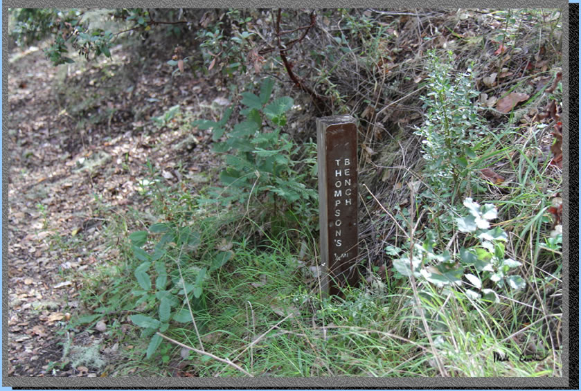
I think that I will have
a bench placed somewhere when I die. It seems like a cool thing to be
remembered by .
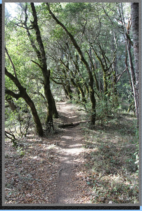
So the trail is not all
redwoods and this shot proves it.
When you reach the Aptos
Creek Fire Road take a left as you are almost to camp now.
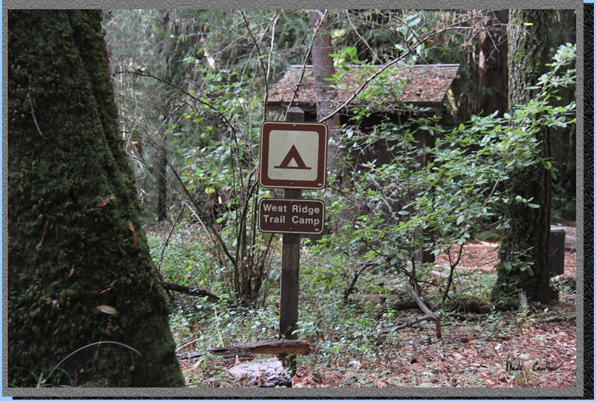
Here is the Trail Camp.
You can see the outhouse in the background. There is one site to the
right and one to the left of the outhouse. The other sites are further
behind and to the left of the outhouse..
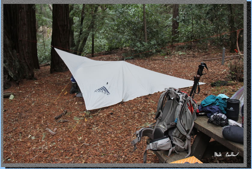
We decided to setup shelter
before the rain hit. I suggested bringing the tarp down low on the right
side should the wind pick up and blow the rain. As it turns out it made
for a low shelter as our heads had to be in the low end that night because
of the slope and the wind never really picked up much. It did keep us
warm and dry that night though. We didn't worry much about the left
side as there was a clump of redwoods blocking any weather on that side.
There was evidence that someone was making some primitive shelters out
here at some point. Maybe a scout troop?
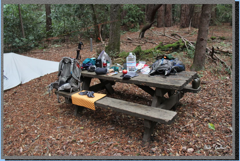
The table shows all of our
gear spread out before we hustled it into our shelter when the rain
started. This is a great trip except you have to pack water in and watch
out for rule breaking bicyclists. I think Butano
SP is slightly better (no water but you could pump some and no bicyclists)
but this is even a lesser known destination than Butano so you are likely
to have it to yourself. You also have this one open year round while
Butano is closed in the winter to camping. More newts at this trail
camp but more banana slugs at Butano. Visit both and tell me what you
think :-)
Red line (with blue dots)
shows the path we hiked. Elevation profile below map shows the way to
the trail camp. Click on map or profile for larger version.
.
(back to top)