


![]()
Page 1 of 2
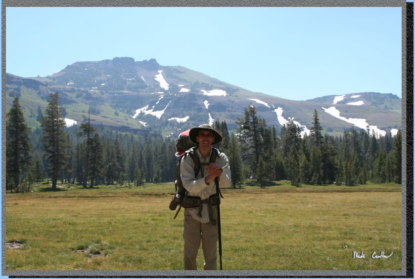
So our friend
Eric was going to do a section of the Tahoe Rim Trail (TRT) 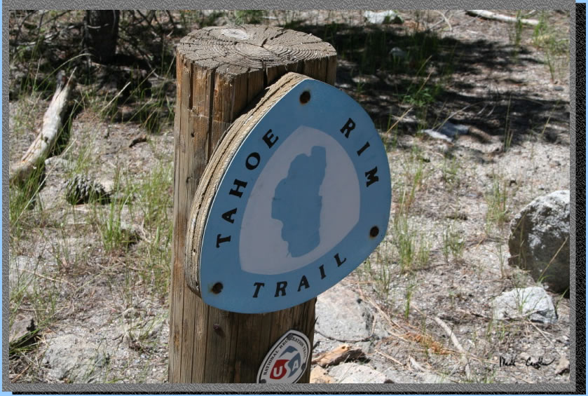 this
summer and Leo and I wanted to coordinate a trip with him for a couple
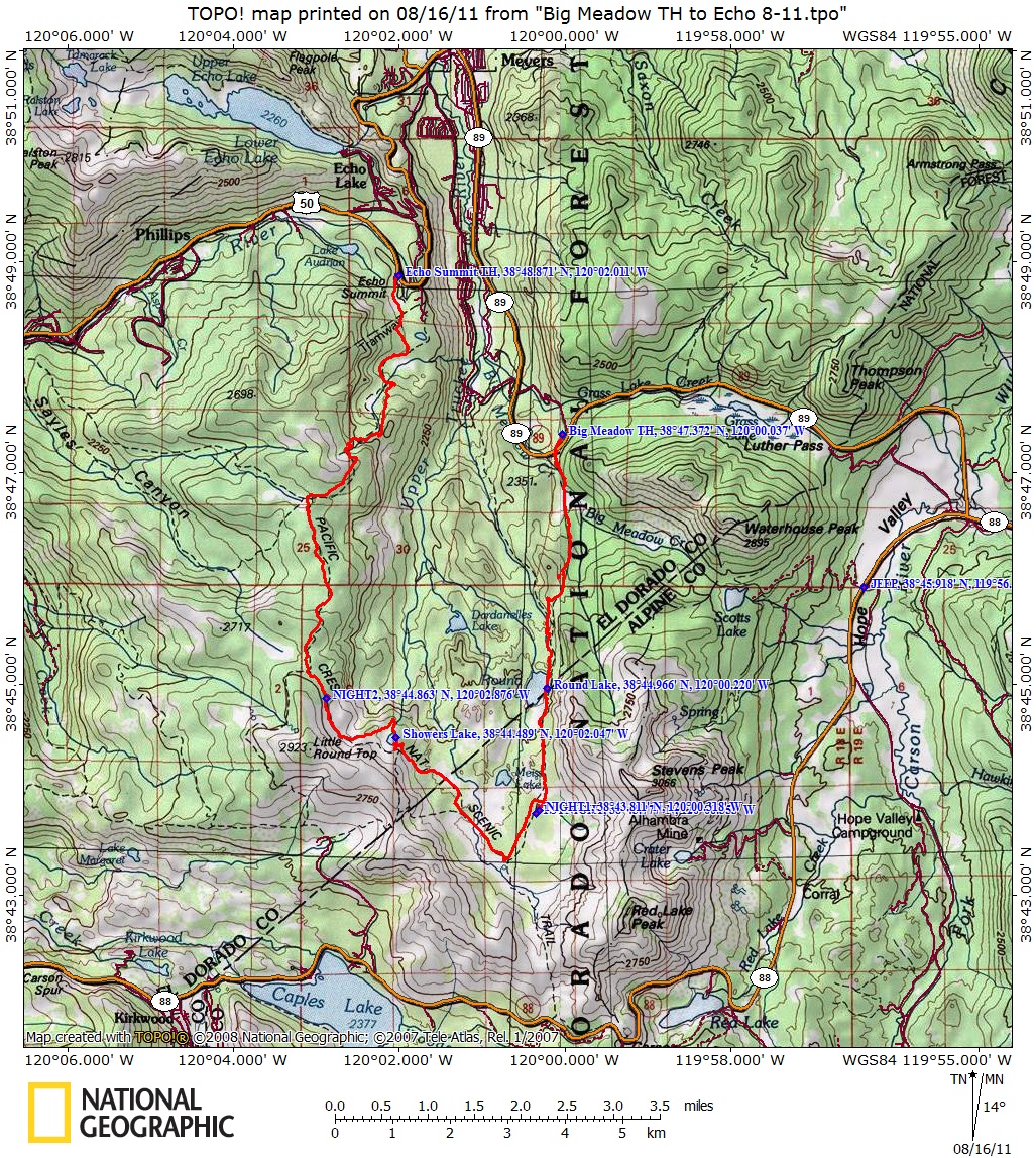
nights. After some serious looking over the maps we decided that the
best option for everyone was to start at the Big Meadow Trailhead in
the Meiss Country Roadless Area off Highway 89. To get to the trailhead
either head east on 50 and take a right onto 89 (south) after going
over Echo Summit and down toward Lake Tahoe (junction is well marked)
or head east on 88 and travel over Carson Pass and then take a left
onto 89 (north) after you pass Blue Lakes Road. We decided to keep the
mileage short since Eric and his college friend Todd were going to be
using this section as their warm up to another week in Desolation Wilderness,
see map and profile below. We decided on 5 miles
as a good average day mileage over the three days. The difficulty with
the 5 mile mileage was there were likely no established sites at those
increments. Since we mainly wanted to have a somewhat level site with
a decent water source nearby we picked spots that looked like they would
fit these criteria based on topo maps. We knew going in that we would
have to be pretty flexible on where we ended up each night as what looks
good on a topo map might be quite different in the field. No permits
are required to hike in this section except for a fire permit. Eric
went up the day before to do a car shuttle and gear drop for his Desolation
portion of the trip and the next day Leo and I met him at the Pacific
Crest Trail/Tahoe Rim Trail junction on the south side of Echo Pass
on Highway 50. We left my vehicle there and took Todd's the rest of
the way to Big Meadow Trailhead.
this
summer and Leo and I wanted to coordinate a trip with him for a couple
nights. After some serious looking over the maps we decided that the
best option for everyone was to start at the Big Meadow Trailhead in
the Meiss Country Roadless Area off Highway 89. To get to the trailhead
either head east on 50 and take a right onto 89 (south) after going
over Echo Summit and down toward Lake Tahoe (junction is well marked)
or head east on 88 and travel over Carson Pass and then take a left
onto 89 (north) after you pass Blue Lakes Road. We decided to keep the
mileage short since Eric and his college friend Todd were going to be
using this section as their warm up to another week in Desolation Wilderness,
see map and profile below. We decided on 5 miles
as a good average day mileage over the three days. The difficulty with
the 5 mile mileage was there were likely no established sites at those
increments. Since we mainly wanted to have a somewhat level site with
a decent water source nearby we picked spots that looked like they would
fit these criteria based on topo maps. We knew going in that we would
have to be pretty flexible on where we ended up each night as what looks
good on a topo map might be quite different in the field. No permits
are required to hike in this section except for a fire permit. Eric
went up the day before to do a car shuttle and gear drop for his Desolation
portion of the trip and the next day Leo and I met him at the Pacific
Crest Trail/Tahoe Rim Trail junction on the south side of Echo Pass
on Highway 50. We left my vehicle there and took Todd's the rest of
the way to Big Meadow Trailhead.
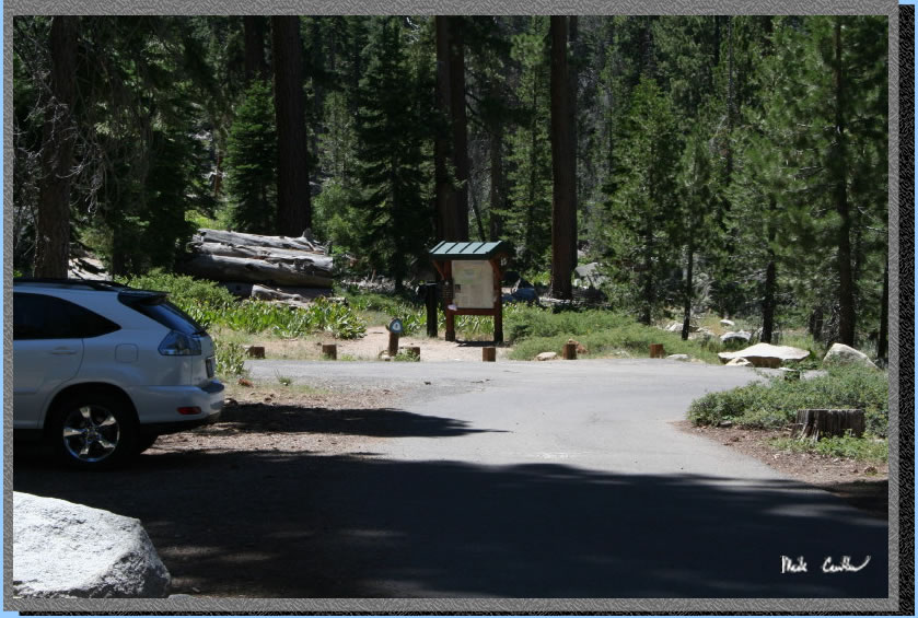
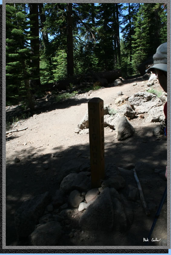
Here is Big Meadow Trailhead.
The parking lot is a decent size but this is a popular taking off point
on the weekends so get there early if you want to stay off the road.
I have seen it overflowing before. There are pit toilets and trash cans
but no water so fill up before the trailhead.The trail starts on the
north side of 89 and immediately crosses the highway. Be very careful
here as the crossing is on a curve and tourists probably don't expect
to see hikers crossing the road here (despite the signs warning them).
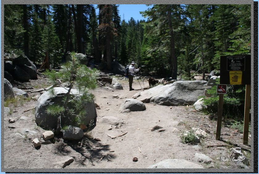
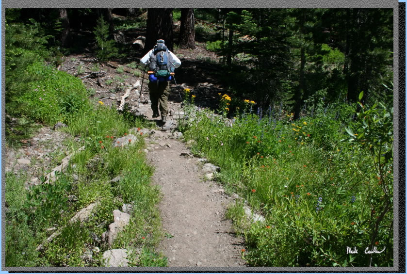
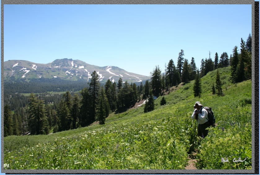
So we made it to the other
side and started climbing the first section. Not much warm up to the
uphill as it starts immediately. It was on this first climb that Todd
let us know that he was battling a bit of a stomach bug/food poisoning
from the day before and felt it was best to bow out of this section.
We were disappointed to see him head back to the car but appreciated
his ability to access his current state and choose the safer course
of action. He told us he would meet up with us at Echo Summit where
he and Eric would continue on. In hindsight we should have told him
that he could "catch" up to us using the Carson Pass trailhead
the next day if he was feeling up to it. The shot below shows the start
of the trail once you cross the highway.
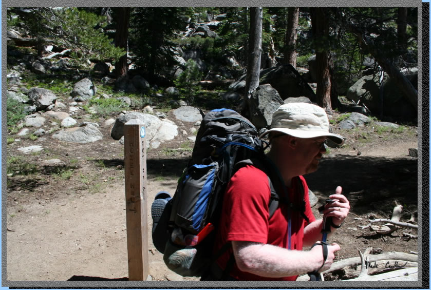
After heading up the first
section the trail levels out and you come to your first junction. You
want to go towards Meiss Meadow, not Scotts Lake.
Not sure why the junction is labeled Meiss Meadow though, as the first
meadow you pass is Big Meadow, at least on my map. I think Meiss Meadow
is the one closer to Meiss Lake (still a ways away). But in any event
you are headed toward a meadow and not a lake at this point so pick
the meadow direction. Here is Eric after we discussed the signpost with
another hiker on the way in and a map check. I have found you can never
review your map too much, although it is sometimes depressing to see
how far you still have to go with a heavy pack and tired legs.
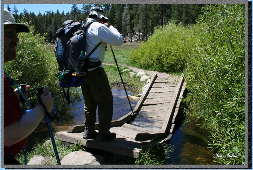
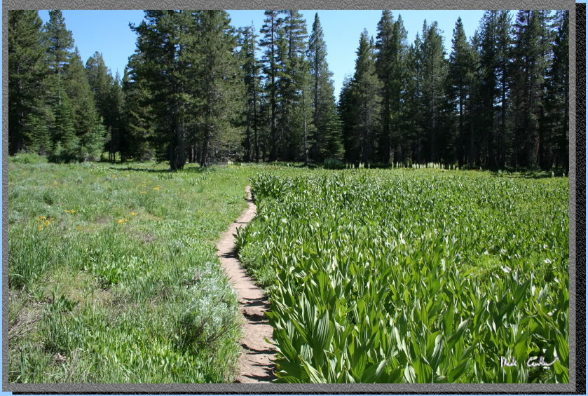
So head through the mostly covered section to Big Meadow. You get to
cross Big Meadow Creek on the way to Big Meadow via this bridge. It
was strong enough to help is across if you didn't stand on it too long
but I hope someone repairs it before next year.
I forgot to mention that some backpackers at the trailhead let us know
that mosquitoes were plentiful around Round
Lake. It is a gorgeous Lake and I recommend it as a quick overnight.
It has great swimming and the rock formations are just cool. Metamorphic
rock is pretty interesting to look at, and if you are into it, climb.
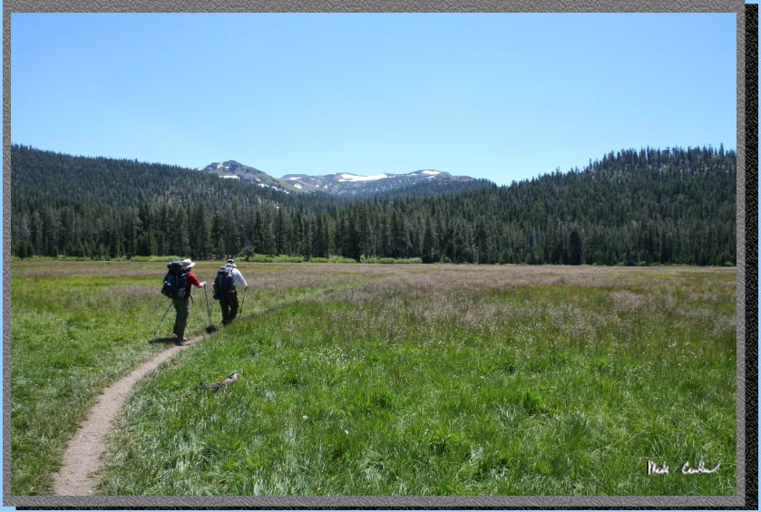
Here we are crossing Big Meadow. This year was especially wet from the
late season snow and generally mild summer so it was no surprise to
hear that DEET and mosquitoes would be common words on the trip.
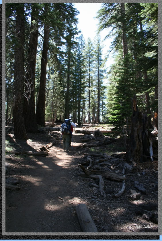
The trail transitions to a decent uphill to the top of a ridge but it
is mostly covered with the grade mild for most of it. Check out the
rocks on the way in. Horses and bikers are able to use this trail as
well so keep an eye or ear out for them. Here we are nearing the top
of the ridge. We saw both varities even on this Wednesday.
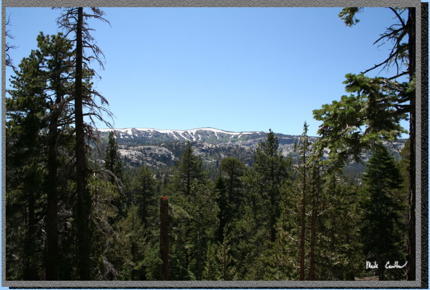
So we started our decent down the ridge via a few dusty switchbacks.
I am glad that the majority of the trail was not this dusty. Dusty trails
remind me of my days in Scouts at summer camp. Here is the view on the
way down. There was a decent breeze on the way down keeping the bugs
away from us. We had already deeted up at this point because those lovely
blood suckers were already out to get us early on the trail.
Here in the next junction to Dardanelles Lake.
Continue on towards Round Lake through a mostly covered section with
gradual uphill.
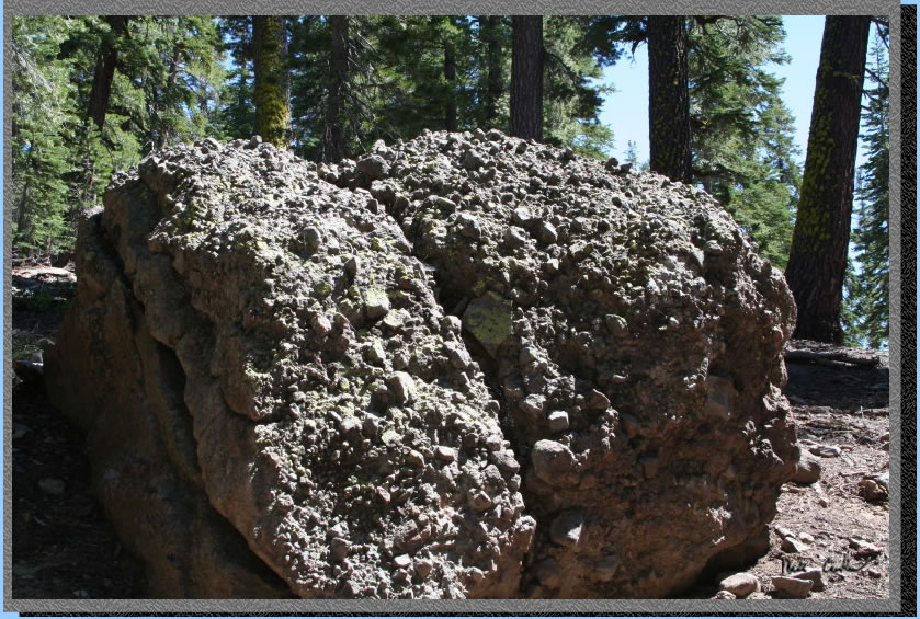
Here is a good example of
the rock out here. It looks a bit like really rough concrete aggregate
but it is naturally made through volcanic action.
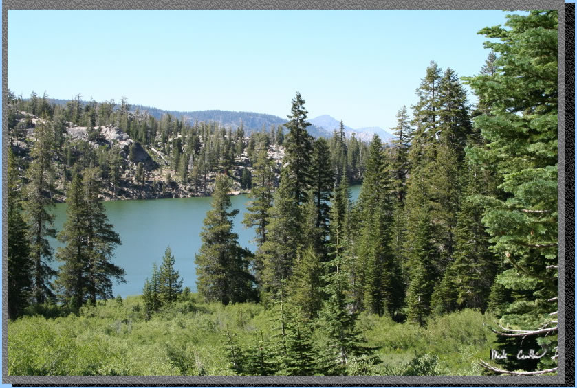
With it getting late in the day and us needing to get 5 miles done before
picking a camp we had to keep on trekking past Round Lake. We stayed
on the east shore of the lake where I grabbed this shot. There are many
campsites around this lake and with the size of the lake you can have
a fair amount camped around the lake before it feels crowded. 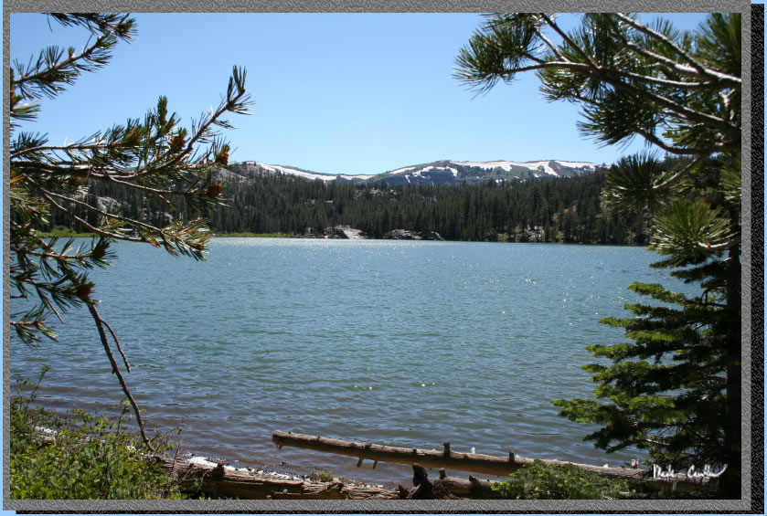
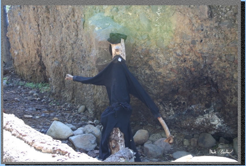
As we traveled around the lake we saw this rather stiff fellow perched
on a log. He wasn't much for conversation so we continued on.
The trail starts to head up after you take a left to head away from
the lake. We had our first taste of the wildflowers through this section.
I am just going to say now that I took a lot of pictures of flowers
but not any really captured what it was like out there. This was one
of those trips you just had to be on to see for yourself. Don't worry
though I did get a few decent shots along the way.
So we left Round Lake behind us (well below us technically). It was
a little weird to see it from this angle as I have explored many areas
around this Lake but never this section of trail.
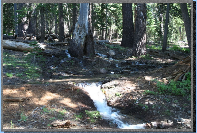
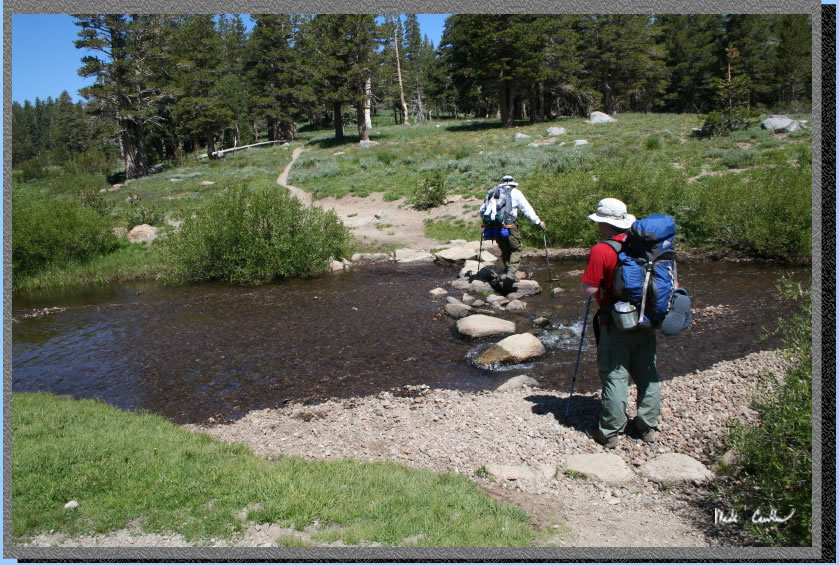
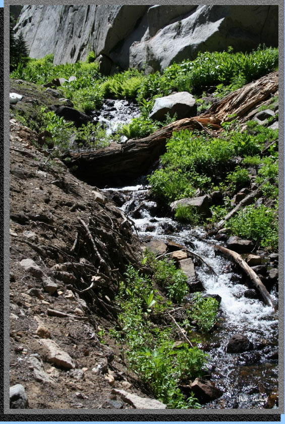
There was plenty of water
still coming out of the hills. None of the crossings amounted to much
as for difficulty but this one was very creative. The water goes right
through a downed tree on the left and around a live tree in the middle
before rejoining at the trail. As you can imagine the sound of it cascading
through the terrain was amazing and not captured here.
The trail was mostly level
after the section to get above Round Lake. It was mostly covered but
this section opened up to a decent meadow. We decided around here to
find a good water source and call it a day (we had almost done our 5
miles at this point).
Another shot of the meadow
above.
I don't have many pictures
of our first night's camp. We moved camp once in an effort to find a
more mosquito free zone but after we moved camp to what I thought was
mosquito free they quickly came back. I still think it was better than
our first camp selection since it was more open. We had a fire and reapplied
Deet so as to ward off the pesky blood suckers. There was plenty of
dry downed wood so we had a fire in no time. Water was probably 1/ 8
mile away but that was OK because when we filtered water those mosquitoes
were bad down there. Did I mention the mosquitoes were plentiful! We
slept in that morning and I don't think we hit the trail until almost
11. But we had all day to hike so it wasn't that big of a deal.
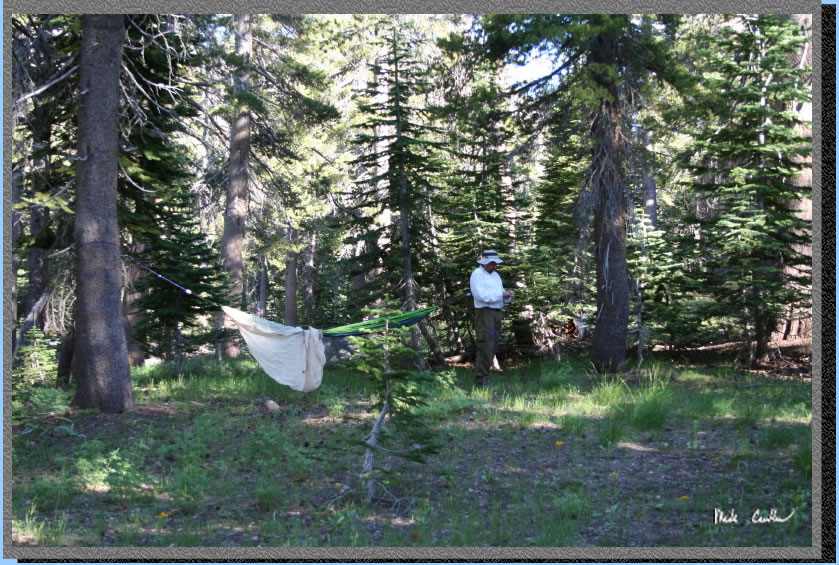
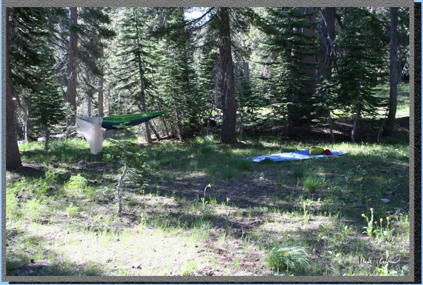
Here is my shot of camp
that morning as we were packing up. Leo is the lucky guy in the hammock,
Eric slept out (well mummified in his bag to keep the bugs away) and
I used my 1 man Sierra Design Lightyear. We were way off the trail and
well away from water. I think I heard people on the trail once before
we left.
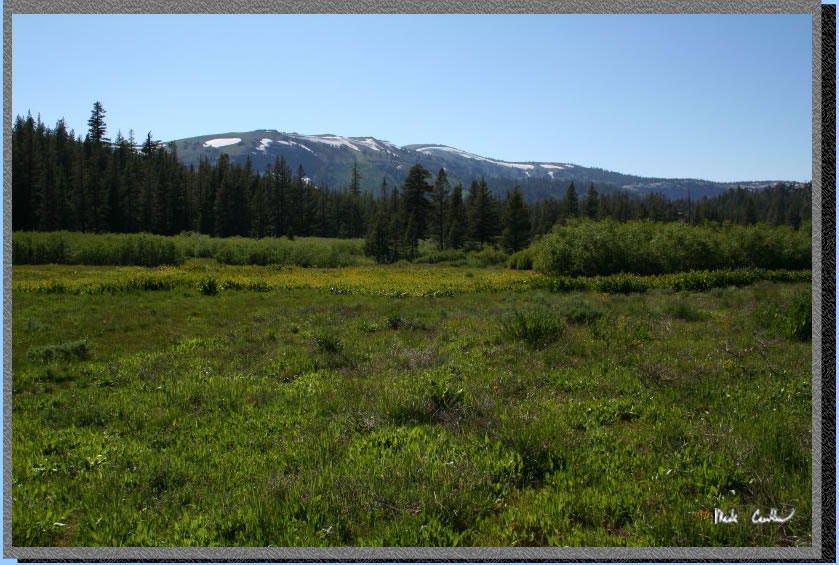
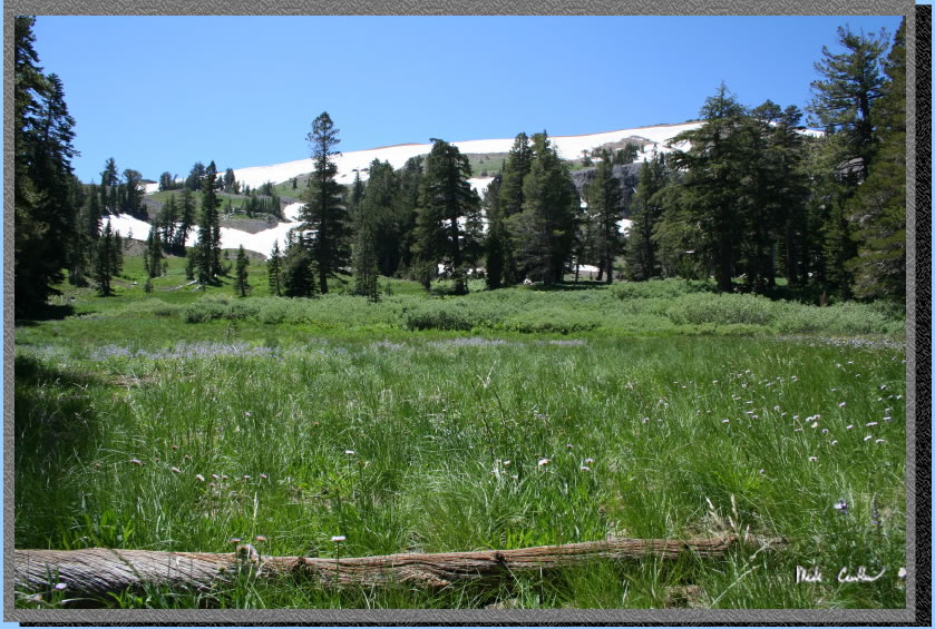
So here is what I really think is Meiss Meadow, or at least close to
it. I had Leo take a shot of me, well actually he suggested it since
my kids always ask if I went on the trip when I show them pictures.
Telling them I was the one shooting the pictures is just starting to
sink in with the oldest. Patches of snow can be seen on almost every
ridge. We ran into just a couple tiny patches on the way in the day
before. Nothing impressive enough to post a picture of, yet.
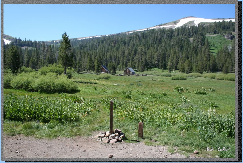
The section of trail from our camp to the PCT junction was level to
slightly downhill. It was really nice with it being covered until the
meadow section. Slight breeze again today but a little more sustained
which was nice. Cabin and barn in the distance can be rented out per
some cowboys we spoke with about 9 years ago, or so. How time flies.
In any event take a right to head to Echo Summit or a left to get to
Carson Pass. We actually had cell coverage the night before so we tried
to get word to Todd that he could meet us here today. Unfortunately
we could not reach him live so we couldn't coordinate it.
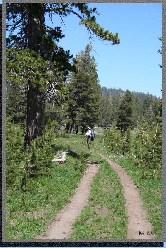
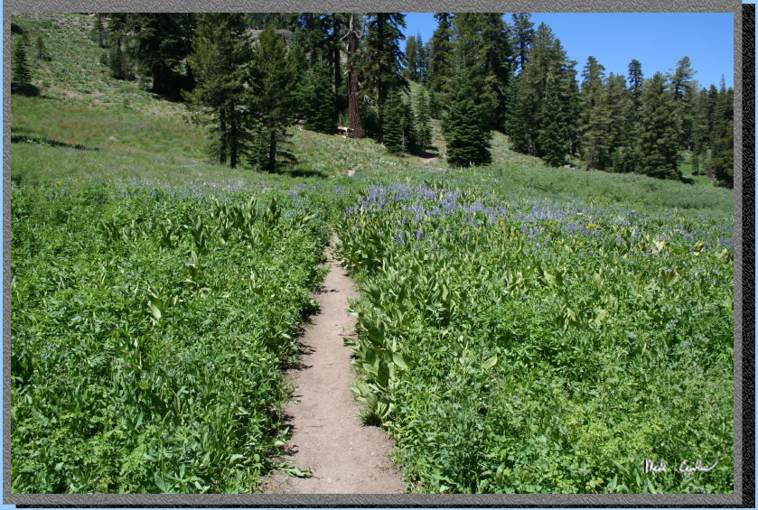
The trail is level through
the meadow. I think this is still Meiss Meadow but I don't know for
sure. All I know is pretty soon you can see Meiss Lake and it appears
to be pretty meadow-e to me. The trail has two to three tracks through
this section.
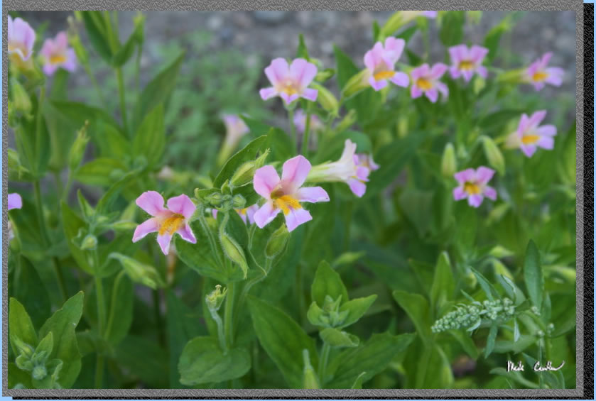
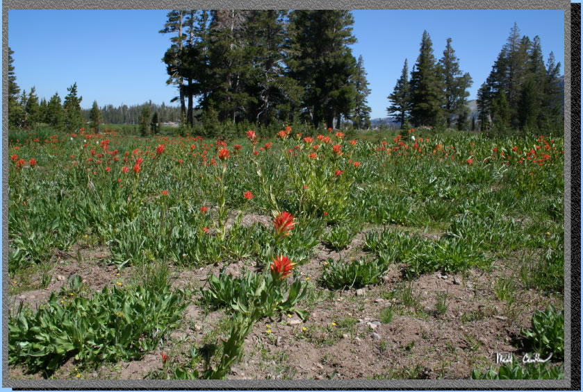
Wildflowers were everywhere which for mid August was just amazing.
Here is the Upper Truckee River crossing. It doesn't look to bad, because
it wasn't. Remember we are up where the river starts close to the snow.
The water was damn cold though.
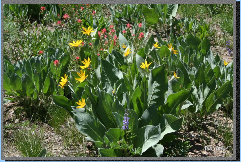
The wildflowers only seemed
to be getting better the farther we hiked on this day. I took this shot
just to try to capture the assortment of flowers on one little section
along the trail.
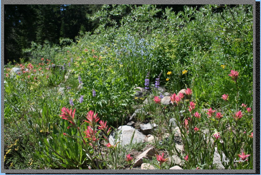
There were lupine, mule ear,
larkspur, paintbrush and corn flower all over the place. You pretty
much had to stay on the trail or be stepping on wildflowers in most
open sections. The trail is mostly up but gentle grade.
Another great wildflower
shot.
Here is Leo taking it all
in. The trail starts to climb a little more now but it didn't seem bad
at all. Maybe the views of the surrounding terrain and flora made us
forget we were hiking at 8,000 feet uphill. Of course I was stopping
all over the place to get pictures as well. My own version of rest breaks
I suppose.
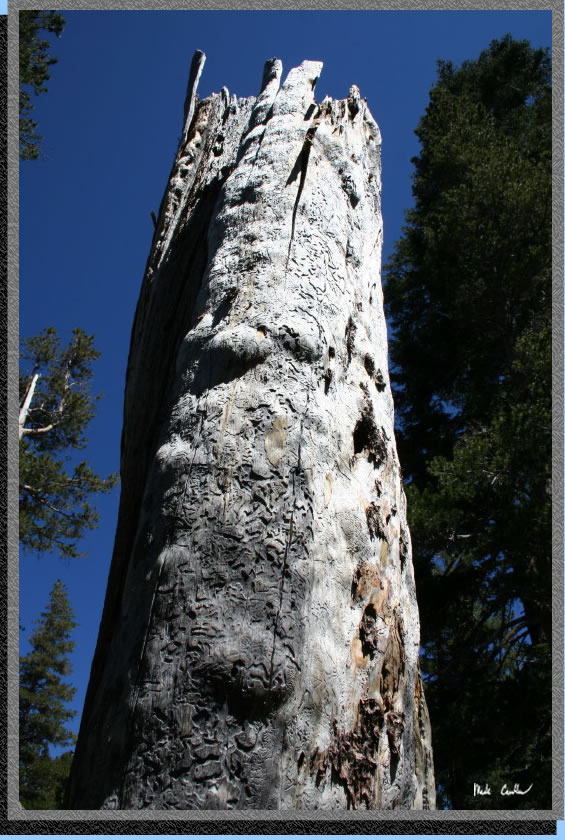
Beetle or some other hungry
bug ate this tree up before the bark fell off.
The snow was getting closer
now as we approached Showers Lake. The final trek up to Showers Lake
is a bit steep and the elevation certainly doesn't help you travel any
faster. Here is a clearing before the steep section.
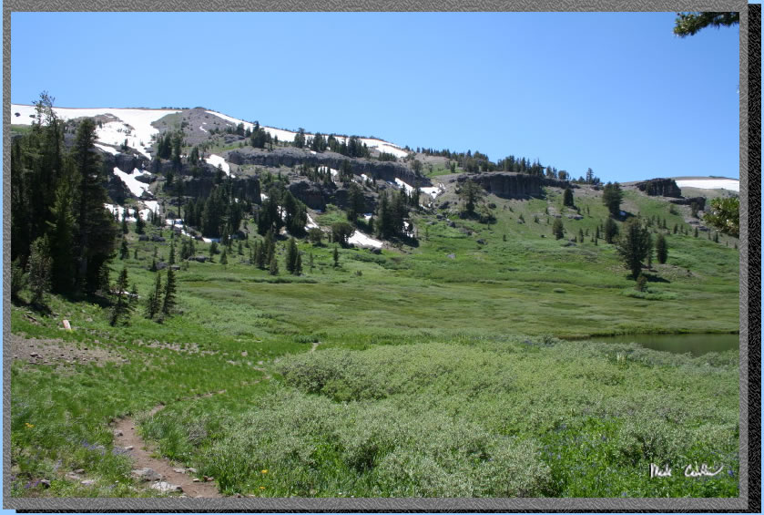
So my picture of Showers
Lake captures the meadow around it and to the west well but Showers
Lake is barely visible. We decided to stop here for a lunch break which
was nice. A word on the route through here. The PCT and TRT, which are
the same trail through this area, have been rerouted to the outlet side
of the lake. Not sure when or why but old maps show it through the section
in this picture along the ridge. You probably could do it but get ready
for marsh conditions. Newer maps and descriptions have you go down to
the outlet and back up that side. It is much rockier but you are doing
much less damage to the landscape traveling over the rocks as opposed
to the original route.The trail to the outlet is well marked.
Here is the outlet at Showers
Lake. It made a great place to filter some nice cold water. I have swam
in the lake before and it is damn cold even after the snow melt stops.
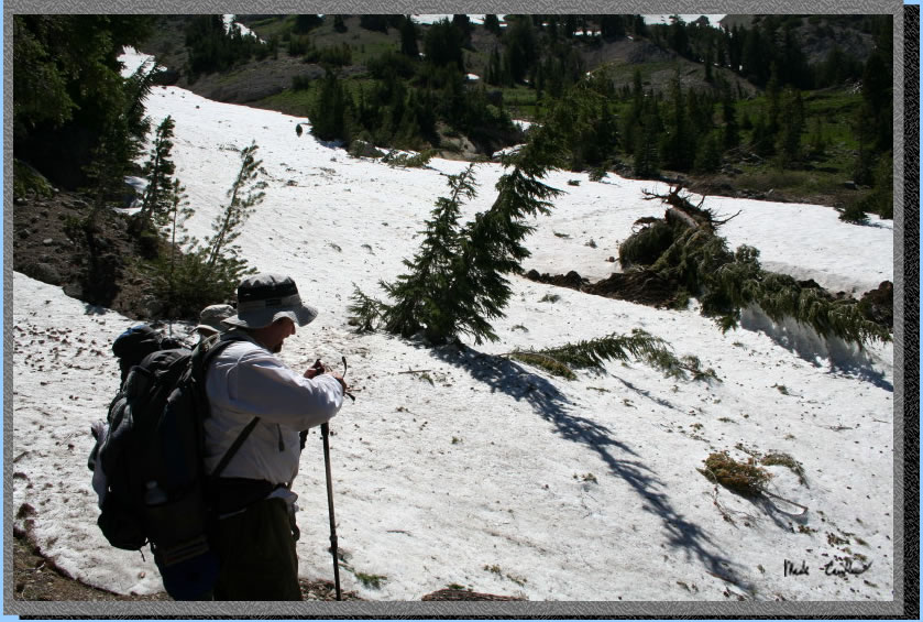
So you could say there is
a little snow still in spots. This is the largest of the snow fields
we had to cross. You could tell this was (I guess technically still
is) an avalanche chute. The downed trees give it away. There is also
a snow feed creek running under this snow field so we crossed it carefully
and quickly. It was late in the day by now so it was mushy enough to
have good traction and also be weaker snow. Here we are getting ready
to make the trek across. Trekking poles can be real lifesavers on sections
of trail like this when traction is a problem.
Continue to Page 2 by clicking
here. Scroll down for map and elevation profile.
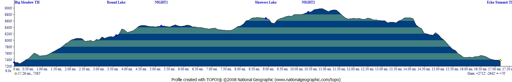
Red line shows the section
of the Tahoe Rim Trail we hiked. Elevation profile below map. Click
on map or profile for larger version.
.
(back to top)
Page 1 of 2