![]()
 Permit
- Desolation Wilderness only allows a certain number of people
per zone per
night. Many zones have more than one lake in them. Seventy percent
of each zones quota can be obtained through the online reservation system
at www.recreation.gov,
the other half are obtained the same day from the ranger station (two
miles east of the Highway 50/89 junction in South Lake Tahoe on Highway
50) or the Taylor Creek Visitor Center (three miles north of the Highway
50/89 intersection). I would get to the ranger station early if
you are doing the same day option. Fees: $5
for the 1st night; $10 for 2-14 nights per adult with a $6 service fee
per permit. (2 nights for 3 people would be $36)
Permit
- Desolation Wilderness only allows a certain number of people
per zone per
night. Many zones have more than one lake in them. Seventy percent
of each zones quota can be obtained through the online reservation system
at www.recreation.gov,
the other half are obtained the same day from the ranger station (two
miles east of the Highway 50/89 junction in South Lake Tahoe on Highway
50) or the Taylor Creek Visitor Center (three miles north of the Highway
50/89 intersection). I would get to the ranger station early if
you are doing the same day option. Fees: $5
for the 1st night; $10 for 2-14 nights per adult with a $6 service fee
per permit. (2 nights for 3 people would be $36)
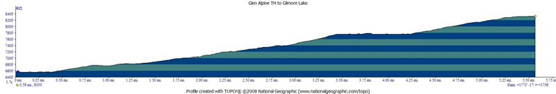
Mileage - ~5 miles to Gilmore Lake (~1,800' elevation gain). map
Camps/Water - There are trash cans and bathrooms at the Glen Alpine trailhead but no water. You could pump from the creek that leaves Lily Lake. Gilmore Lake had plenty of water, as did the creeks (but this winter was crazy).
Hazards - Bears, Lightning, Golden Mantled Ground Squirrels.
NO FIRES ARE ALLOWED IN DESOLATION WILDERNESS (only camp stoves)
**BEAR CANISTERS are REQUIRED in Desolation Wilderness**
-Day 1-
Eric, Dan, and I decided
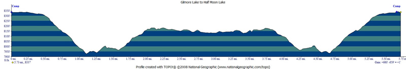
to do a two night trip to Gilmore Lake with a day hike to Half Moon Lake and Alta Morris Lake
on day 2 (map/profile below). This is a popular section
of Desolation Wilderness and even midweek you will not have the trails
to yourself. We decided to head in from the Glen Alpine trailhead. The traditional route to
get to this trailhead you need to head past South Lake Tahoe on Highway
89. Head north past Camp Richardson and then look for Fallen Leaf Lake
Rd on the left hand side. The road in goes along the lake and is very
narrow (one lane). Stay on this road until it dead ends into the trailhead
parking lot. You go by quite a few private cabins and have some nice
views of the lake on the way in. You pass right by the Fallen Leaf Lodge
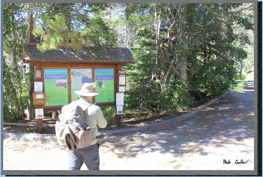
and also the Fallen Leaf Lake Fire Department. Here is a shot of the
trailhead. Parking can be full at this trailhead on the weekends, I
have had to park along the road on the way in to the official parking
lot in the past. We allowed our navigation to route us from Highway 50 and it took us on some narrow rough roads, likely saved us time, but I didn't leave via that route (once was enough). Trails are well traveled and all junctions
are well marked.
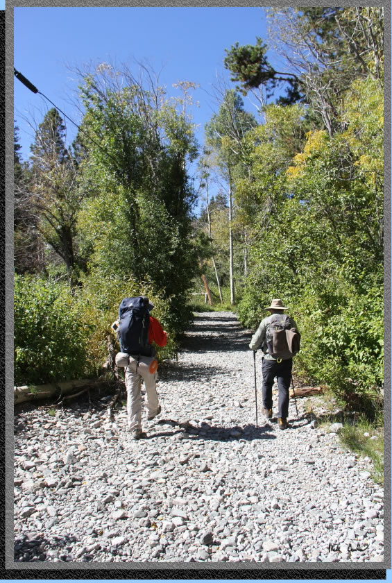
The trail is
gently up along the rocky road on the way in. I am just going to take a minute to do a PSA here. Make sure that even if you have hiked with members of your group a bunch you go over what you should do/expect if a member of your party gets lost/separated from the group. I recommend not getting separated of course, but hypothetically, it could happen. Also check to see if your bear spray is expired before you leave home (why bring expired bear spray). The trail starts on the rocky road past the gate that will likely be closed/locked. Here is Lily Lake you quickly pass on the way in. Weather was cool with a nice breeze (natures air conditioning).
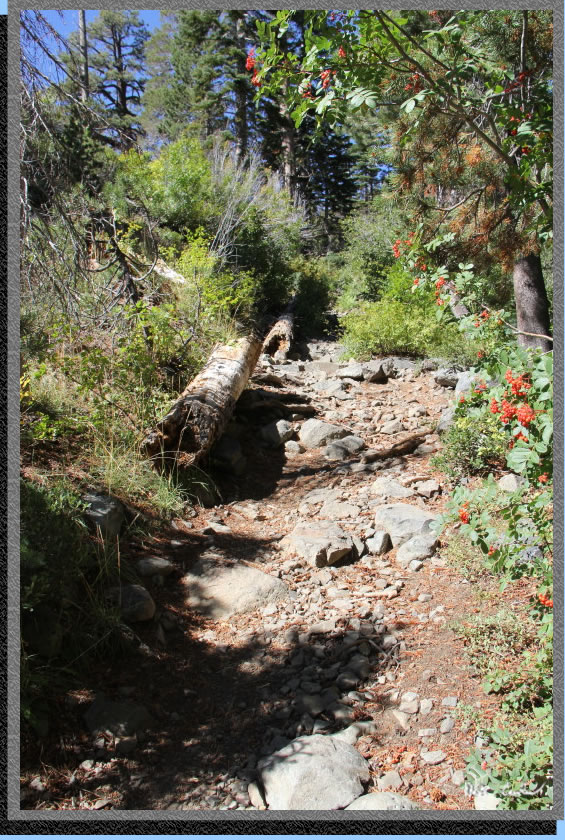
I am not going to mention "rocky trail" through this whole trip description - I could but that would just be annoying to type/read. Just assume that the trail is rocky and uphill on the way in. Here is the "trail" through this section. A nice warm up and ankle workout.
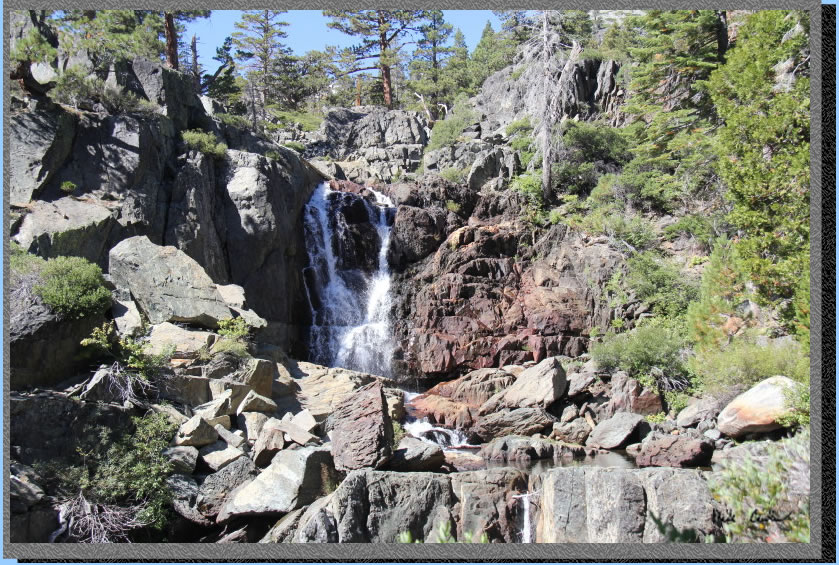
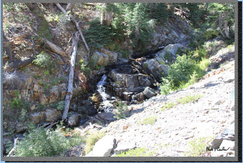
You will hear and then see the falls along the trail on the left. Take a minute to walk out to the overlook and take a gander.
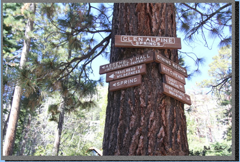
The trail/road on the way in passes through Glen Alpine Springs (historic resort). There are signs to keep you on the trail and away from the cabins along the road. There are also signs to direct you to some of the historic structures.
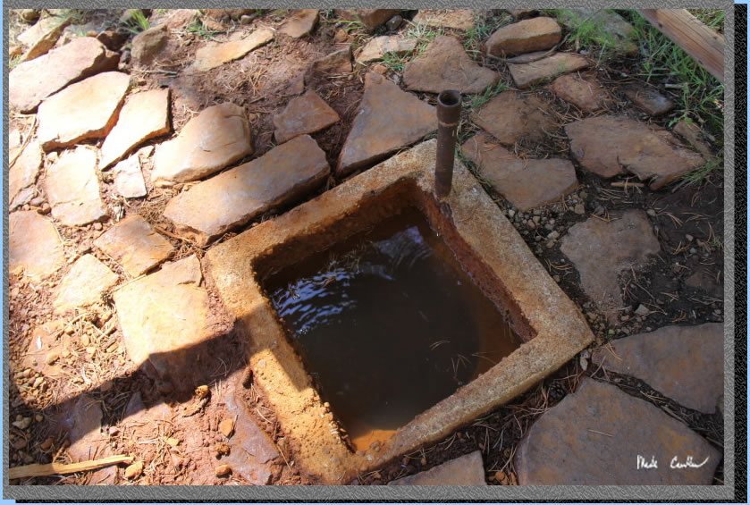
Here is the actual bubbling brownish spring. I have not been brave enough to take a sample yet. Maybe one time on the way out...
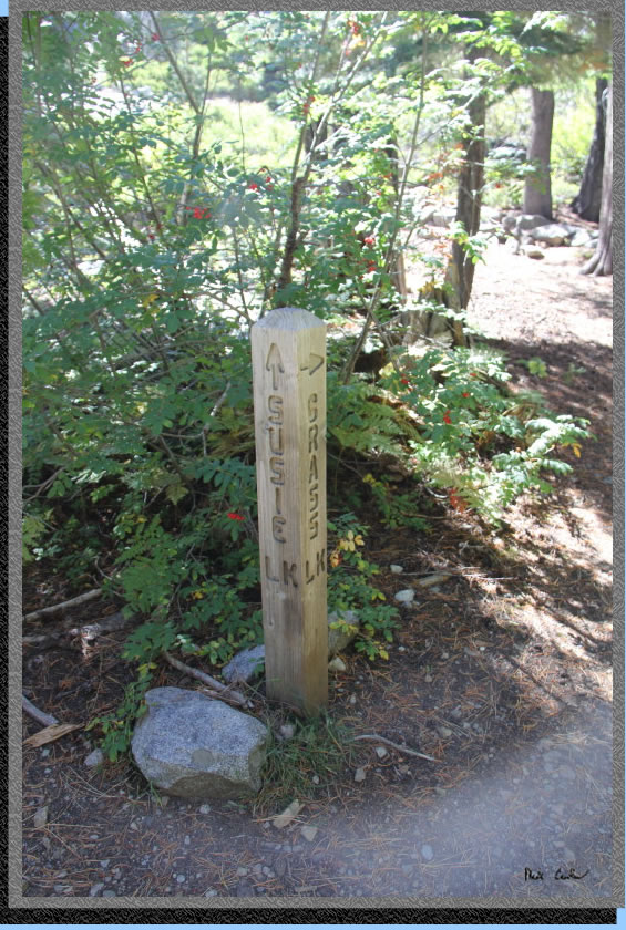
Here is a trail marker that just confuses me. It says to go straight or right, but there is only one trail through here so there is no choice to be made. Follow the trail and then slightly go left, on the trail.
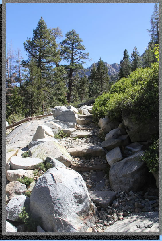
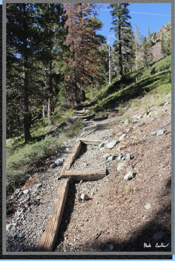
There are some rock steps on the next section to get you ready for the steady climb up to Gilmore.
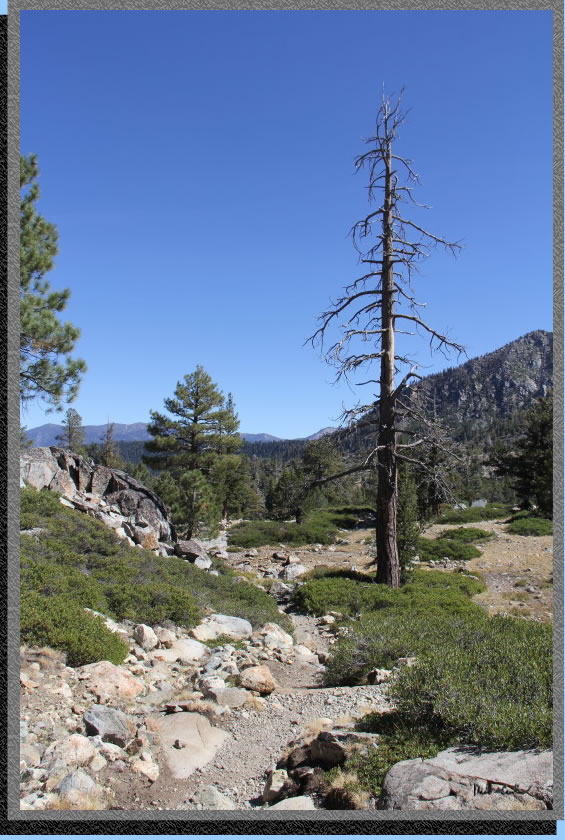
Beautiful clear skies allowed me to grab this shot looking back towards the trailhead with this stoic tree.
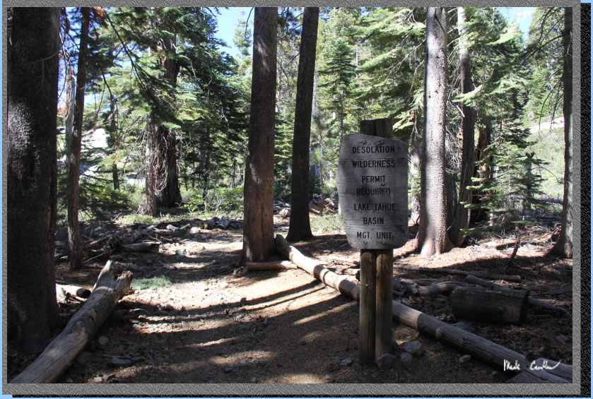
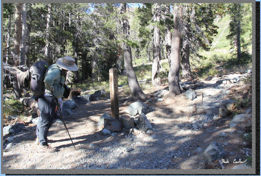
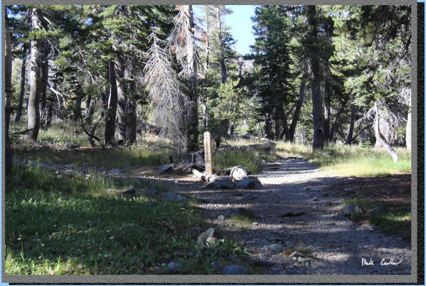
You quickly approach the official wilderness boundary. Hopefully you have a permit as the rangers in Desolation do not mess around (unless you tell them you heard voices)... Be sure to have a valid permit if you are in Desolation Wilderness (THhey are requried for camping overnight AND if you are just out for a day hike). Day permits are available at the trailhead.
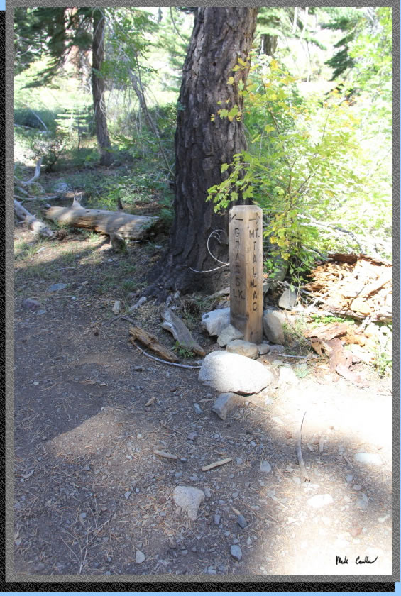
If you are headed to Gilmore you pretty much just stay right at all the trail junctions. Here is the junction for Grass Lake. Stay right for Gilmore Lake and Mt Tallac (it is above Gilmore Lake).
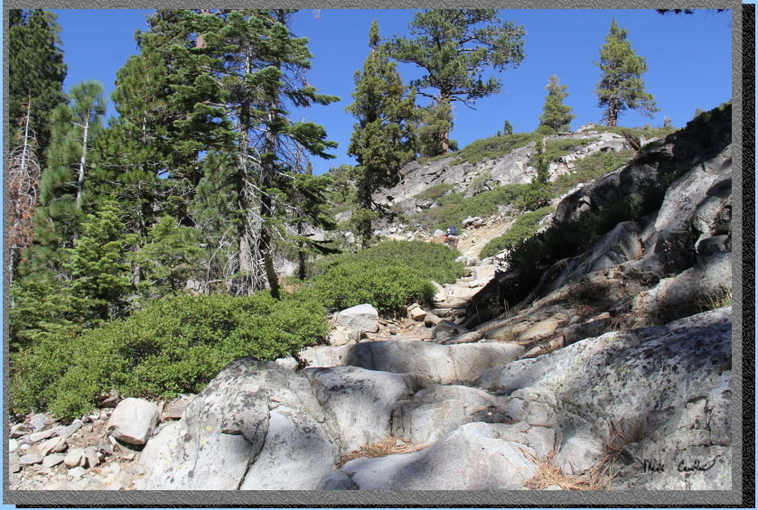
This shot give some good perspective of the trail conditions through this stretch. You want to be in decent shape for the altitude and elevation gain on this trip. Be sure to also know what altitude sickness is and what to do about a group member if they show signs. Altitude can affect people differently, even if you are in shape.
I took this shot just to show there are other things besides rocky uphill sections. Ok, so there are still rocks and it is still uphill, but also some green/red berries.
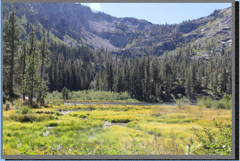
You should start hearing the creek as the trail approaches the creek that drains from Gilmore Lake. There was still some good flow and pools should you need to treat water on the way in.
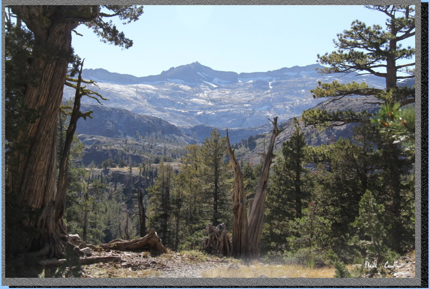
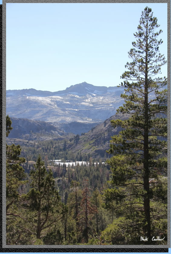
The views just get better and better as you switchback your way up to the next trail junction. You will have views of Pyramid Peak and Mount Price above Lake Aloha.
You pass a junction that says Lake Aloha to the left and straight/right to Gilmore Lake. I didn't grab a picture of that junction on the way in. If you head left at that junction you pass Susie Lake and Heather Lake on the way to Lake Aloha. We continued straight toward Gilmore Lake and quickly saw the next junction pictured below. Here is the junction to Half Moon Lake (and another chance to head toward Lake Aloha). Gilmore is close now, but of course uphill.
Most of the trail in has some partial cover (or at least the occasional strategically placed tree to shade you while you catch your breath), which is nice if the weather is warm. We still stopped a bunch for the views (and to catch our breath) but the breeze and cool weather made it perfect backpacking conditions. Here is the uphill, again.
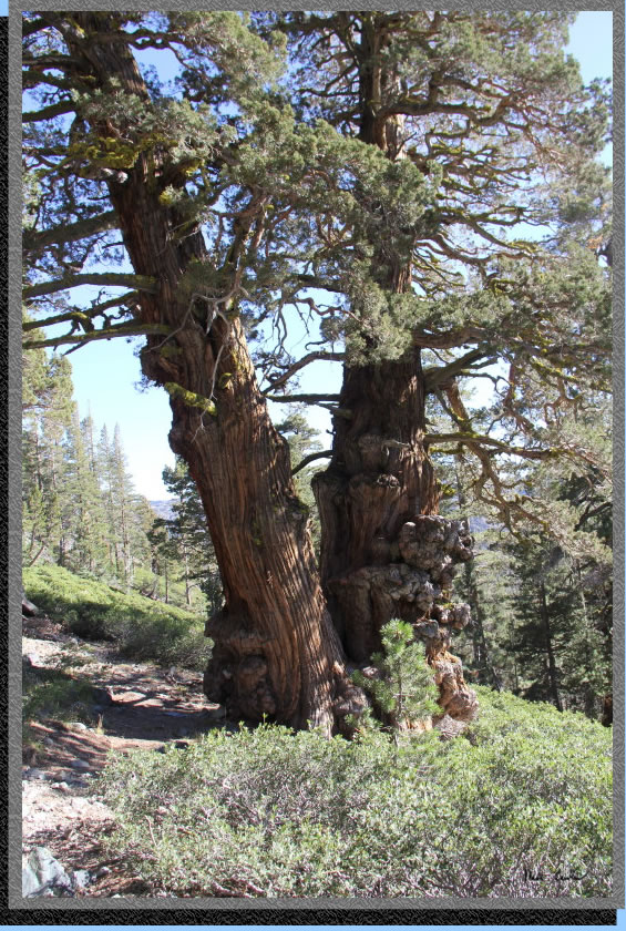
I took a few pictures of this knotty tree on the way in, while I waited for the rest of the group in the shade.
Looking out now to the west at the views including Pyramid Peak and Susie Lake.
Stay right at this junction with Dicks Pass to continue to Gilmore Lake. The uphill is done now (well only 100 yards or so left).
We decided to head over the dam to camp on the other side. Here is a shot of me looking back at Dan heading over.
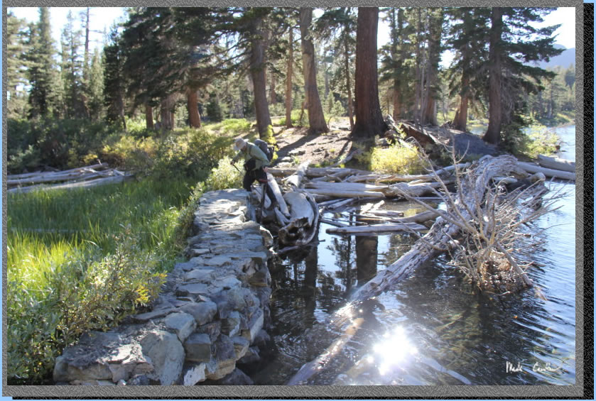
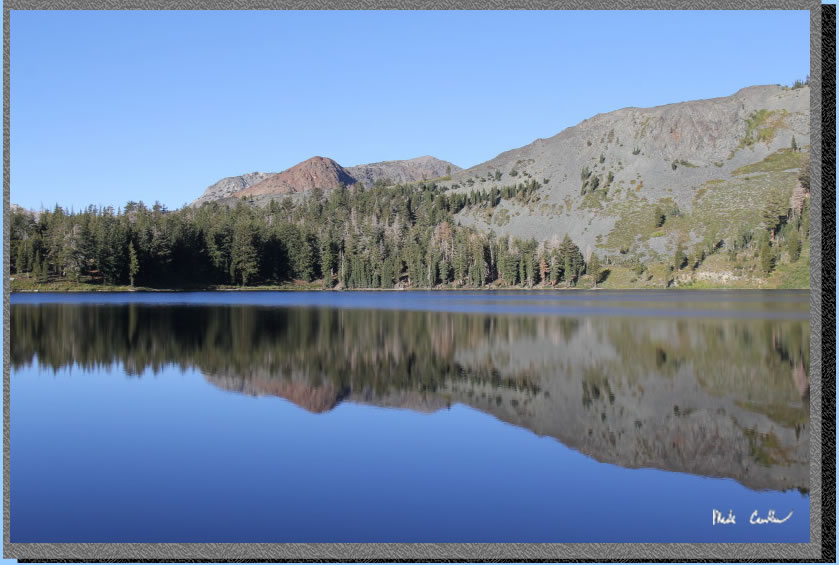
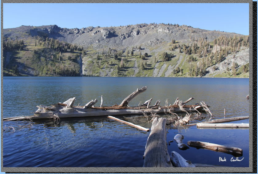
Looking at Gilmore from the dam. Damn nice view.... sorry.
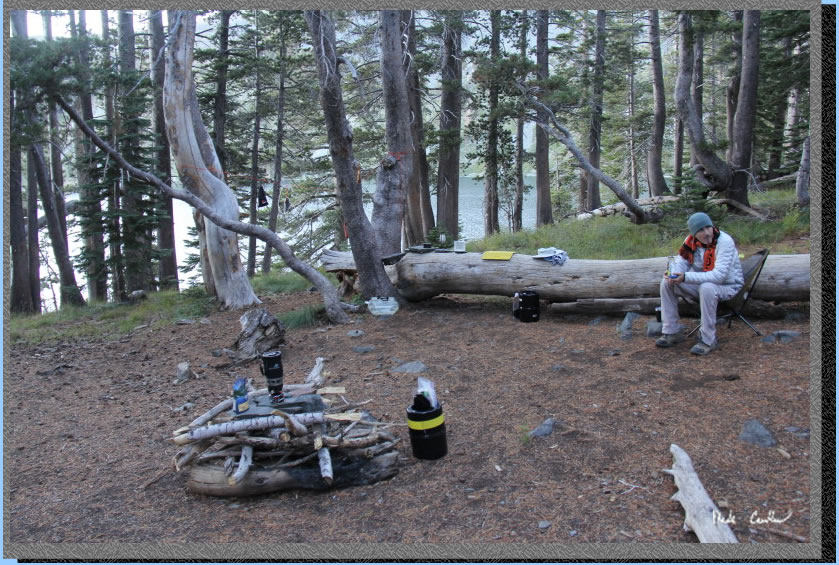
We scouted around and found this site that was the required distance from the lake and had nice sitting logs, stove rocks and flat tent spots. The stick/rock table thing we did not build and almost had to remove the next day when the rangers showed up. Yes, rangers showed up and checked our permits and talked with us about the rules (and the voices).
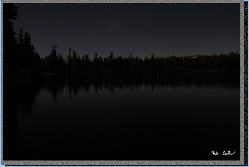
Nighttime shot at Gilmore. It cooled down a bunch that night but only the occasional breeze. Not much for bugs either. The full moon was up to keep our tents lit and the stars harder to see.
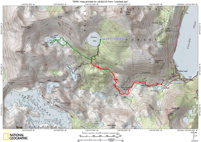
Bright red line shows the
trail from the parking lot at Glen Alpine trailhead to Gilmore Lake. Green Line shows trail/path taken to Half Moon Lake and Alta Morris Lake on Day 2. Elevation profiles below show hike in to camp on Day 1 and round trip hike from Camp to Half Moon lake and Alta Morris Lake on Day 2. If you are interested in mileage to Mt Tallac see the previous trip. Mt Tallac should be on everyone's to-do list.. Click on either the map or profiles for a larger image.