


![]()
-Day 2-
Dan and I decided
to head over to Half moon Lake and Alta Morris Lake. I had always wanted to see it and never had a chance on any of my previous trips out this way.
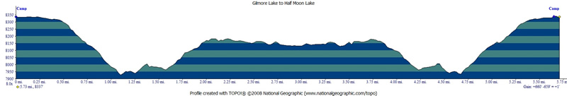
The map/profile below shows the total round trip mileage 5.7 at and the elevation change at 660 feet. You have to head down to the junction and then back up to the lakes.
We were traveling light on this day trip. Just enough supplies for lunch and emergency supplies(10 essentilas, or whatever you would need if something bad/unexpected hapens and you get stuck out there). Here is Dan headed down from Gilmore Lake ahead of me.

The weather was great again. Here are the clear skies to the west.

It used to be hard to find goo dead trees for pictures. There seems to be plenty of them now. I don;t think it is because I am better at finding them. This multi-trunk one is faded to white, but still standing.

The trail is a little less traveled past the junction with the trail to Gilmore Lake. Route finding is still easy, except for the rocky sections close to Half Moon Lake. There are still enough clues to stay on the trail though. Trail goes by several unnamed lakes on the way in.

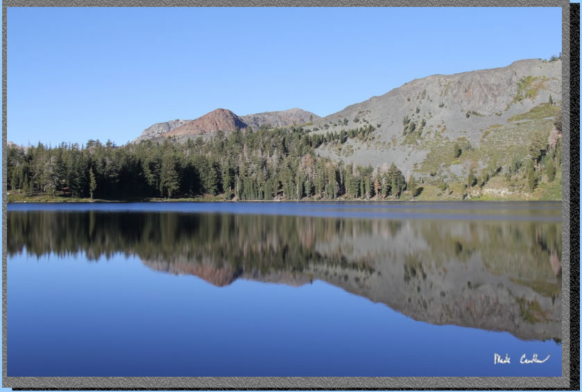
Here is one of the bigger unnamed lakes you pass by.

This is the rocky sections you could lose your way on. We decided to ditch the trail as it looks like it travels along the far side of the lake. We wanted to see the near side and enjoy the views of the surround mountains.

Here is the first glimpse of Half Moon Lake. It is an unusual shape with some fingers out toward the southeast.

We traveled across the granite surrounding this lake and saw several campsites. i would say that none were great. There is a lot of rock so the tent sites we saw were small.

I was able to grab a few shots of Alta Morris Lake. To be honest I didn't pay attention to the name of it until I was looking at the map later. I thought it was just another finger of Half Moon Lake. Around this spot you can hear the water falling down from the ridge to the west. I was contemplating talking Dan into hiking around the trail to the inlet.

However, I was able to zoom in with my camera to see the noise from the inlet was a waterfall high up the cliff face. Not sure you could see it above you if you were on the trail. We were hungry at this point and had lunch around the Half Moon Lake outlet. There was still a nice breeze and it was cool in the shade (when you weren't moving).

After lunch we decided we should head back. I grabbed a shot of this cooperative Clark's Nutcracker on the way back.

Another cool shot I grabbed on the way back with Pyramid Peak in the background.

I am always in awe of how trees can grow right out of the rocks. This one seems to be doing quite well.

Here is what the trail looks like. It is mostly open but there is more tree cover closer to the junction with Gilmore Lake.

We headed down to the junction with Gilmore Lake and took the left to head uphill to Gilmore Lake. Here is another shot of the view to the west with a cool log in the foreground.

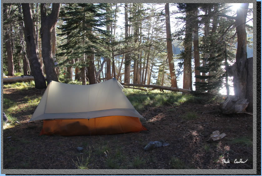
Dan and I made it back to camp safely and found Eric who was relaxing around camp after having hiked most of the way up to Tallac. We hung around camp and the shore of Gilmore Lake some. I went into the lake to my knees and dunked my head, to make sure I could say I "went in". It was, refreshing. After I was dried off and back at camp three rangers came up to us to verify we had a permit and to make sure we knew all the rules. We passed there tests and they were off to check on the next hikers/campers. I brought the Big Agnes Scout tent on this trip. it has held up well through the years and has nice space for sleeping/gear (for one). No vestibule means the gear is either out in the elements or in with you. The sun is already setting in this shot. One of the downsides of camping this time of year is the short days.
Bright red line shows the trail from the parking lot at Glen Alpine trailhead to Gilmore Lake. Green Line shows trail/path taken to Half Moon Lake and Alta Morris Lake on Day 2. Elevation profiles below show hike in to camp on Day 1 and round trip hike from Camp to Half Moon lake and Alta Morris Lake on Day 2. If you are interested in mileage to Mt Tallac see the previous trip. Mt Tallac should be on everyone's to-do list.. Click on either the map or profiles for a larger image.
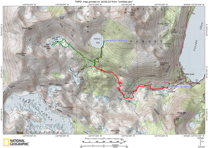
Day 2 (profile show hike from Camp at Gilmore Lake the Half Moon Lake/Alta Morris Lake and return to camp)
(back
to top)