![]()
 Permit
- A permit is required for all overnight stays on Angel Island. Permits
can be obtained using the state park website at www.reservecalifornia.com.
Permit
- A permit is required for all overnight stays on Angel Island. Permits
can be obtained using the state park website at www.reservecalifornia.com.
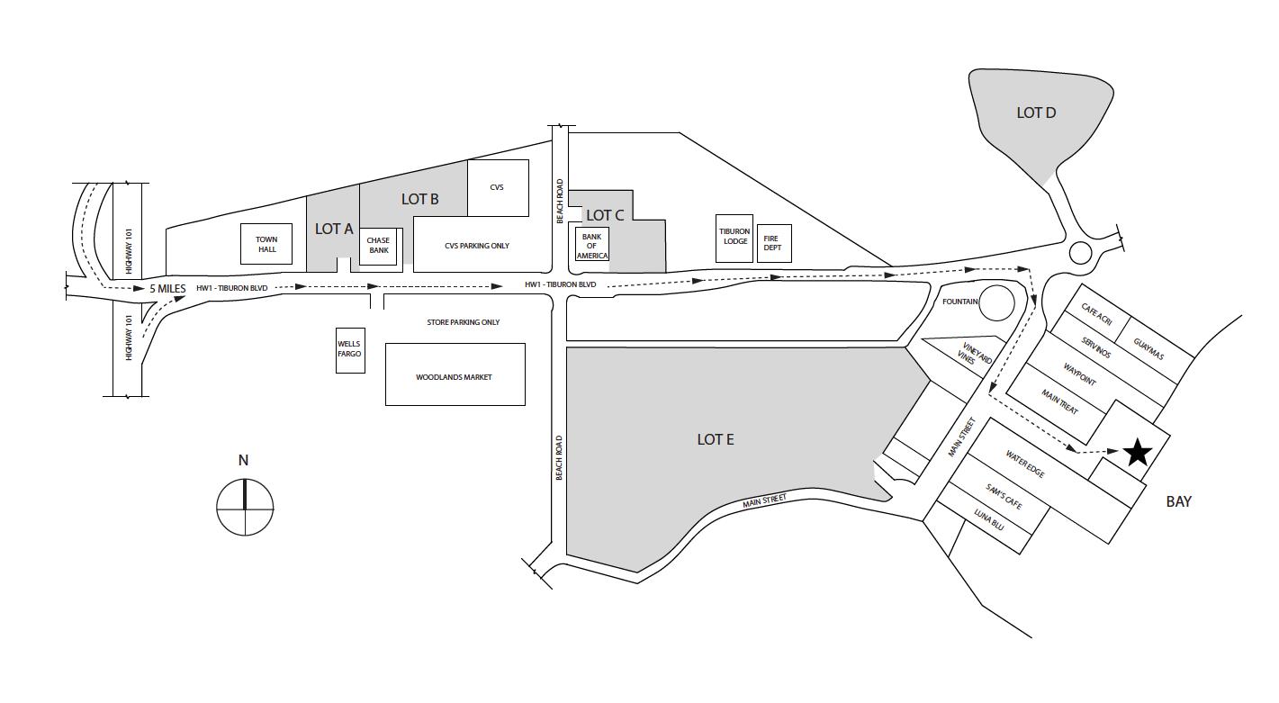
Transportation/Parking - Your options include private charter, Tiburon Ferry or Golden Gate Ferry . Be sure to check the ferry schedules prior to making your camping reservation. Ferry service is limited in the off season. For parking in Tiburon see map below map/profile. Parking is credit card at Lot A and Tiburon Ferry you can reserve ahead on website (choose camper rate) Golden Gate Ferry is clipper card.
Mileage - Ridge sites are 1.6 miles on the way in (walk from ferry dock to campsite). Your mileage may vary depending on your campsite and route/exploring selection. See map/profile below of all the hiking we did. Trail map is here.
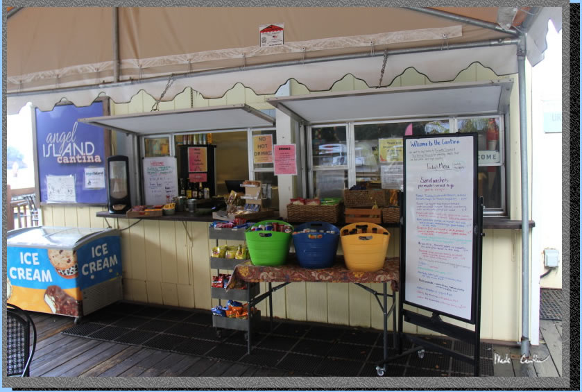
Camps/Water - There is a bathroom (pit toilet), trash can, and water at each group of campsites. Once you check-in with ranger after reaching dock there is a bathroom and cafe (seasonal). Winter storms have closed the cafe as of 07-2023 (should be open summer 2024 after repairs). Snack bar may be open.
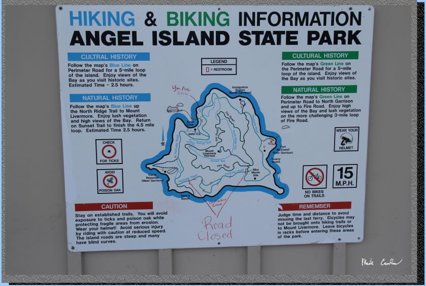
Hazards - Mice, raccoons, Poison Oak, missing your ferry. Nearest Ranger # 415-435-1915 (always check with ranger ahead of time for current water/trail conditions).**Perimeter Road is closed east of Ridge sites and west of "four corners" due to repair work as of 12/2023**
Leo and I made this trip to Angel Island Ridge Site #4..
For other site descriptions use these links (Sunrise site #8 in 2010, East
Bay site# 2 in 2023 and Ridge site in 2021). Sunrise camp has uninterrupted views, East
Bay site #1 is big, away from neighbors, and has shade and some shelter
from wind. The Ridge sites are the most exposed, but have the killer
views of the San Francisco skyline. Ridge site #4 has the best views
but no shade and no shelter should the wind/weather head in. Each group
of sites has a water faucet and pit toilet. We used the Tiburon
Ferry on this trip on the way in and the Golden Gate Ferry on the way out. It is about a ten minute ferry ride to Angel Island from Tiburon. We parked at one lot "A" couple blocks from the ferry.
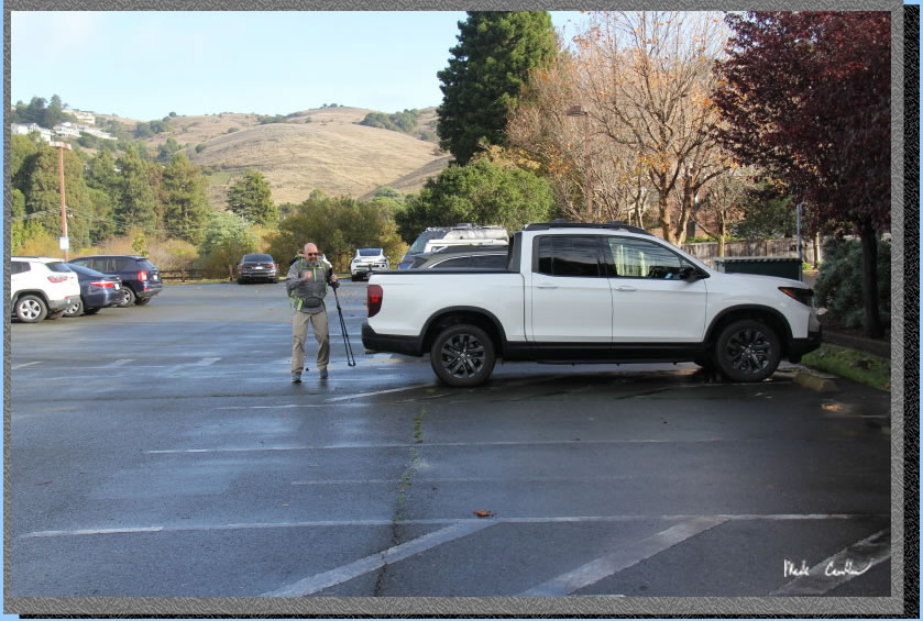
Parking in lot "A" has a machine that accepts credit cards. Here
is Leo as we are getting ready to head to the dock. It had rained on the way in but looked like weather was going to clear up the rest of the day.
. 
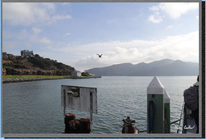
We had booked the 11 am ferry on this trip. If you are looking for food/caffeine there is Cafe Acri on the corner. I have eaten here a couple times and food was good (and it is still recommended by the locals). If you have more time try Salt and Pepper (have also eaten here a few times on the way out and would recommend). We decided to forgo any food stops and did the quick easy urban stroll to the dock. Fog was still sitting out there but we got lucky and the rain did not return. You can see The Tiburon Railroad & Ferry Depot Museum on the left (white building that looks too close to the water). Angel Island is off in the distance.
Be sure to enjoy the views (assuming no fog) of the Golden Gate on the ride to Angel Island. City views will be on the starboard side on the way in.
After you get off the ferry you need to head over to the ranger kiosk. Rangers make sure all the ferry passengers have debarked first, so take your time when getting off the ferry. The ranger let us know that the raccoons are able to get into the food lockers unless you lock them (or us a carabineer). After we checked in with the ranger, and went over the rules, we hiked past the cafe toward the Visitor Center. Here is the cafe with the assortment of foods/drinks. We ended up hiking back here after setting up camp.
We continued past the cafe and the Visitor Center/picnic areas to the Perimeter Road. Here is the shot of the Visitor Center and picnic areas as we passed the cafe.
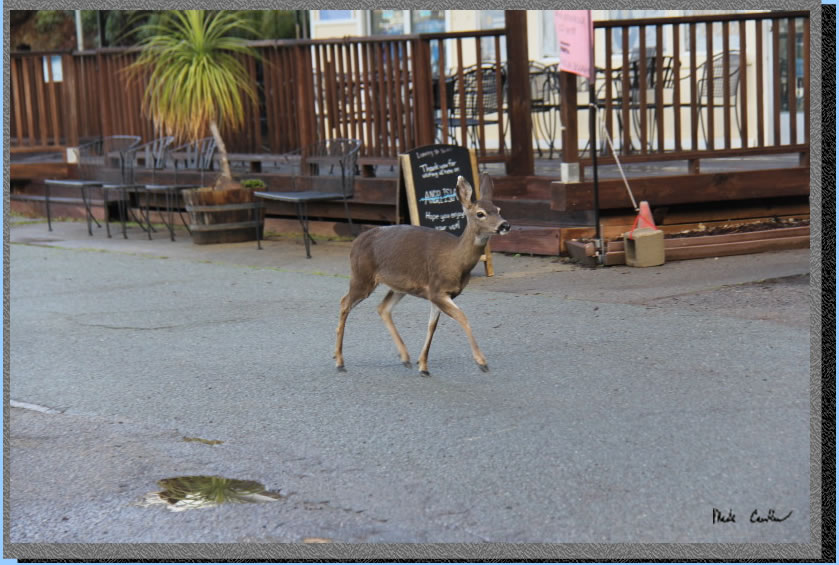
We had this deer follow us on the way to the Visitor Center. You can tell the deer on this island are not afraid of much.
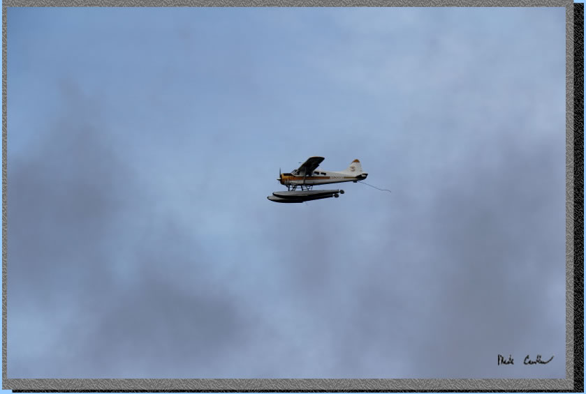
Leo and I saw this seaplane and discussed which one of us should win the lottery to allow for more exciting transportation options on future backpacking trips.
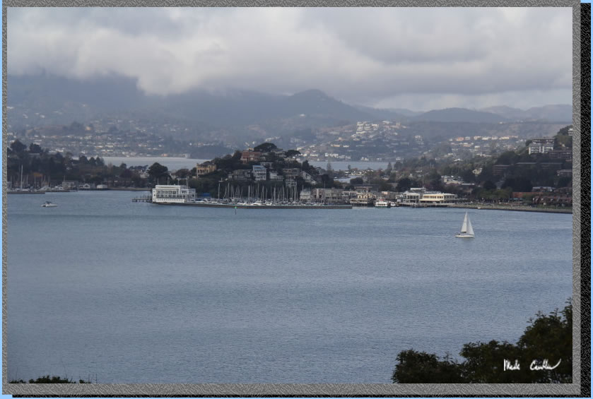
We followed the road on the Perimeter Road on the way in. Besides the walk uphill past the Visitor Center the Perimeter Road is easy on the legs. In this shot we are looking back at Tiburon/Belvedere.
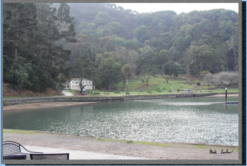
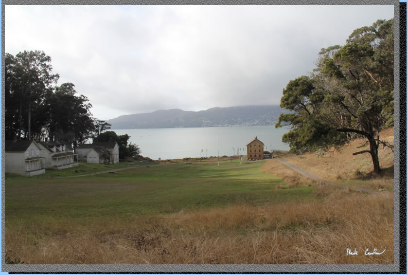
We were quickly at the Camp Reynolds (just past this building). We decided to head down and check it all out.
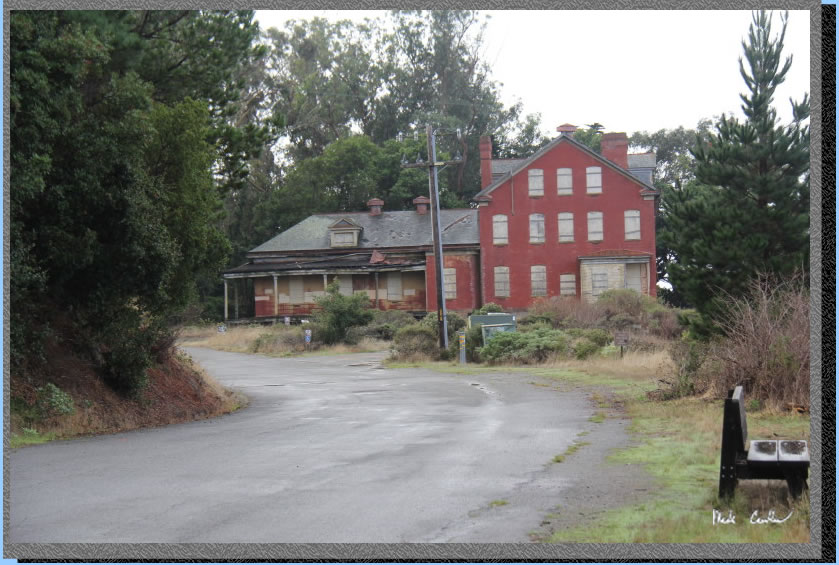
We hiked all the way down the to water. There are some placards to read about the various buildings still standing out here. Lots of history on this island.
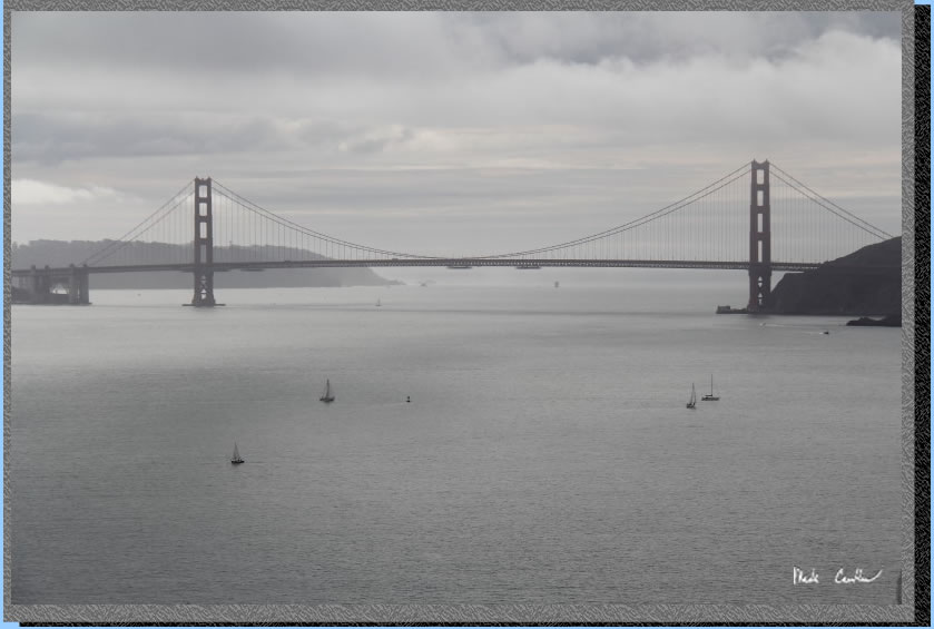
We hiked back up to the Perimeter Road and continued toward the Ridge Sites. The views only get better the closer you get to camp. Make sure to check out this side of the island for the views.
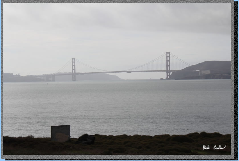
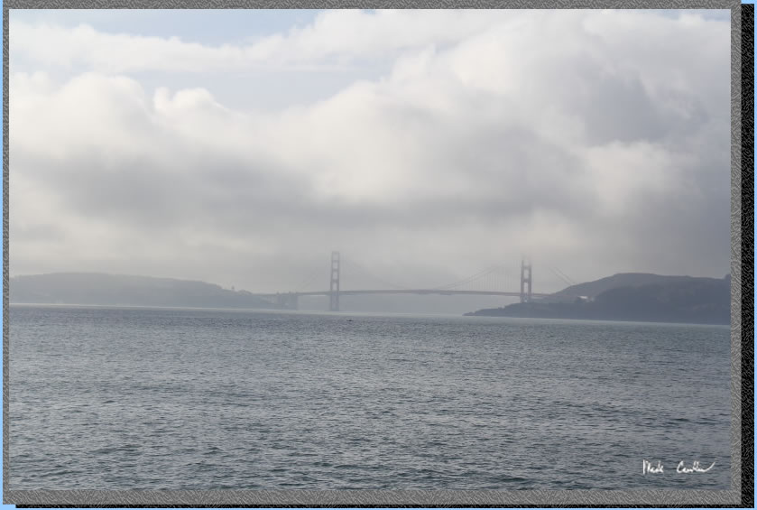
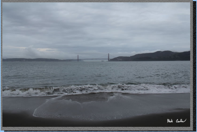
We didn't stop to enjoy the views too long as we thought we would be daring the weather gods to rain on us. However, I did grab this quick shot of a gray San Francisco with a menacing dark gray above..
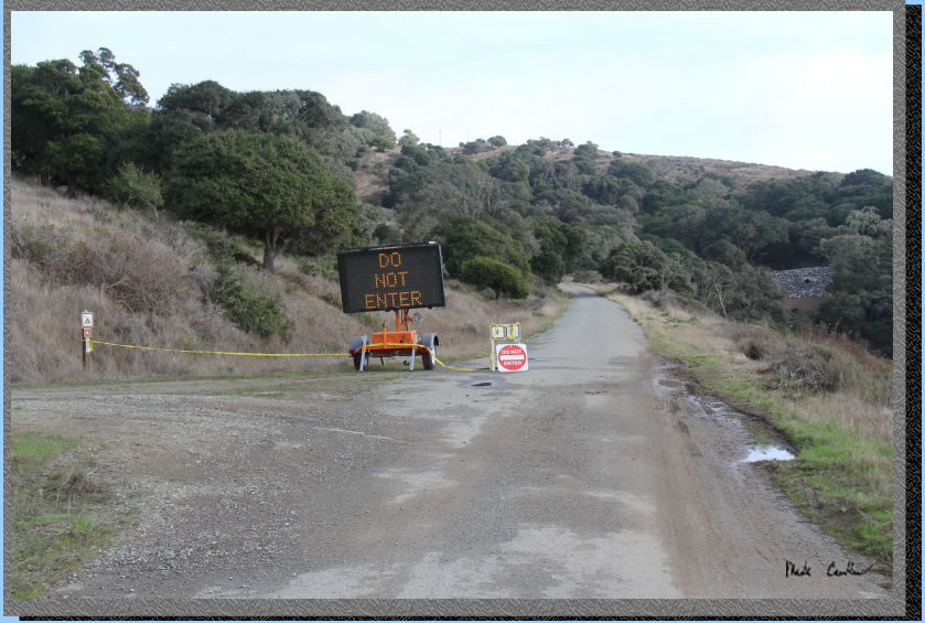
Here is the west side of the road closure. It is closed to all traffic, including bicyclists and pedestrians. In the image below you can see the gray hillside with a pipe coming through it where the road was washed out last winter. See this trip for photos of washed out area. We took a left up the hill to get to our campsite.
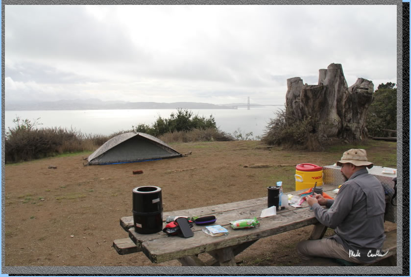
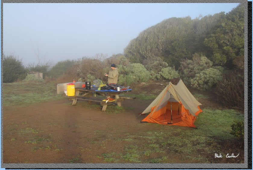
We setup tents and had a nice lunch watching the clouds/ships go by. We had two small tents setup and there is room for at least one more. The view is really just ridiculous from this site.
We watched some type of sailing school/club out on the bay learning/practicing, The small sailboats provided a nice foreground in this shot (only interrupted by the occasional air horn blast that I think meant time to turn).
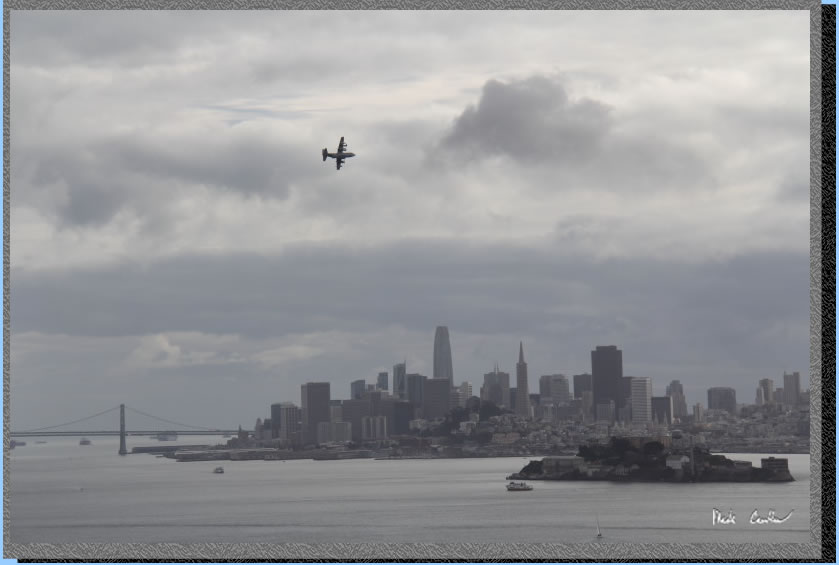
While we were enjoying our lunch there was this military cargo plane that decided to do a few laps around the bay. We were not sure on the "why" but we enjoyed seeing it fly so close to the island and the San Francisco skyline. It looks photoshopped in this image but it wasn't.
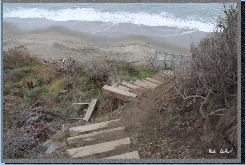
We decided to hike back to the snack bar after lunch. We sat out on the deck and watched as hikers/bicyclists boarded the last of the ferries for the day. On the way back we decided to head down to Perles Beach. This beach is just south of the Ridge sites. The stairs are not super safe, so be careful if you head down here.
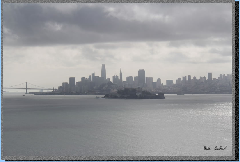
We made it safely to the beach and a took this shot of a rock with "The Rock" behind it.
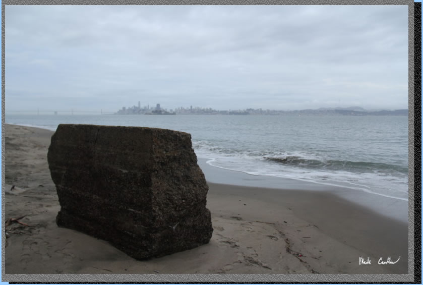
Angel Island provided a unique perspective on some of the bay's most famous landmarks.
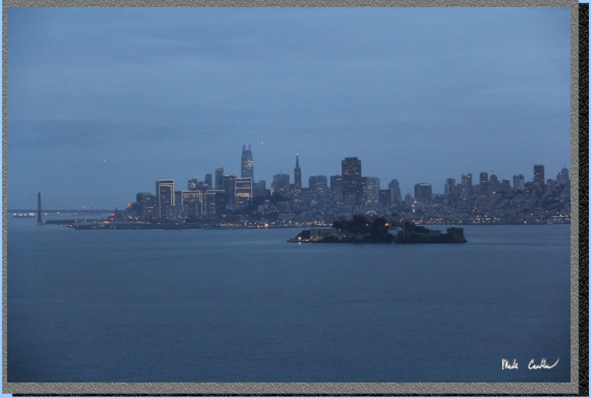
We headed back to camp and had a nice dinner watching the lights turn on in the city. Luckily the fog had cleared out to enjoy the night skyline.
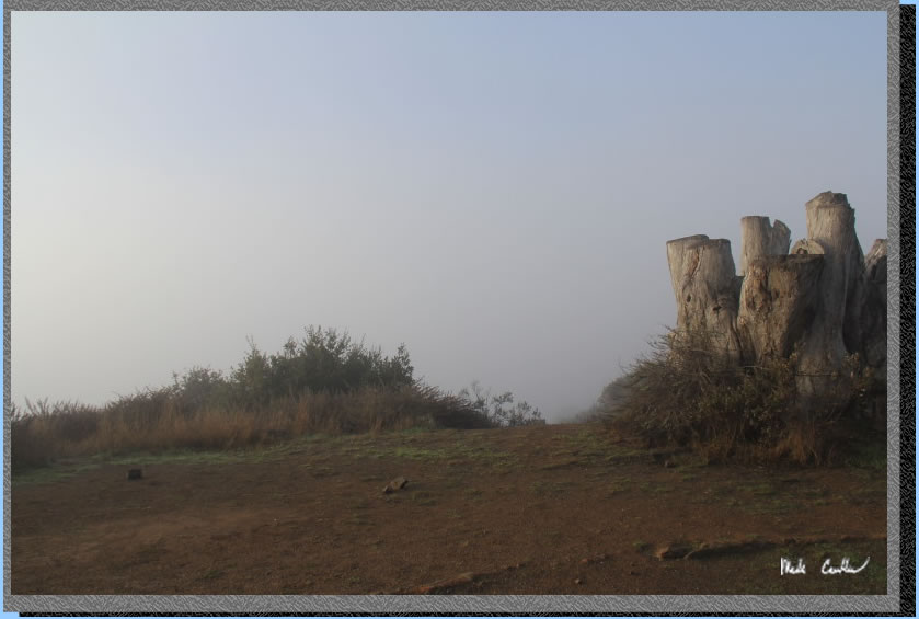
I need to bring a real tripod on one of these trips. I have a little one that I propped up on the large stump at camp that at least allows for some night exposures.
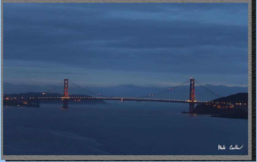
Here is my last picture that night from the picnic table. You can see the Bay Bridge, Salesforce Tower and Sutro Tower in this shot.
.
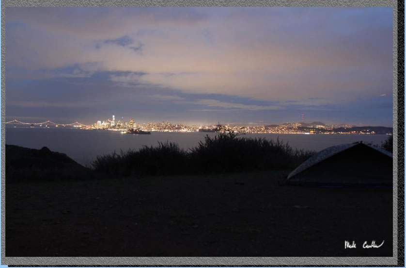
We had a very foggy night with lots of "boops" followed by "boooooops" and "boop-boops". We didn't hear any crashes so I guess all the "boops" were worth it. Everything was damp and the view was great, if you liked gray. This was the"view".
We had a nice breakfast and started to pack up. My tent was just as wet as if it had rained that night. I brought my single-wall Big Agnes Scout. It is lightweight and spacious. It kept me dry. However, the condensation on the inside is just one touch away from dripping on you. Here you see Leo getting packing up. We packed up all of our dry (and not so dry) gear. I almost had to wring out my tent. I actually put it in a plastic bag in my backpack to keep it from getting my dry gear wet.
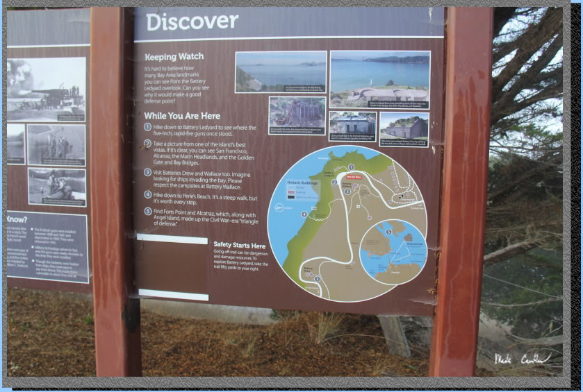
I forgot to mention that the area of the Ridge sites lies on Battery Wallace. There are still many of the concrete structures created to house the guns to protect the bay. I took a picture of this sign on the way back out that explains some of the history of the batteries on the island.
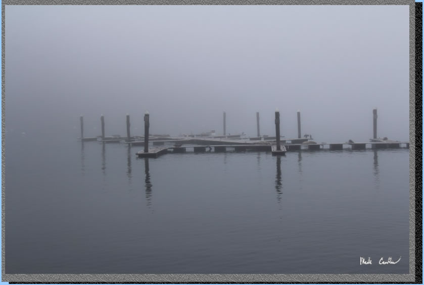
We hiked through the gray toward the dock. The sea lions did not seem to mind the weather. I took this shot that shows how thick the fog was. We took the Golden Gate Ferry back. I should mention that if your destination is Tiburon you should wait for the second ferry (11:35) so you can ride it directly to Tiburon. If you get on the one before it goes to the Ferry Terminal and then back to Angel Island and then to Tiburon... Which is fine if you want practice using your clipper card. This was another great trip to this island. Make sure to get out here and spend an night in the middle of the bay.
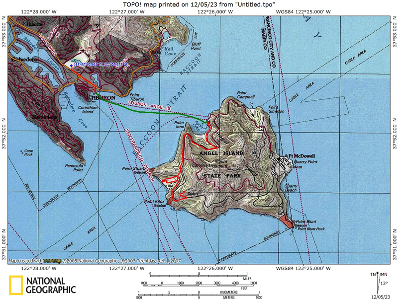
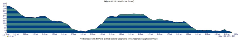
Green line shows the ferry trip. The short red line is the short walk from Lot A to the dock. The longer one on the island is the ~1.6 miles from the dock on the island to Ridge Site #4. Well it is normally about 1.6 miles (ours was 2.3 miles). We took a detour to explore Camp Reynolds (West Garrison). Click on either the map or profiles to see larger versions.
Profile from Camp At Ridge Site #4 to Camp Reynolds beach then dock via paved road (not stairs).
(back
to top)
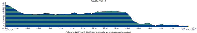
Hike out via using the stairs (from previous trip).
(back
to top)
PARKING:
Overnight parking
is allowed in lots A, B, D. The star on this map is the dock for the Tiburon Ferry.
Click on map to see larger version.