


![]()
 Permit
- A permit is required for all overnight stays in Emigrant Wilderness.
Permits can be obtained in person at the Summit Ranger Station at 1
Pinecrest Road in Pinecrest off Highway 108. There are currently no
trailhead quotas or fees for the permit.
Permit
- A permit is required for all overnight stays in Emigrant Wilderness.
Permits can be obtained in person at the Summit Ranger Station at 1
Pinecrest Road in Pinecrest off Highway 108. There are currently no
trailhead quotas or fees for the permit.
Mileage - We did about 31 miles in total over 4 nights/5 days from Crabtree Trailhead to Grouse Lake, Wood Lake, Deer Lake, Grouse Lake and back to trailhead (also walked by Jewelry Lake, Gem Lake & Buck Lakes). Your mileage may vary depending on site selection. See map/profile below.
Camps/Water/Trailhead - There is a bathroom at Crabtree Trailhead (no water or trash service). You drive through Aspen Meadow Pack Station on the way in (5 MPH speed limit).
Hazards - Black Bears, creek crossings, mice/squirrels, and Mosquitoes. Nearest Ranger # 209-965-3434 (always check with ranger ahead of time for current water/trail conditions).
- Day 1 - Day 2 - Day 3 - Day 4 - Day 5 - (click the day you want or just scroll through them all :-)
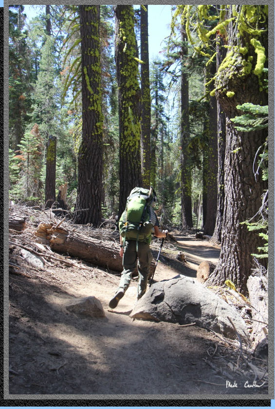
Day 1 (Crabtree Trailhead to Grouse Lake, ~ 5 miles) -Yellow Line-

Tyler and I planned
this late summer Sierra trip. We
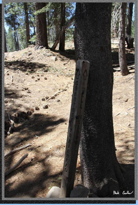
started at the Crabtree Trailhead, off Crabtree Road, off Highway 108,
just west of Pinecrest (and the ranger station). We went to the ranger
station first to get a free permit, check on any last minute info for
area, and get a new map (Tyler told me that my 12 year old map would
not do). The wilderness permit is also the fire permit needed for the
area. We were under just the normal fire restrictions for this trip
(fires had to be under 9,000'). We also found out that Emigrant Wilderness
has adopted the pack out your used toilet paper policy. I honestly think
this is the future for all of us backpackers, so get used to it. If
you plan ahead it is really not that big of a deal. To get to the trailhead
from the ranger station you either go back out onto Highway 108 and
turn left onto Crabtree Road, or you can stay on Pinecrest Road and
take a right onto Dodge Ridge Road and head almost all the way to the
ski area (past the start of the on-street parking) and you will take
a right onto a paved road that cuts over to Crabtree Road (it will "T"
into Crabtree Road and be a left onto Crabtree Road). Crabtree Road
is paved, mostly. Either way you go you will you will head to Aspen
Meadows Pack Station. You will drive through the pack station, staying
on the main road, and eventually make a right onto a rougher road to
Crabtree Trailhead for the last half mile. The road in is narrow in
spots but altogether a pretty easy drive. You are allowed to camp one
night at the trailhead. There is no trash or water at the trailhead
- plan accordingly. You could filter water out of nearby Bell Creek
if needed. There is a decent sized parking lot at the trailhead with
an overflow lot as well. That being said, on the way out on Saturday
all spots in the lot and the overflow lot were filled, with many vehicles
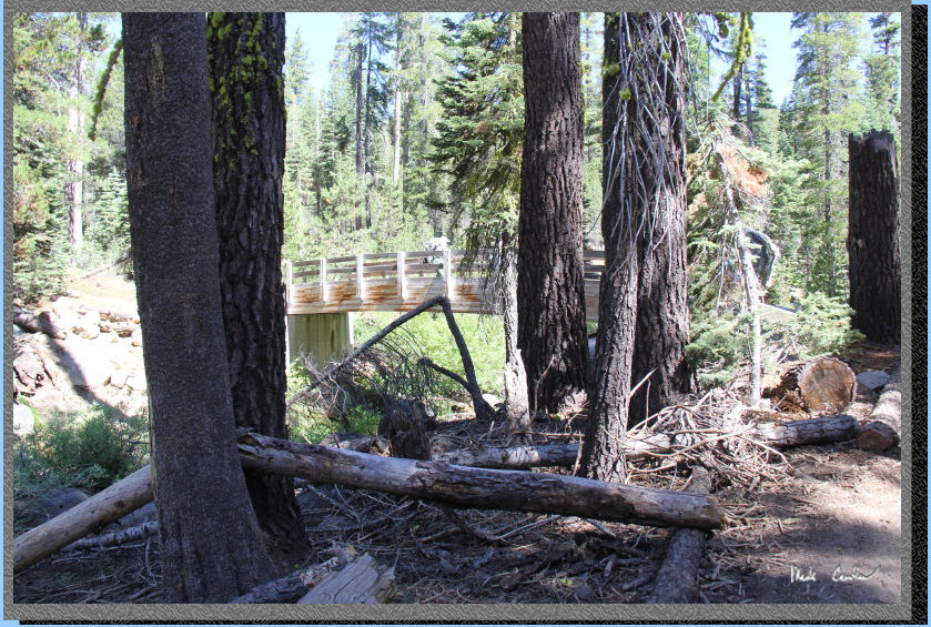
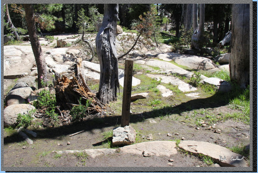
also parked along the road. Trail starts from east side of the parking
lot and immediately crosses Bell Creek (on a tall bridge). Here is Tyler
checking out the info board at the trailhead.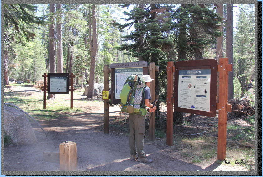
Once you are ready
to hit the trail you head over the bridge and quickly arrive at your
first junction with Chewing Gum Lake. I feel like I should make the
hike out to this lake one of these times as I have seen most of the
rest of them. See previous trips to (Bear Lake,
Camp Lake, Lily Pad
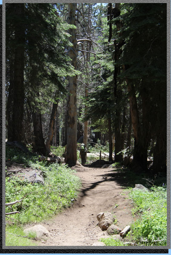
Lake). Today would not be that day though. We continued straight
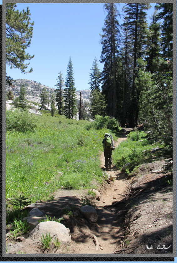
in the shade of the tall trees and a gentle breeze. The trail is dusty
due to the high traffic and livestock using the trail. The trail is
mostly uphill to the next junction and mainly under tree cover. Here
is the bridge over Bell Creek.
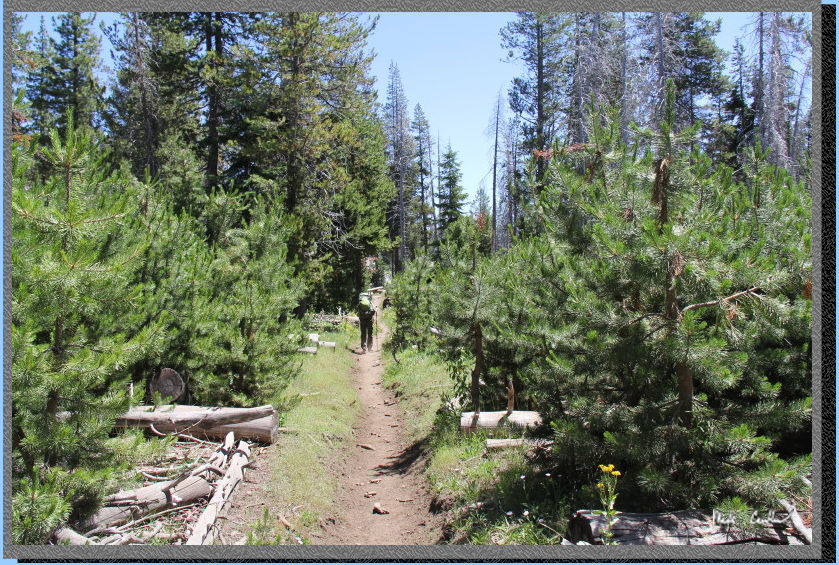
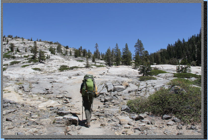
Typical look of
trail on this section.
Before you know it you will be at the next junction with Camp Lake straight
ahead and Pine Valley to the right. We took the right here and started
our descent into Pine Valley..
Take in the view
of Pine Valley before you start down.
Continue down through the mostly covered trail to the next junction
with Bell Meadow on the right. This sign post was in need of some repair
(but at least it was still providing correct directions). Stay straight/left
to Pine Valley.
The trail is mainly
level now (which is a welcome relief). The trail is also more open now
with older dead trees and many new baby trees racing toward the light.
"Racing" is a relative term you know.
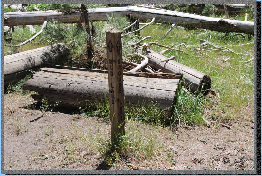
Before you know
it you will be at the next junction (Mud Lake). Here is the trail junction
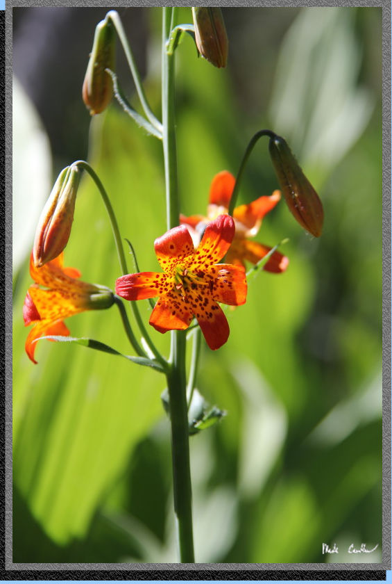
post. Stay straight on to Grouse Lake. With all the sun there were plenty
of wildflowers now. The trail runs parallel to Lily Creek now, eventually
you will need to cross it to continue on.
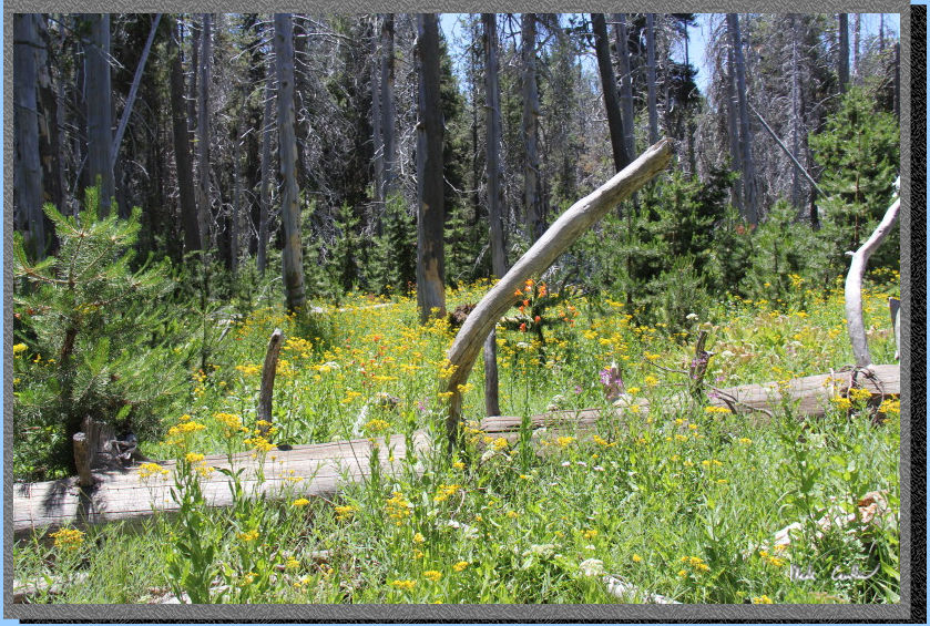
Some of the wildflowers
in this section.
Looking toward the
ridge to the north of us from the trail.
Here is the Lily
Creek crossing. We were able to just rock-hop our way across. I was
a little concerned with the potential of some high water at some of
the later crossings, due to some of the trail reports I had read in
preparation for this trip. I had originally thought that we could head
out of Kennedy Meadows and stay on the higher trails to Emigrant Lake.
In talking to the ranger he warned of significant snow above 9,000 feet
(Emigrant Lake is at 9,000 feet). With that information we altered our
plan to start lower, and then dip into the higher elevations on the
second to last night (Deer Lake is 8,500 feet). In talking to the ranger
the day we got our permit it sounded like the water levels had lowered
a bunch in the past week (which was good news to me). There is nothing
fun about having to modify your trip due to impassable streams.
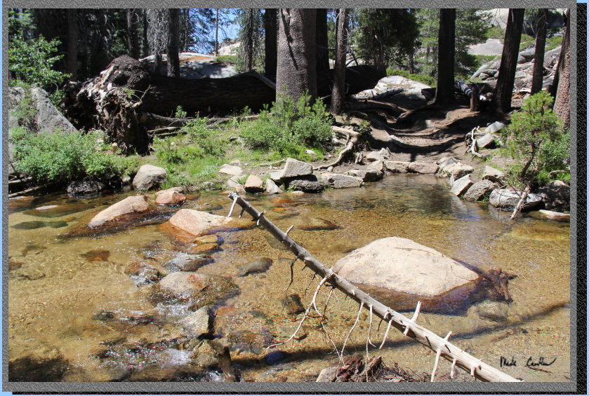
Another section
of Lily Creek just east of the crossing. The water was beautifully clear
and you could see the fish swim by.
Continue on through
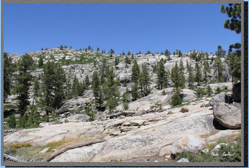
the open trail, with younger baby trees than the previous section. Here
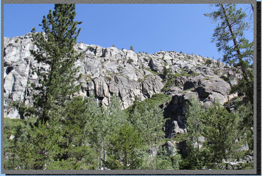
is Tyler out in front. The trail is level a bit before starting the
ascent to Grouse Lake. You can see in the distance that route finding
is pretty easy. If you just continue east staying between the two ridges
you will do just fine.

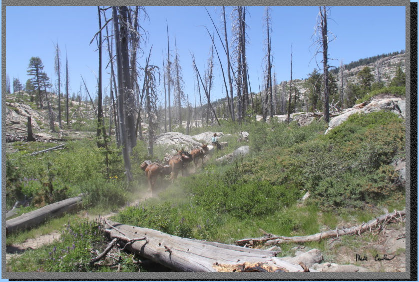
Another look at
this section as some horses go through. The were running supplies out
to some campers today per the cowboy. I didn't ask the logistics of
that. There are definitely bears out here, so you can't just leave supplies
out...
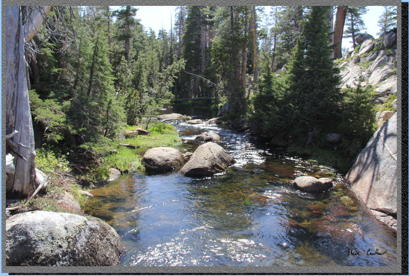
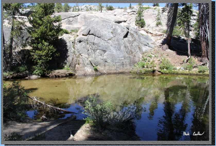
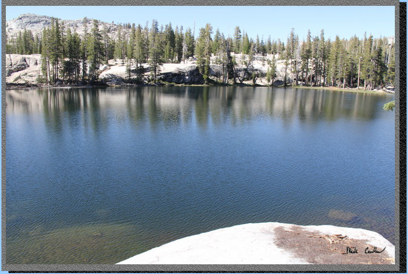
Here is Grouse Lake. It is a warm, not so deep, lake with plenty of
plants growing in and around it. Be careful if you walk into it (it
could be muddy enough to swallow a sandal if you aren't careful, hypothetically
of course). We camped a little ways north of the lake's inlet, but came
out to the lake to pump water. There was a group that camped on the
west side of this lake on our last night out here. Make sure you follow
the rules of camping 100 feet from trails/water. Also try not to play
music if you have a lakeside campsite, not everyone wants to rock out
while backpacking.
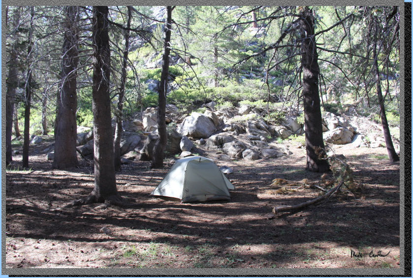
So here is part of the campsite. It is rather large and likely used
by those on saddles. The tree limb was already on the ground when we
got there, no trees were hurt on our watch. Although this shot makes
it look like we are camped under dead trees, I can assure you that the
trees were greener at the tops and none of the dead limbs were hanging
over our tent.
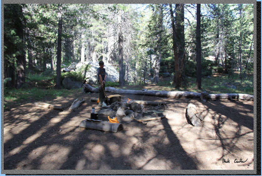
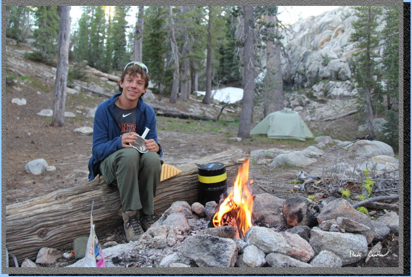
Here is Tyler getting
a fire started. There was plenty of dead wood on the ground to have
a nice fire. The smoke also helped keep some of the mosquitoes away.
We pumped some water out of the collapsible bucket to refill our reservoirs
for the next day and for hydrating that evening around camp. I have
found filling a bucket and letting anything in the water settle before
pumping just makes the water filtering go easier. Cleaning the filter
in the field is not that much fun, so I try to limit how many times
I need to do it. Grouse Lake water still made me have to clean the filter
once to regain a better flow rate. We had a nice evening and the bugs
weren't too bad until we were getting ready for bed (which was a little
early as we were both tired, and Tyler had a trail report to fill out).
It seemed once we drowned our fire the mosquitoes took that as a signal
we were to be attacked. We managed to safely get into the tent though
and have a good nights rest. Day 1 was about 5 miles.
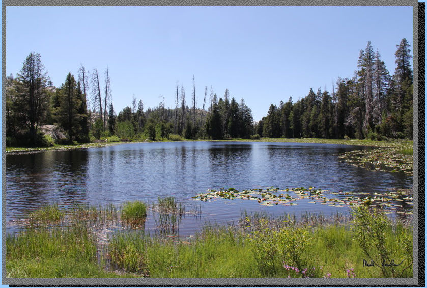
Day 2 (Grouse Lake to Wood Lake, ~8 miles) -Red Line-
The next day we
packed up at a leisurely pace and eventually hit the trail to Wood Lake.
The trail immediately crosses the inlet to Grouse Lake and then starts
the ascent up some granite. Here is one of the wildflowers in this section.
Here is the ridge
now to the north again. Between the ridge and the creeks it is pretty
easy to navigate this section of trail.
Continue up the granite steps in this section until the trail levels
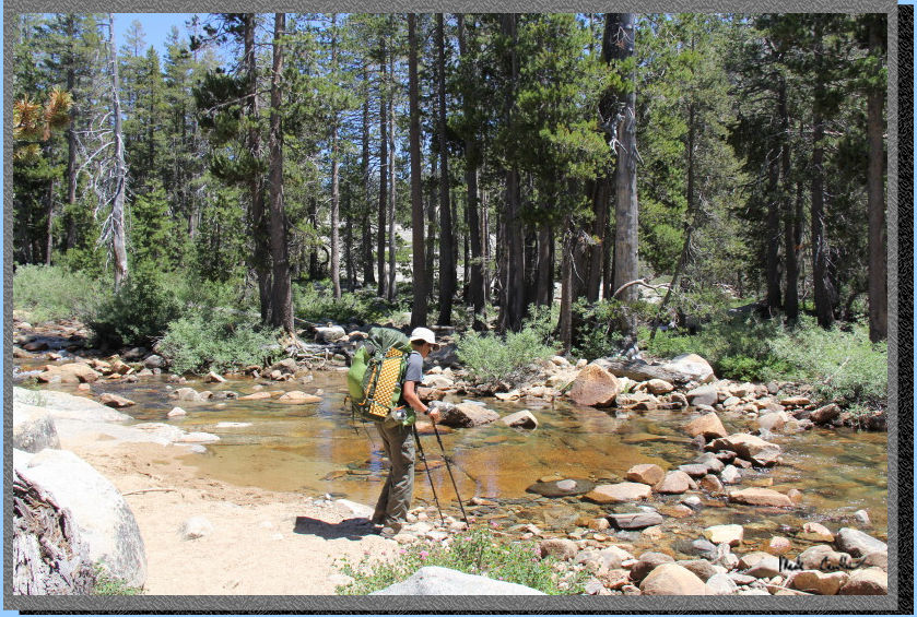
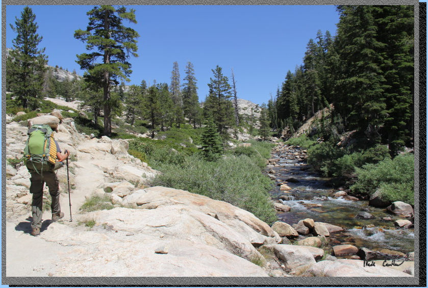
off and then descends to the Piute Creek crossing.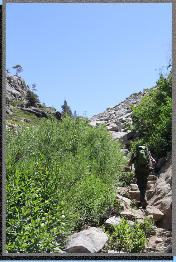
Here is Piute Creek's
good clean flowing water. We decided to pump water here on the way back
out instead of at Grouse Lake. This creek is about 1.75 miles from Grouse
Lake. We were able to rock-hop this creek without any trouble.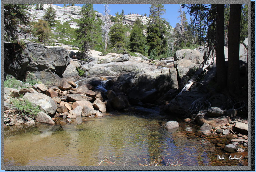
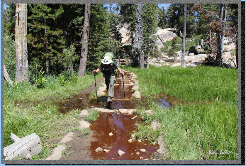
The trail stays
level now to the junction with Piute Meadow on the left. Stay straight
for Wood Lake across the next flooded section. Another item for the
trail report to the ranger.
I think this section
is part of Groundhog Meadow - it could use a little drying out still.
Here is Tyler crossing the channel that is supposed to keep the trail
dry (probably works once the water level is a little lower). On this
day it was a mosquito sanctuary.
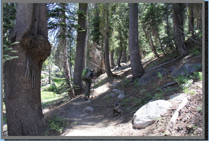
The trail turns
uphill again through a covered, but dusty, section.
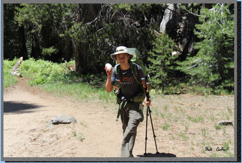
We ran into our
first snow bank as demonstrated by Tyler's snowball here. Spoiler alert,
snow would be more common later today and the first part of the next
day.
The trail levels
off again before a rockier ascent. Here is an open section along this
section of trail.
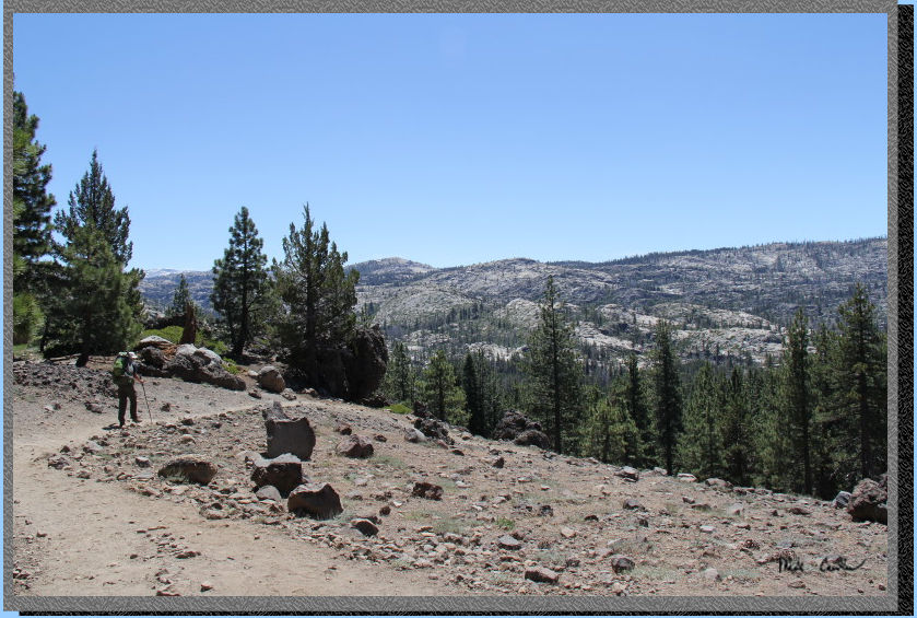
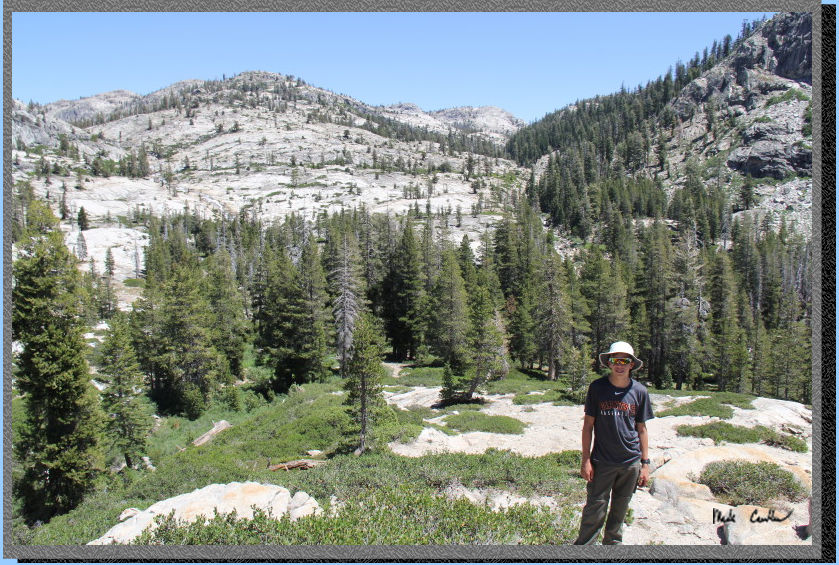
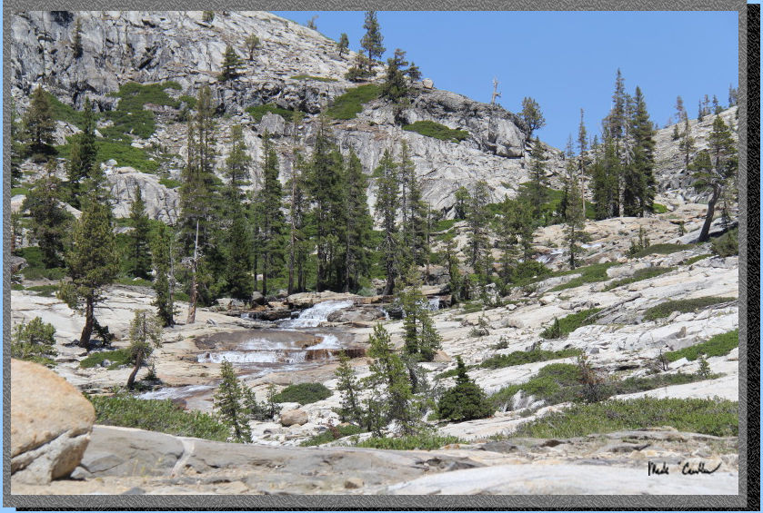
Eventually the view
really opens up so you can see the west fork of Cherry Creek and Buck
Creek cascading down into the valley below. We decided that the views
were not going to get better than this high vantage point, so we stopped
for lunch before heading down to cross Cherry Creek.
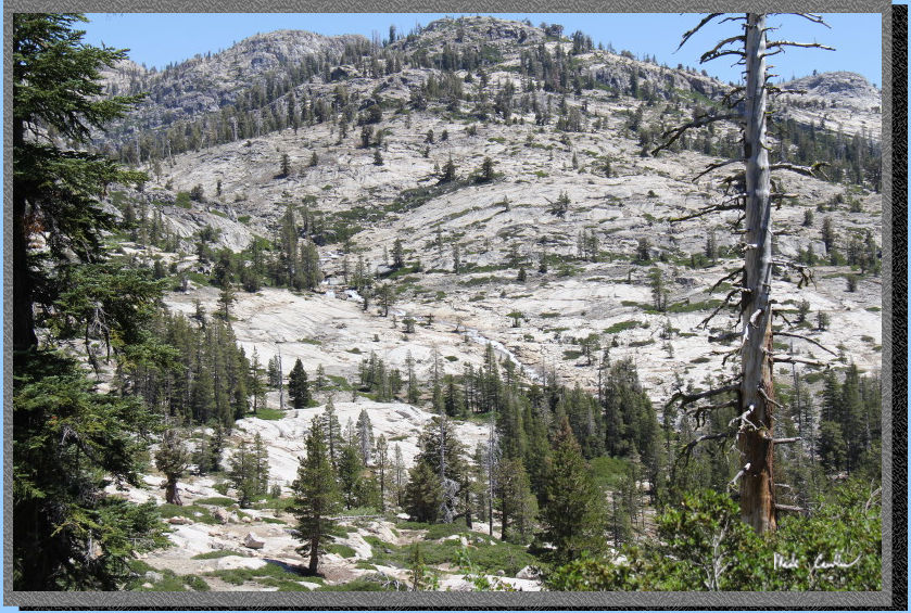
Here is Tyler as
we finished lunch. Cherry Creek is the one the left, and Buck Meadow
Creek is just right of middle as you follow the tree line. We could
see where they merge and continue south as one bigger creek (it is out
of this shot on the bottom right). It calls the area it flows through
Louse Canyon. Eventually this combined creek feeds into Cherry Lake.
More rock-hopping
to get across Cherry Creek. This is one of those multi-fingered creeks,
so "the crossing" is more of like several small crossings.
This is the first one.
We crossed the rest
of the creek without incident (but without any pictures either) Continue
uphill now on exposed granite. Watch the trail carefully through here,
generally following Buck Meadow Creek that is just to the south (right)
of trail. The trail is pretty well marked with rocks/ducks to get you
through this section without too much trouble. Here is Tyler following
the trail.
You are are hiking
between the two major creeks now. Here is Cherry Creek on the north
(left). The sound of water through here was great.
And here is Buck
Meadow Creek on the south (right). Hiking in this area is all exposed
granite but it makes the sound of the creeks amplified.
Eventually you will
reach the junction with Gem Lake lake on the left. We would eventually
be headed back down this trail in a few days on our return trip. We
continued straight toward Wood Lake. The trail is level now and you
quickly find a fallen tree on the trail the you get to navigate around
(another item for Tyler's trail report to ranger).
Continue downhill
now to next creek crossing (Buck Meadow Creek). I didn't take a picture
of this crossing but it was wide and deep enough for us to have to take
off the boots and roll up the pant legs. The creek was about knee high
and fast moving. It would likely be a couple weeks before you could
rock-hop this one. The trail goes up and over a grade to another tiny
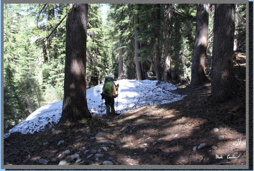
creek crossing and eventually downhill to Wood Lake. Here is this snow
covered section of trail. Snow was not bad but there were spots where
going around the snow banks was a better because of where you would
end up if you slipped on the snow.
You had to cross
Buck Meadow Creek two more times (both log crossings). Here is a shot
from one of them. I was too nervous to take a picture of Tyler on either
of the crossings. You can tell this crossing is a considerable distance
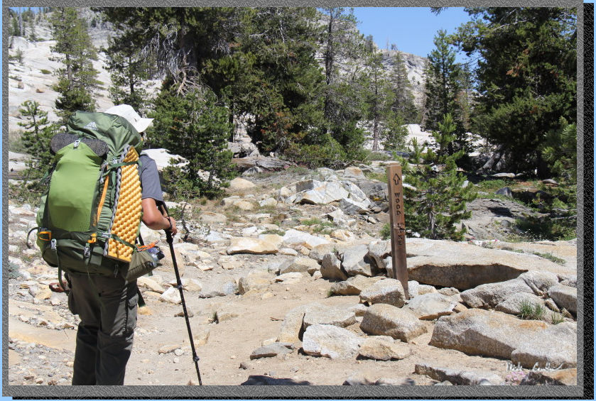
above the fast moving water. Continue on to junction with Deer Lake,
stay on trail headed southeast to south side of Wood Lake (trail will
say Cow Meadow now).
Continue along the
south side of this lake being careful to avoid walking on the slick
snow sloped toward the lake. I always try to think of where I would
end up prior to stepping on the frozen stuff. We ended up camping above
the lake on the south side, about the middle of Wood Lake.
Here is camp the
second night at Wood Lake. We pumped water down at the lake this time.
I was able to find a good rock to sit on that allowed me to filter water
in a deep enough part of the lake. We had to fight off the mosquitos
a little more at this site. The fire again helped until we drowned it
(using some of the snow in the background, and some of the water we
had in the collapsible bucket for fire protection). We had to bear bag
the first night since we had a little more food than our two bear canisters
could hold. This night we were able to get all of our "smellables"
into the bear canisters (no throwing ropes today). The ranger will ask
you how you plan to store your food. Have a bear proof plan. Here is
Tyler enjoying the little fire he built. Not as much wood around this
site, but still plenty to have a little fire. This was our longest hiking
day and with the snow/log crossings, also the most technical. We had
originally planned day three to go to Wire Lakes, we decided to be a
little less ambitious and camp at Deer Lake.
Click here to continue to Day 3 (Wood Lake to Deer Lake via Buck Lakes)
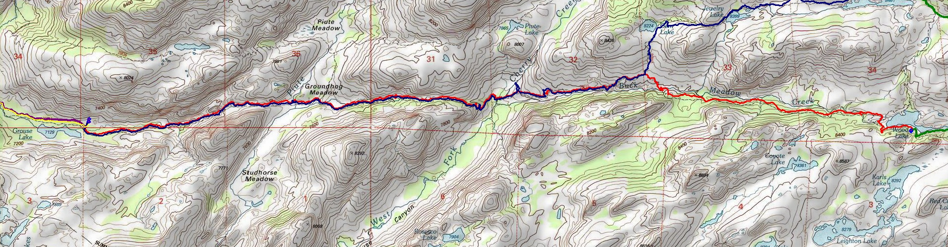
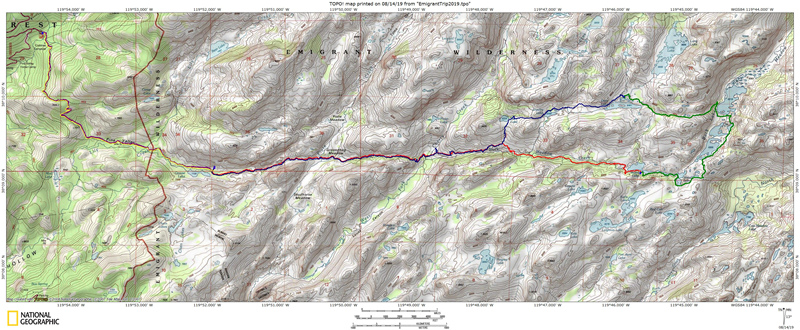
The yellow
line shows Crabtree Trailhead to Grouse Lake (Day
1), the red line shows Grouse
Lake to Wood Lake (Day
2), the green line shows Wood
Lake to Deer Lake (Day
3), the blue line shows Deer
Lake to Grouse Lake (Day
4) and the violet line shows
Grouse Lake to the Trailhead (Day
5). Scroll down for elevation profiles.
Click on map or profiles to be taken to the larger
version.
(Back
to top)
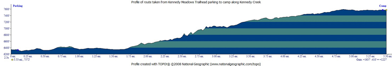
Here
is the profile from the Crabtree Trailhead to camp at Grouse Lake (Day
1).
(Back
to top)
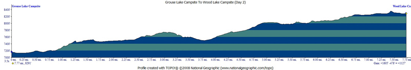
Here
is the profile from Grouse Lake to Wood Lake (Day
2).
(Back
to top)
Here
is the profile from Wood Lake to Deer Lake (Day
3).
(Back
to top)
Here
is the profile from Deer Lake to Grouse Lake (Day
4).
(Back
to top)
Here is the
profile from Grouse Lake to Crabtree Trailhead (Day
5).
(Back
to top)